
Map Categories
Thank you! Your submission has been received!
Oops! Something went wrong while submitting the form.
000
,
000


Farm & Ranch
Agricultural Property Appraisal Report
Streamline your land appraisal process with Land id™, where every crop, building, and land feature is captured in an interactive map.
View this map

Real Estate
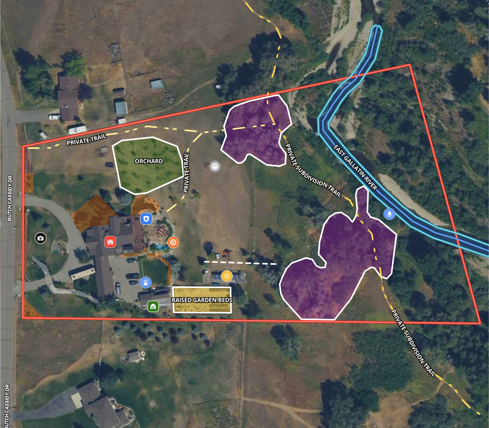
5.6 Acre Rural Listing in Bozeman, MT
Land id™ GIS mapping software creates immersive real estate maps that showcase property features, land parcels, and lifestyle highlights for this Bozeman riverside retreat.
Listing
Residential
Rural
Luxury
Fish
Farm & Ranch
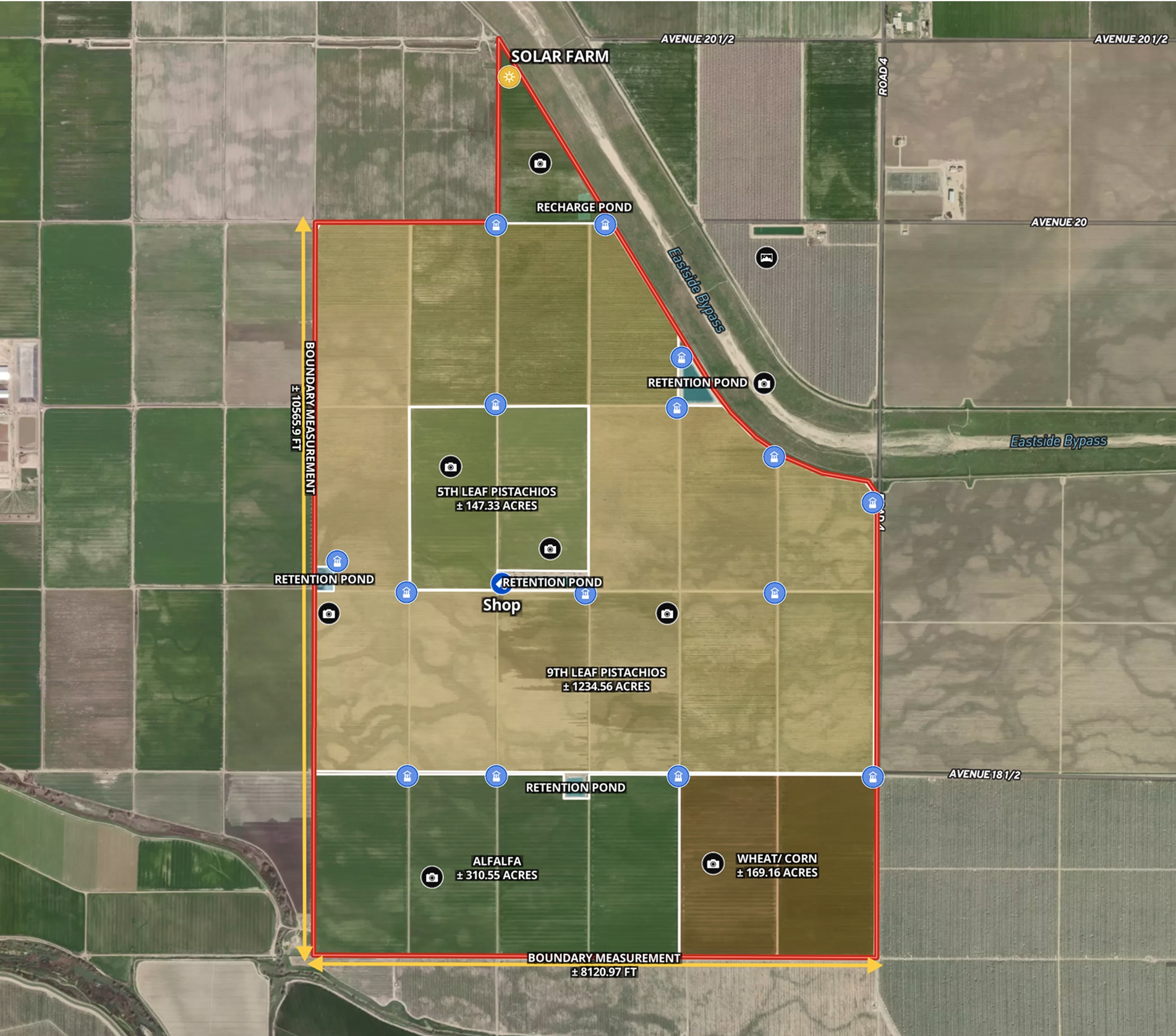
Ag Farm in Madera County, CA
Todd Peterson uses Land id™ GIS mapping software to embed real estate maps that showcase detailed layout of productive California farmland.
Listing
Agricultural
Rural
Soil
Water
Real Estate
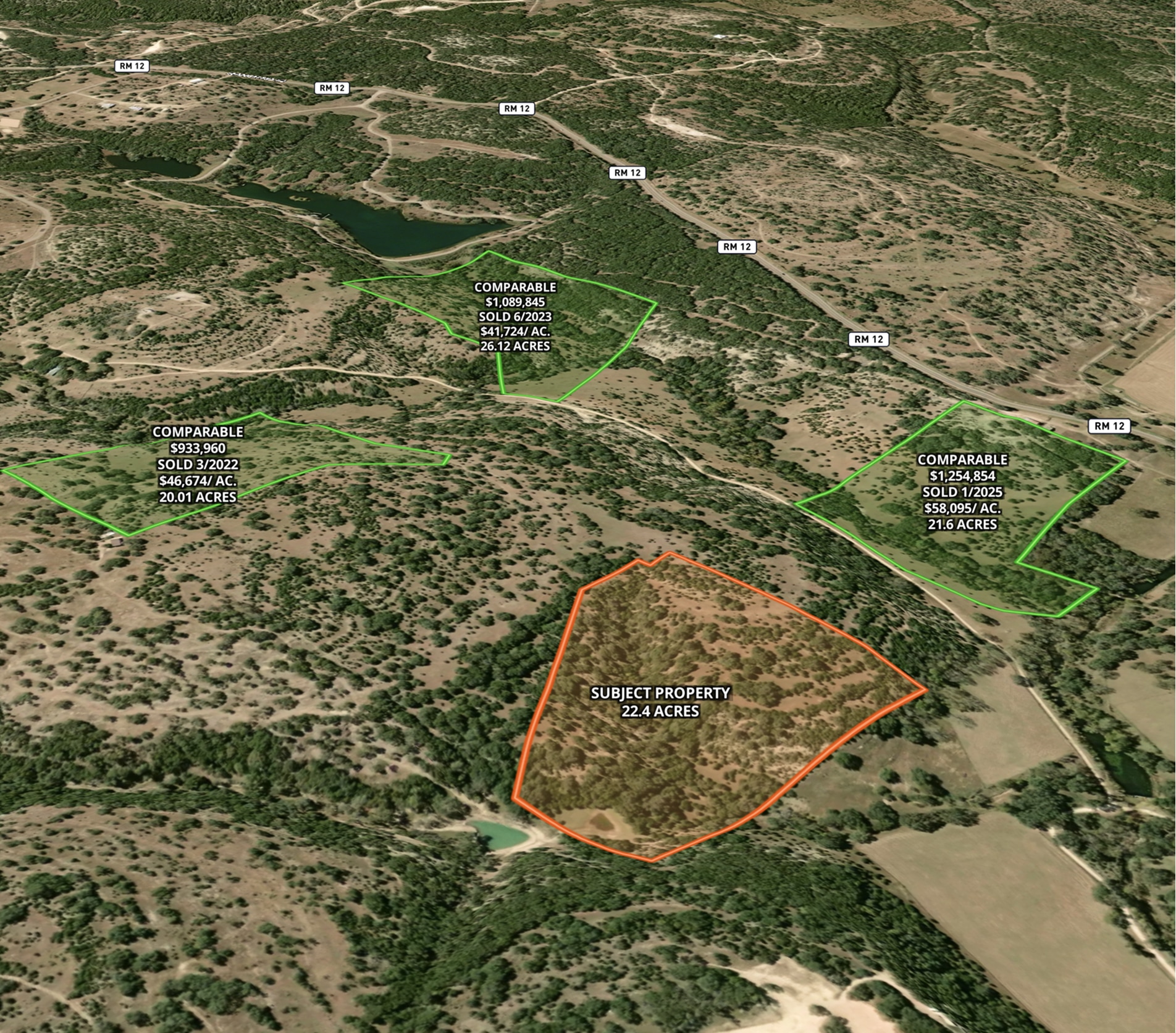
Market Trends Overview – Interactive Comps
Use Land id™ GIS mapping software to visualize property comps on a map. Simplify how you present similar land parcels and sales data.
Listing
Agricultural
Rural
Comps
Residential
Real Estate
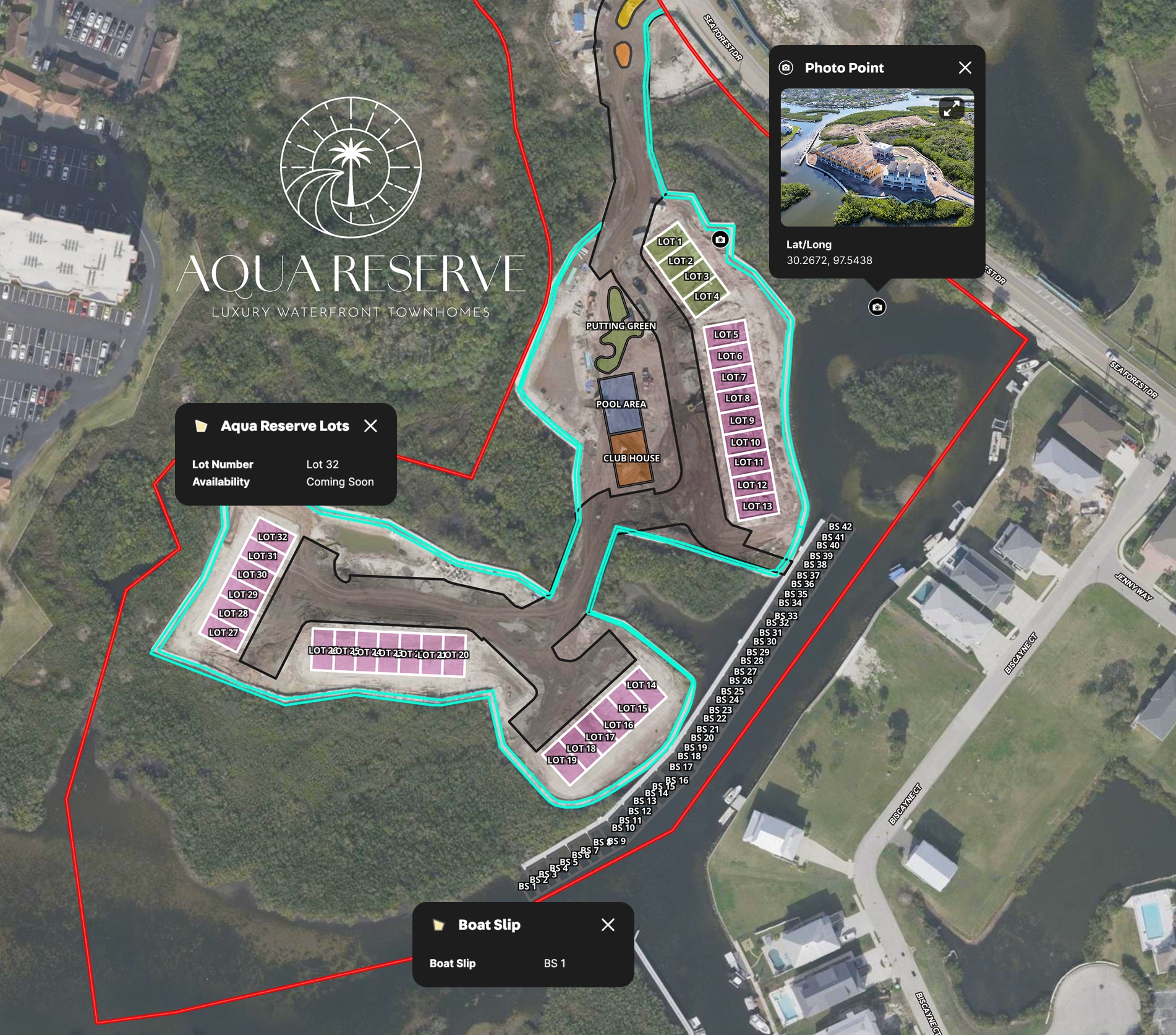
LPT Realty Aqua Reserve Development Map
LPT Realty used Land id™’s GIS mapping software to create a branded property map for new construction and show real-time availability insights.
Listing
Urban
Water
Property Development
Real Estate
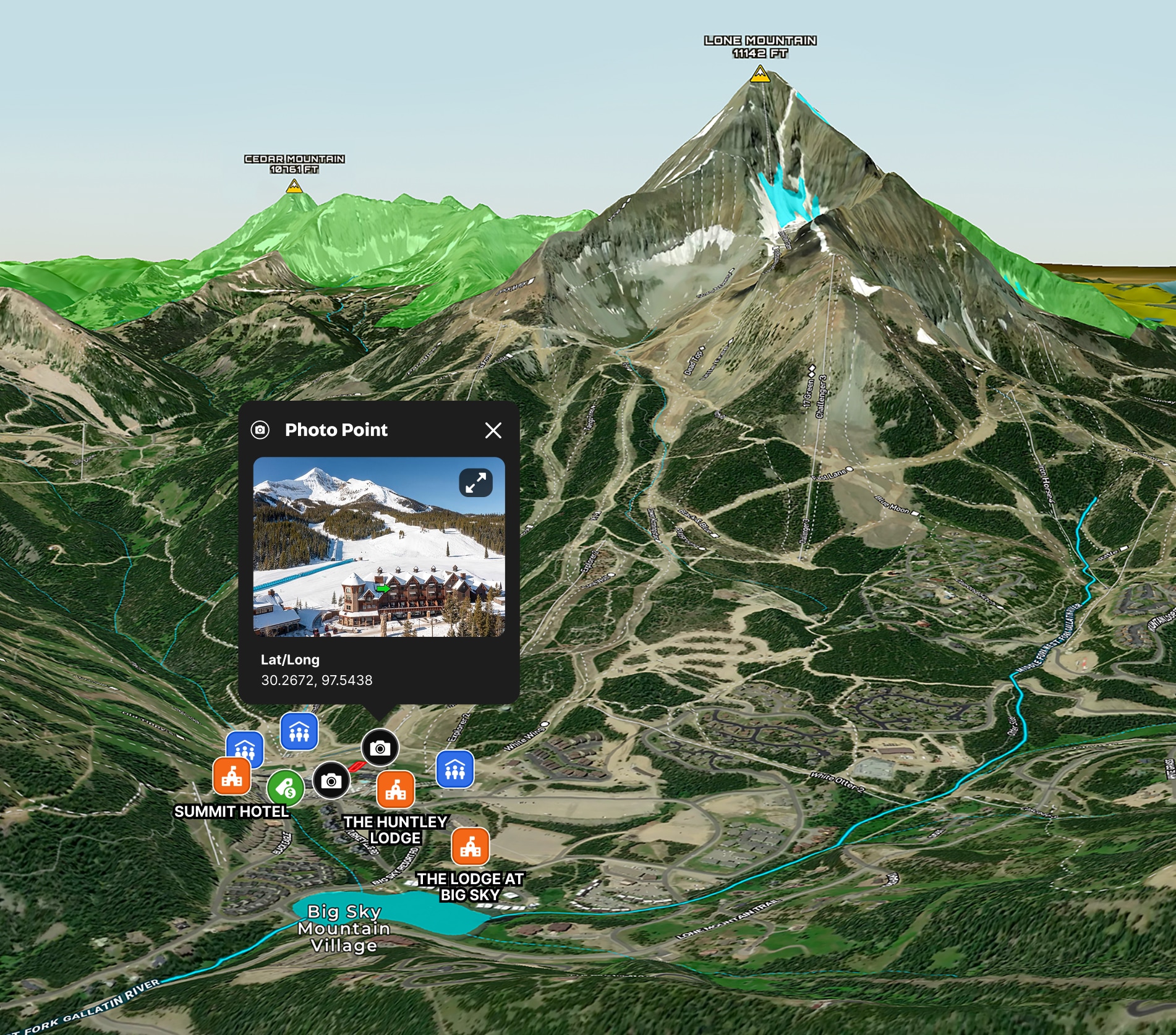
Big Sky Ski Condo Map
Land id™ GIS mapping software creates a clear real estate map showcasing prime slope access and resort amenities for this ski-in, ski-out Big Sky condo.
Residential
Luxury
Listing
Snow
Real Estate
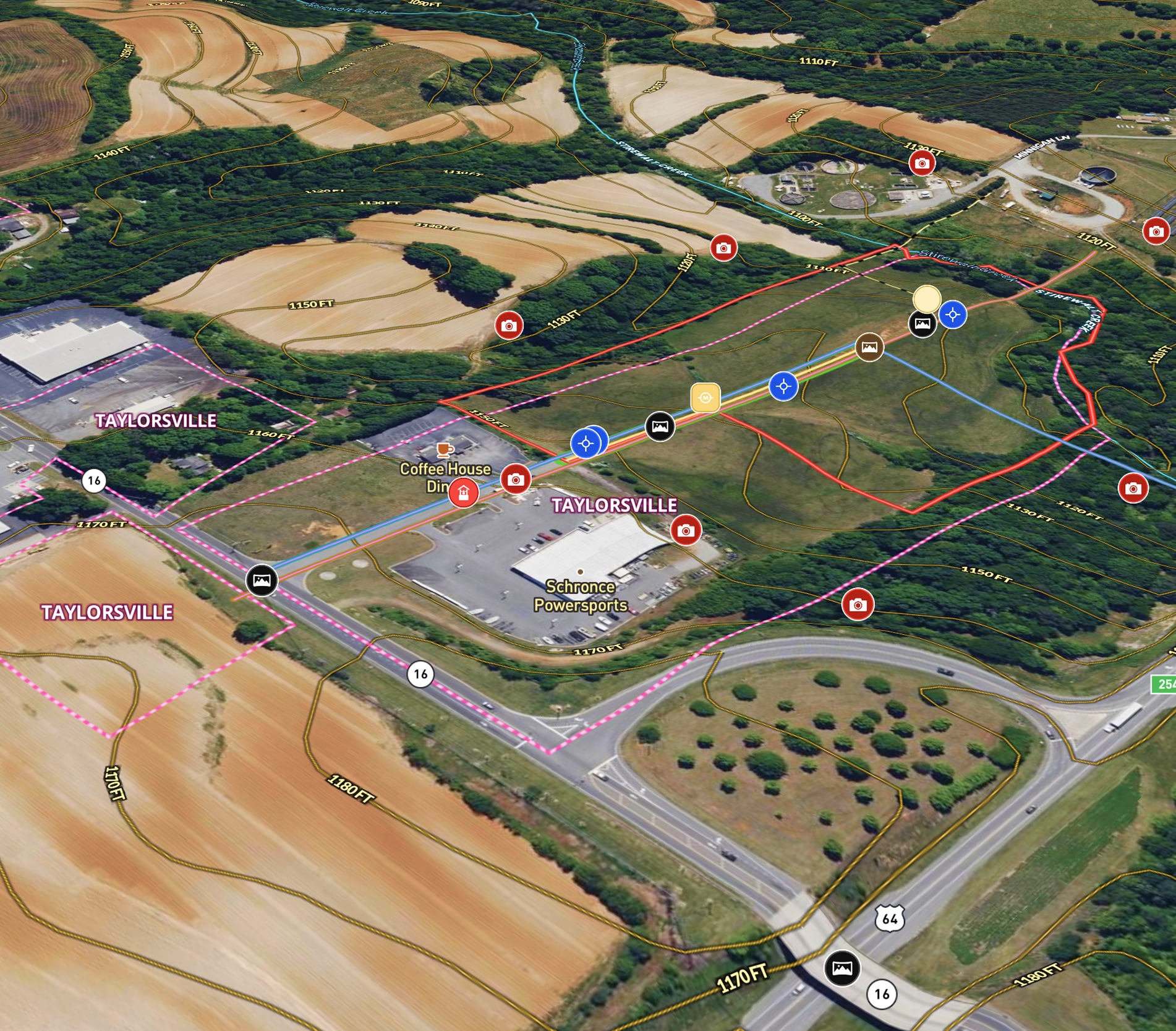
Commercial + Development Listing in NC
Mossy Oak uses Land id™ GIS mapping software to showcase this ±11.90-acre land parcel with a real estate map highlighting utility availability, highway acess, floodplain and development potential.
Listing
Commercial
Panoramics
Property Development

Real Estate
Subdivided Lots for Sale
Simplify how you subdivide a parcel of land with our cut tool.
Property Development
Rural
Homebuilders
Listing

Planning
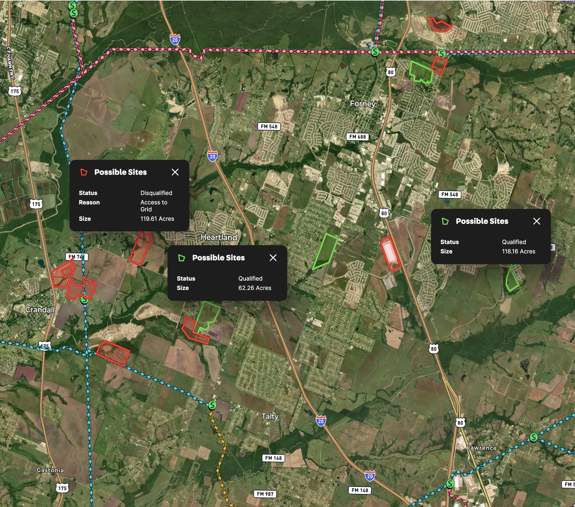
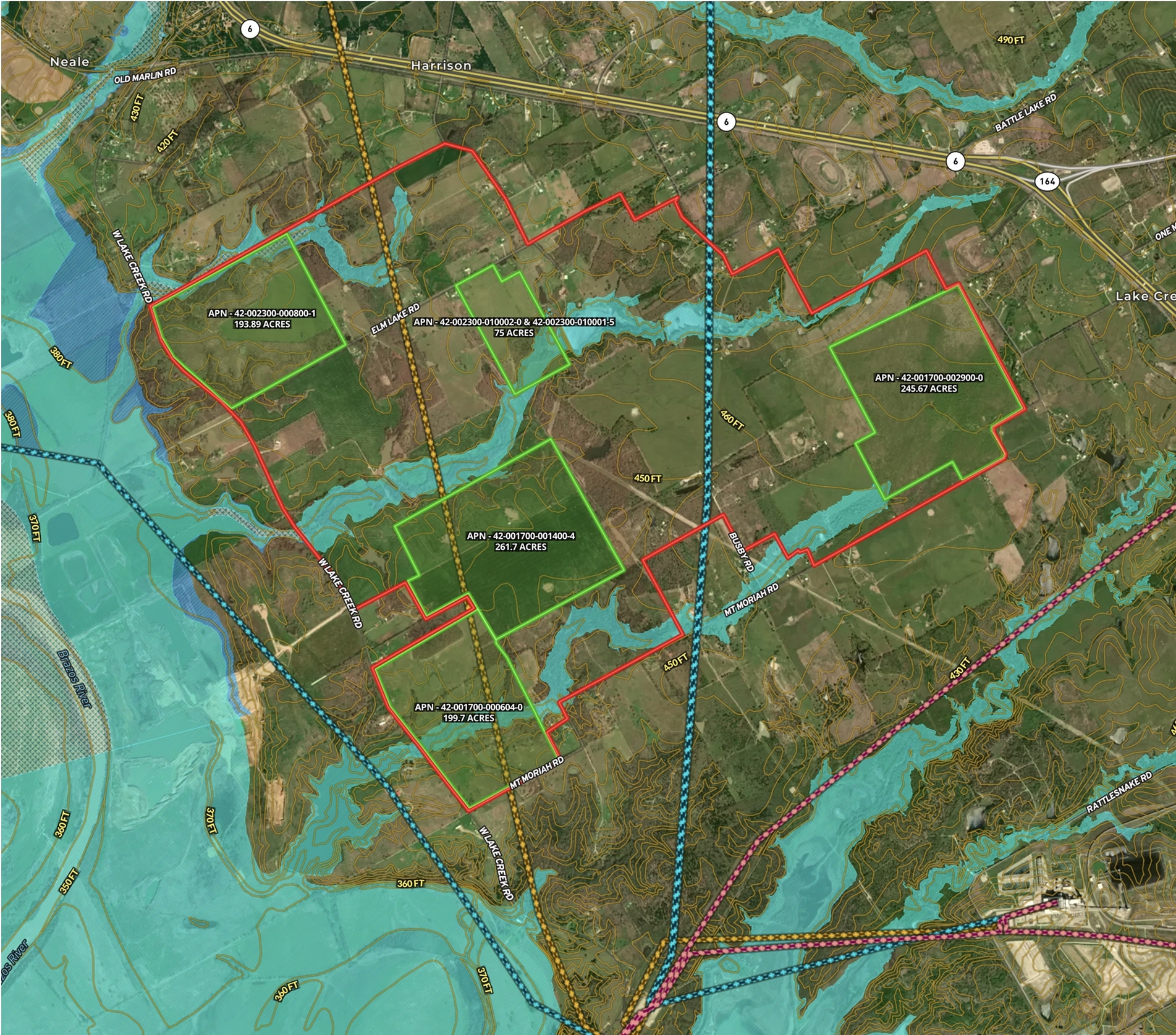
Data Center Development Site Analysis
Use Land id™ GIS mapping software to evaluate land parcels for data centers. Create a property map with overlays for utilities, floodplains, and more using real estate maps.
Commercial
Property Development
Research

Real Estate
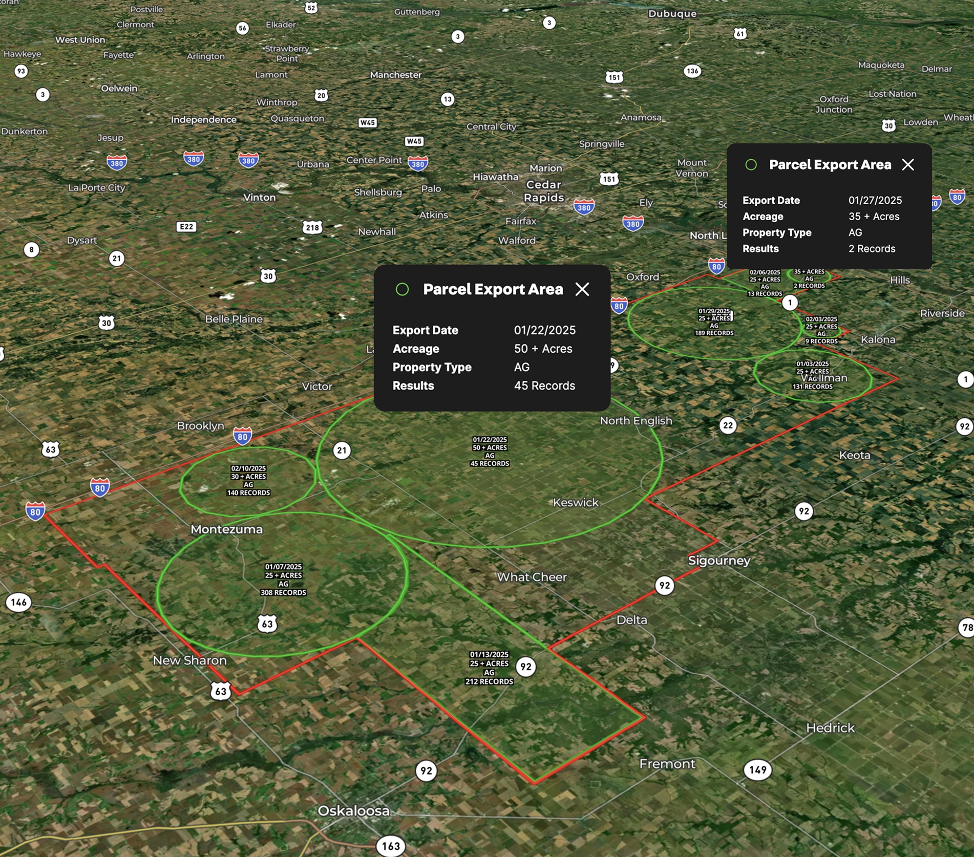
Commercial real estate off-market prospecting
Boost your sales pipeline with Land id™'s real estate mapping software. Create property maps to track land parcels, market trends, and off-market opportunities with ease.
Commercial
Comps
Research

Farm & Ranch
Fencing for Texas Red Deer Ranch
Jimmy Banks uses Land id™'s real estate mapping software to map his Texas ranch, get land measurements to plan fencing projects, and integrate new land parcels with precision.
Rural
Land owner
Land management
Planning
School Site Selection
Land id™ GIS mapping software simplifies school site selection with real estate maps that visualize land parcels, floodplains, and infrastructure for smarter planning.
Municipality
Research
Farm & Ranch
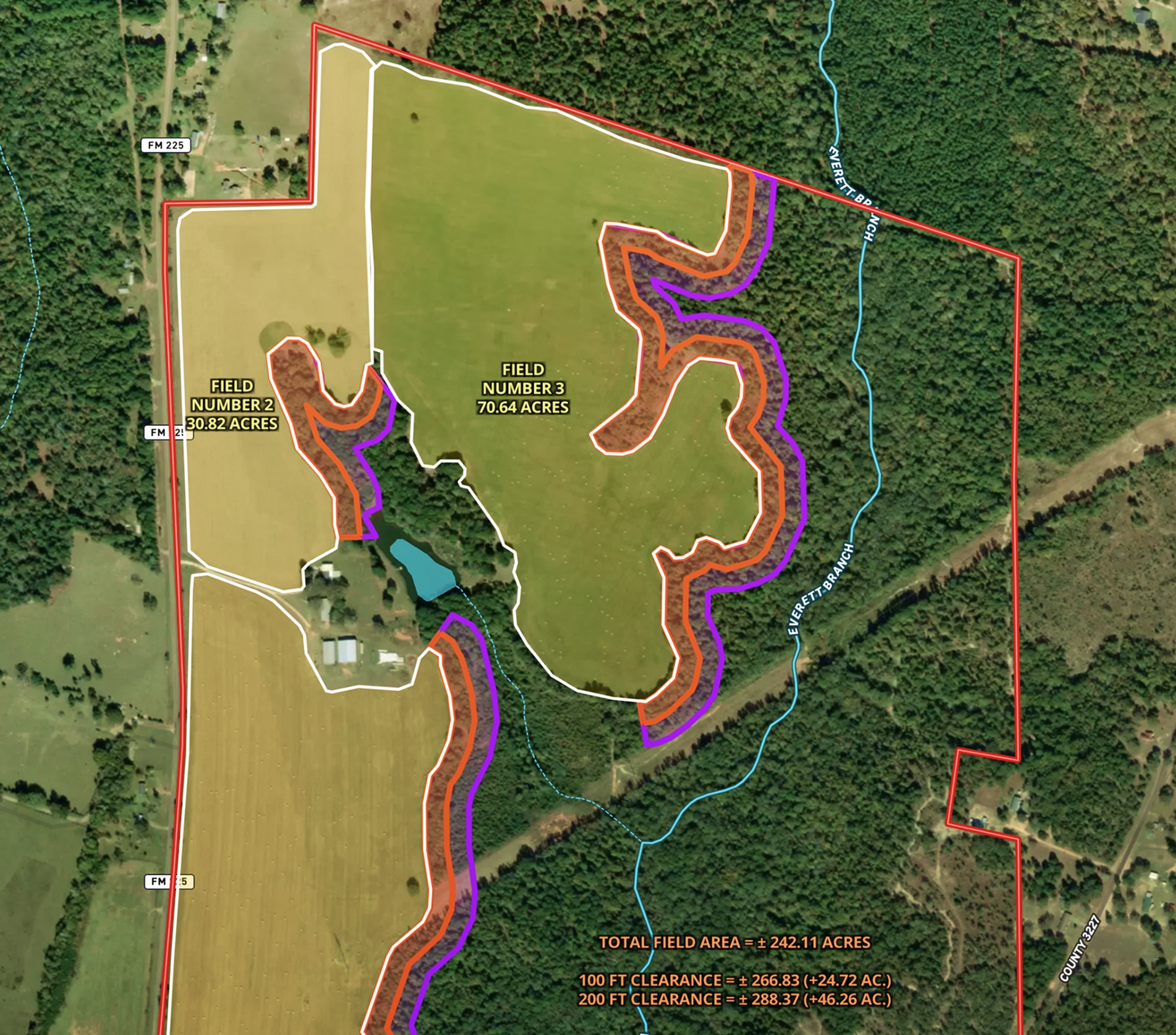
Land Clearing Analysis Map
Land id™ GIS mapping software helps landowners visualize field expansion with property maps, buffer zones, and acreage gains—making land clearing plans easy and clear.
Land owner
Land management
Timber
Renewable Resources
Farm & Ranch
The Broken Fence – Premier Utah Hay Farm
Interactive Map of High-Quality Hay Production in Utah Zeb White uses Land id™ GIS mapping software to create a real estate map of The Broken Fence, showcasing land parcels, hay fields, and key property infrastructure.
Agricultural
Listing
Rural
Water
Real Estate
Lead Farming
Land id™ GIS mapping software helps you visualize lead areas with a map and track your targeted outreach efforts.
Agricultural
Rural
Commercial
Luxury
Residential
%20off%20Blanco%20River%20-%20Thumbnail.avif)
Real Estate
Residential Listing (7.5 Acres) off Blanco River
Enhance your property listing strategy with our real estate mapping software.
Luxury
Residential
Water
Rural
Listing

Real Estate
Office Park Development in Texas
Embed site plans and surveys in a map to elevate your commercial real estate project.
Commercial
Property Development
Real Estate
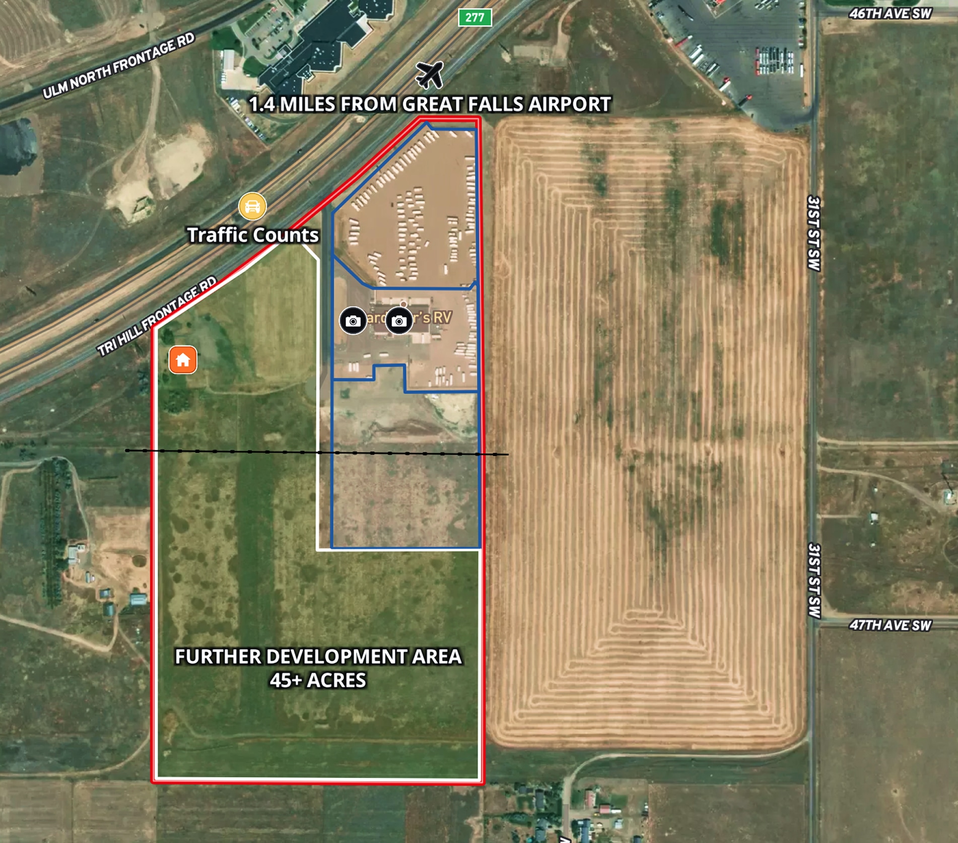
RV Commercial Listing
Tyree Real Estate uses Land id™ GIS mapping software to create a commercial property map showcasing land parcels, access points, and development potential.
Listing
Commercial
Property Development
Real Estate
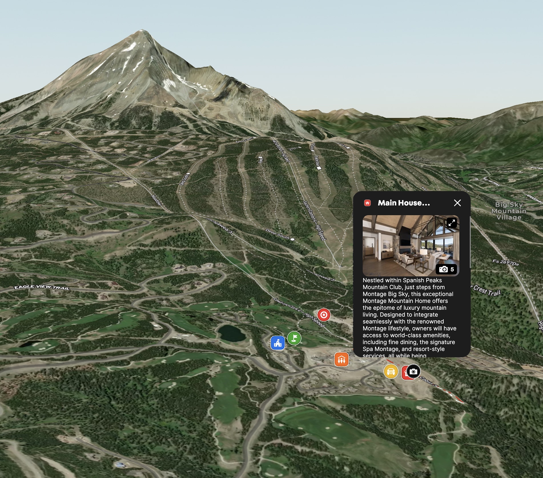
Montage Mountain Home in Big Sky, MT
Land id™ GIS mapping software showcases this luxury mountain home's ski access and resort amenities with a clear, interactive real estate map and property map.
Residential
Luxury
Listing
Snow

Farm & Ranch
Grateful Harvest Farm
Lisa Johnson and the Horsepower Real Estate team used Land id™'s GIS mapping software to accurately appraise and sell Grateful Harvest Farm. Detailed property maps and acreage reports enhanced farm land pricing.
Rural
Listing
Agricultural
Soil
%20in%20Rollingwood%2C%20Texas%20-%20Thumbnail.avif)
Real Estate
Residential Listing (0.3 Acres) in Rollingwood, Texas
Maximize property appeal using our mapping tools, showcasing residential proximity to retail areas, parks and schools.
Luxury
Listing
Residential
Urban

Planning
Big Sky PBR 2024 Event Map
Explore the Big Sky PBR event map made with Land id's interactive GIS mapping software.
Events
Rural

Farm & Ranch
Recreational Ranch in Texas
Land id™ transforms land ownership, enabling owners to craft detailed property maps of ranch amenities.
Hunt
Rural
Land owner
Land management


Natural Resources
Developing and Assessing Timberlands
Maximize timberland potential with Land id™, featuring Infrared Basemap, soil reports, and essential forestry GIS overlays.
Timber
Soil
Listing
Rural
Forestry

Natural Resources
Mississippi Timber Stand Map
Boost your timber sales strategy with Land id™, creating interactive timber maps that highlight timber stand features and access.
Forestry
Timber
Soil
Listing
Rural

Real Estate
Wildflower Ranch in Colorado
Supercharge your listing strategy with our cutting-edge real estate mapping tools.
Campgrounds
Water
Rural
Luxury
Listing

Real Estate
Ski in/Ski out Listing in Big Sky, Montana
See the difference Land id™ makes with real estate mapping that effectively demonstrated ski-in/ski-out access, leading to a quick sale
Luxury
Residential
Listing
Snow


Recreation & Fun
City Bike Trails in Alameda Area
Explore Alameda's bike trails and parks on our interactive, modern city map.
Cycle
Urban
Municipality

Planning
City Park in Rollingwood, Texas
Streamline city planning with comprehensive maps, highlighting features and regulatory zones for effective public and department use.
Urban
Municipality
Park

Natural Resources
Wind Farm in Pennsylvania
Streamline renewable energy projects with Land id™, leveraging GIS mapping tools for site selection and lease management.
Wind
Renewable Resources

Planning
Potential Build Sites on Colorado Mountain Ranch
Enhance remote property planning with Land id™, integrating 360° views and drone paths for informed landowner choices.
Rural
Land owner
Land management
Panoramics

Planning
Municipality Map for Rollingwood, Texas
Use Land id™ for effective city planning: map business districts, track project updates, and stretch budgets further.
Urban
Municipality

Real Estate
Comparable Sales
Optimize real estate pricing with Land id™: Create a visual real estate database to track and justify property values effectively.
Luxury
Residential
Agricultural
Commercial
Rural

Farm & Ranch
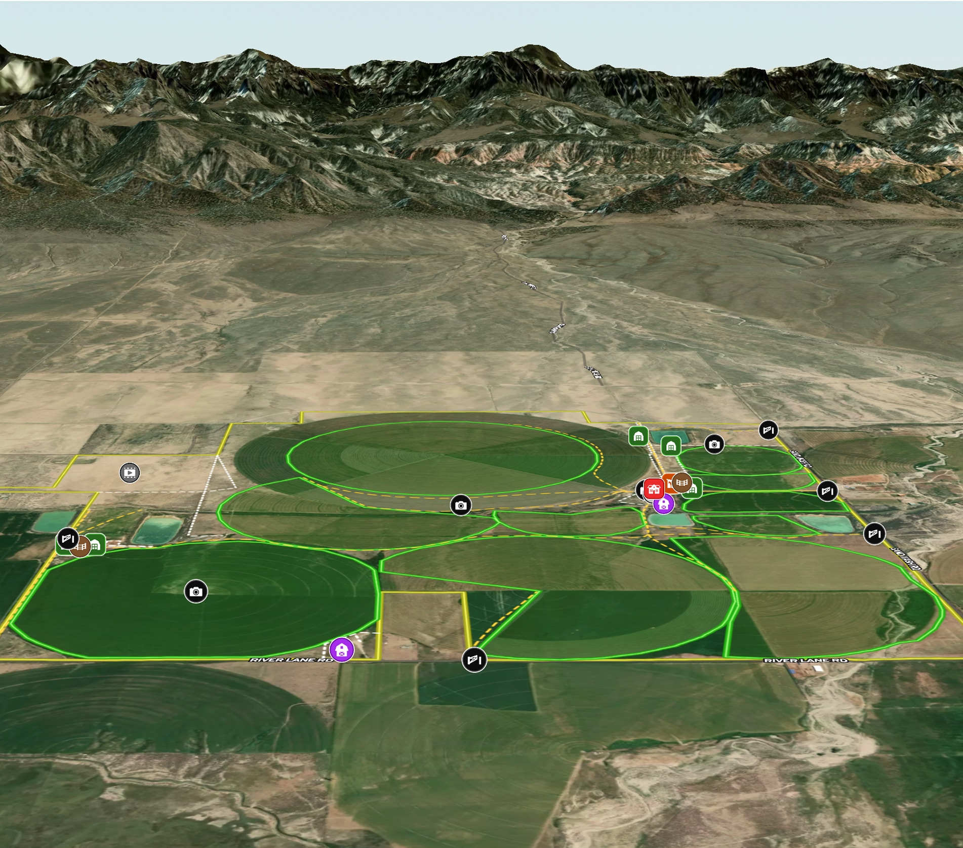
Managing New Mexico Farm
Elevate farm efficiency with Land id™: Advanced agriculture GIS, field mapping software, and parcel maps for optimized crop and irrigation planning.
Agricultural
Soil
Water
Land owner
Land management
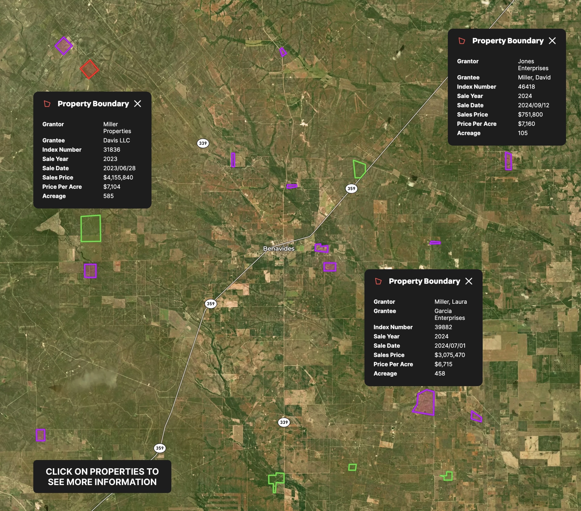
Real Estate
Appraisal Sales
Use Land id™ GIS mapping software to create a property map of sold land parcels, analyze sales data, and streamline appraisals.
Appraisals
Comps
Farm & Ranch
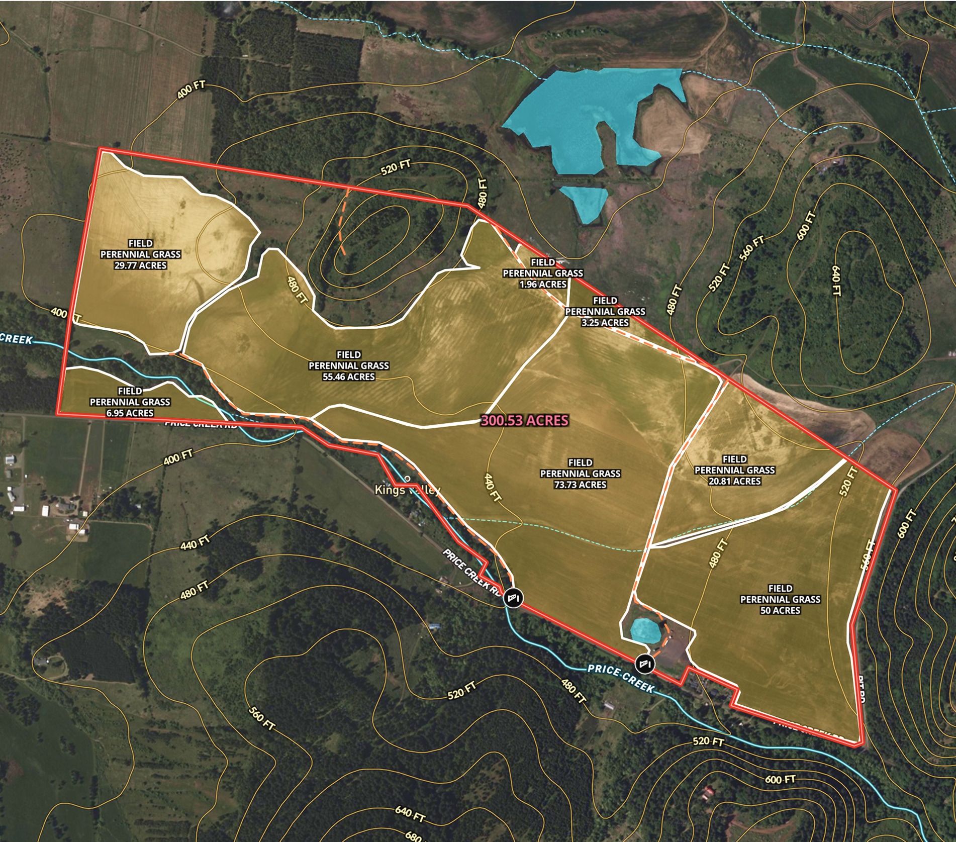
Oregon Farmland Overview – 300 Acres
Angie LaPointe uses Land id™’s GIS mapping software to showcase land parcels with a detailed property map, ideal for real estate marketing and topography insights.
Listing
Agricultural
Rural
Soil
Water

Real Estate
Round Mountain Ranch
Harlan Ray uses Land id™'s real estate mapping software to create property maps that build relationships. Perfect for easy real estate mapping.
Listing
Rural
Luxury
Agricultural

Farm & Ranch
Agricultural Listing for Iowa Farm
Revolutionize farm listings with our real estate mapping software, integrating soil reports and multimedia for a standout presentation.
Agricultural
Listing
Rural
Water
Soil

Farm & Ranch
Hill Country Property
Landowners use Land id™'s real estate mapping software to create and update property maps effortlessly. Ideal for property owners managing land parcels.
Rural
Land owner
Land management
.avif)
Recreation & Fun
Paulina Lake & East Lake Recreation
Help visitors plan their trip with our campground map maker, showcasing trails, boat launches and campgrounds.
Fish
Campgrounds
Hike
Park
Rural

Real Estate
Neighborhood Development Project in Texas
Use our real estate map maker to vividly present new developments, from trails to parks, enhancing buyer understanding.
Homebuilders
Property Development
Rural
Residential
Listing

Real Estate
Diamond A Hickory Farm
Harlan Ray uses Land id™'s real estate mapping software to create clean, engaging property maps for real estate listings, enhancing buyer experiences and showcasing key land parcels.
Listing
Rural
Luxury

Real Estate
Marketing a Commercial Lease
Enhance tenant site selection with our property mapping tool.
Commercial
Listing
Urban

Recreation & Fun
RV Campsite near Glacier National Park
Use our campground map maker to dynamically showcase campground amenities and site details.
Campgrounds
Rural

Real Estate
Buyer Representation Map
Save time with our mapping tool for real estate, allowing buyers to filter potential properties interactively before visiting.
Rural
Agricultural

Planning
Developing a Dream Home in Utah
Streamline high-end property planning and client communication with our real estate mapping software.
Rural
Land owner
Property Development
Luxury

Real Estate
Sandy Creek Ranch
Harlan Ray uses Land id™'s real estate mapping software every day to create detailed property maps, build relationships and showcase expertise.
Listing
Rural
Luxury
Hunt
Agricultural

Recreation & Fun
My Rim to Rim Hike in the Grand Canyon
An adventurer used Land id™'s GIS mapping software to create a custom Rim to Rim Grand Canyon map, combining photo points and key landmarks for an interactive keepsake.
Hike

Real Estate
Cromwell Island
Explore Cromwell Island with Land id™'s GIS mapping software. Create property maps to showcase land parcels, shoreline, and terrain for an engaging real estate experience.
Residential
Luxury
Listing
Rural

Planning
Eminent Domain
Land id™ empowers eminent domain projects with easy GIS mapping software, creating property maps to assess land parcels, visualize impacts, and ensure fair negotiations.
Property Development
Government

Farm & Ranch
Land Trust Baseline Documentation
Land id™ streamlines baseline documentation for land trusts with easy GIS mapping software. Create and share property maps in minutes, empowering efficient land conservation.
Land owner
Land management
Recreation & Fun
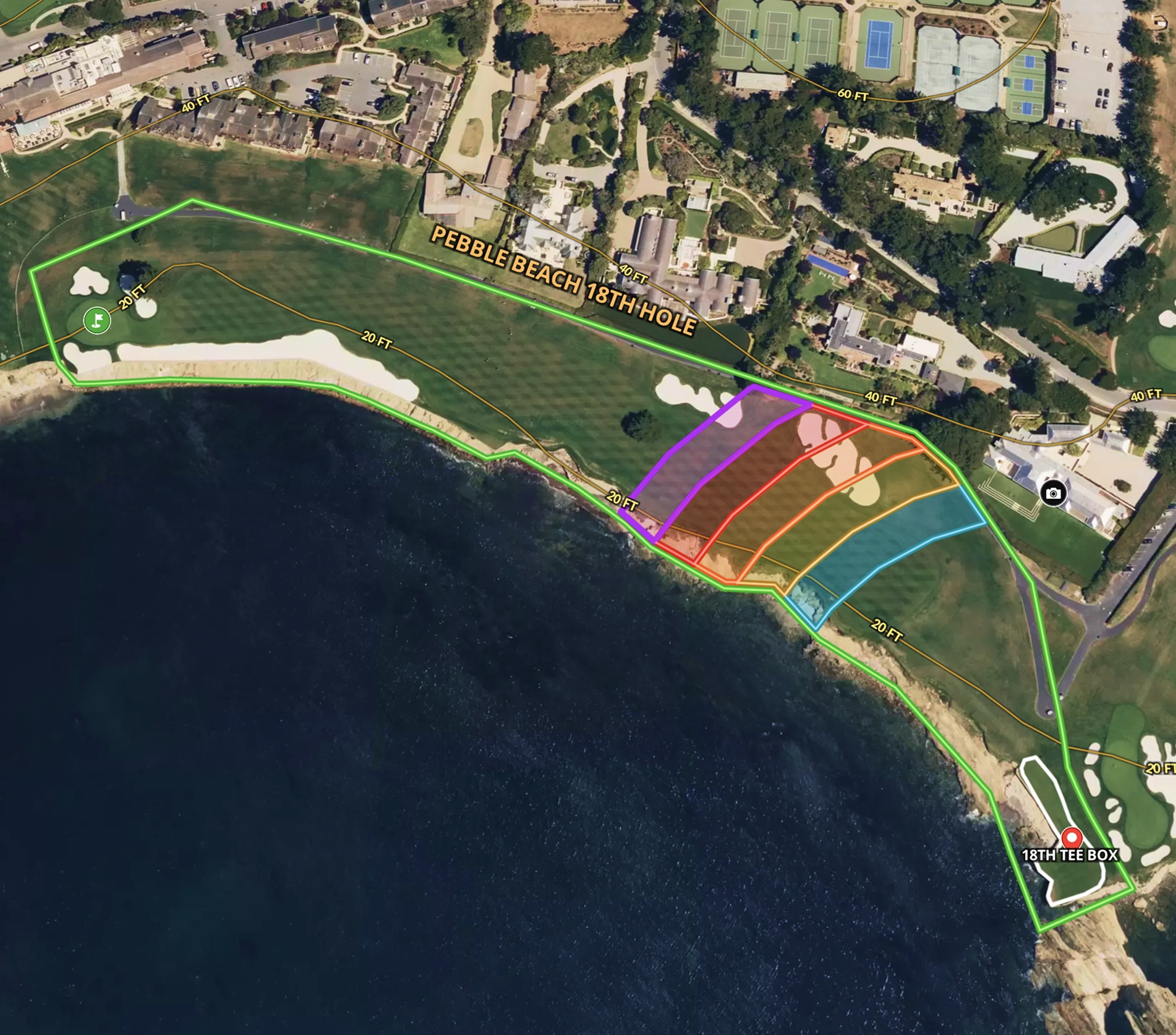
The 18th Hole at Pebble Beach
Land id™ easy map maker and GIS mapping software created a custom real estate map of Pebble Beach’s 18th hole, showcasing land contours and shot placements.
No items found.
Farm & Ranch
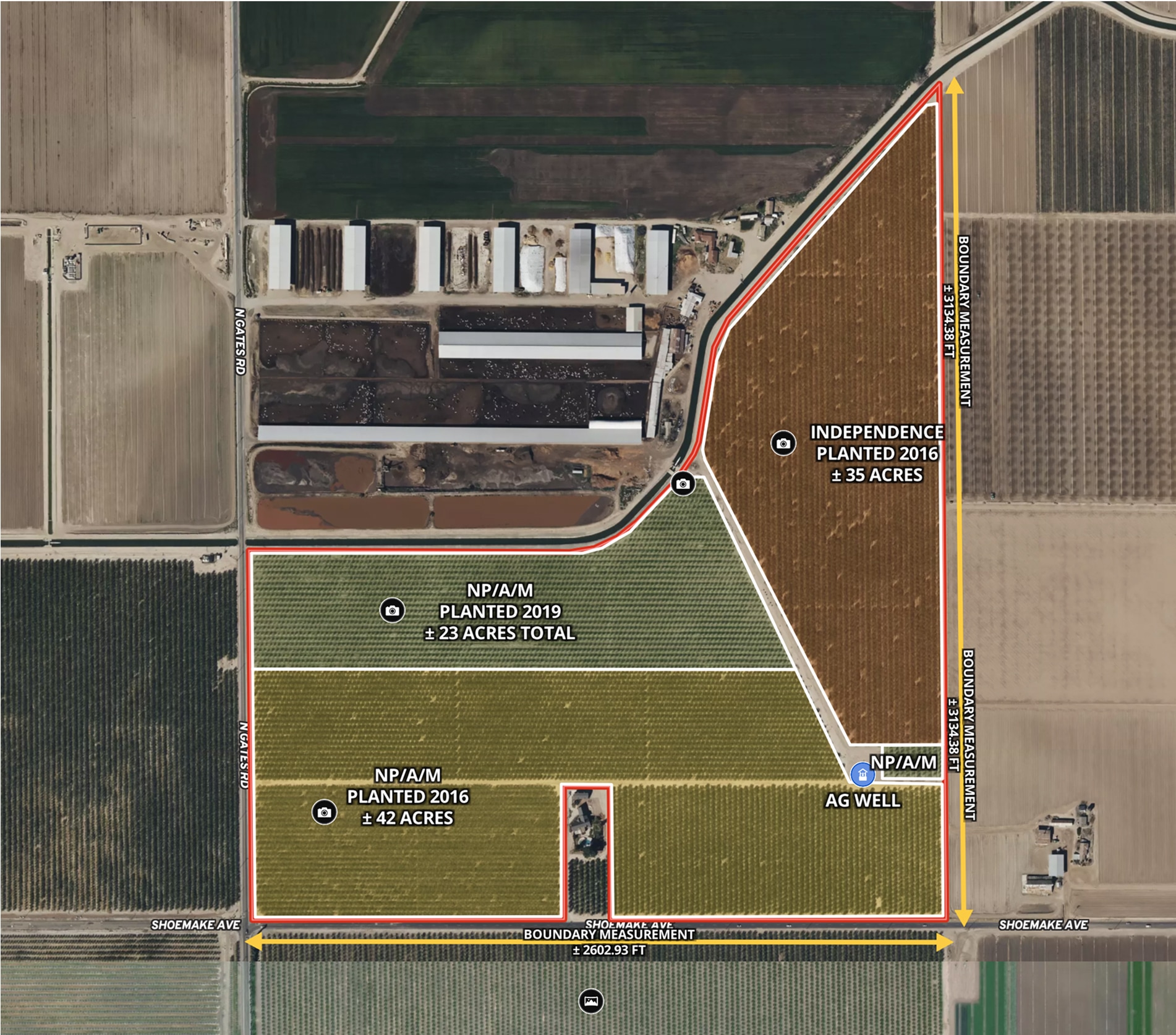
CA Almond Farm – 107 Acres
Todd Peterson uses Land id™ GIS mapping software to embed real estate maps that showcase an almond farm details for a standout listing experience.
Listing
Agricultural
Rural
Soil
Water
Farm & Ranch
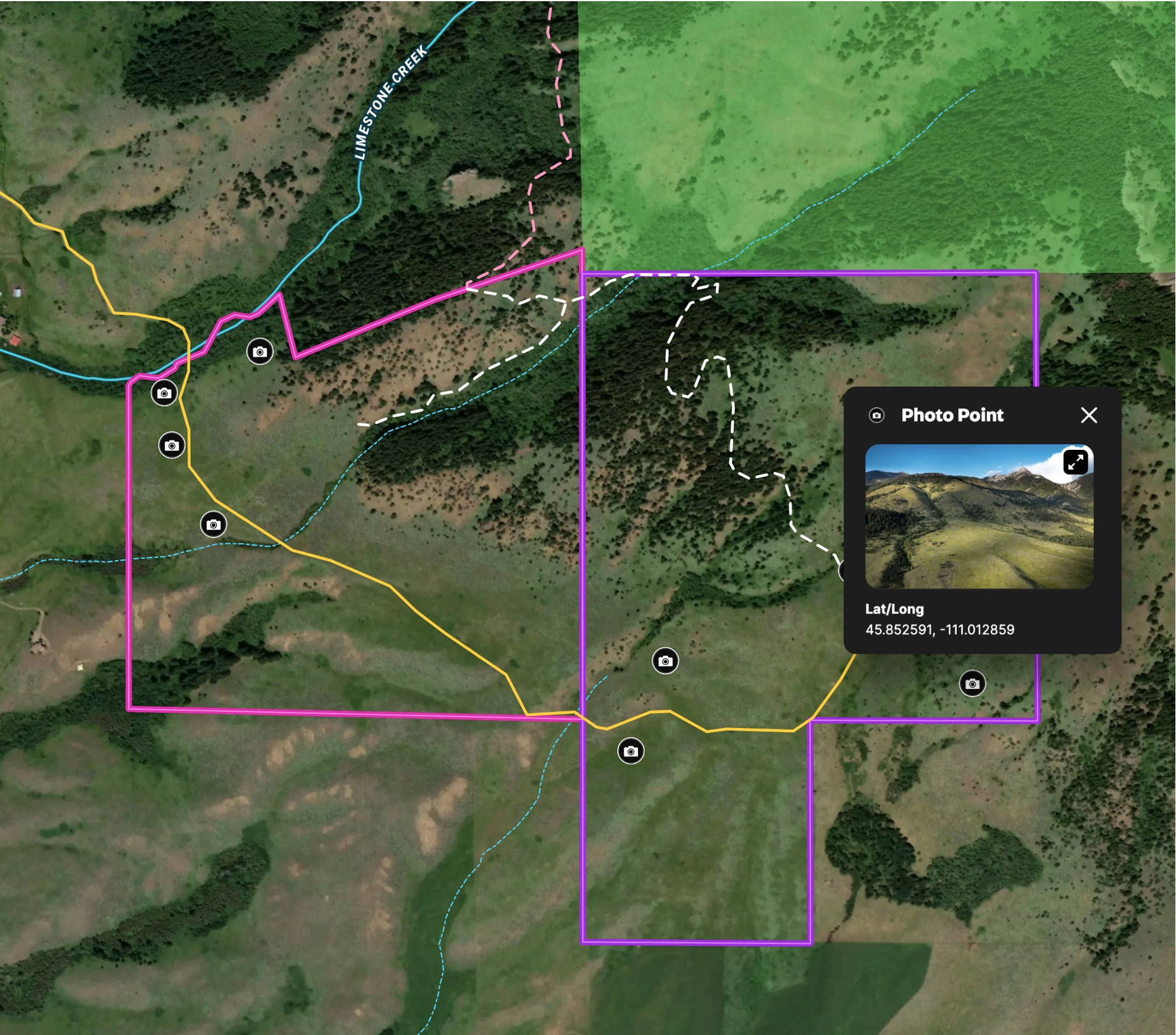
Ranch in Bridger Foothills
Land id™ GIS mapping software creates a detailed property map of this 341-acre land parcel, showcasing trails, access, and views.
Listing
Rural
Hunt