
Map Categories
Thank you! Your submission has been received!
Oops! Something went wrong while submitting the form.
000
,
000

Real Estate
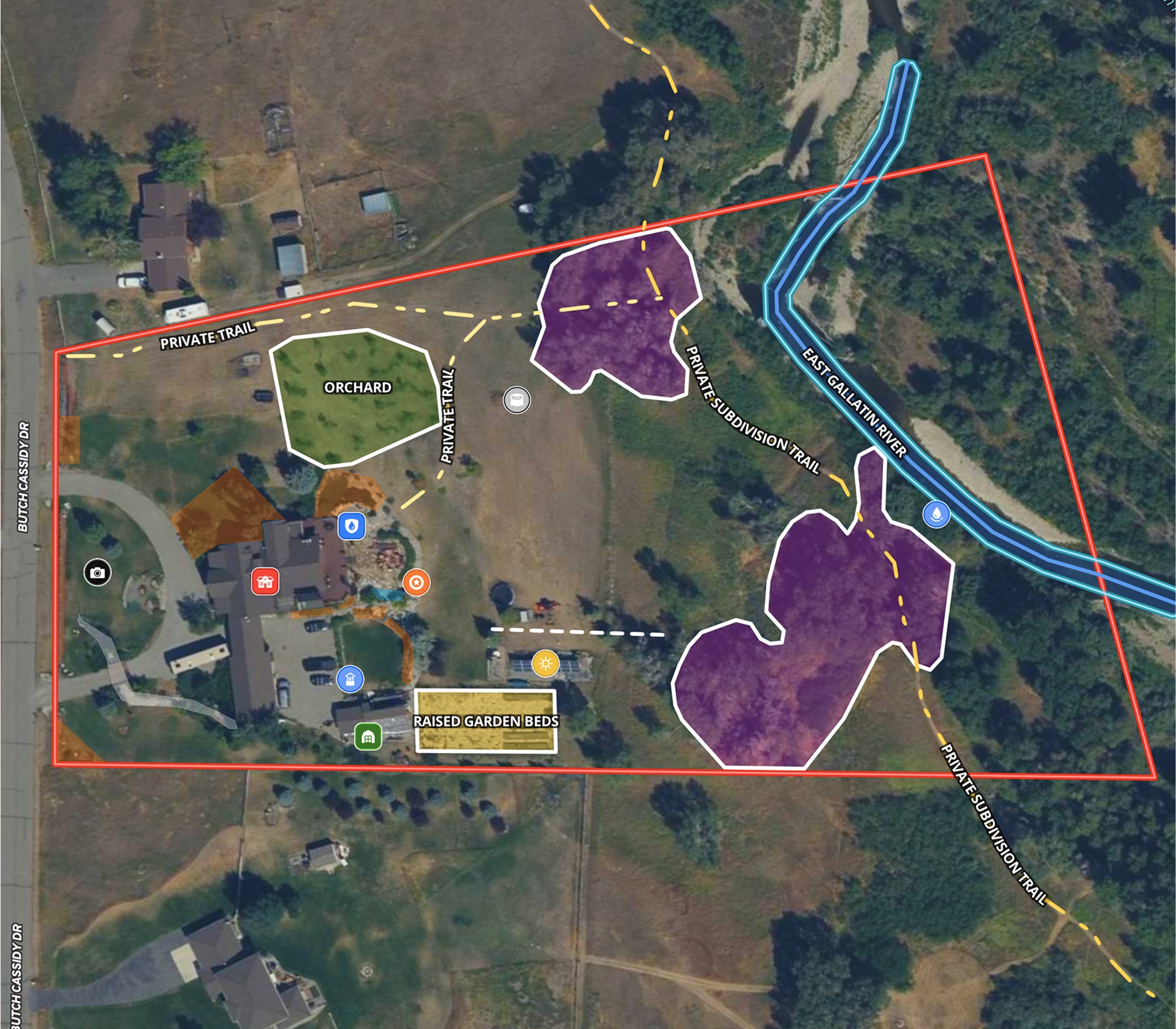
5.6 Acre Rural Listing in Bozeman, MT
Land id™ GIS mapping software creates immersive real estate maps that showcase property features, land parcels, and lifestyle highlights for this Bozeman riverside retreat.
Listing
Residential
Rural
Luxury
Fish
Real Estate
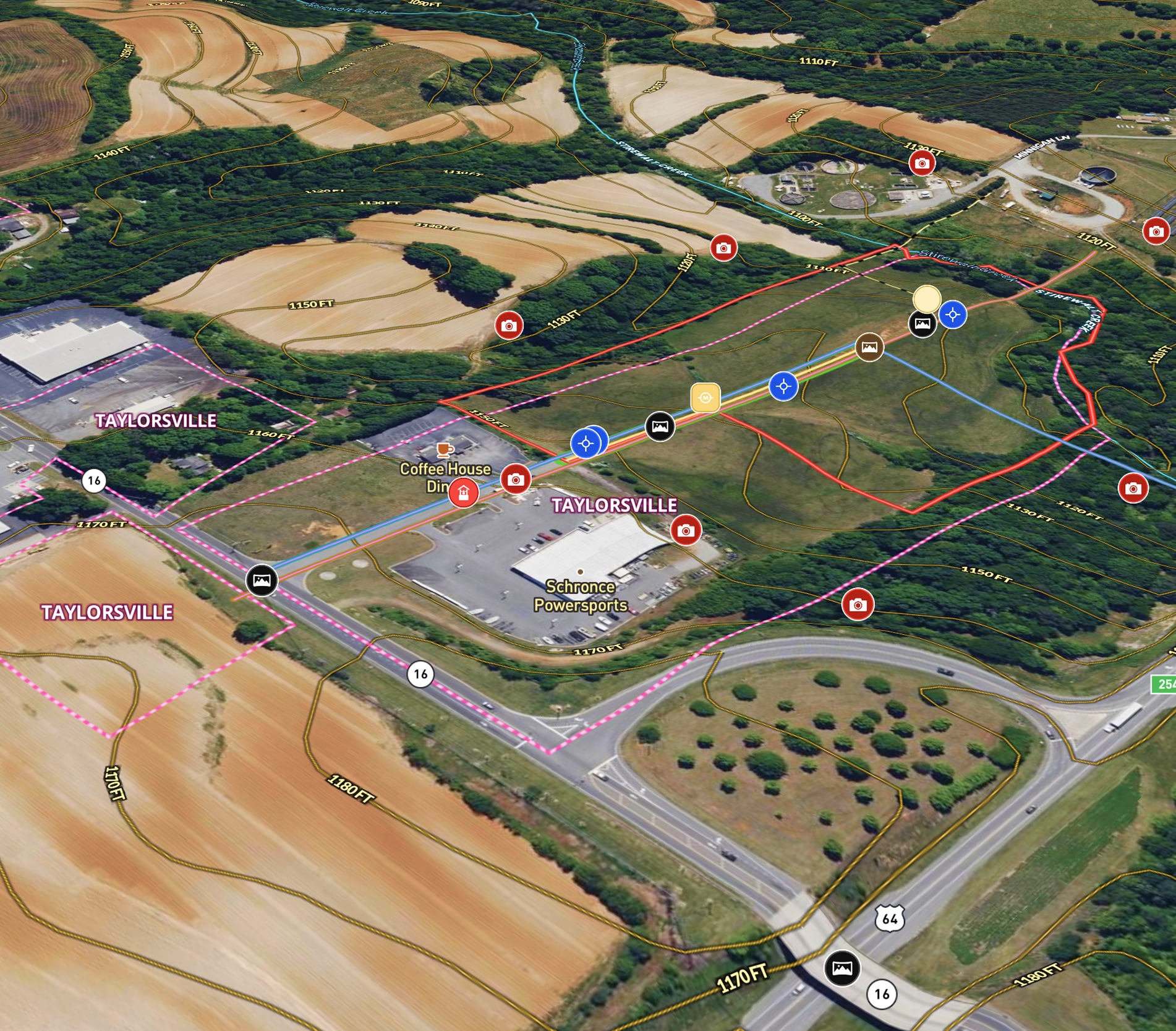
Commercial + Development Listing in NC
Mossy Oak uses Land id™ GIS mapping software to showcase this ±11.90-acre land parcel with a real estate map highlighting utility availability, highway acess, floodplain and development potential.
Listing
Commercial
Panoramics
Property Development
Real Estate
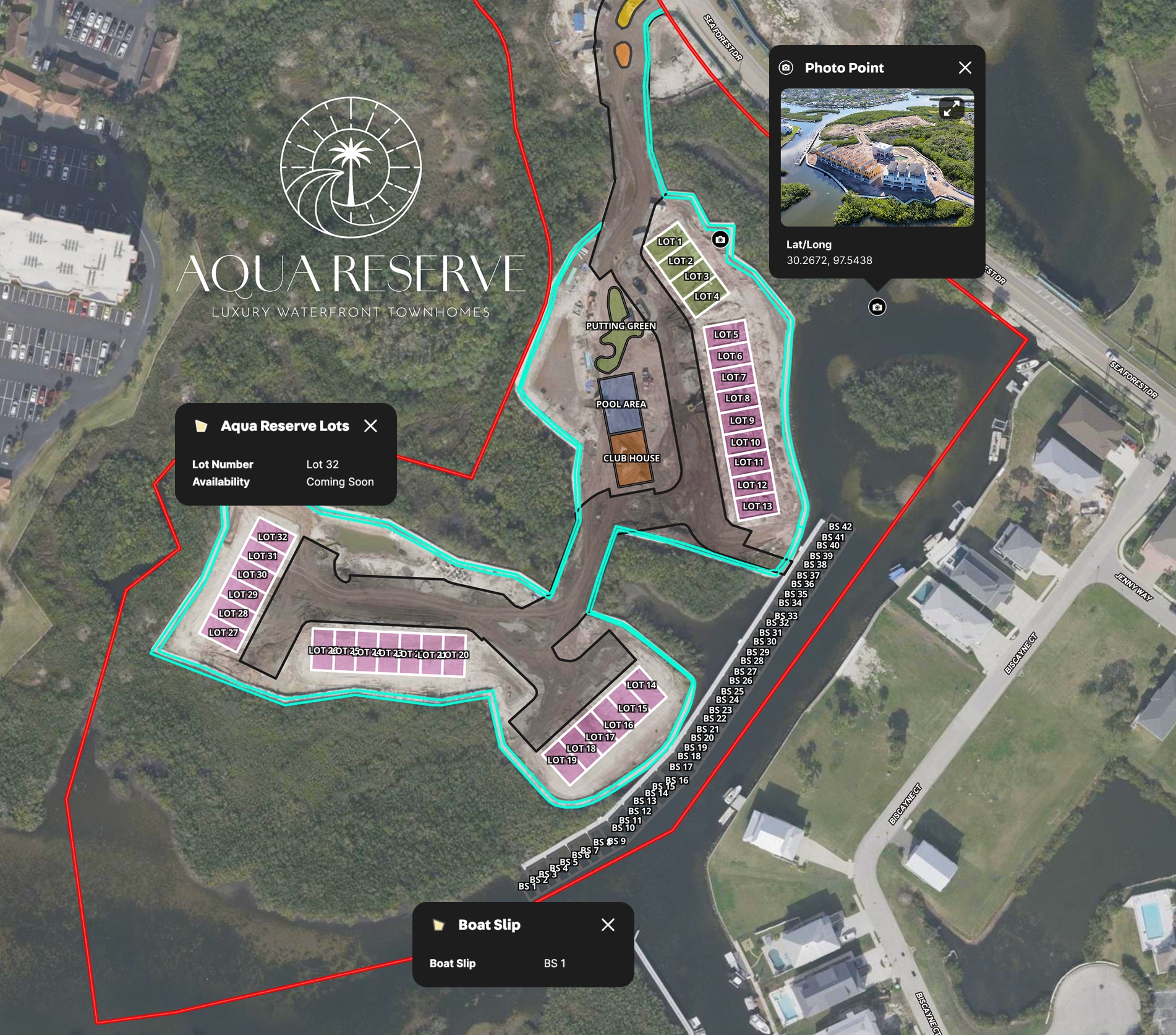
LPT Realty Aqua Reserve Development Map
LPT Realty used Land id™’s GIS mapping software to create a branded property map for new construction and show real-time availability insights.
Listing
Urban
Water
Property Development
Real Estate
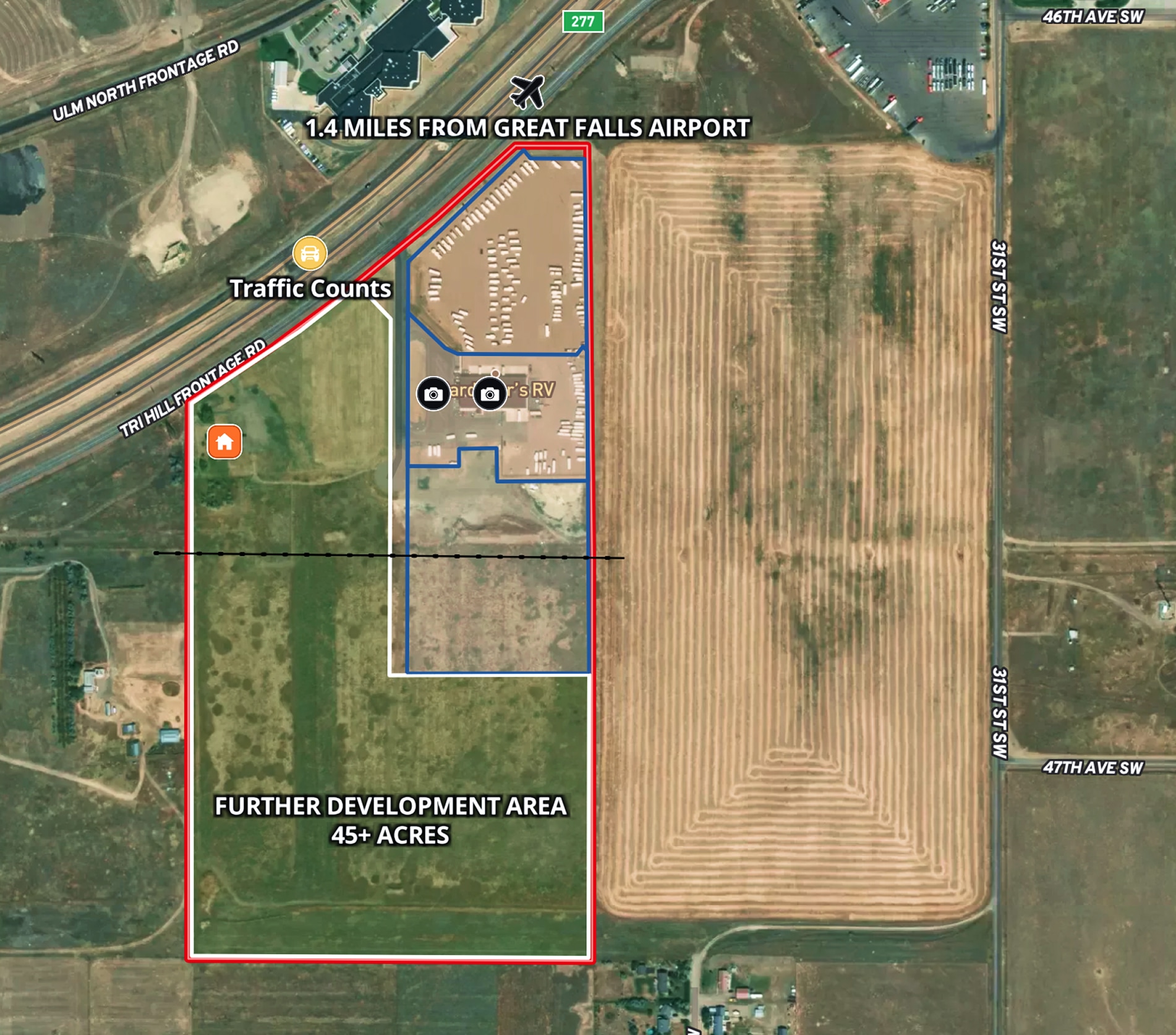
RV Commercial Listing
Tyree Real Estate uses Land id™ GIS mapping software to create a commercial property map showcasing land parcels, access points, and development potential.
Listing
Commercial
Property Development
Real Estate
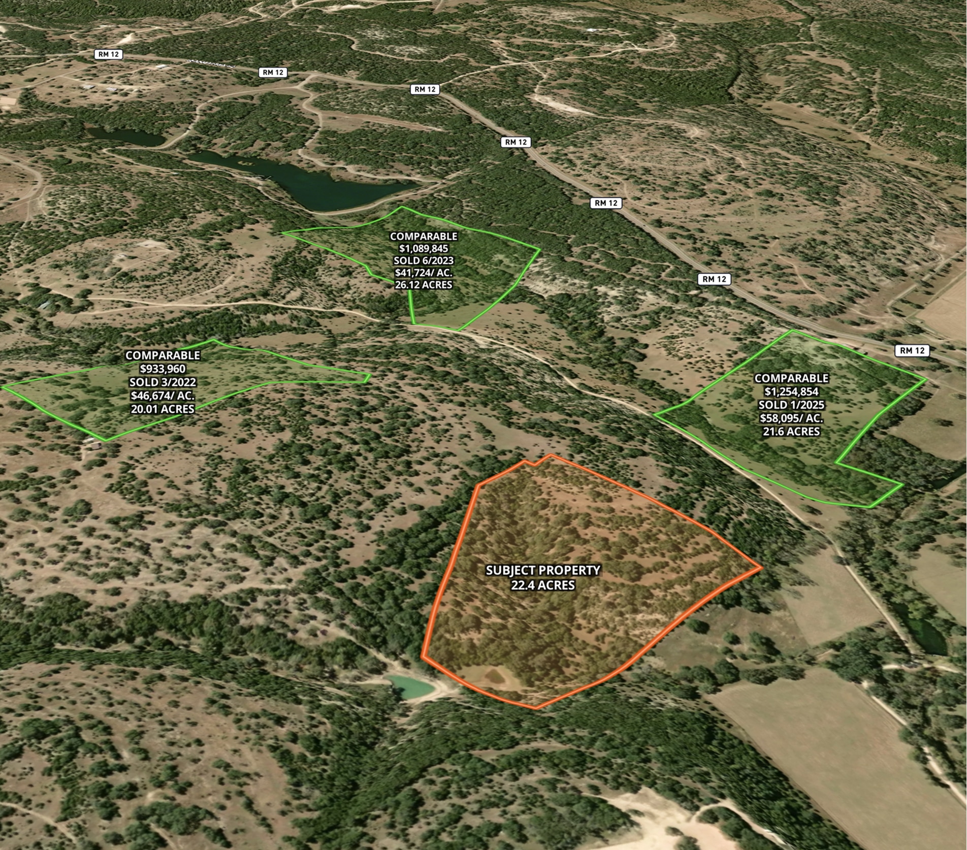
Market Trends Overview – Interactive Comps
Use Land id™ GIS mapping software to visualize property comps on a map. Simplify how you present similar land parcels and sales data.
Listing
Agricultural
Rural
Comps
Residential
Real Estate
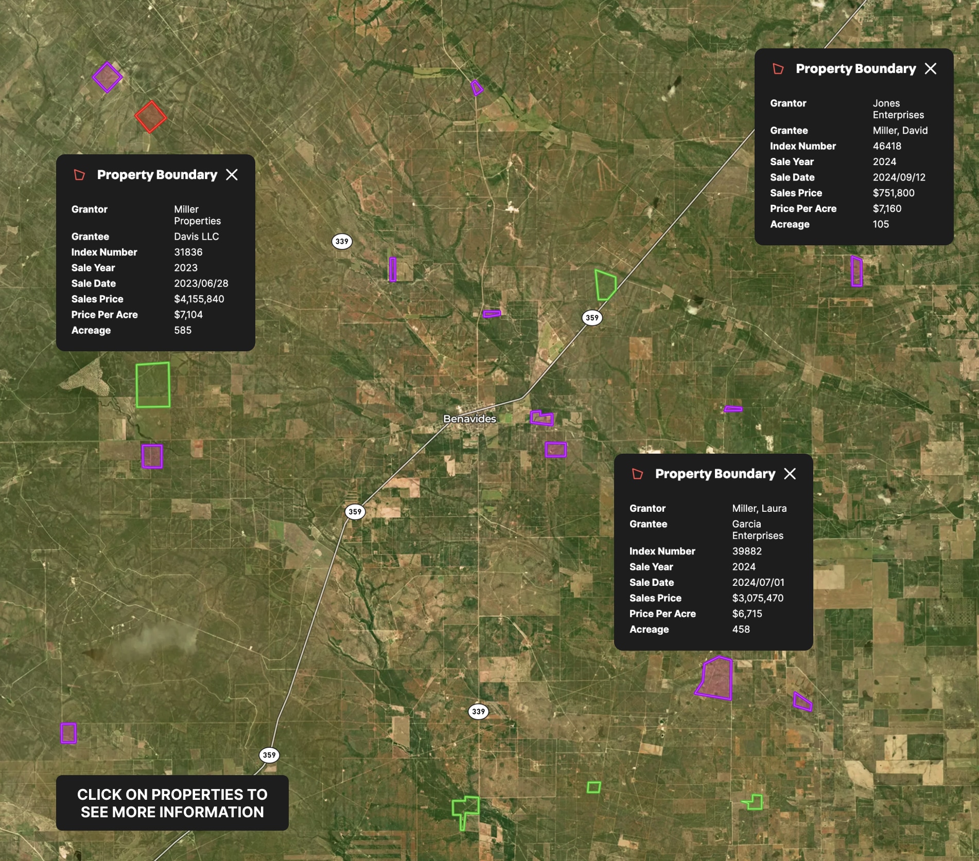
Appraisal Sales
Use Land id™ GIS mapping software to create a property map of sold land parcels, analyze sales data, and streamline appraisals.
Appraisals
Comps
Real Estate
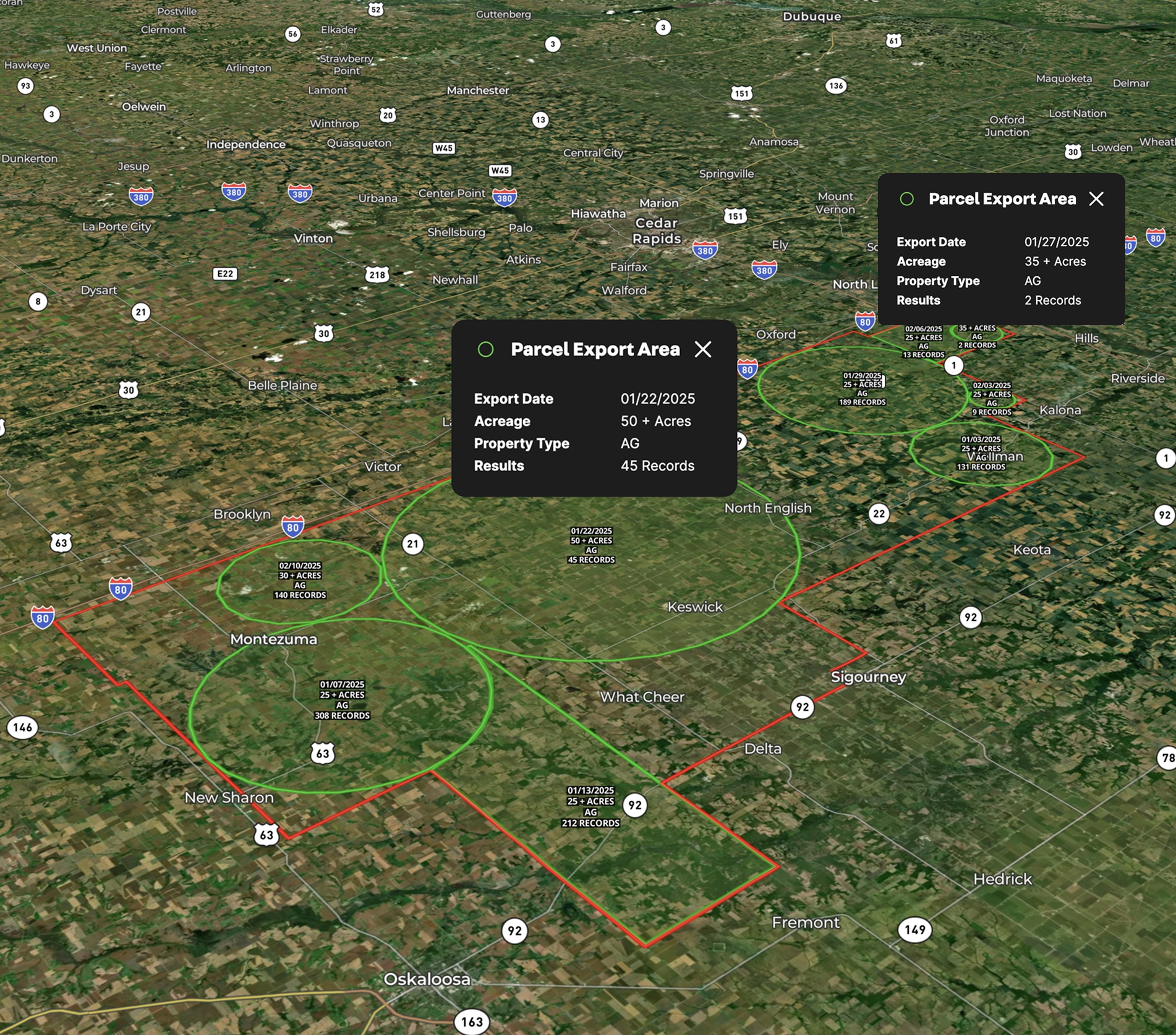
Lead Farming
Land id™ GIS mapping software helps you visualize lead areas with a map and track your targeted outreach efforts.
Agricultural
Rural
Commercial
Luxury
Residential
Real Estate
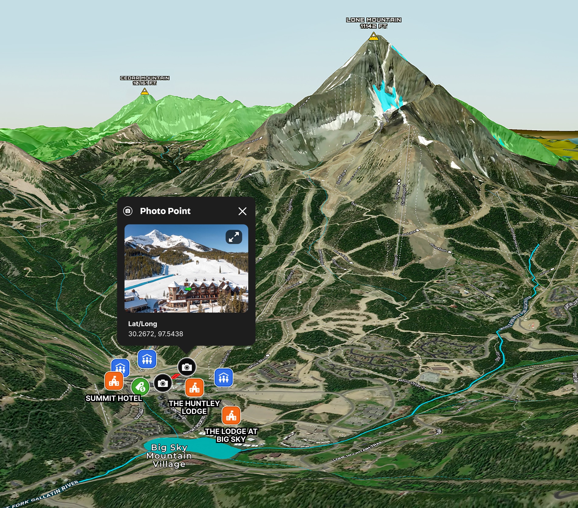
Big Sky Ski Condo Map
Land id™ GIS mapping software creates a clear real estate map showcasing prime slope access and resort amenities for this ski-in, ski-out Big Sky condo.
Residential
Luxury
Listing
Snow
Real Estate
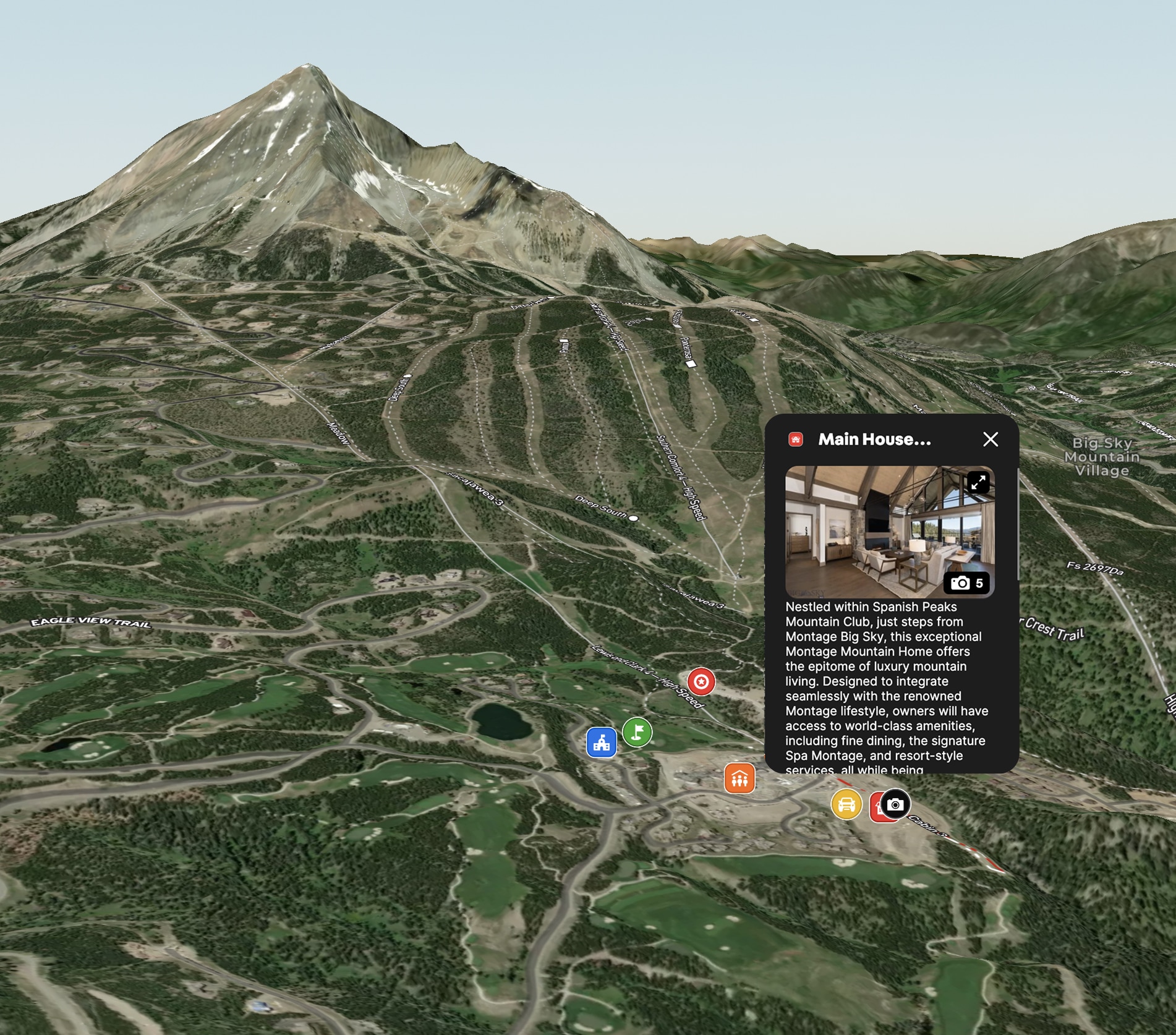
Montage Mountain Home in Big Sky, MT
Land id™ GIS mapping software showcases this luxury mountain home's ski access and resort amenities with a clear, interactive real estate map and property map.
Residential
Luxury
Listing
Snow

Real Estate
Cromwell Island
Explore Cromwell Island with Land id™'s GIS mapping software. Create property maps to showcase land parcels, shoreline, and terrain for an engaging real estate experience.
Residential
Luxury
Listing
Rural

Real Estate
Commercial real estate off-market prospecting
Boost your sales pipeline with Land id™'s real estate mapping software. Create property maps to track land parcels, market trends, and off-market opportunities with ease.
Commercial
Comps
Research

Real Estate
Diamond A Hickory Farm
Harlan Ray uses Land id™'s real estate mapping software to create clean, engaging property maps for real estate listings, enhancing buyer experiences and showcasing key land parcels.
Listing
Rural
Luxury

Real Estate
Sandy Creek Ranch
Harlan Ray uses Land id™'s real estate mapping software every day to create detailed property maps, build relationships and showcase expertise.
Listing
Rural
Luxury
Hunt
Agricultural

Real Estate
Round Mountain Ranch
Harlan Ray uses Land id™'s real estate mapping software to create property maps that build relationships. Perfect for easy real estate mapping.
Listing
Rural
Luxury
Agricultural

Real Estate
Buyer Representation Map
Save time with our mapping tool for real estate, allowing buyers to filter potential properties interactively before visiting.
Rural
Agricultural

Real Estate
Marketing a Commercial Lease
Enhance tenant site selection with our property mapping tool.
Commercial
Listing
Urban

Real Estate
Neighborhood Development Project in Texas
Use our real estate map maker to vividly present new developments, from trails to parks, enhancing buyer understanding.
Homebuilders
Property Development
Rural
Residential
Listing

Real Estate
Subdivided Lots for Sale
Simplify how you subdivide a parcel of land with our cut tool.
Property Development
Rural
Homebuilders
Listing