All over the country—but especially in the desert Southwest and semi-arid plains—farmers and ranchers worry about water. It’s the real liquid gold, necessary in everything they do, and they use a lot of it.
According to the Sustainable Agriculture Research and Education (SARE) program, 85% of U.S. water consumption can be attributed to agriculture. That makes proper water management on your property not only incredibly important but also necessary for everyone’s sake.
No one set of practices is universally appropriate to manage water. Landowners must evaluate their crop and livestock systems, potential constraints, and water supply to determine the right mix of water management practices.
Property maps and data from surveys and assessments are key components to gaining a better understanding of your land and determining these factors that will play a role in how you manage it. With this data, you’ll be able to create a water management process that enhances the natural abilities of your land, ultimately fostering a healthier and more productive environment.
Understand the Land
You’ll notice as you read that one of the most important reasons to study the inner workings of your land is to trap and contain your water. Water wastage is a huge problem you have to solve if you want to optimize the output of your land without harming it.
Know Your Limits
A healthy ecosystem is key to a successful water management plan. However, if you don’t understand the resources you have on your land—usable space, vegetation, soil type, water supply—then your agricultural activities are much more likely to overtax them, causing the ecosystem to deteriorate.
A practical example of this is overstocking a pasture with only one stock pond. The livestock will destroy the vegetation around the water source that naturally filtered runoff before it collected in the pond. Without these plants, contaminants such as fertilizer will remain in the water your livestock ultimately drink. If you take the time to learn the limits of your land, you’ll be less likely to overwork it and negatively affect its natural abilities to manage water.
Learning your land usually requires a mix of old-fashioned, boots-on-the-ground observations and analysis of property maps and data collection from surveys. You can map out resources and determine what steps should be taken to preserve them.
There are activities you can take to ensure you do not push your land too far.
- Prescribed grazing is a popular practice among ranchers to manage vegetation, ensuring no area is being over- or under-grazed, thus disrupting the natural ecosystem.
- Areas around rivers or streams can also be fenced off, allowing you to regulate how much access livestock have to them.
- If you have pushed your property too far, the land can usually regenerate on its own if you lessen the agricultural pressures you’re applying to it.
Map Topography & Contours
With an understanding of the topography of your property, you can create a system that maximizes usage of available land and water resources. This is especially valuable for owners of arid or rugged land. By understanding the slopes of your land, you can map out the path rainwater runoff takes downhill and design a collection system tailored to your specific topographic requirements.
Contour farming is a sustainable and economic way to make the most of your available acreage, reduce soil erosion, and slow down runoff allowing it to soak into the ground where it’s needed most. By adapting your activities to emphasize hillside runoff and snowmelt, you’ll also be taking the stress off of other water sources such as aquifers or rivers.
Understand Your Water Features From the Surface Down
Mapping out water features helps you understand how water moves into, around and off your property. From the examination of property maps and data provided by state and federal sources, you can learn a great deal about how water management will look in practice for you.
Streams, rivers, wetlands, floodplains, and even the aquifers storing water right under your feet all play key roles in the way your land has developed. Learning all you can about these water features will help you determine how your agricultural or growing efforts will fit into the land.
Wetlands
Wetlands are critical to the health of your land. They perform a number of functions including the filtering and replenishing of groundwater, aiding in regulating both terrestrial and aquatic ecosystems and even serving as natural fire breaks.
These systems store or remove nutrients from runoff and trap sediment; if you’ve ever wondered why well or spring water tastes so fresh and clean, it’s thanks to places like marshes, riparian zones, and swamps.
Unfortunately, these areas can be fragile, and as landowners work the land, these efforts can hurt wetland areas. Mapping them out and planning around these areas will benefit the health of your land in the long run.
Floodplains
Floodplains collect water during high periods of discharge. They sit next to a body of water such as a lake or a river, making them a type of riparian zone. They allow water to spread out and slow down so runoff doesn’t run straight into rivers and streams and cause rapid, severe flooding.
Any changes you make on your property that changes the natural flow of water could destroy floodplains. We’ve seen what happens when we lose natural floodplains along major rivers, the almost-yearly Mississippi River flooding being a prime example.
Floodplains also happen to produce very fertile soil, and people have been farming in these areas for millenia. So, if you can map out the floodplains on your property and anticipate where flood waters will flow, you can plan your crops around this knowledge, planting crops that need less water away from these areas and plants that thrive on more water near these areas.
Aquifers
These underground storehouses of water may seem like a limitless resource, but overuse will deplete them much quicker than one expects. When that happens, it takes thousands of years for aquifers to replenish.
For this reason, it’s important to know what minor and major aquifers the wells on your property pull from. Property maps and data about your aquifers will tell you several things: how reliable a resource you have, the quality of the water being pulled from these wells, and if you have any alternative sources.
Look Under Your Feet
Soil supports everything farmers and ranchers do, especially water control and conservation. If it's unhealthy, the water, plants, wildlife, and livestock living on top of it will also be unhealthy.
That’s because soil is responsible for the filtration of water and storage of nutrients. Some soils such as those containing heavy clay don’t allow water to soak into the ground, causing flooding during storms. Sandy soils, on the other hand, allow water to flow through them too freely and don’t filter out minerals and nutrients.
All soil types can be improved if you know what you’re working with. By analyzing property maps and data from soil reports, you’ll be able to determine the suitability of soils in a particular area for activities such as grazing, farming, or supporting wildlife. You can even learn which improvements can be applied to a certain type of soil and which may be impractical.
The Tarrant series of soils, for instance, is not ideal for seeding, fertilizing, or water control due to its clay-like consistency and presence of limestone, marl, and chalk. This soil type can really only support grazing or wildlife food.
The Frio series of soils, however, occur on floodplains and are better at filtering water and retaining nutrients in the soil for plants. These soils can be used to cultivate crops with proper management practices.
Manage Your Land With Land id®
Land management is a complex process involving the monitoring and analysis of multiple systems on your property. Every aspect—soil, plant and wildlife, agricultural practices, human activity, water supply—must be considered to ensure the equilibriums of your land are not disrupted.
Luckily, technology has only improved over the years to help landowners gain a better understanding of their land.
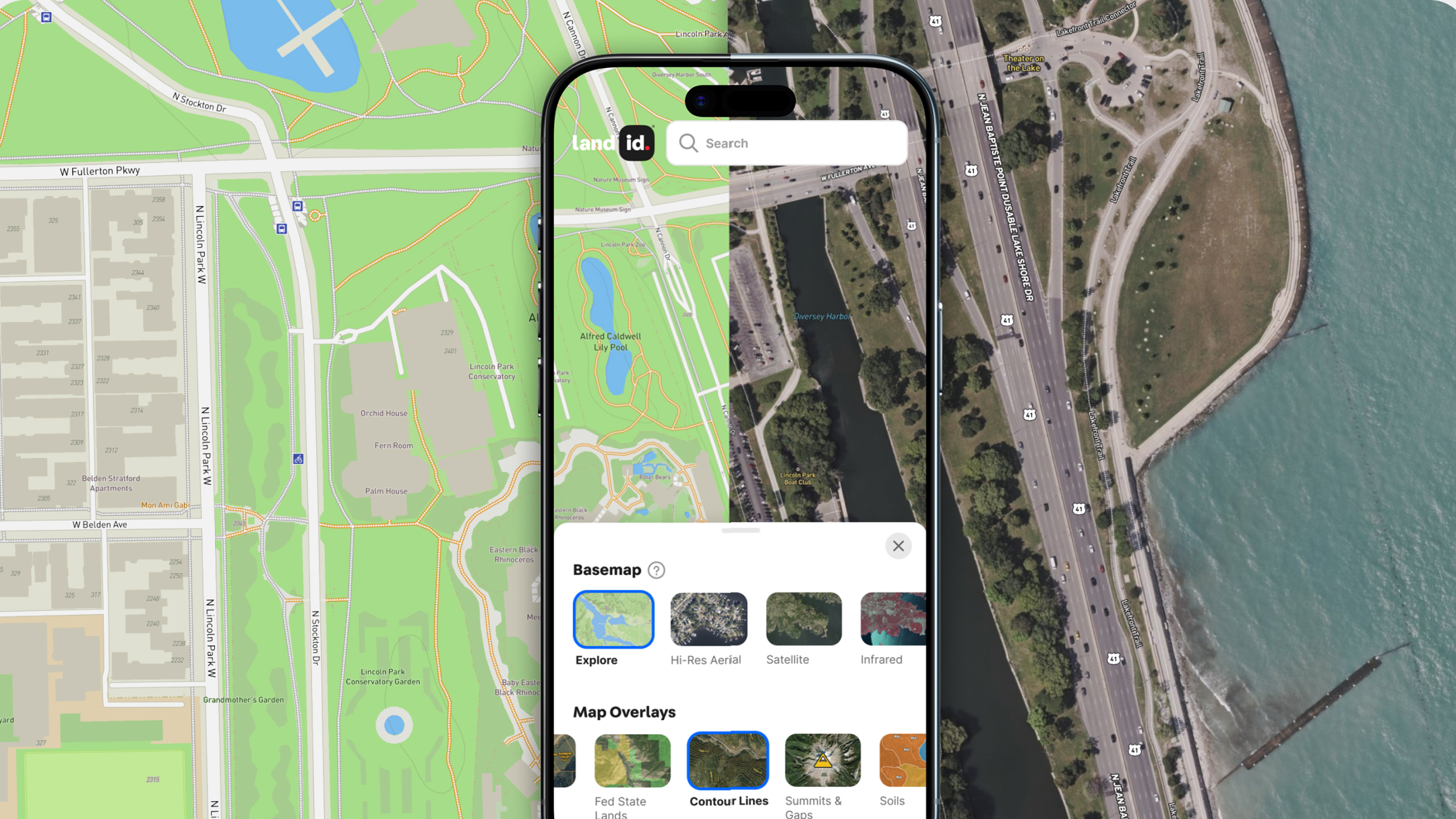
Land id not only helps you map out your land, it helps you plan your ranching or growing activities more holistically. With a few clicks, you can create and customize property maps and data from an array of sources. Layer USGS topographic data, 100 and 500 FEMA floodplains, water features, detailed soil reports, aquifers, and more together on one comprehensive map of your land. With all of this information, plan growing and grazing schedules with more confidence and dedication to the continued health of your land.
Land id also enables you to share any map you create. Email or embed them on a website as an interactive map, print a PDF or PNG, or bring Land id out into the field with you with our mobile app.
From our app, you can add photos and videos, create notes, calculate distances, track your location and movements, work offline, and much more.
Effective water management is critical to the success of all other activities you undertake on your land. With Land id, you can take the guesswork out of planning. Start a free trial today and make maps that truly give you visibility into your land.
FAQs

Continue Reading


