


5.6 Acre Rural Listing in Bozeman, MT
Land id® GIS mapping software creates immersive real estate maps that showcase property features, land parcels, and lifestyle highlights for this Bozeman riverside retreat.
Listing
Residential
Rural
Luxury
Fish

Commercial Real Estate Off-Market Prospecting
Boost your sales pipeline with Land id®'s real estate mapping software. Create property maps to track land parcels, market trends, and off-market opportunities with ease.
Commercial
Comps
Research

Subdivided Lots for Sale
Simplify how you subdivide a parcel of land with Land id's cut tool.
Property Development
Rural
Homebuilders
Listing

Data Center Development Site Analysis
Use Land id® GIS mapping software to evaluate land parcels for data centers. Create a property map with overlays for utilities, floodplains, and more using real estate maps.
Commercial
Property Development
Research
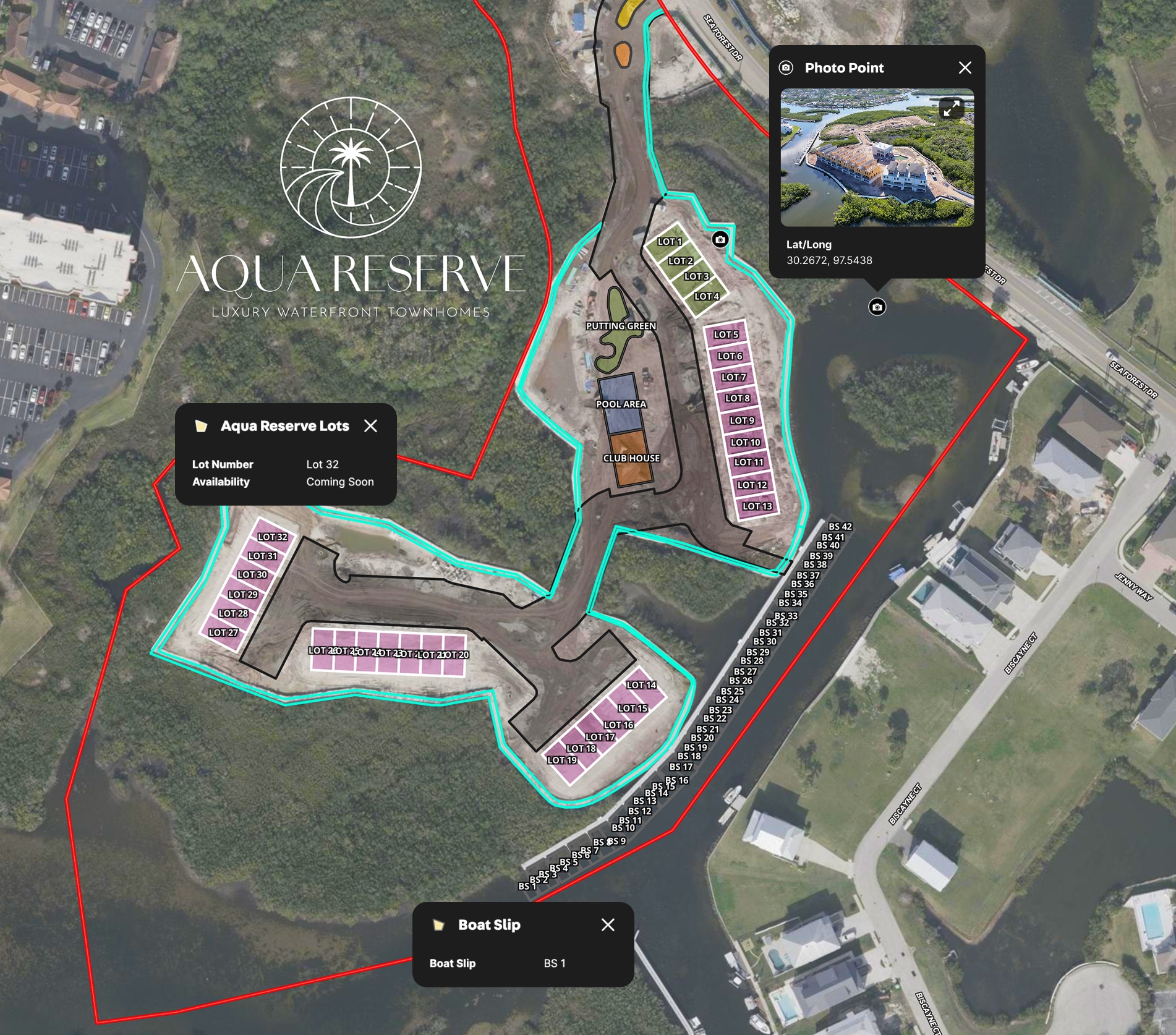
LPT Realty Aqua Reserve Development Map
LPT Realty used Land id® GIS mapping software to create a branded property map for new construction and show real-time availability insights.
Listing
Urban
Water
Property Development
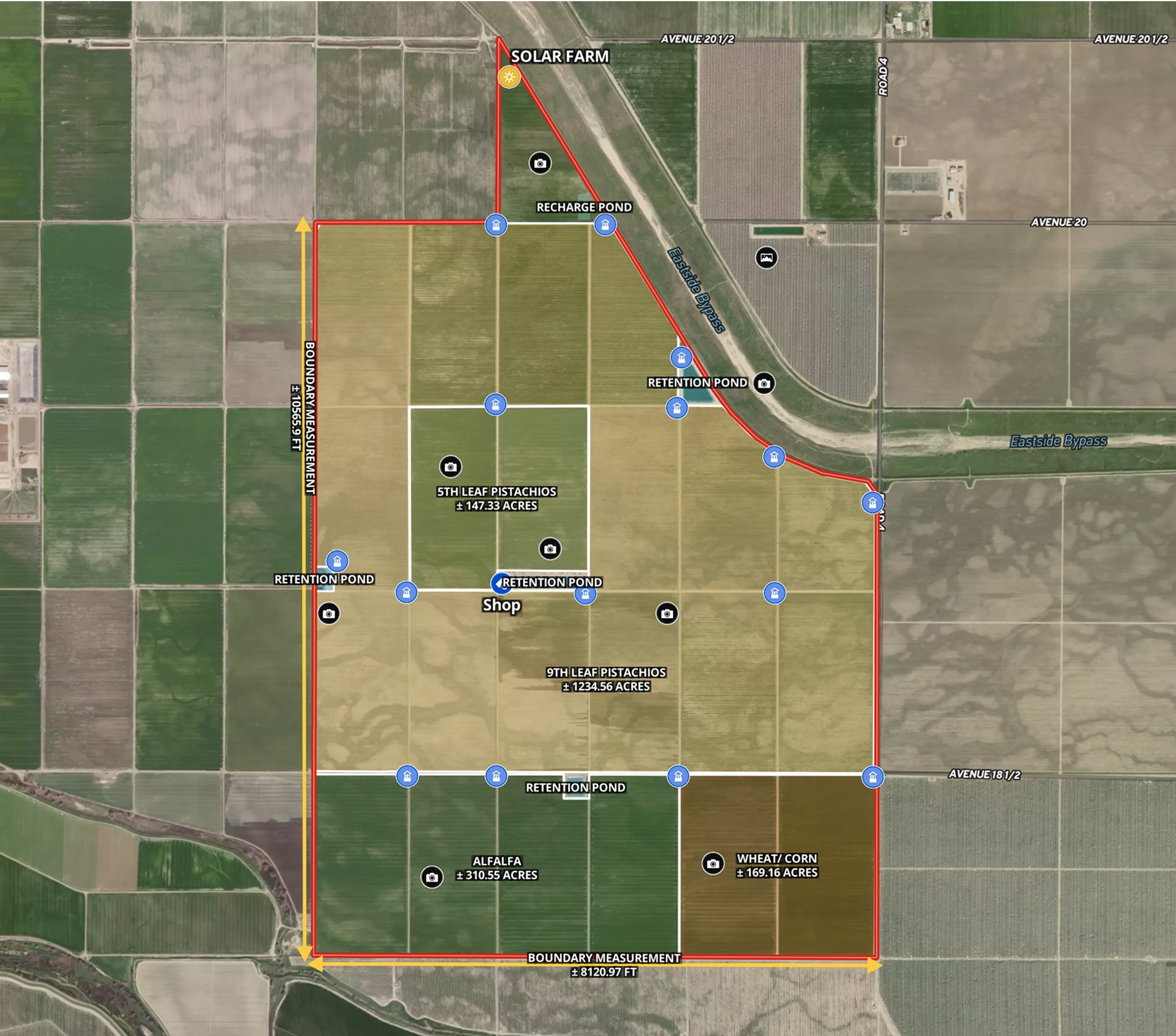
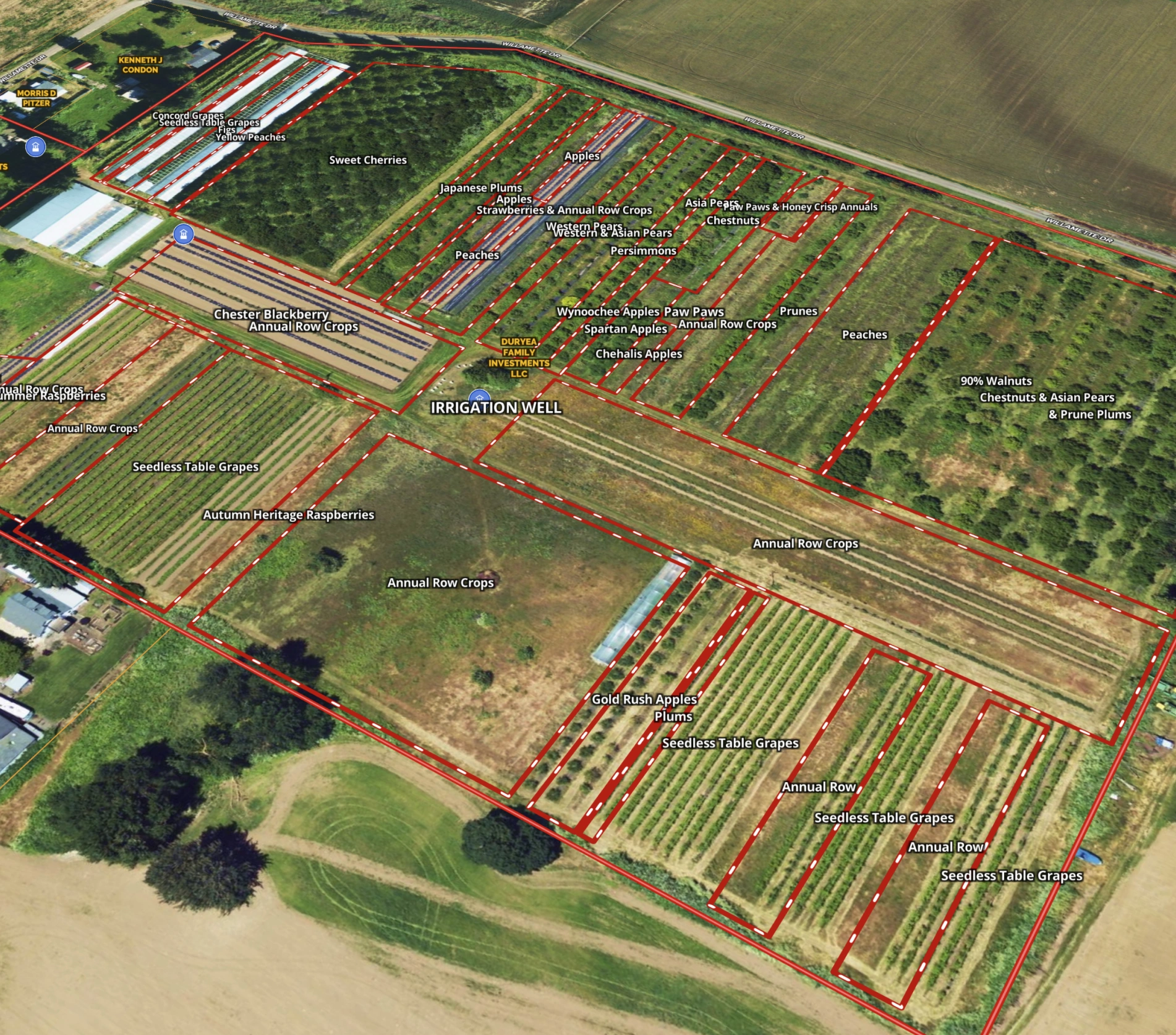
Ag Farm in Madera County, CA
Todd Peterson uses Land id® GIS mapping software to embed real estate maps that showcase detailed layout of productive California farmland.
Listing
Agricultural
Rural
Soil
Water
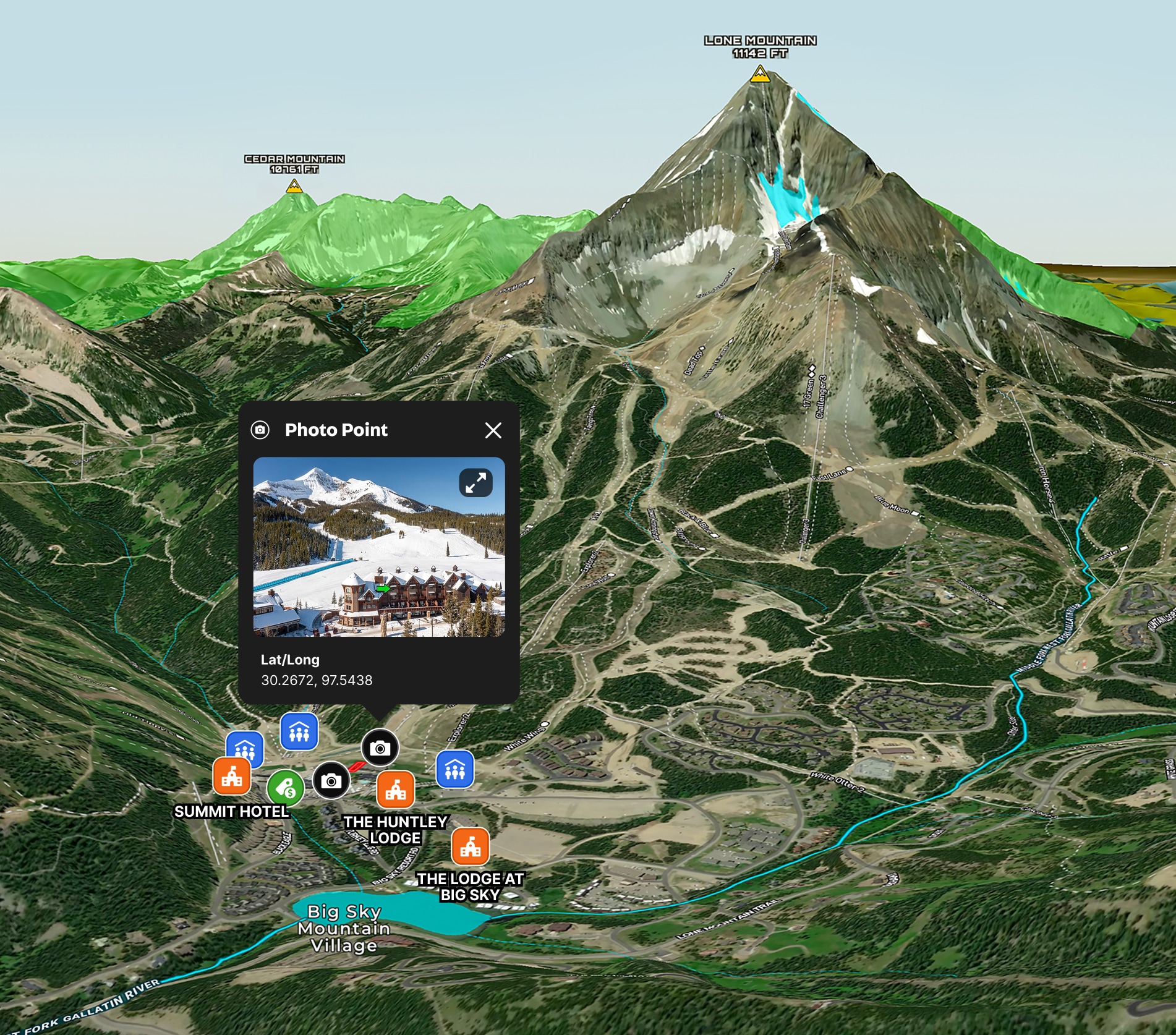
Big Sky Ski Condo Map
Land id® GIS mapping software creates a clear real estate map showcasing prime slope access and resort amenities for this ski-in, ski-out Big Sky condo.
Residential
Luxury
Listing
Snow
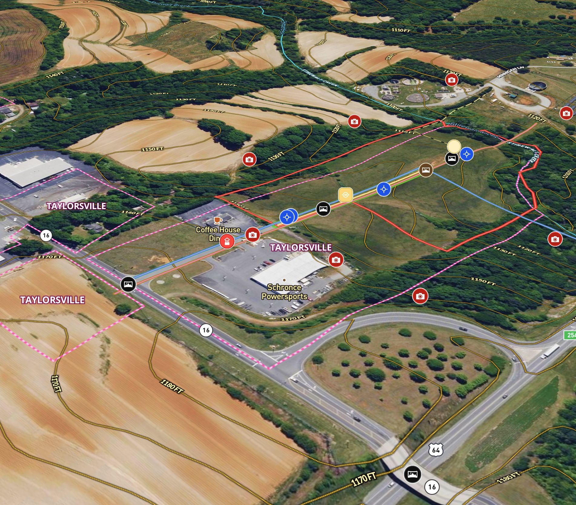
Commercial + Development Listing in NC
Mossy Oak uses Land id® GIS mapping software to showcase this ±11.90-acre land parcel with a real estate map highlighting utility availability, highway access, floodplain, and development potential.
Listing
Commercial
Panoramics
Property Development

Fencing for Texas Red Deer Ranch
Jimmy Banks uses Land id's real estate mapping software to map his Texas ranch, get land measurements to plan fencing projects, and integrate new land parcels with precision.
Rural
Land owner
Land management
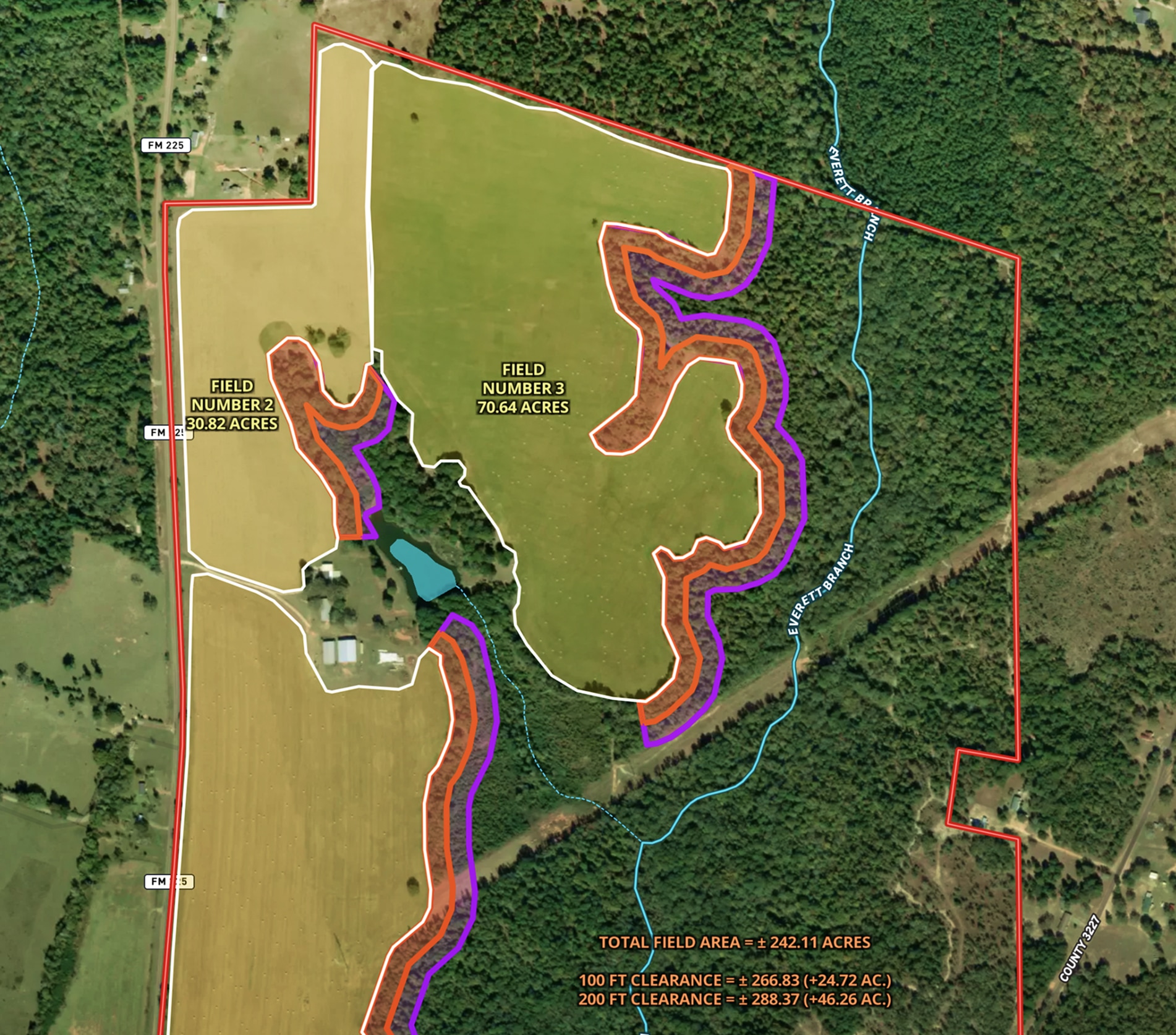
Land Clearing Analysis Map
Land id® GIS mapping software helps landowners visualize field expansion with property maps, buffer zones, and acreage gains—making land clearing plans easy and clear.
Land owner
Land management
Timber
Renewable Resources
The Broken Fence – Premier Utah Hay Farm
Zeb White uses Land id® GIS mapping software to create a real estate map of The Broken Fence, showcasing land parcels, hay fields, and key property infrastructure.
Agricultural
Listing
Rural
Water
Lead Farming
Land id® GIS mapping software helps you visualize lead areas with a map and track your targeted outreach efforts.
Agricultural
Rural
Commercial
Luxury
Residential
%2520off%2520Blanco%2520River%2520-%2520Thumbnail.webp)
Residential Listing (7.5 Acres) Off Blanco River
Enhance your property listing strategy with Land id's real estate mapping software.
Luxury
Residential
Water
Rural
Listing
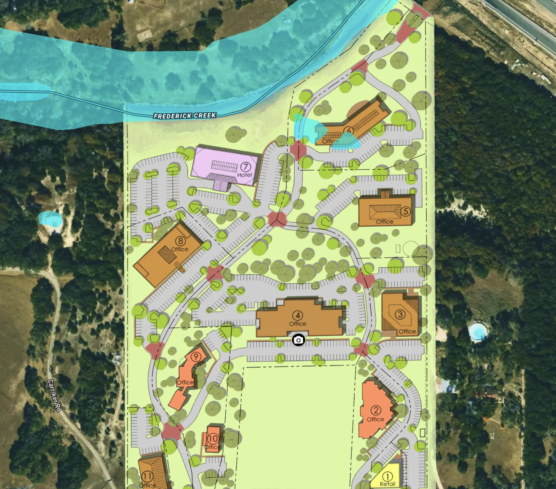
Office Park Development in Texas
Embed site plans and surveys in a map to elevate your commercial real estate project.
Commercial
Property Development

Montage Mountain Home in Big Sky, MT
Land id® GIS mapping software showcases this luxury mountain home's ski access and resort amenities with a clear, interactive real estate map and property map.
Residential
Luxury
Listing
Snow
Grateful Harvest Farm
Lisa Johnson and the Horsepower Real Estate team used Land id® GIS mapping software to accurately appraise and sell Grateful Harvest Farm. Detailed property maps and acreage reports enhanced farm land pricing.
Rural
Listing
Agricultural
Soil
%2520in%2520Rollingwood%252C%2520Texas%2520-%2520Thumbnail.webp)
Residential Listing (0.3 Acres) in Rollingwood, Texas
Maximize property appeal using our mapping tools, showcasing residential proximity to retail areas, parks, and schools.
Luxury
Listing
Residential
Urban
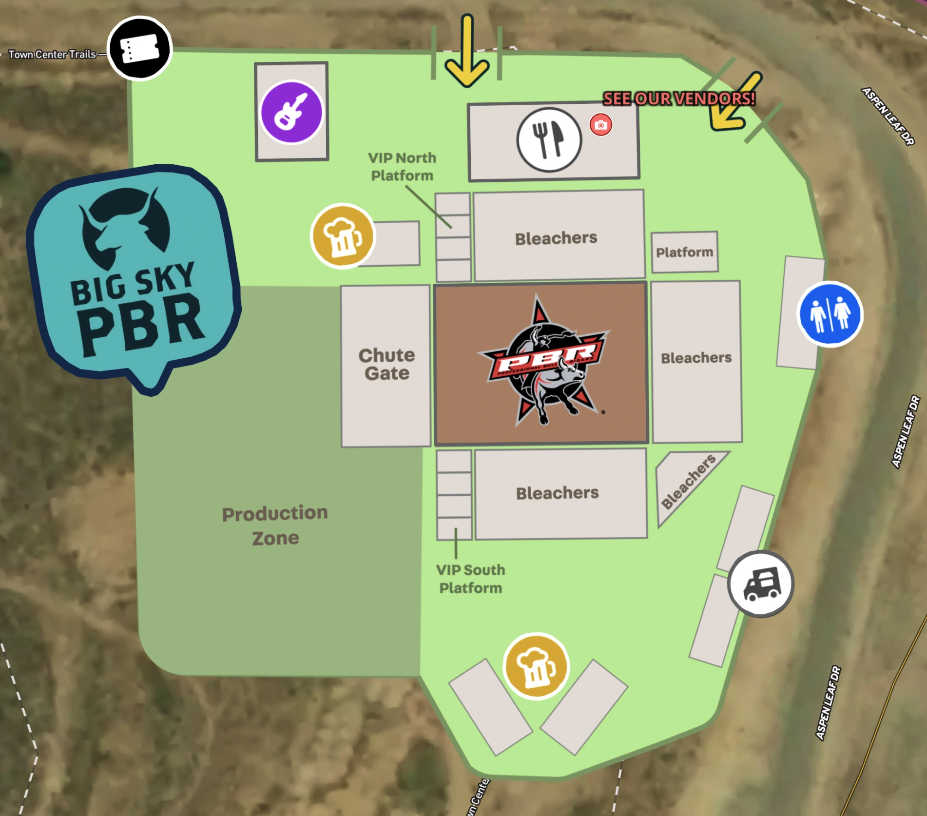
Big Sky PBR 2024 Event Map
Explore the Big Sky PBR event map made with Land id's interactive GIS mapping software.
Events
Rural