Market,
Showcase
& Sell.
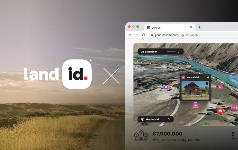
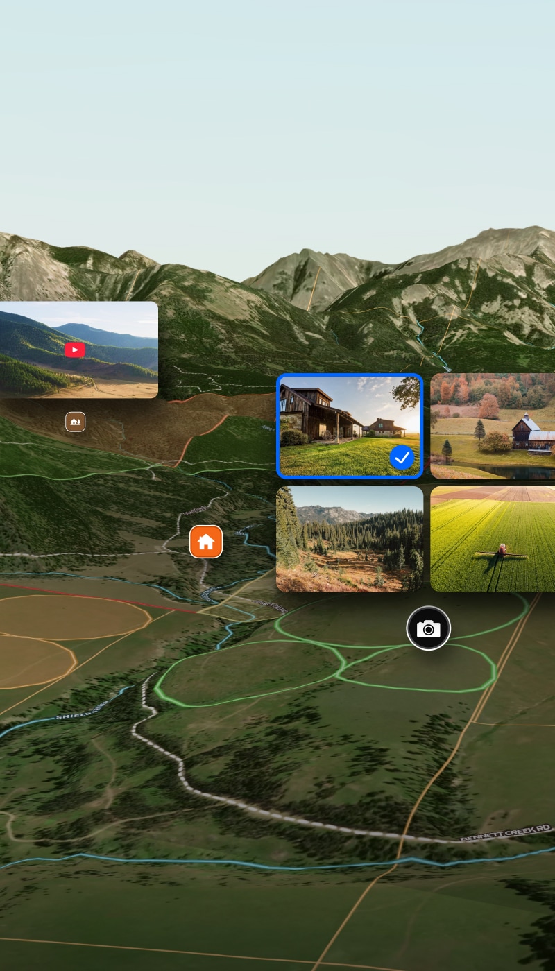
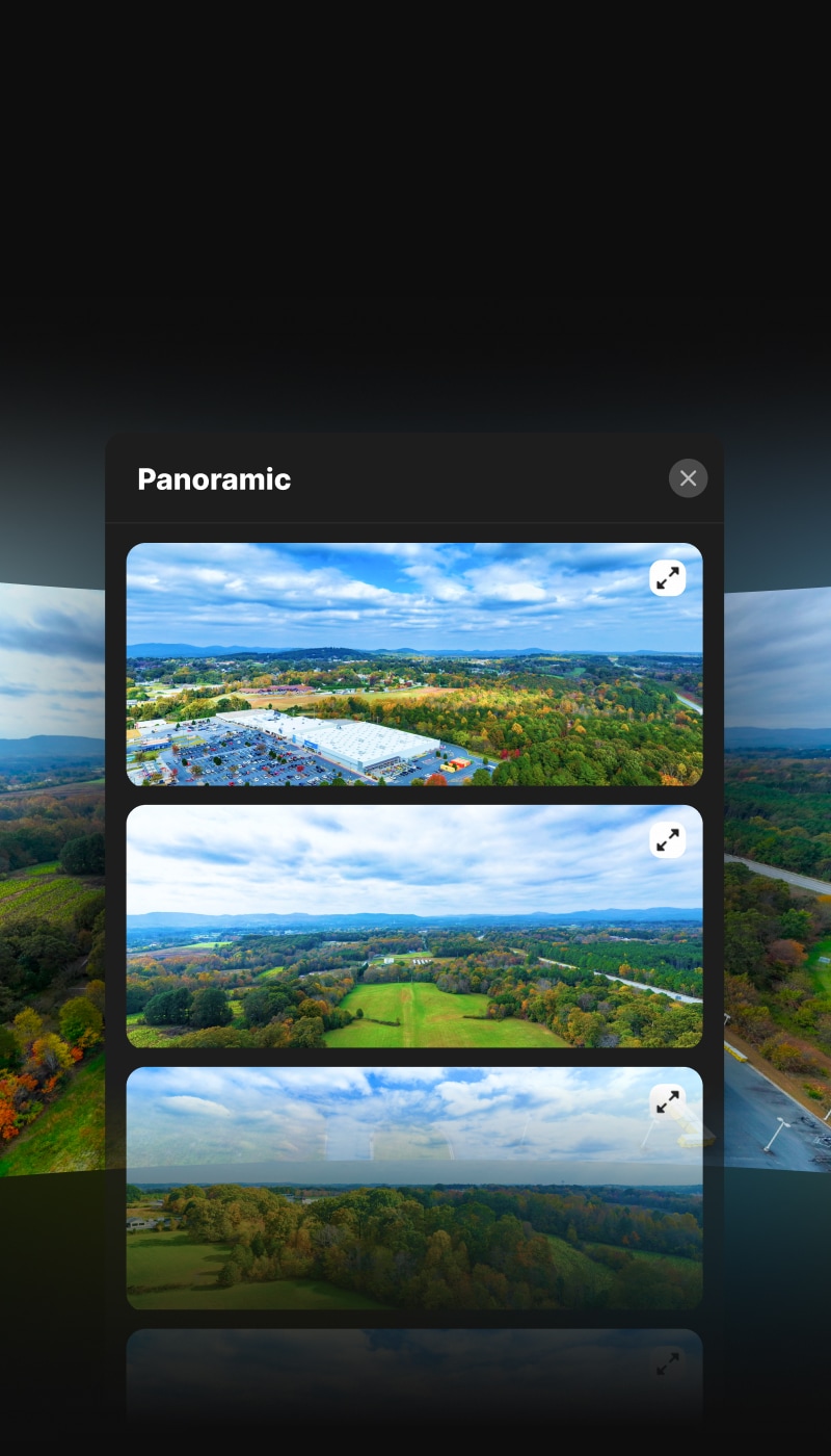
Create Property Tours That Win & Close Deals
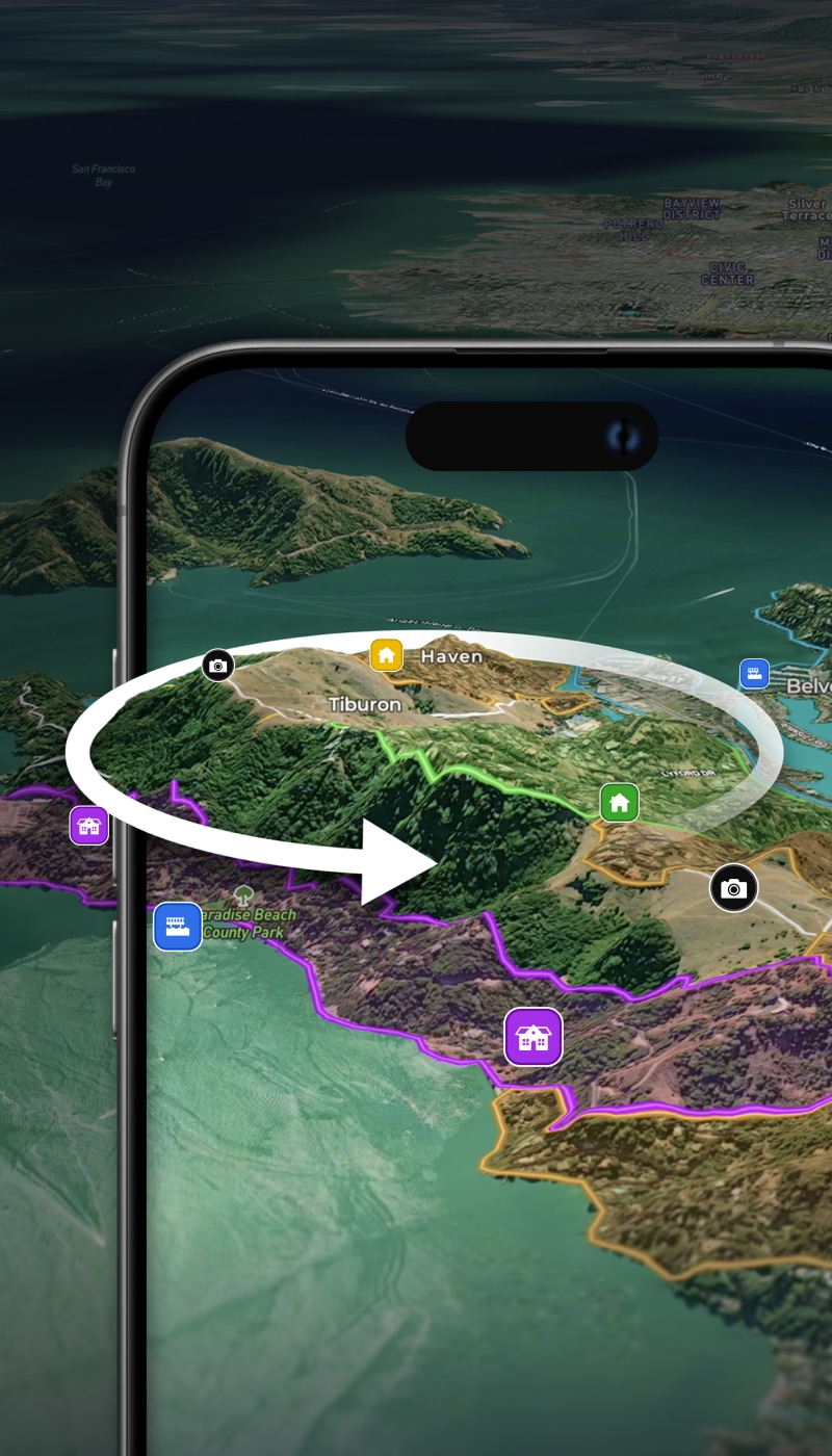
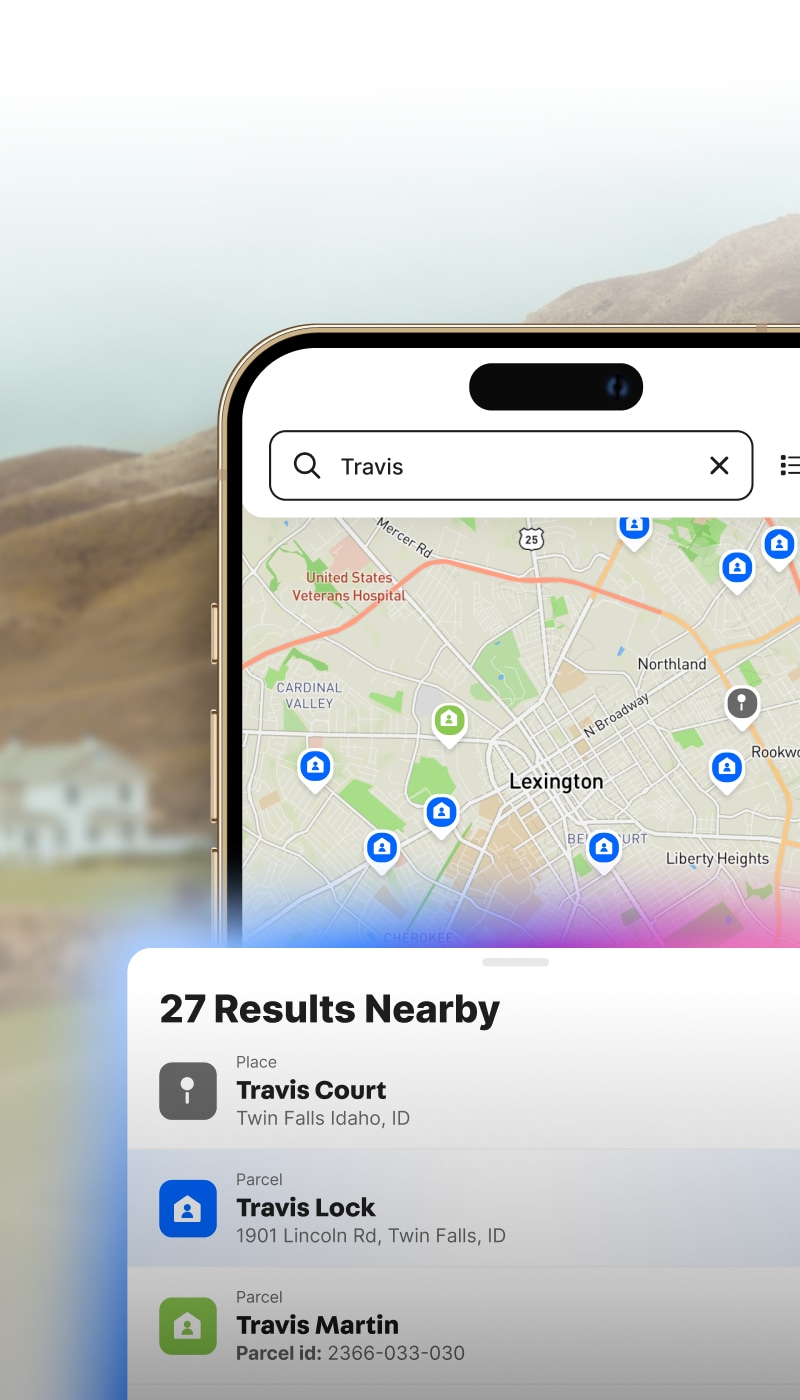
Turn parcel data, 3D maps, boundaries, and key property insights into a shareable tour that helps buyers understand the opportunity faster.
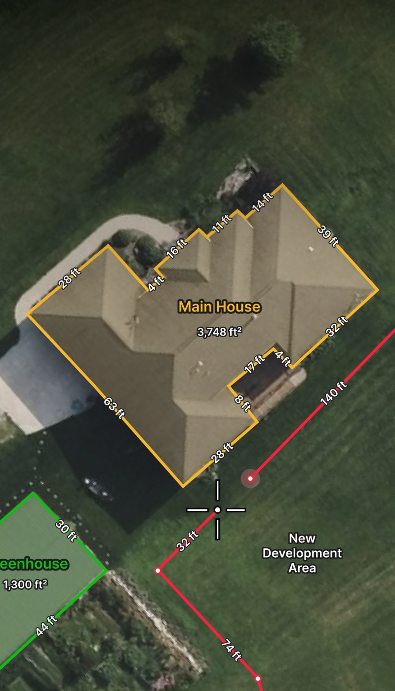
A good map of a property is worth thousands if not millions of dollars to a seller, as it gives the best representation of what you are selling to a prospective buyer.

Create personalized maps for your real estate listings, projects, and beyond with Land id on your desktop and mobile devices.

I use Land id because it’s practical, it’s beautiful, it’s feature-rich, and it makes selling real estate so much easier.
Your Go-To Prospecting & Marketing Toolkit


Get Property
& Owner Insights.
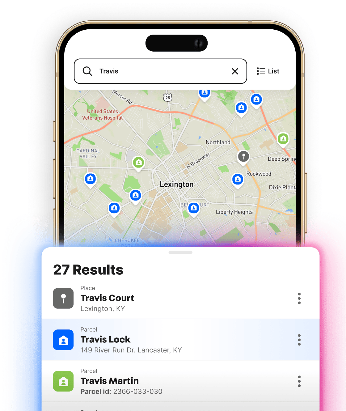
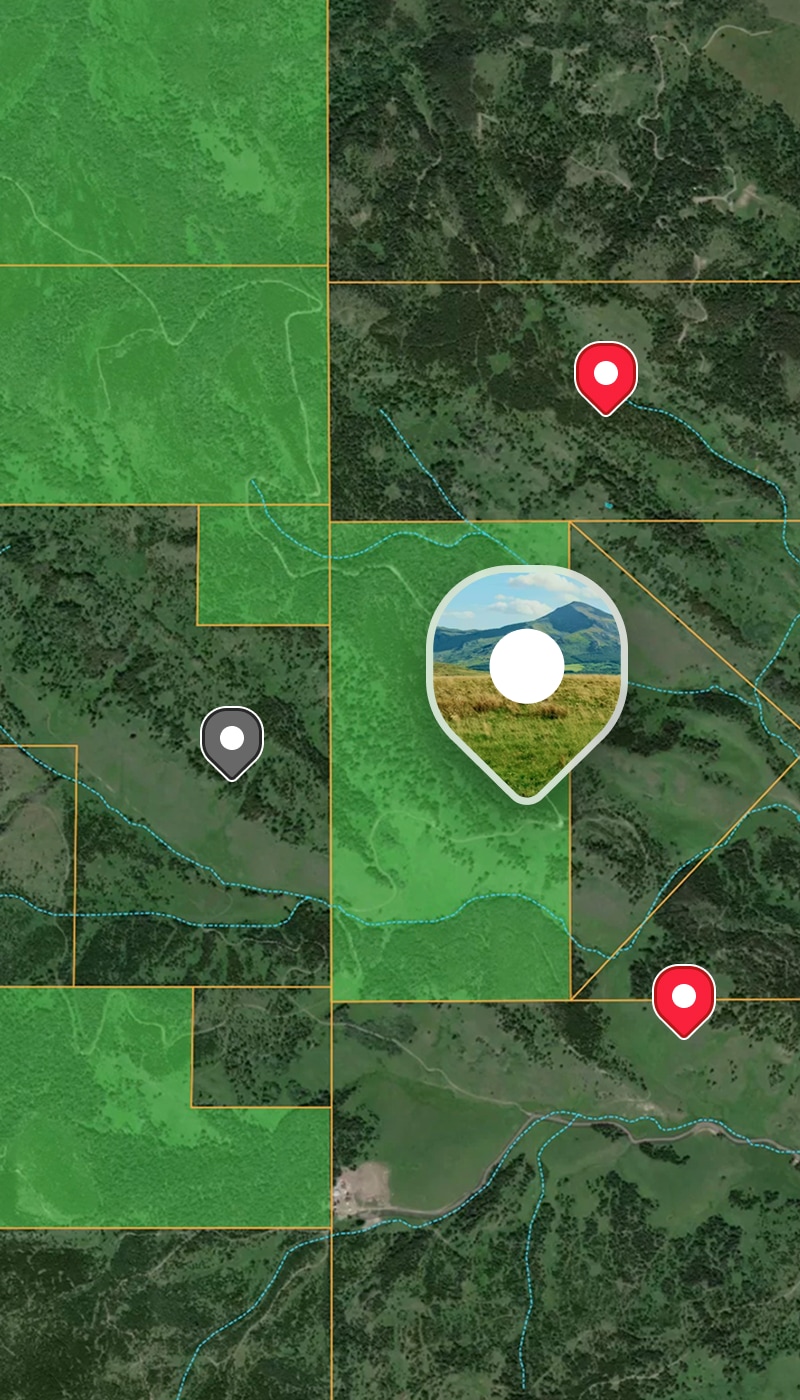
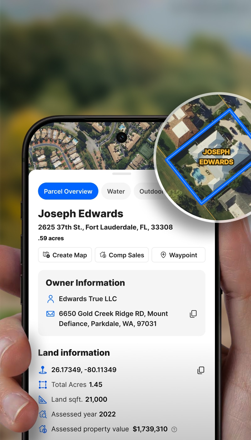
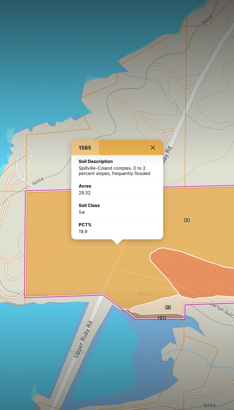
Understand the Potential of Any Property
Know everything there is to know about a property.
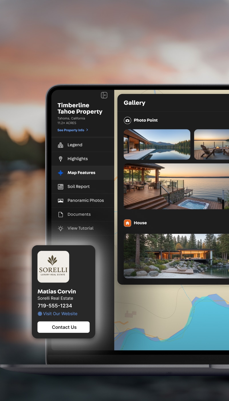
Turn deep data—from soil analyses to easements to water access—into clear, go/no-go decisions.
Get nationwide property boundaries and extensive private and pubic property data on your desktop and mobile devices.

Land id is the most valuable tool in my toolkit. For understanding the land, for understanding the attributes of the land, there’s no better tool.
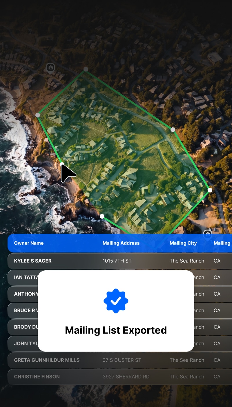
The Industry’s Most Extensive Property Data


Trusted by Industry Pros


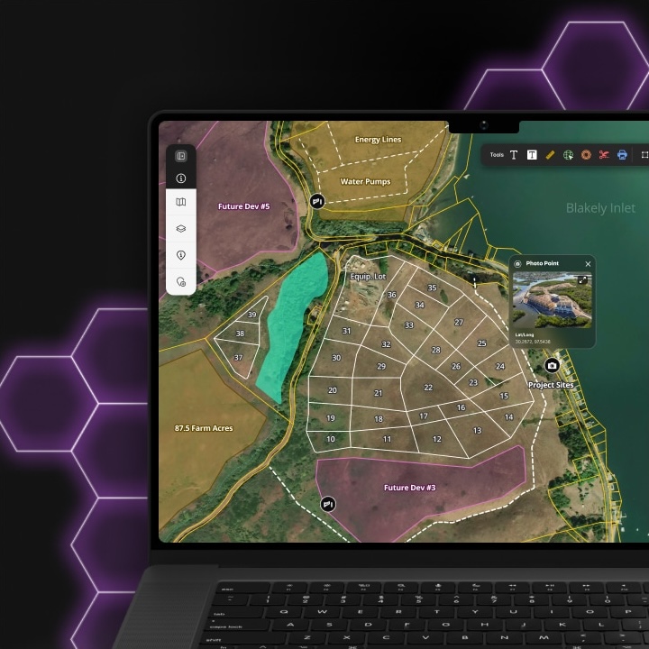
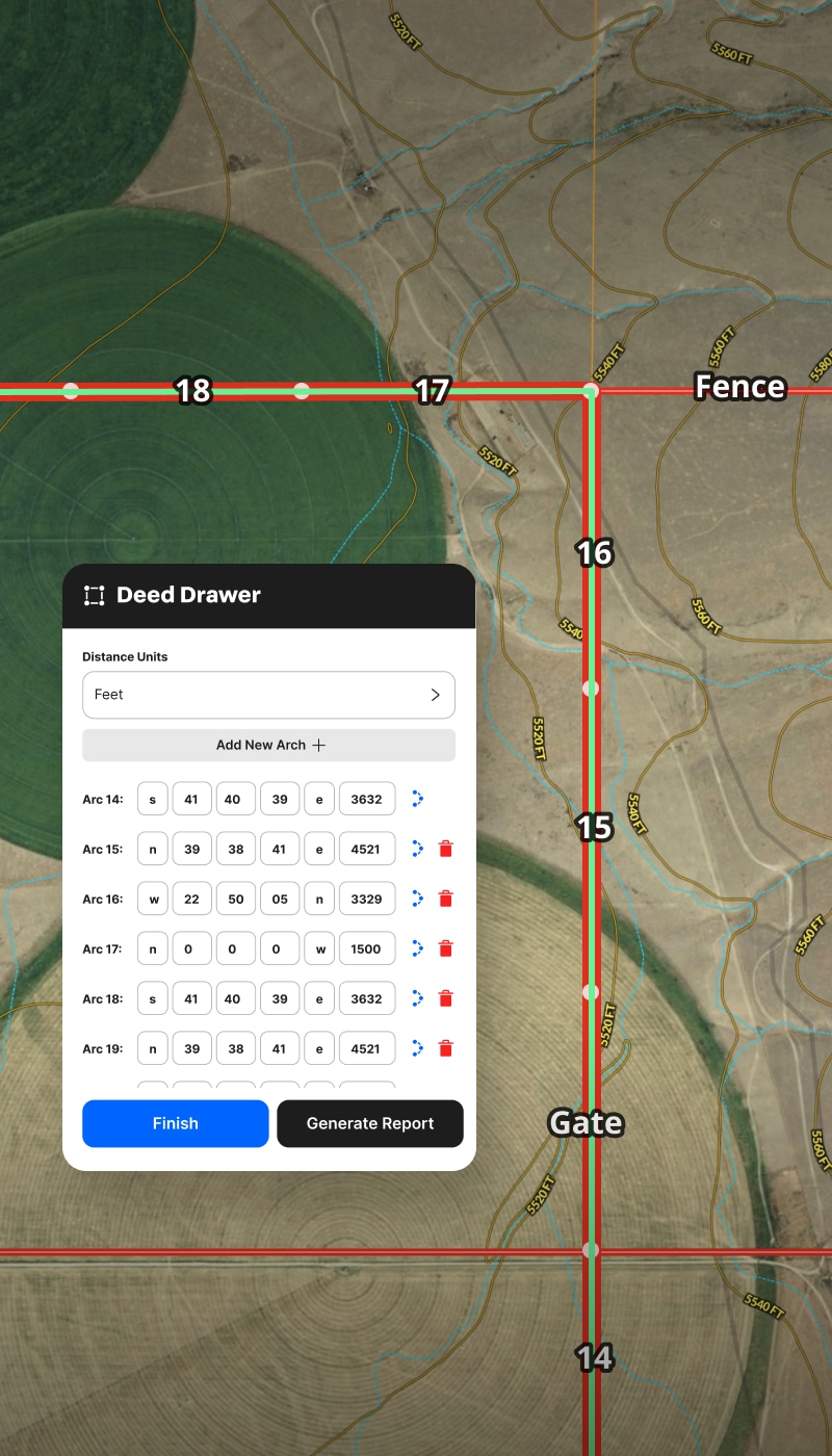
Map, Manage
& Share Land
Projects.
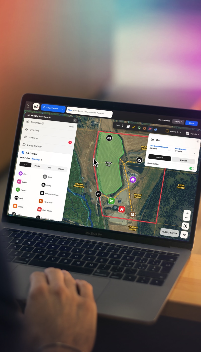
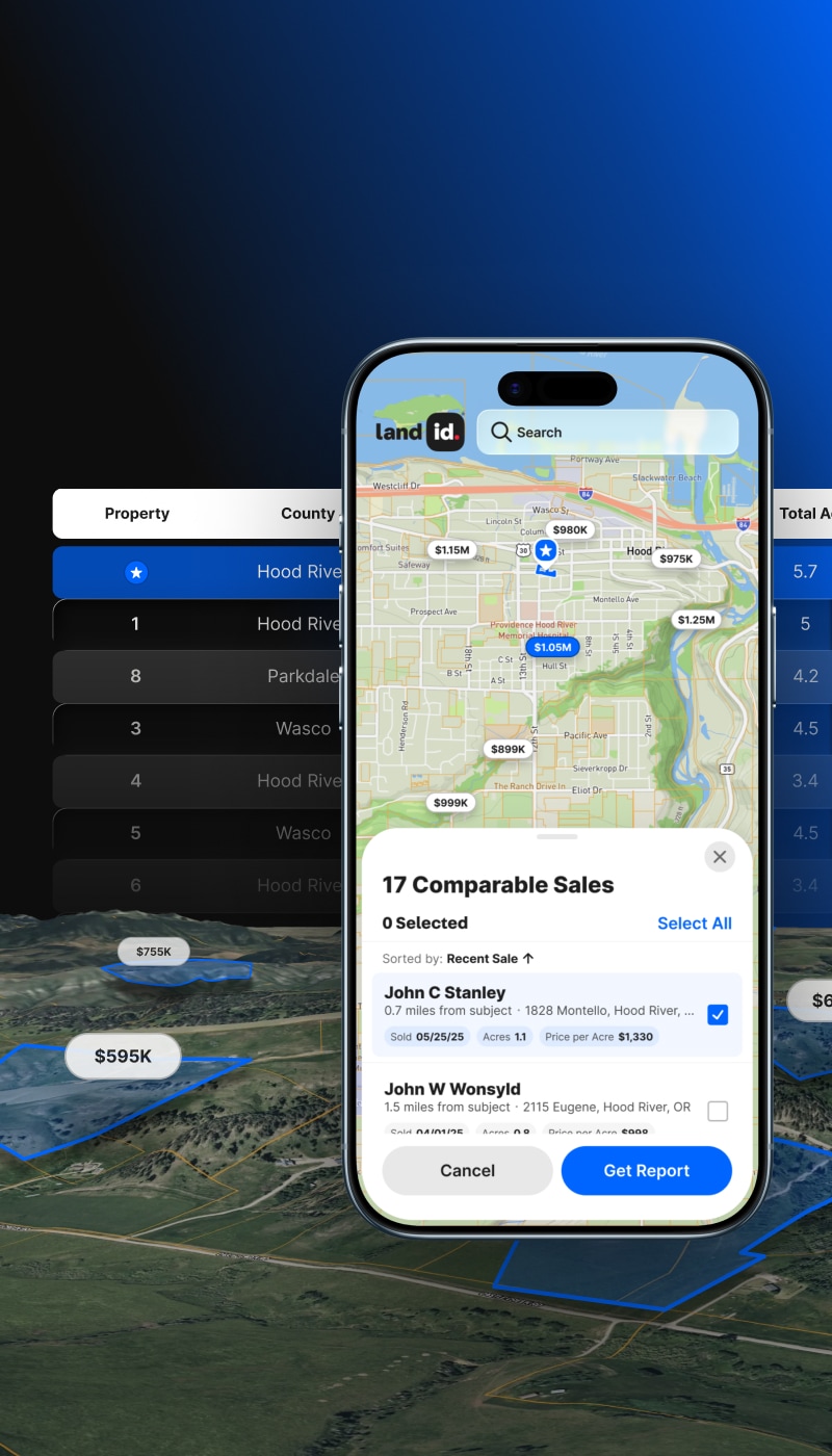
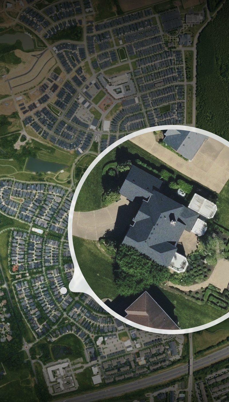
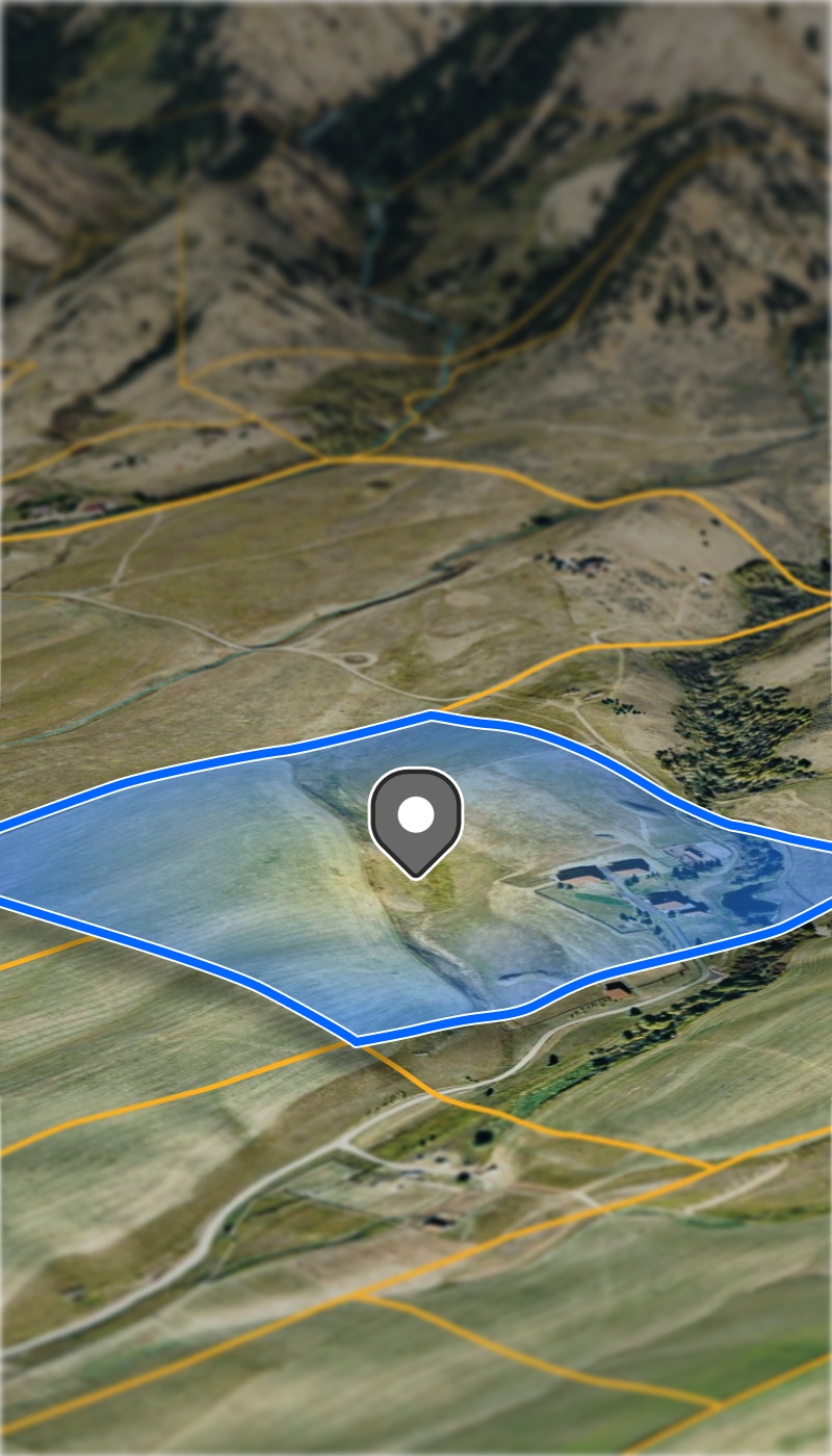
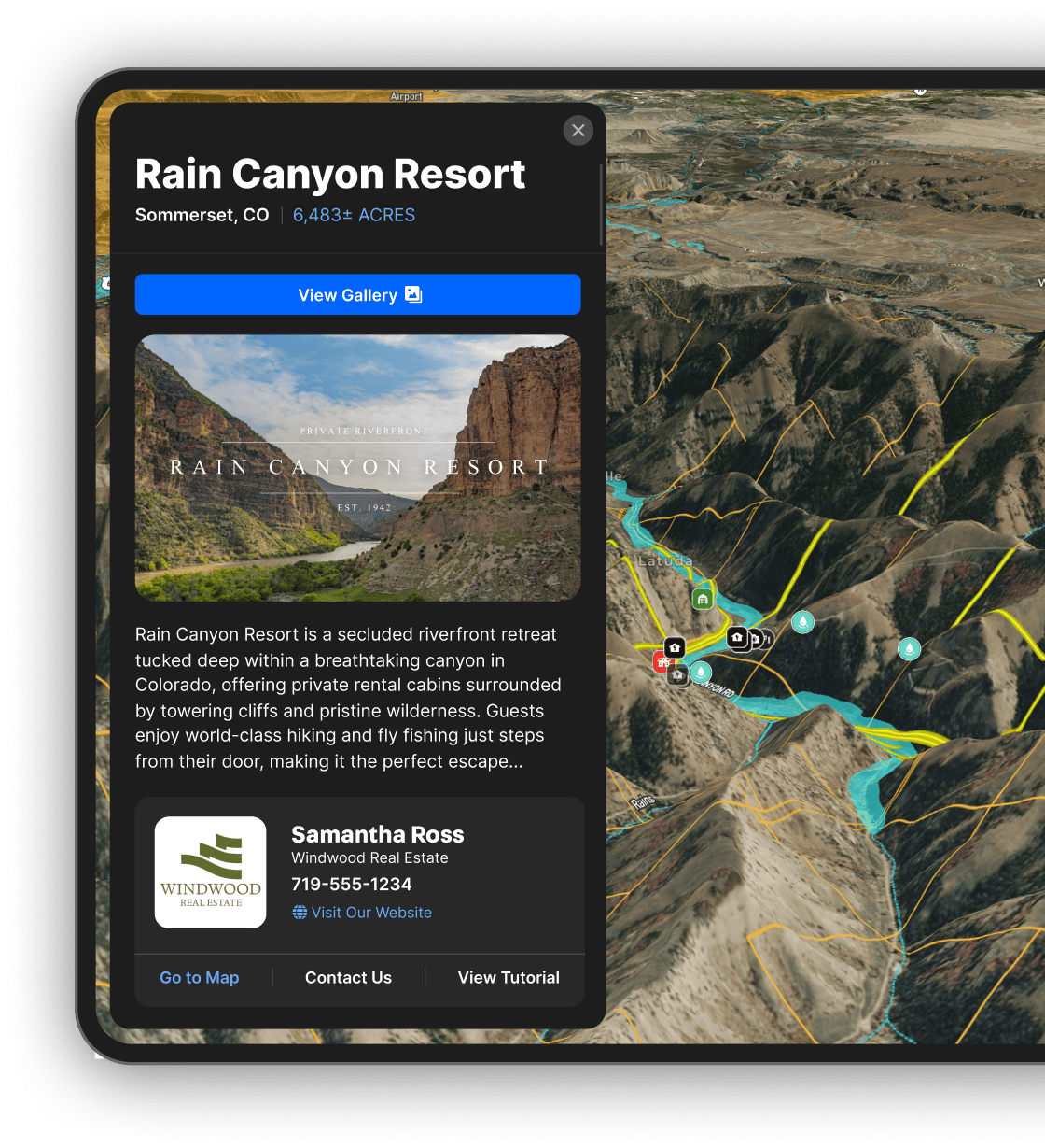
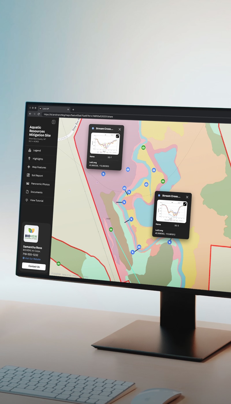
Create Maps & Reports to Move Decisions Forward
Run quick due diligence, dive deep into data, and share maps, reports, and databases to give everyone a shared source of truth. AI works behind the scenes to showcase every aspect of your land and listings, turning property data into confident decisions.
My buyers can view everything about the property online with docs and maps before setting foot on the ground. Land id saves time!

Share maps that tell a story and enable smart decisions with Land id on your desktop and mobile devices.

You don't wanna bounce back and forth between eight different websites and apps. The fact that Land id was just all inclusive—that was the winner for us.
Map Creation & Sharing, the Land id Way
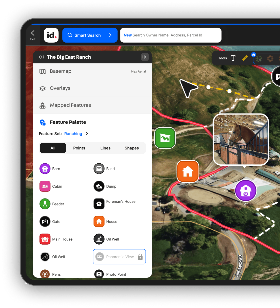


Powerful Property Data
Research and discover the most extensive private property information and land identity nationwide.


Get Started With Land id Today

Get In-Depth Property & Owner Insights
- Great for property buyers, owners, and anyone curious about land.
- Research private and public property info from all 50 states.


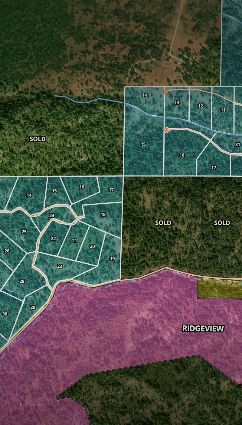
Map, Manage, & Share Property Projects
- Great for land owners and investors.
- Create up to three shareable maps and track property portfolios.


Market, Showcase,
& Sell Property
- Great for developers and real estate pros with due diligence, prospecting, and marketing needs.
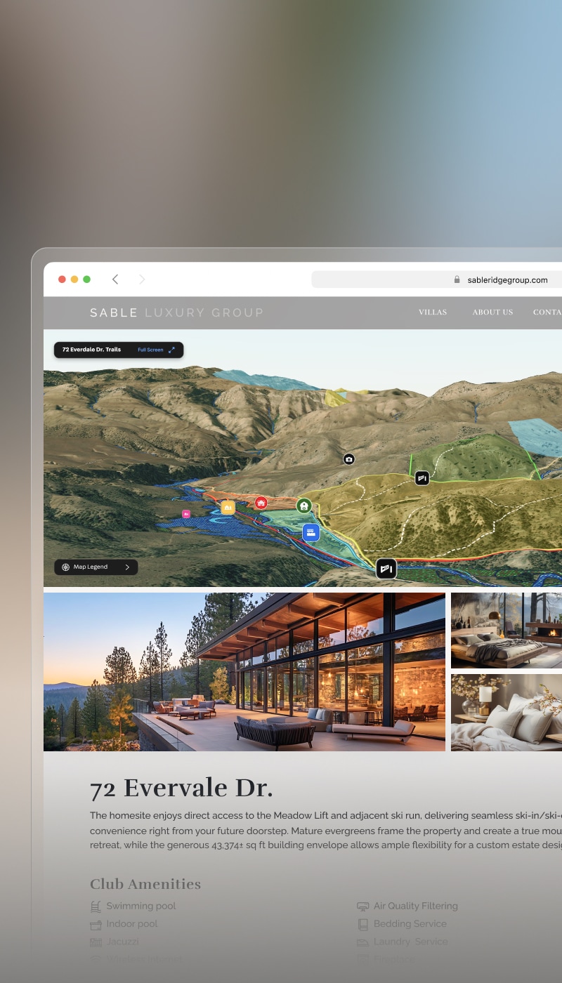
- Create, brand, embed, and share stunning property maps and tours at scale.
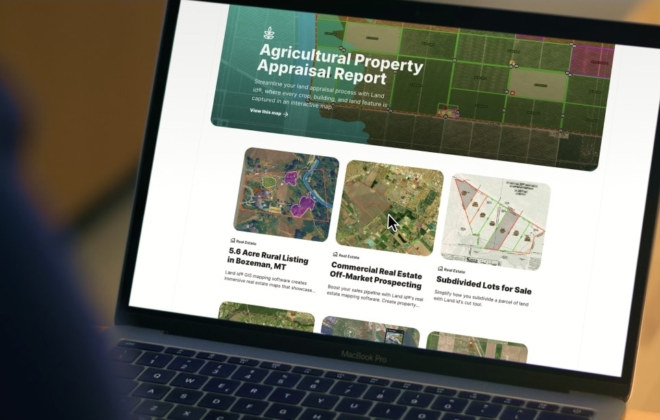
Explore Resources