Agents & Brokers
Discover an indispensable tool for communicating and marketing property stories.
- Evaluate leads on-demand.
- Research properties on the phone.
- Share branded tours, maps, and reports that showcase your expertise.

Land id is the property data platform for residential, land, and commercial real estate professionals who need to research quickly, respond fast, look sharp, and communicate a property story clearly.


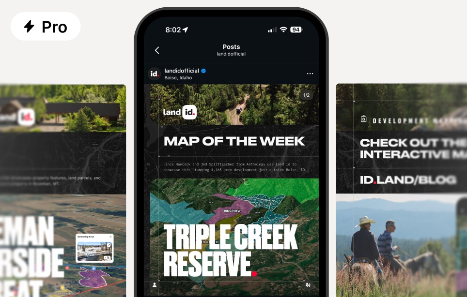
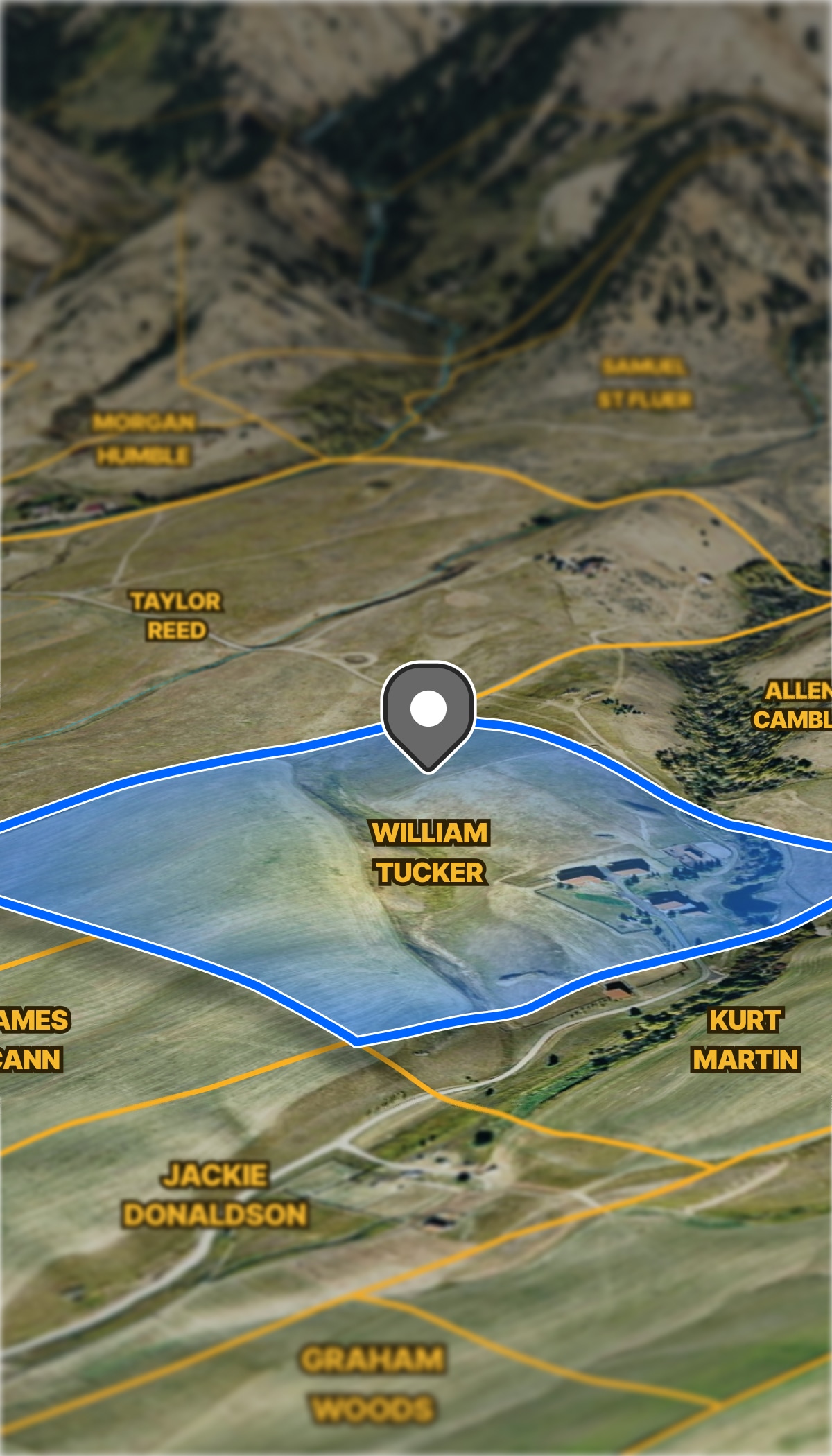
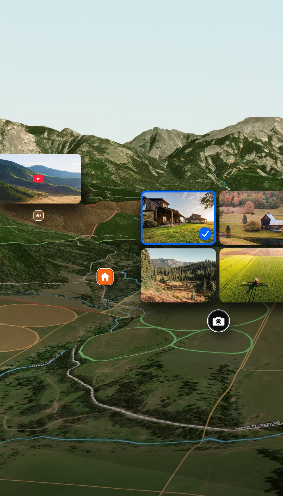
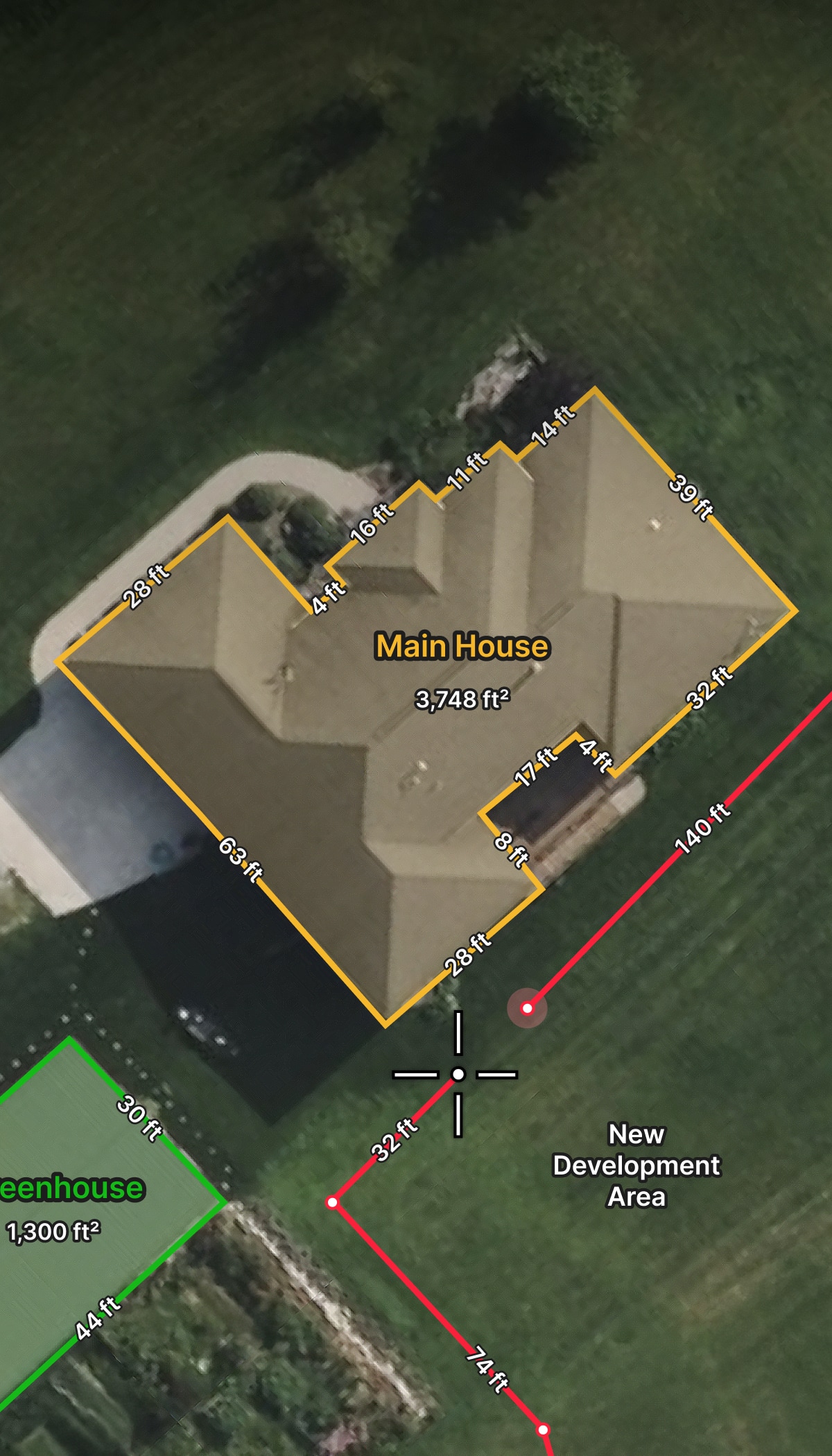
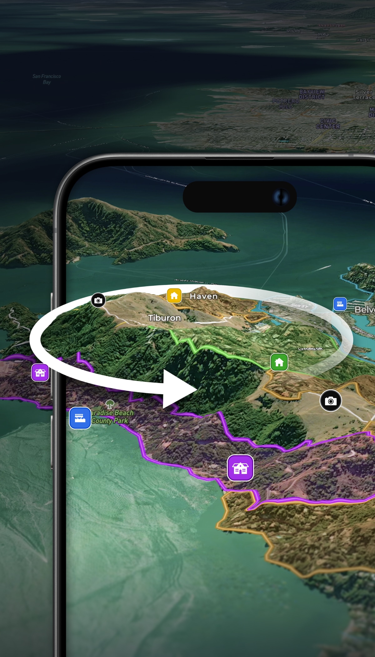
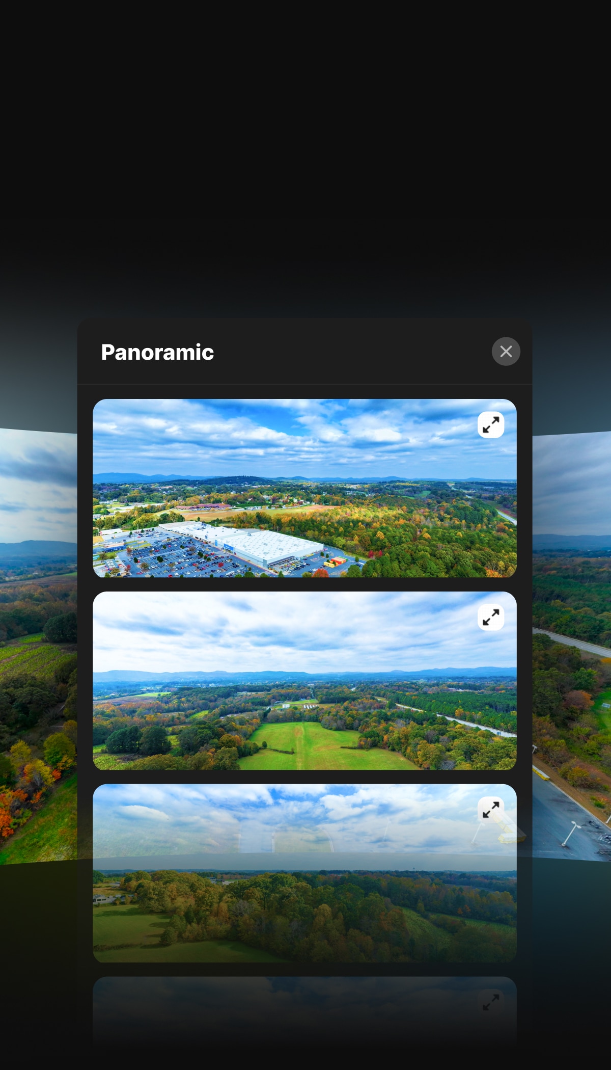
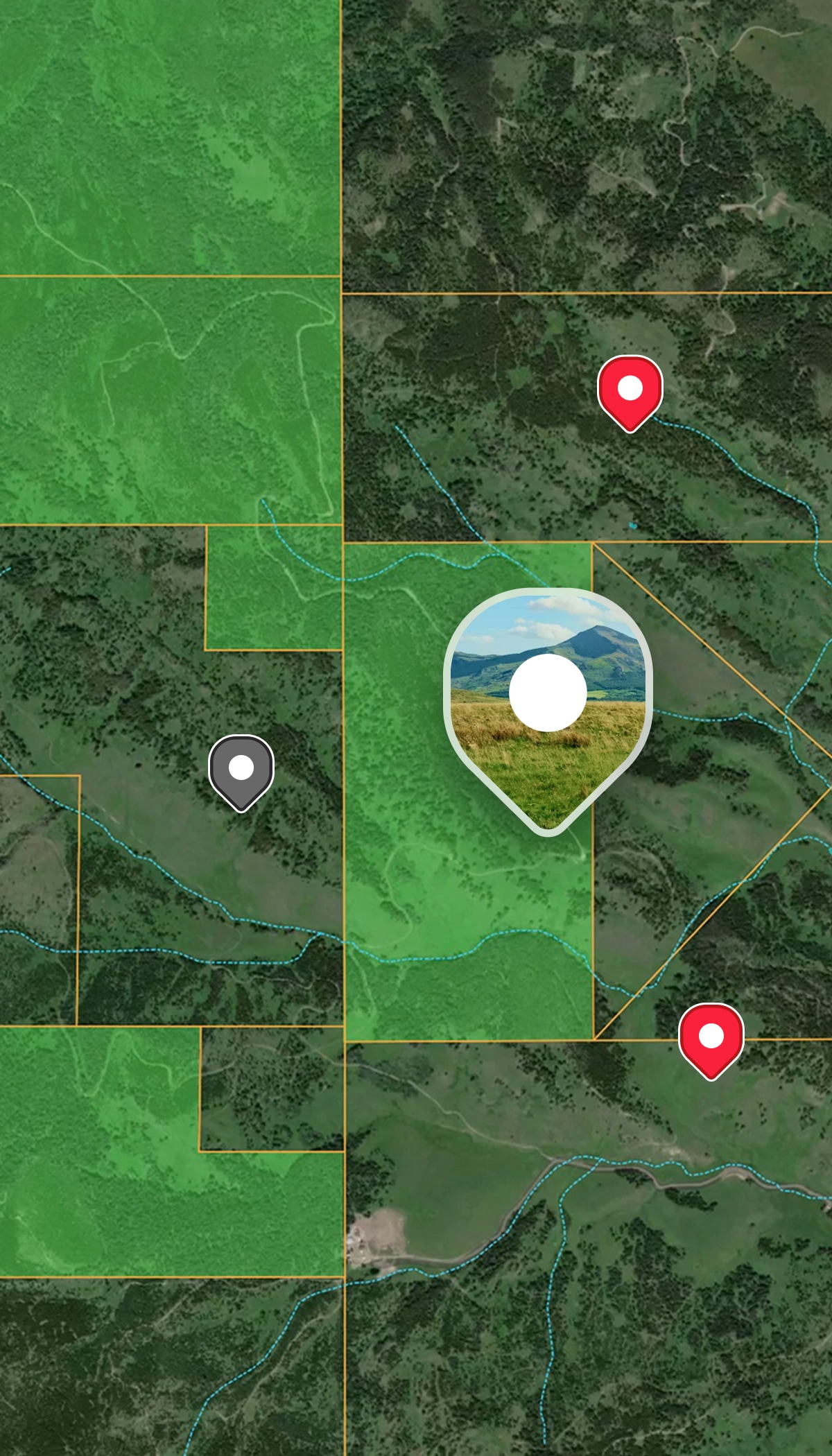
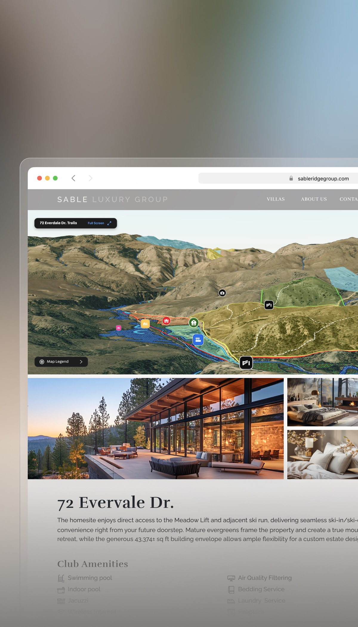
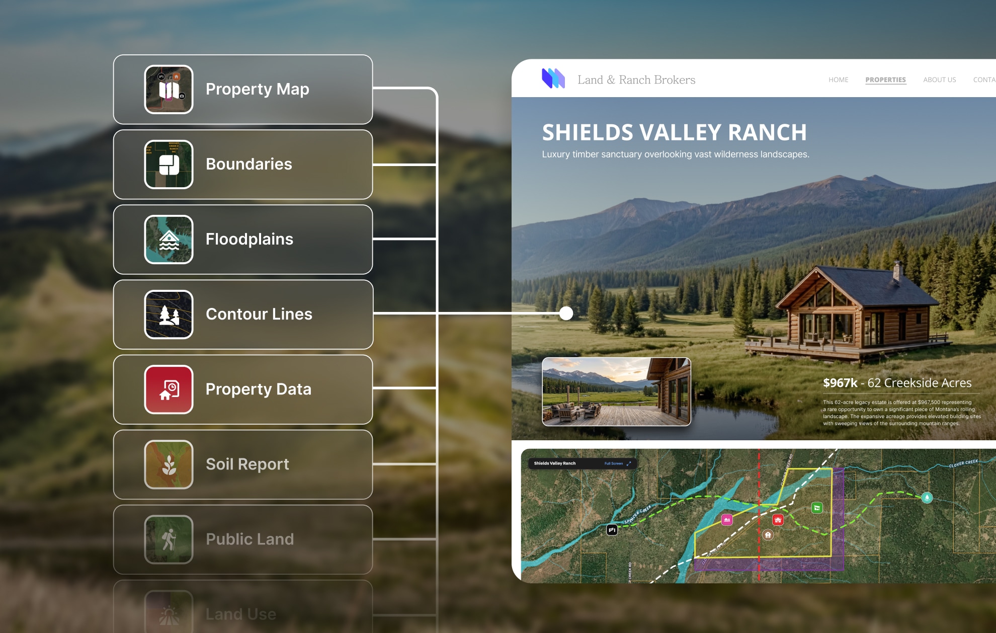
Jaws will drop when you share Land id property tours and maps. Transform parcel data and listings into shareable experiences that stand out to clients—and stand apart from competitors.
With detailed reports and interactive tours you can spin up in minutes, Land id is more than another property research tool—it’s your differentiator.

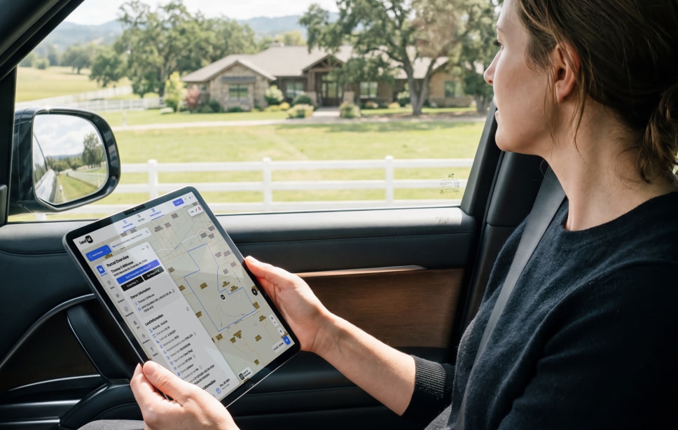
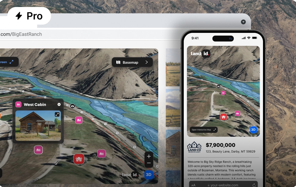
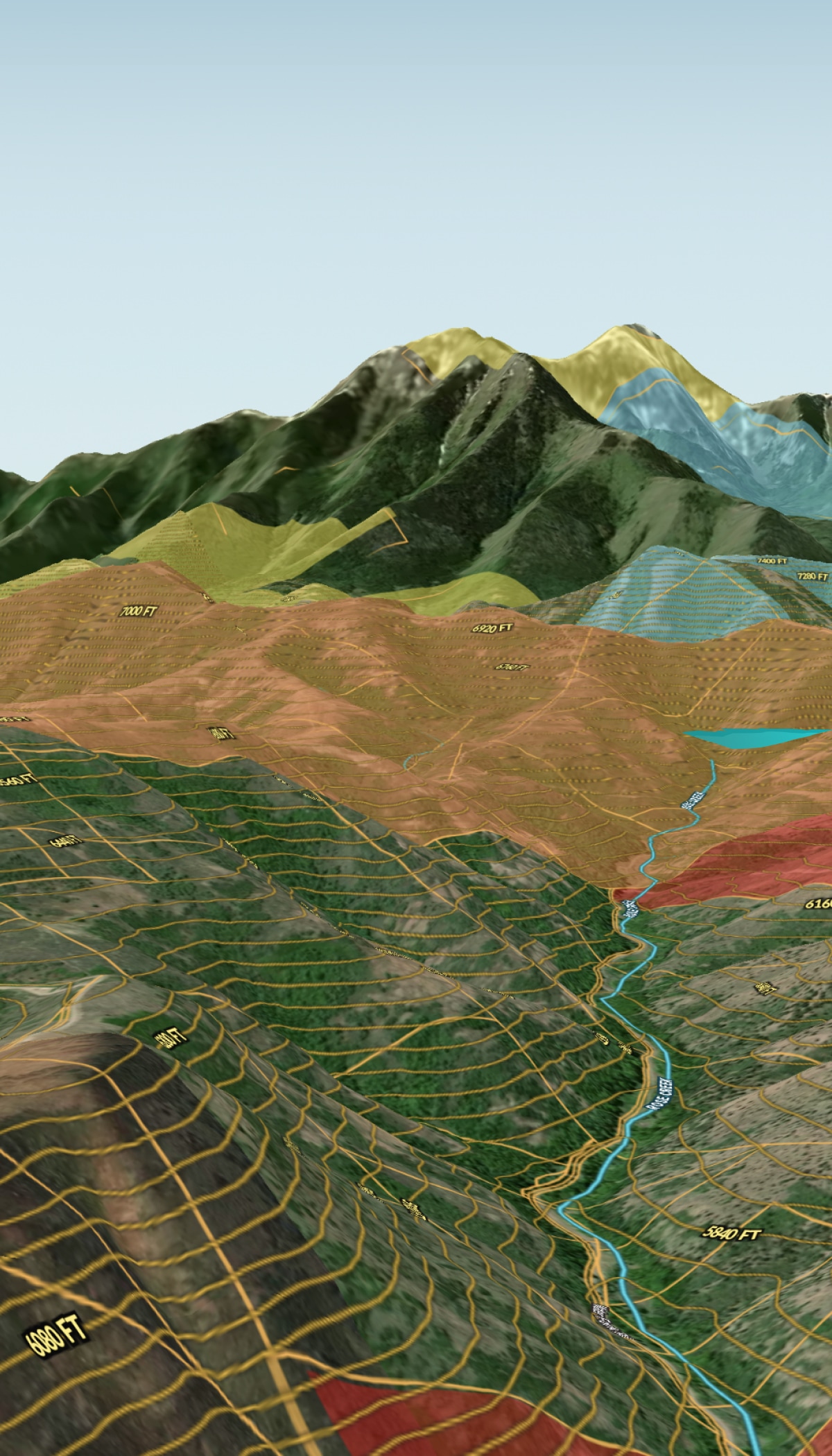
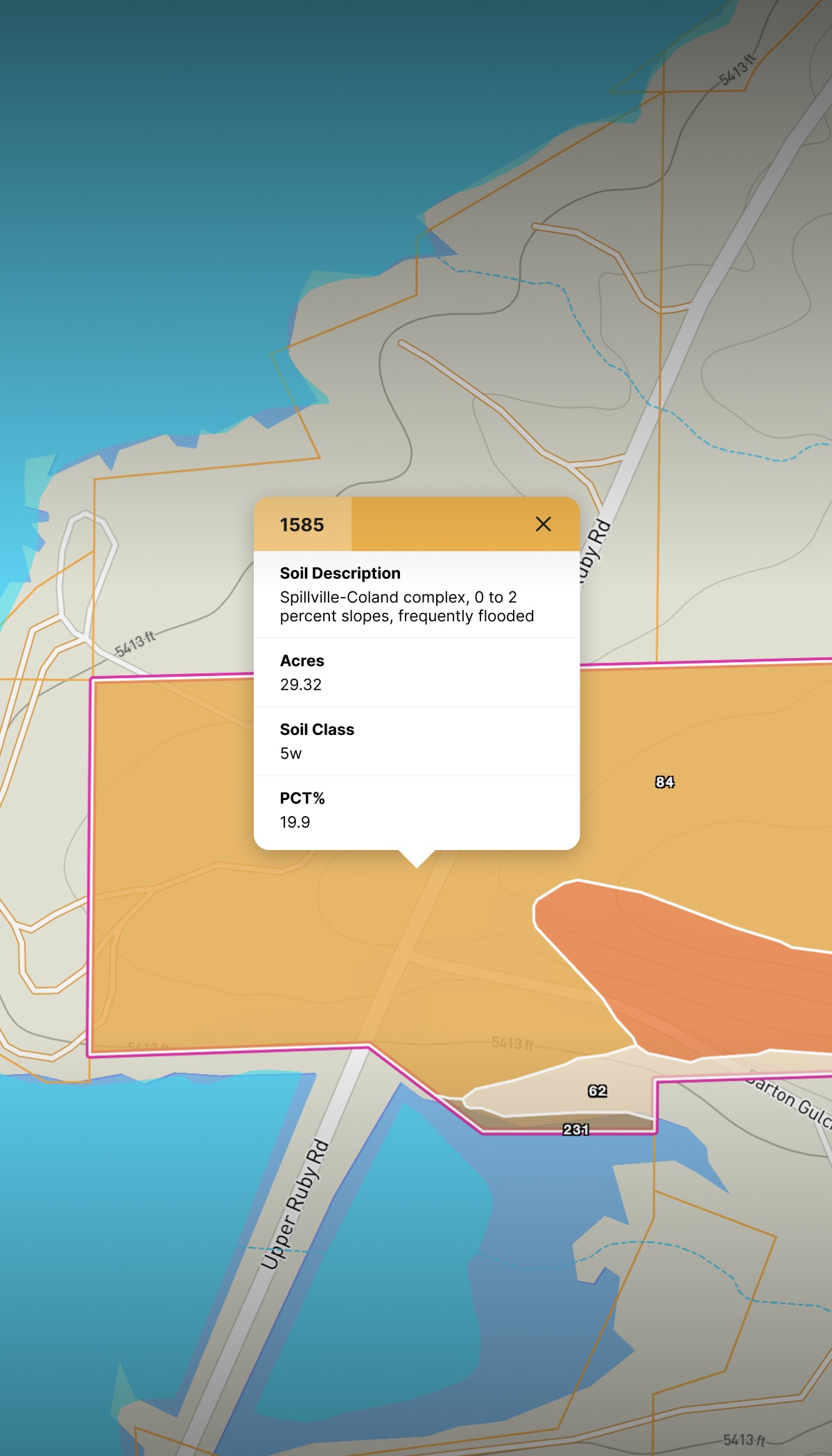
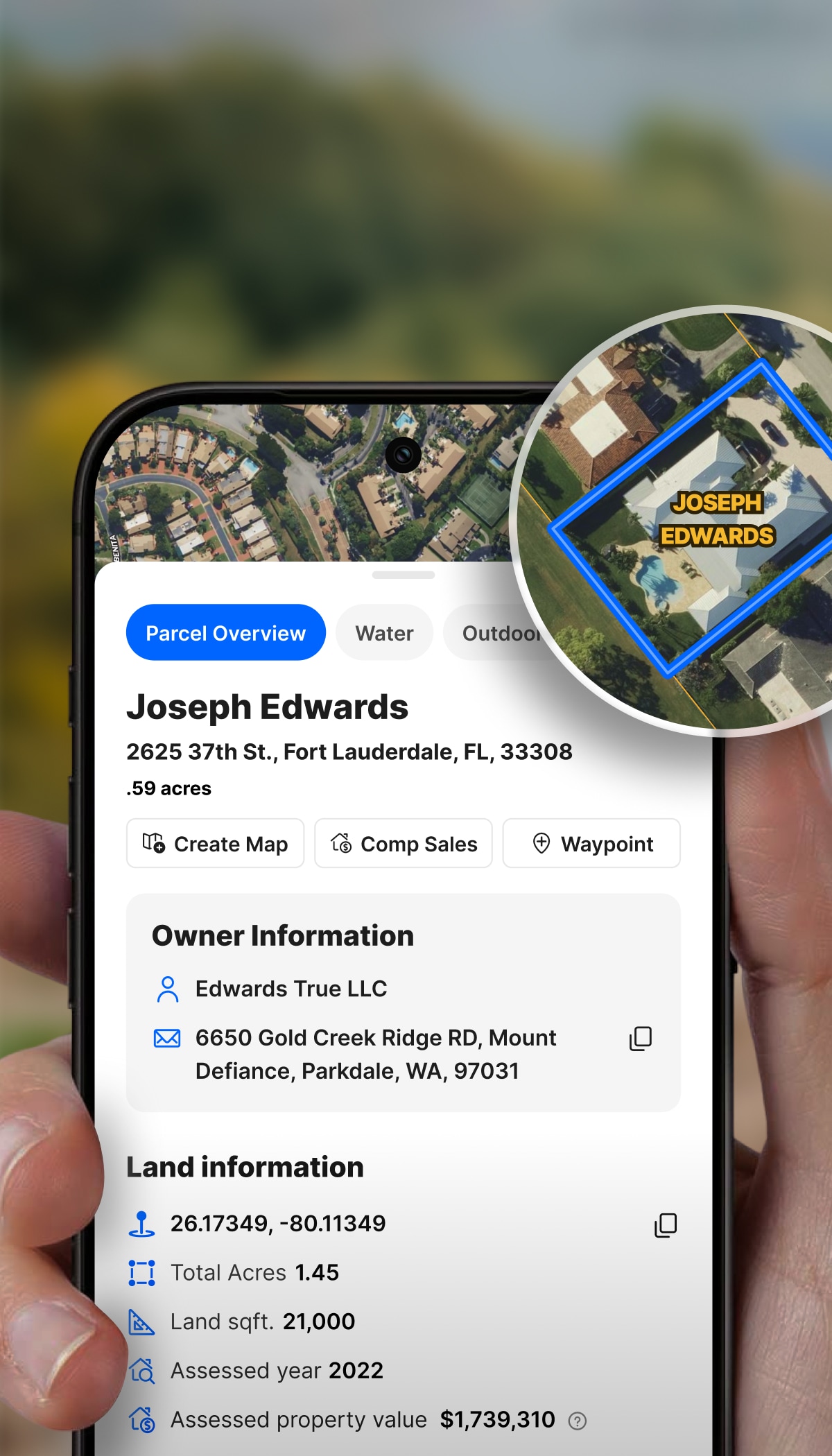
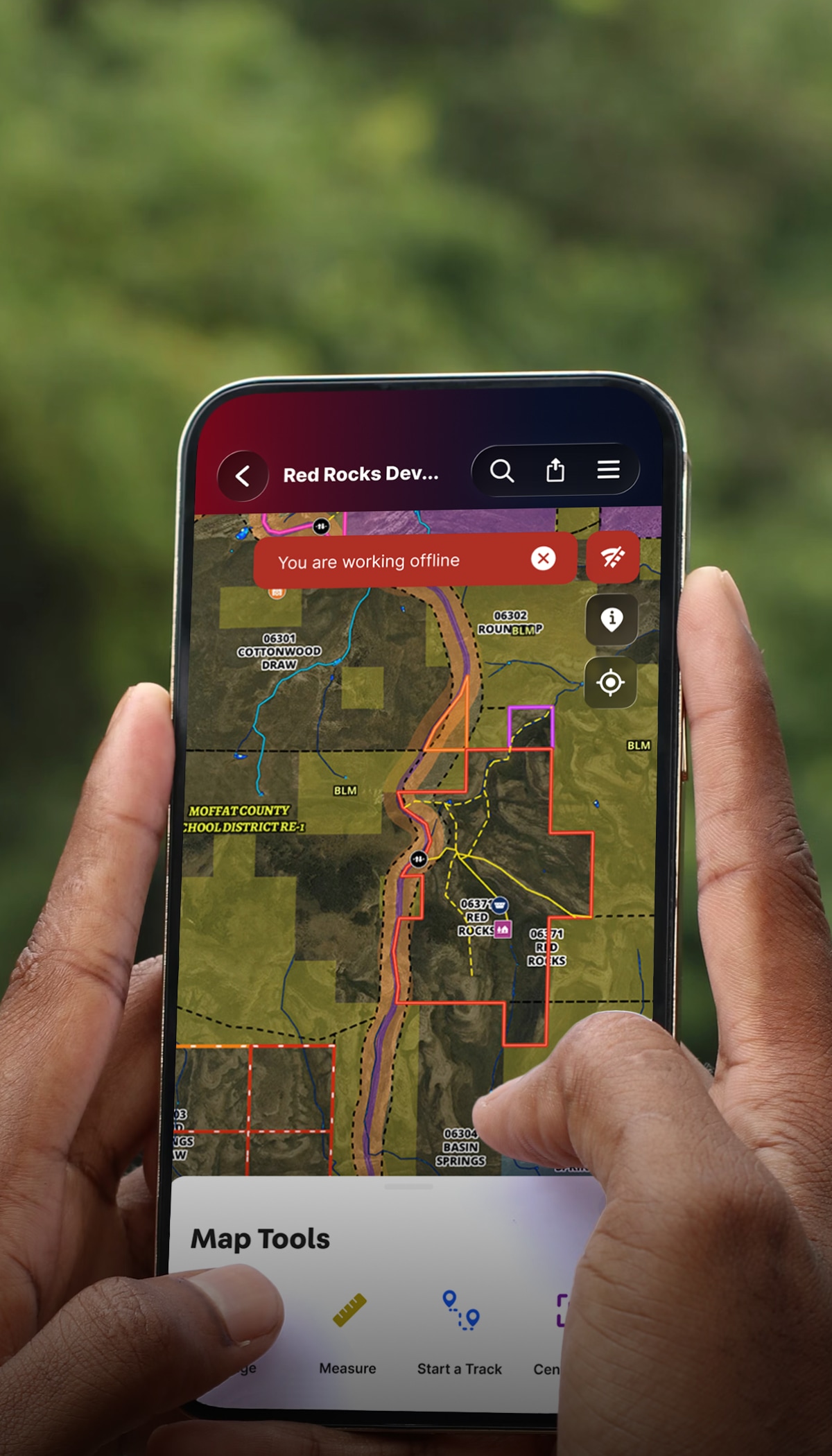
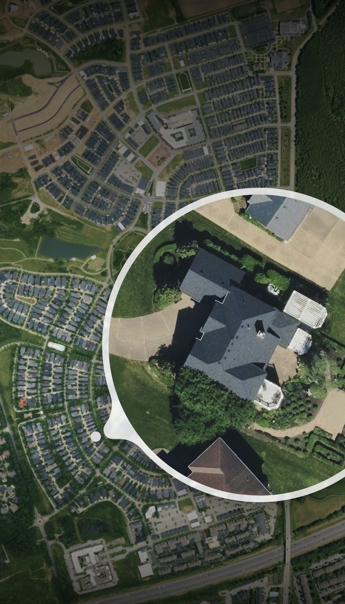
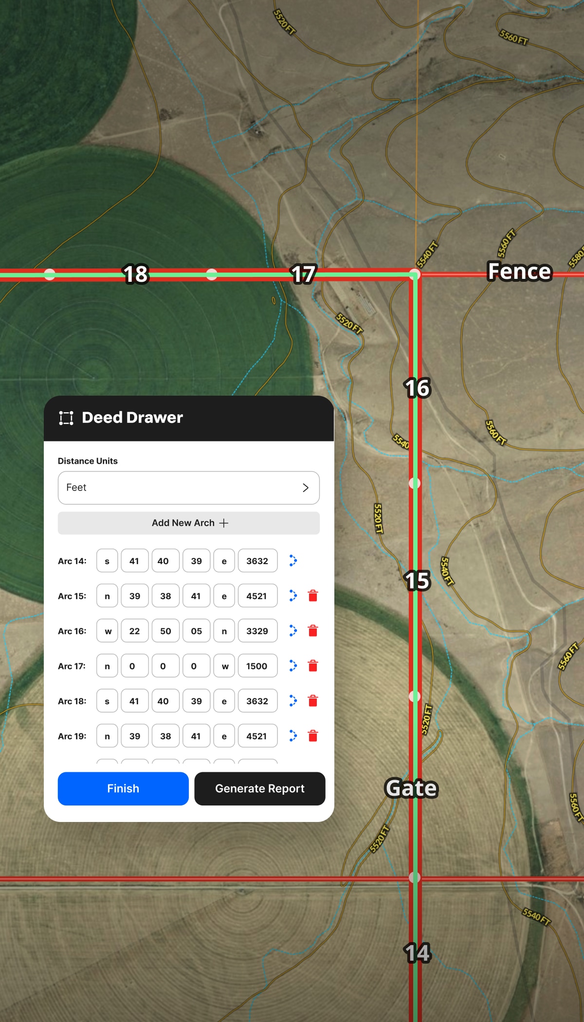
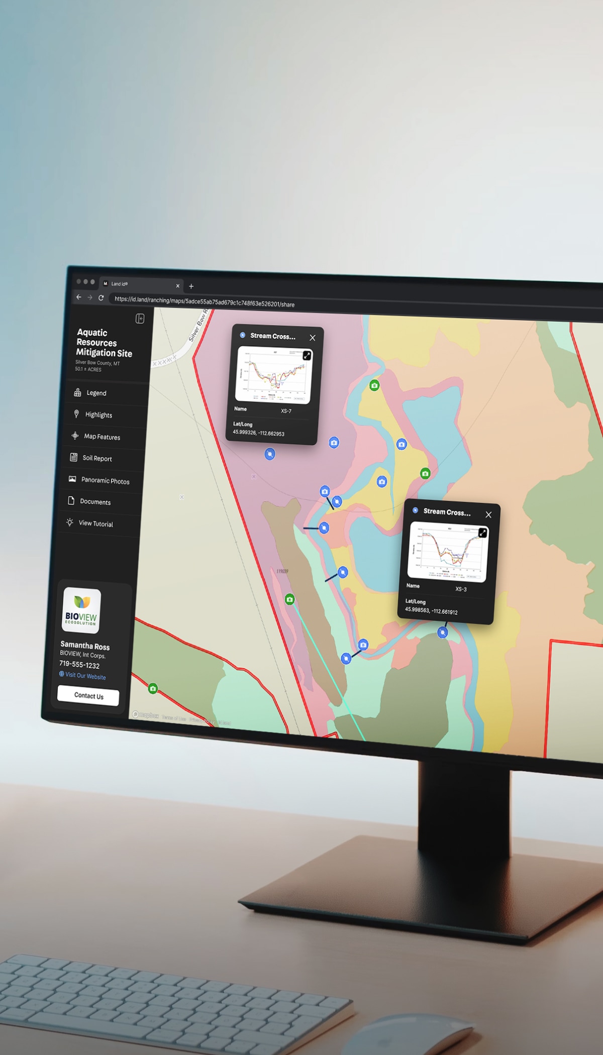
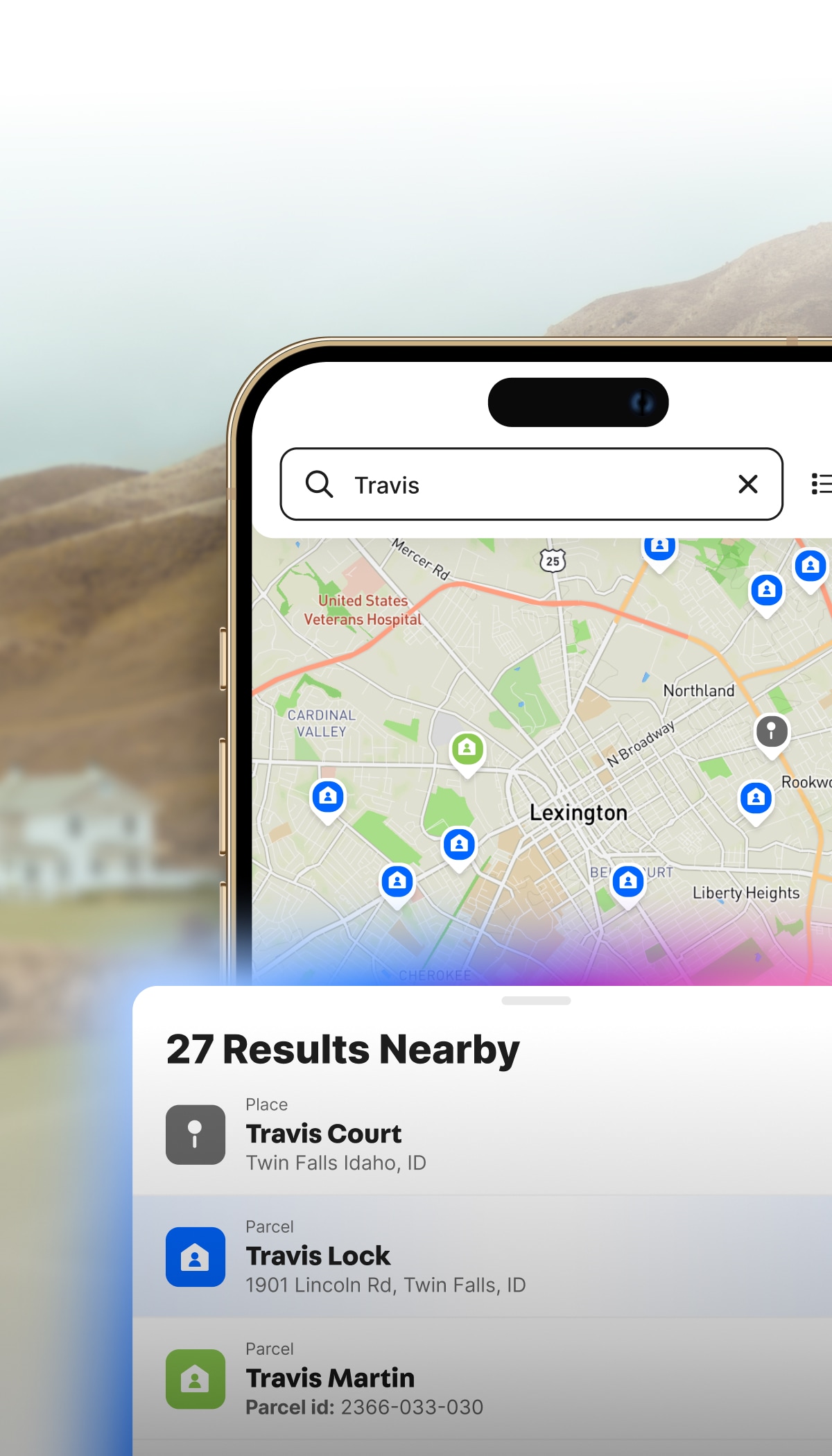
On the road, on the phone, or at your desk, access floodplain, boundaries, utilities, terrain, and more. No digging through county sites or waiting on third-party reports.

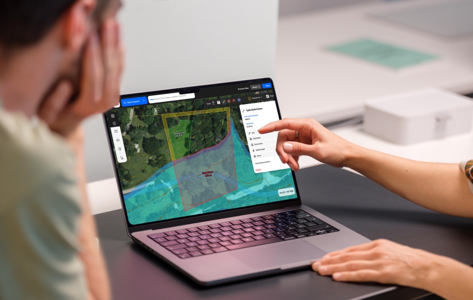
Show sellers you’ve already done your homework. Share interactive tours and maps that highlight what makes a property special—views, access, infrastructure, or development potential.

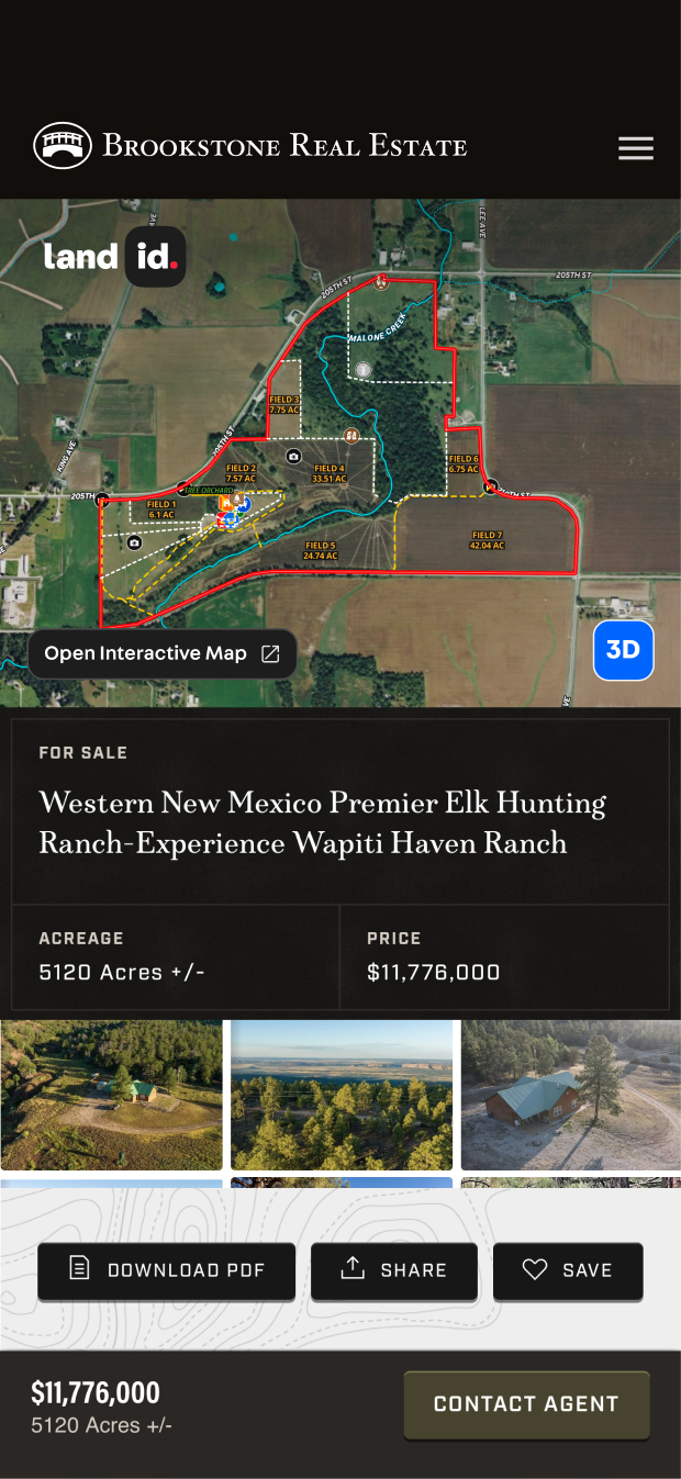
Generate and share client-ready reports and jaw-dropping tours in seconds. Give buyers, investors, and developers a clear, compelling story without screenshots or scattered links.

In a competitive market, speed wins. Land id helps you respond faster, present better, and build trust quickly. While other agents say “I’ll get back to you,” you’ll already have the answers with Land id.


The #1 Property Data Platform & Virtual Tour Creator
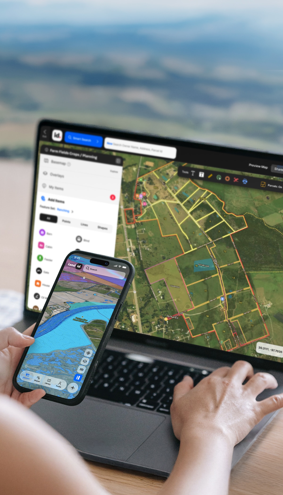
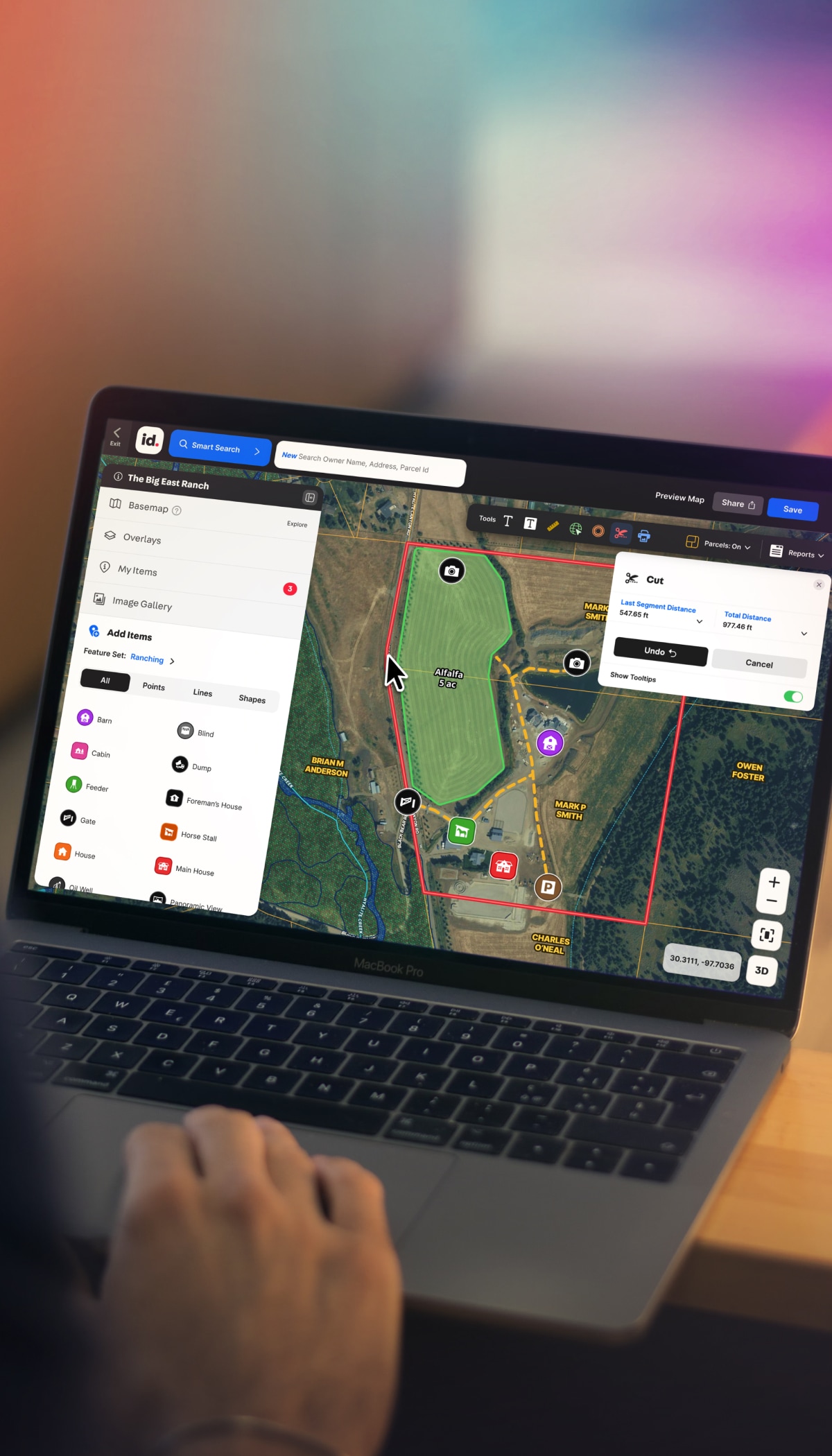
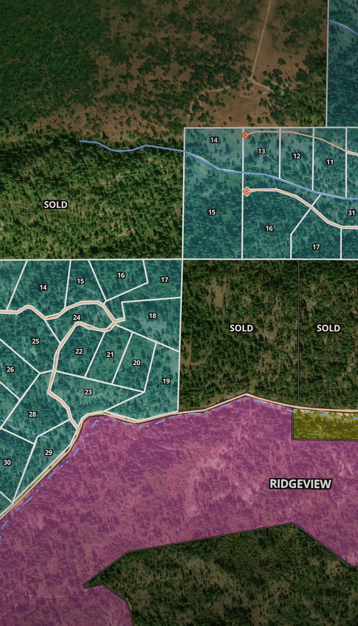
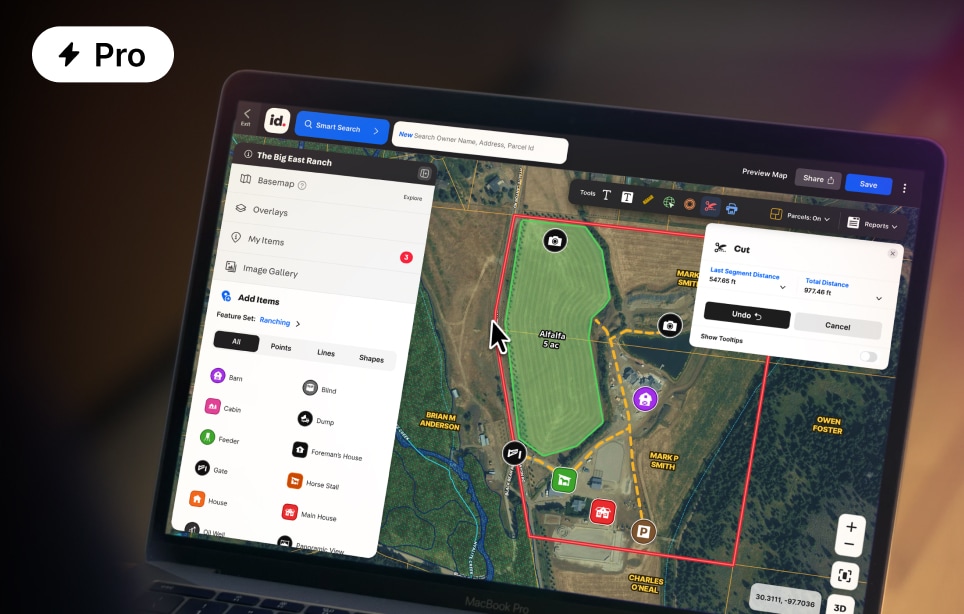
Land id is your #1 real estate marketing toolkit. Run fast due diligence. Find parcel data on any property in the U.S. with AI-driven Smart Search. Embed Property Tours and maps on marketing assets and websites. Share the intel with clients and colleagues to help real estate decisions happen faster.


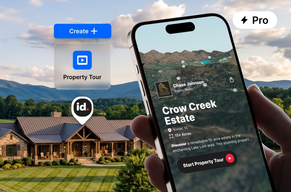
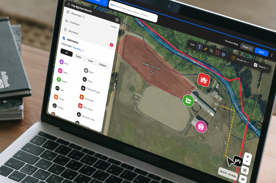
Create a shareable slideshow tour of any property with a few clicks. Show 3D views, boundaries, soil data, water features, and more. No design work required.

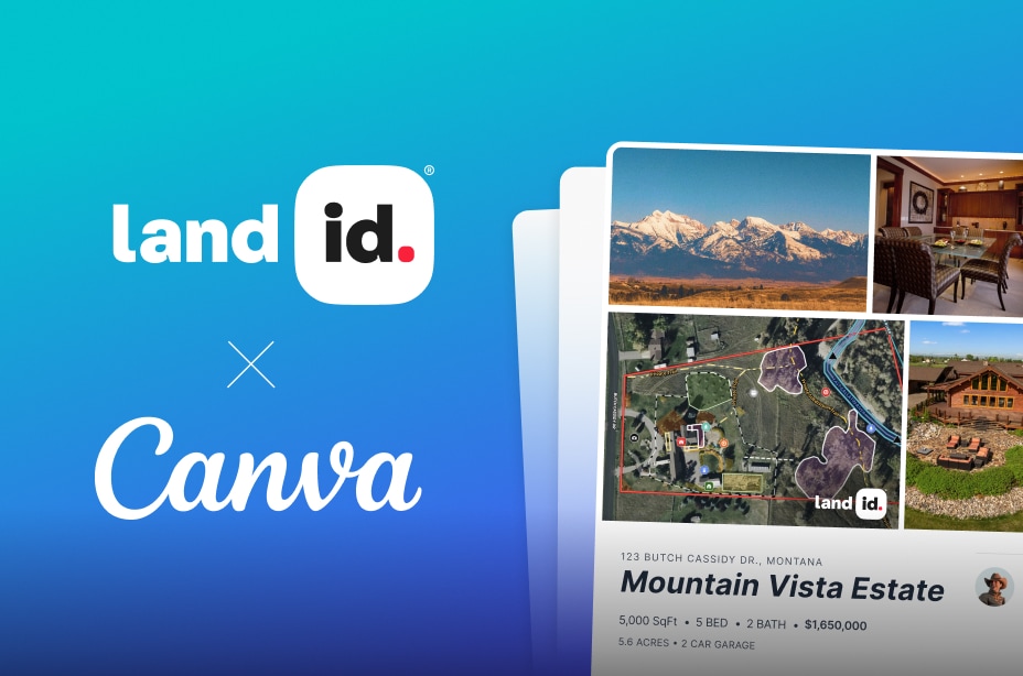
Add your Land id link to Canva. Use the drag-and-drop Canva features you’re used to. Create marketing materials and assets that do the property justice.

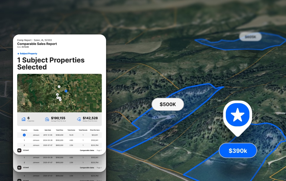
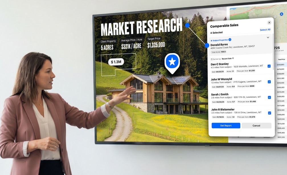
Leverage AI-enabled searching to generate professional, data-backed comparable sales reports—right in Land id.

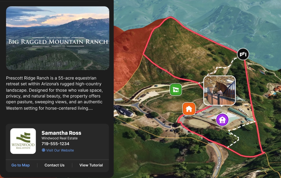
Add your logo and contact info to your maps. In a competitive market, Land id becomes part of your differentiation.
One Platform for Your Real Estate Workflow
Research, analyze, and share property insights the same day—not next week. Power creative marketing content. Discover and share extensive parcel data, land maps, property reports, and virtual outdoor property tours. Showcase real estate in context and communicate across stakeholders and platforms.
You should consider upgrading to Land id Pro when you need to present properties in a more professional, client-facing way. If you are creating marketing materials, sharing maps regularly, or managing multiple properties or projects, Pro provides the tools to do that more effectively and efficiently.
Land id offers over 40 data layers, including property boundaries, ownership information, floodplains, wetlands, water wells, soil types, topography, public lands, utilities, pipelines, and much more. Explore all our features here.
Yes, you can share maps created in the Land id® app with individuals who do not have the app. The Pro Plan allows you to quickly share maps via text or email, and you can even embed these maps on your website for broader access.
Many online property search tools draw from public records to provide basic ownership and parcel data. Reliability and update frequency vary depending on the county’s data systems.
Yes, you can start with the Land id plan and explore the platform at no cost. This allows you to understand how it fits into your workflow before deciding whether you need additional capabilities. Sign up for a free trial today.
Absolutely. We believe in making maps personal:
Initial training included: Many of our mapping packages include optional 1:1 training sessions.
Maintenance training available: If we build your map, we're happy to show you and your team how to keep it updated.
Flexible learning options: We offer various training resources to match your learning style and schedule.
Ongoing partnership: Think of us as your mapping team, available for both one-time projects and ongoing support.
Land id® ensures high accuracy of property owner information by providing up-to-date and comprehensive land data. We offer detailed and reliable parcel data that helps real estate professionals and landowners make informed decisions.
Land id enables you to analyze a property in minutes. Simply search for a parcel, turn on the layers you need, and immediately see the key details that matter without switching between multiple tools or data sources.
With the Land id® Pro Unlimited plan, you can create an unlimited number of maps. This plan is designed for users who need extensive map creation capabilities without any restrictions on the number of maps they can produce. Check out our Pricing page to find the right plan for your needs.
Land id’s basic plan focuses on property insights and contextual land data. It’s great for property owners and anyone curious about land to quickly and easily unlock property insights.
Land id Premium includes everything in the basic plan, plus the ability to create and share up to three custom, non-branded maps per month with markups, photo points, icons, and more.
Land id Pro is designed for professionals who need to go beyond understanding a property and start presenting it. Land id Pro adds the ability to create branded, shareable insights—like interactive maps, presentation-ready property tours, and polished reports that help communicate value more clearly.
Compare features and pricing here.
Real estate mapping software is used by a wide range of professionals, including real estate agents, engineers, appraisers, and agriculture pros. It is also utilized by governmental bodies and individuals in forestry who need detailed land and property data for various applications.