/
Energy & Renewables

Find Viable Land for Renewable Energy Projects, Faster

From site selection to landowner outreach, energy developers and renewables brokers use Land id to connect the dots between viable land, grid infrastructure, and the owners who hold the key to making it happen.

Energy Projects Start With Finding the Right Land

Wind speeds and solar irradiance only get you so far. The hard part is figuring out what you can actually build on, who owns it, and how close you are to the infrastructure that makes a project viable. For that, you need Land id.

Energy Project Due Diligence at a Fraction of the Cost

Land id gives energy developers the property insights and land data that matter most in a renewable energy GIS tool—without the enterprise GIS price tag.

Confirm Before You Commit

See transmission lines, substations, and fiber optics overlaid on parcel data to clearly assess grid proximity and project risk.

Identify Ownership Across Every Parcel You Need

Map multi-parcel project areas and surface owner contact info for each one so your landmen are informed before they reach out.

Track Leases, Negotiations & Open Parcels

Keep your whole team aligned. See what's leased, what's in negotiation, and what still needs outreach on a single, live map.

Avoid Gotchas & Costly Mistakes

Buffer zones, measurement tools, and data layers for flood plains, slopes, wetlands, and required setbacks ensure you identify what's actually buildable.

Solar & Wind Energy Site Selection Mapping Software

The Features That Move Energy Projects Forward

Land id delivers the infrastructure and transmission line data, terrain detail, and ownership records that site selectors and energy brokers need to work quickly. No GIS background is required. Land id’s project mapping and parcel data is cost-effective and simple enough for anyone on your team to use in the field.

Show Context With 40+ Data Layers

Toggle on flood zones, soil types, transmission lines, fiber optic service, water access, and more. Up-to-date data across 40+ overlays, so every decision has the full picture behind it.

Learn More

Nationwide Parcel Data in One Place

Owner, assessment, building info, acreage, and more, pulled up in seconds. Discover deep parcel data across cities, counties, and all 50 states in one platform.

Learn More

See Every Detail in High Res

See brilliant, up-to-date satellite imagery to plan better, save on site visits, and communicate important property details.

Learn More

Soil Analyses for Land Planning & Valuation

Discover soil type, classification, and agricultural potential to make informed decisions.

Learn More

Software for Oil, Gas & Renewable Energy Teams

Keep Every Role in an Energy Project on Track

Everyone on an energy project needs Land id. Site selectors use deep property data to qualify land fast. Landmen use the research to approach landowners confidently. Brokers use maps and reports to communicate clearly. Land id ensures projects move faster and fewer things fall through the cracks.

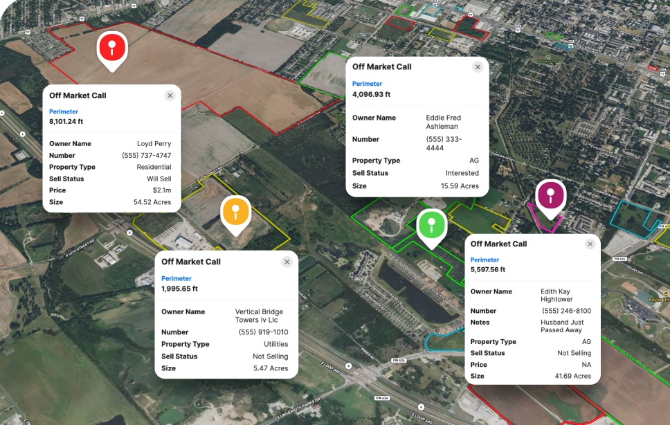
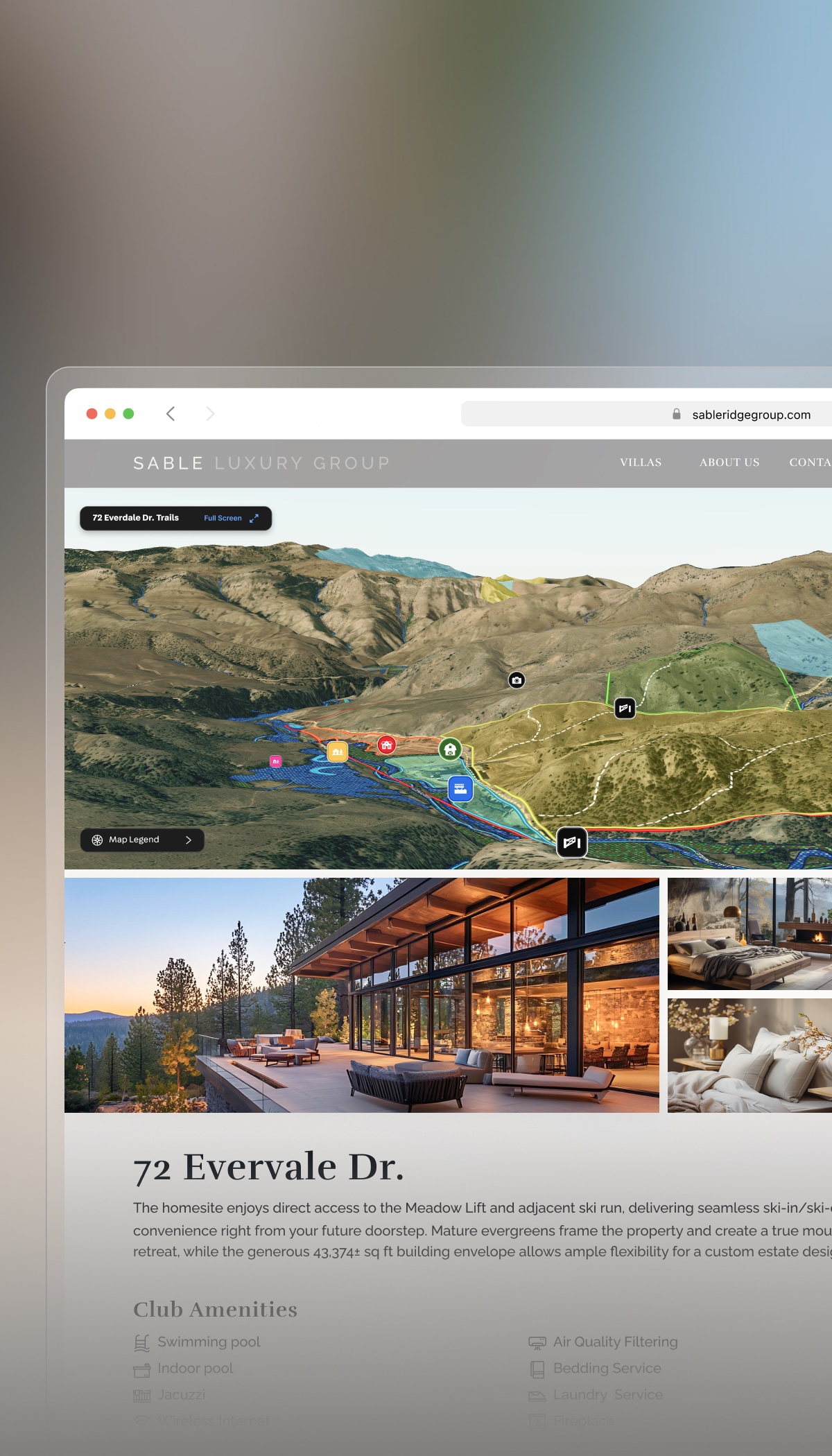
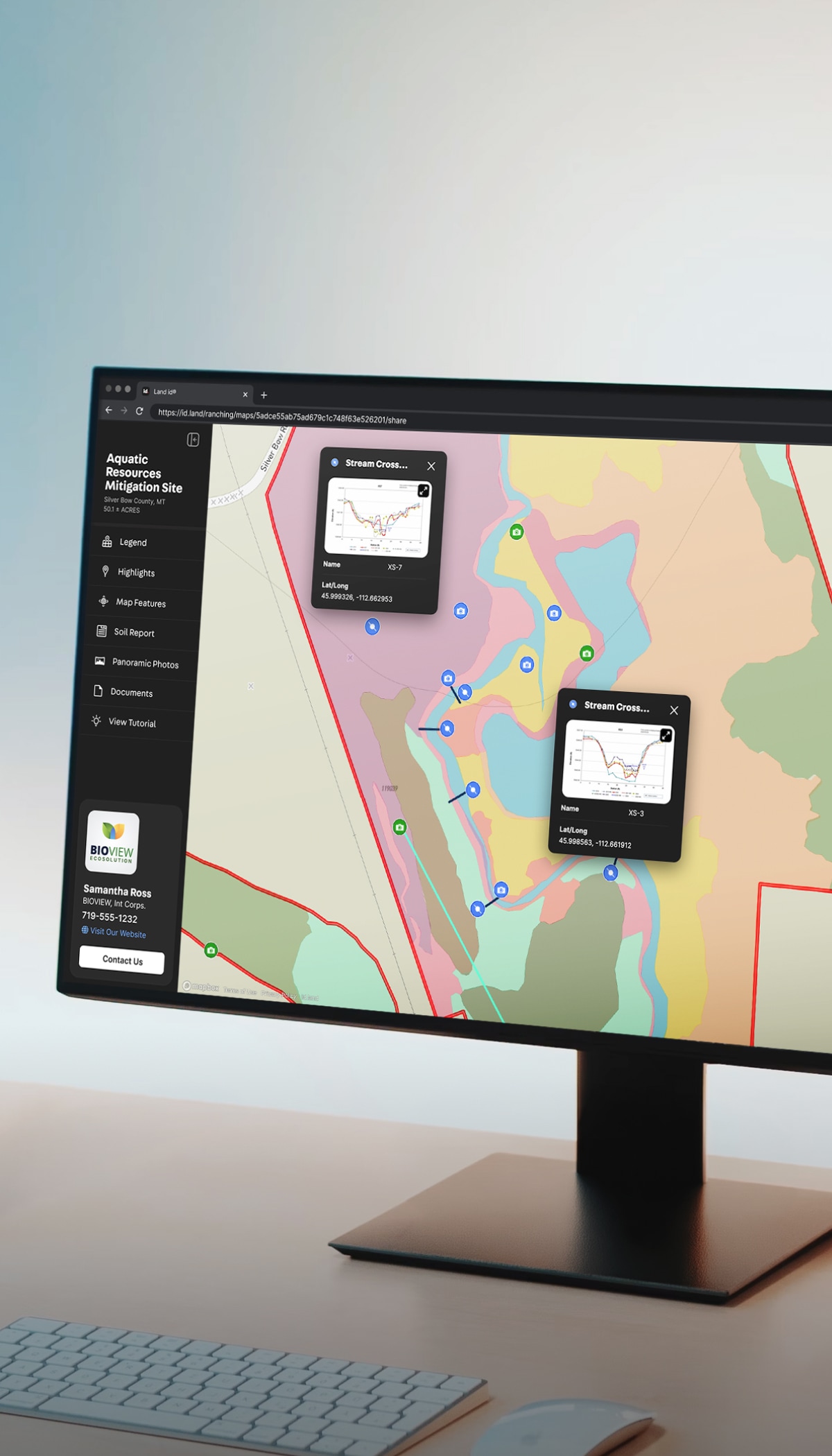
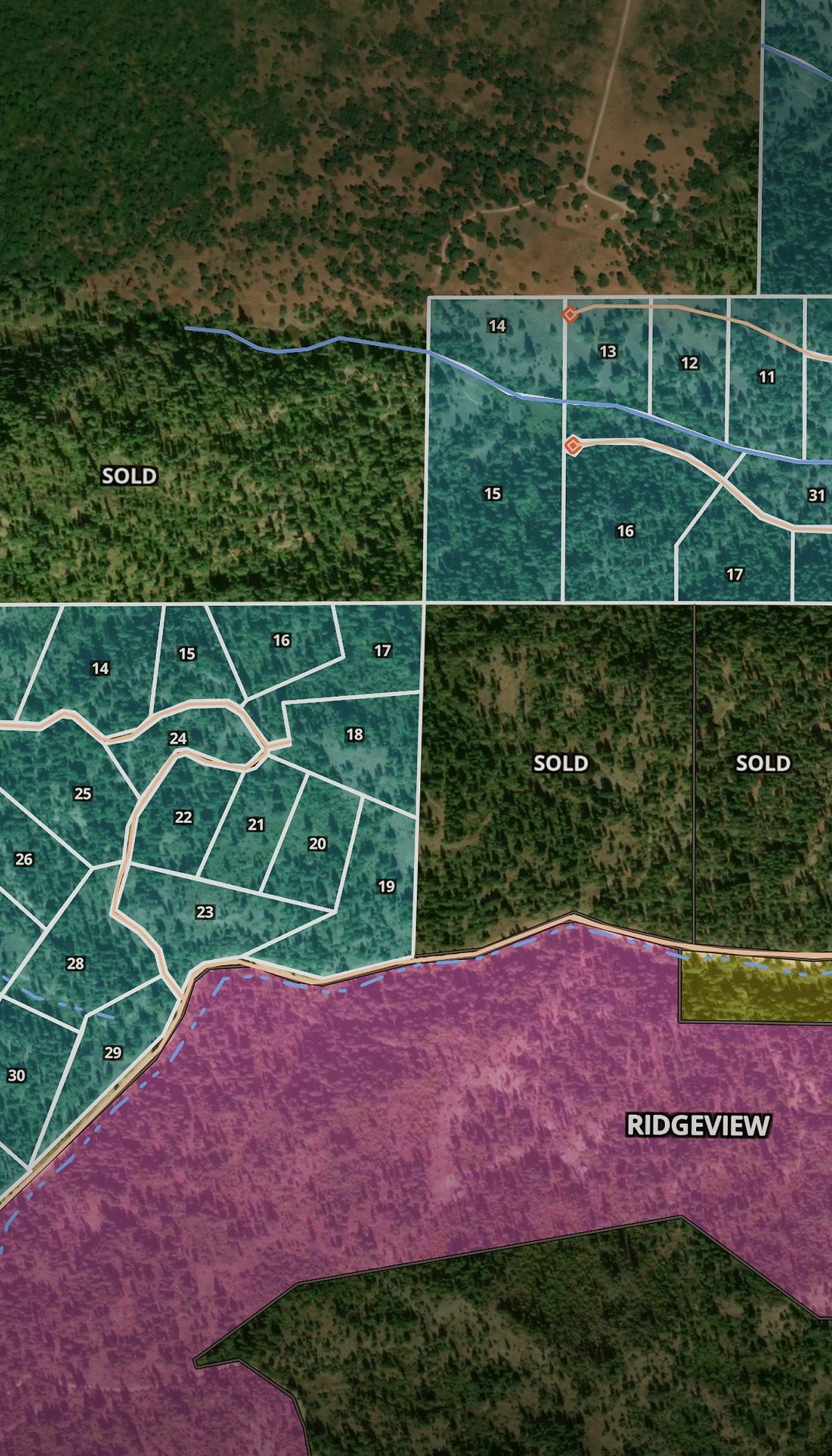
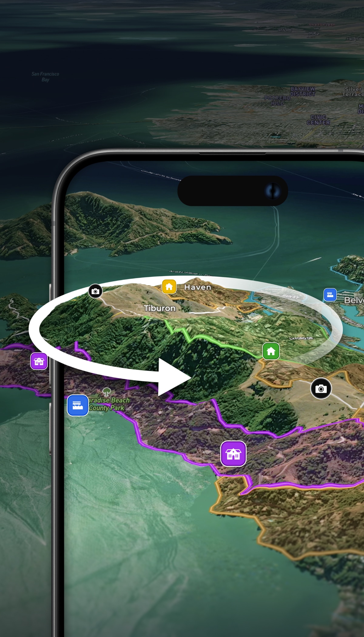
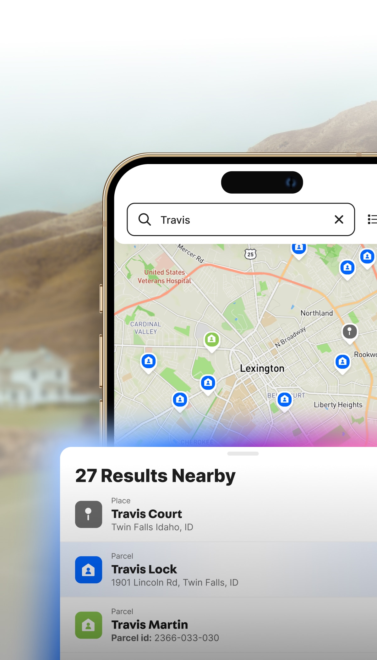
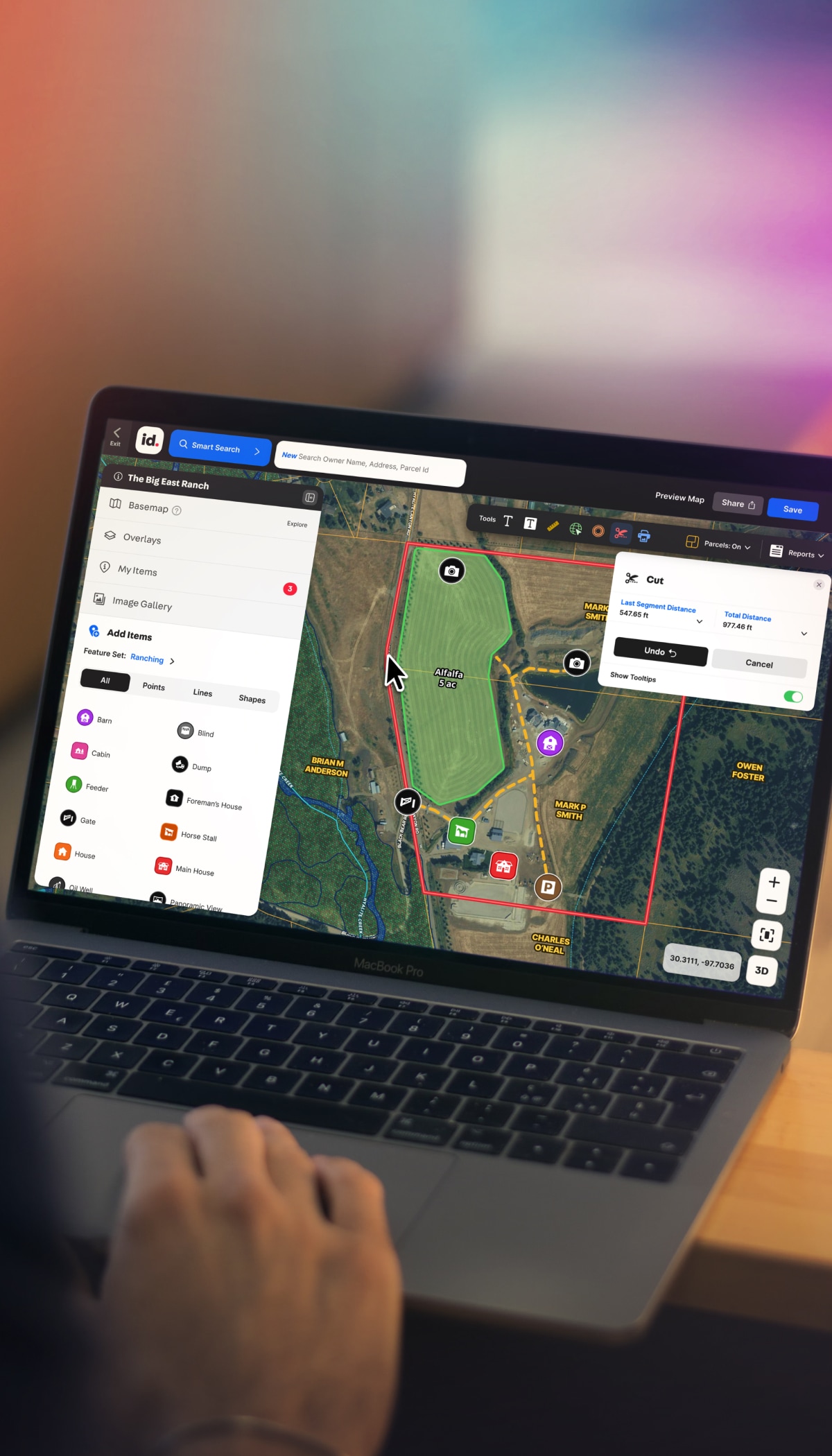
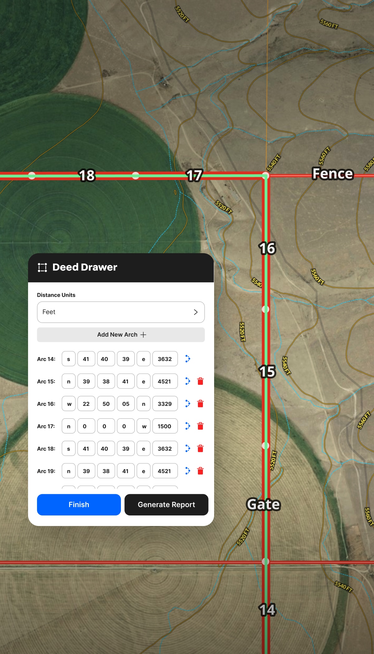
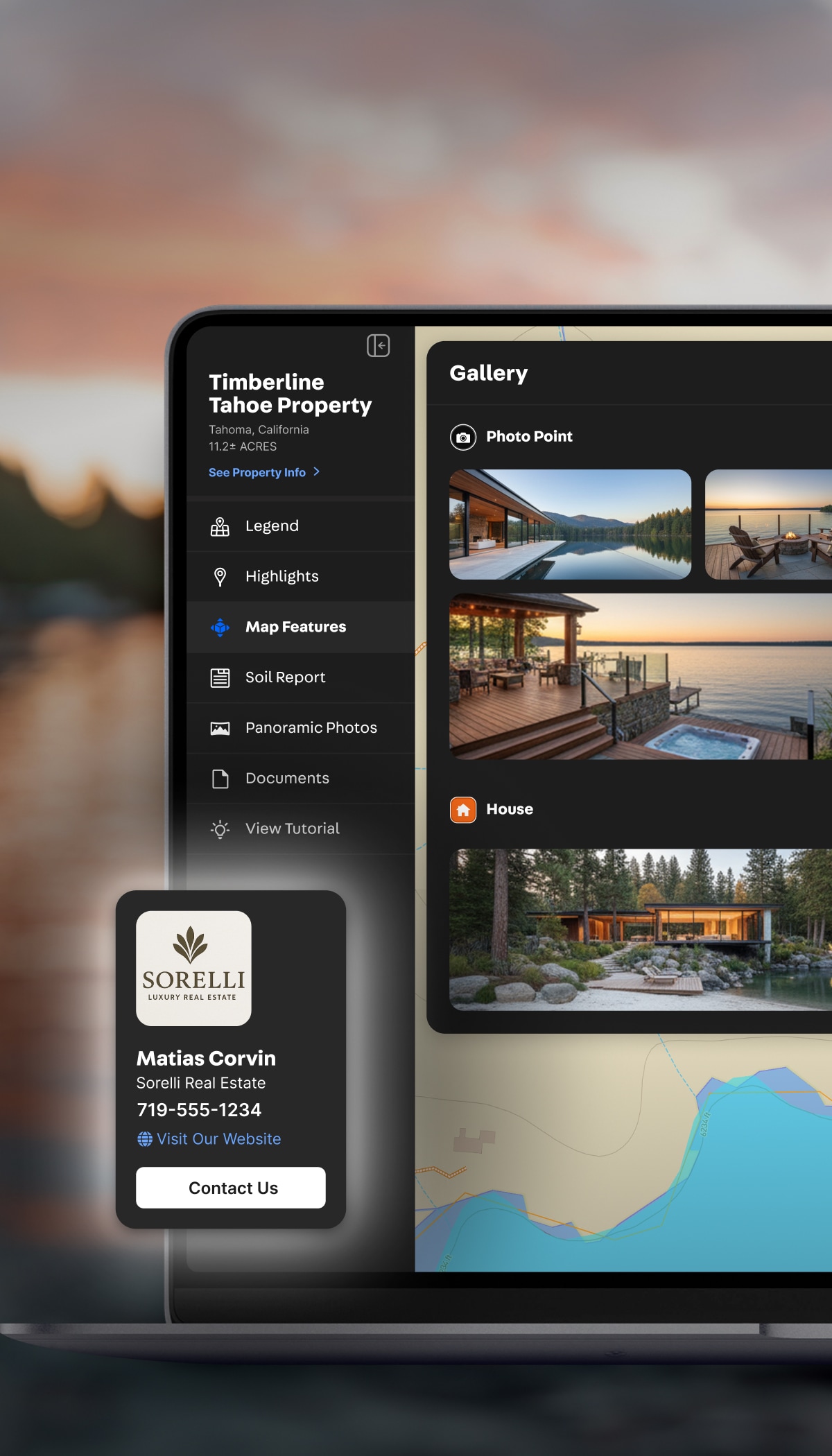
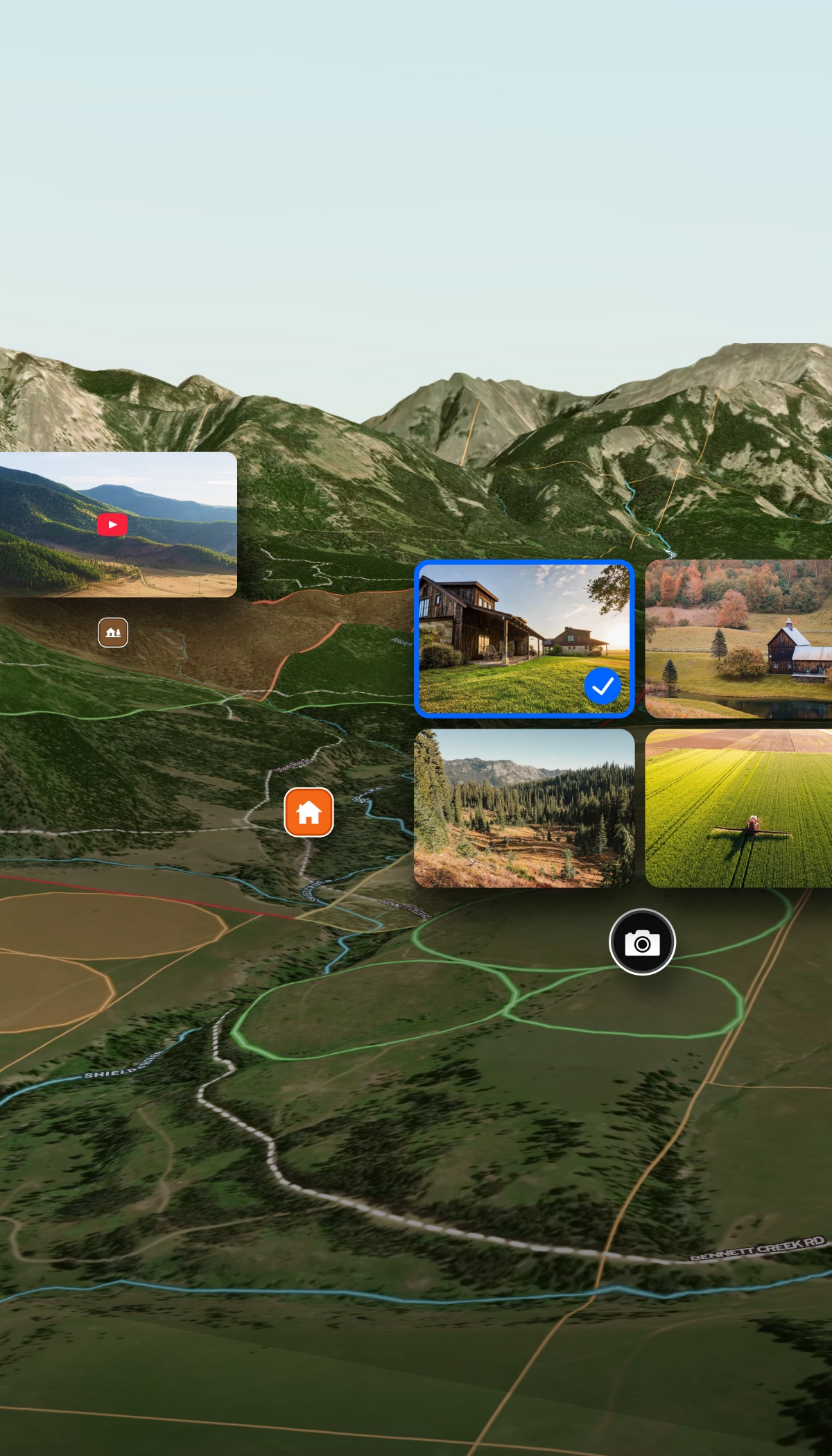
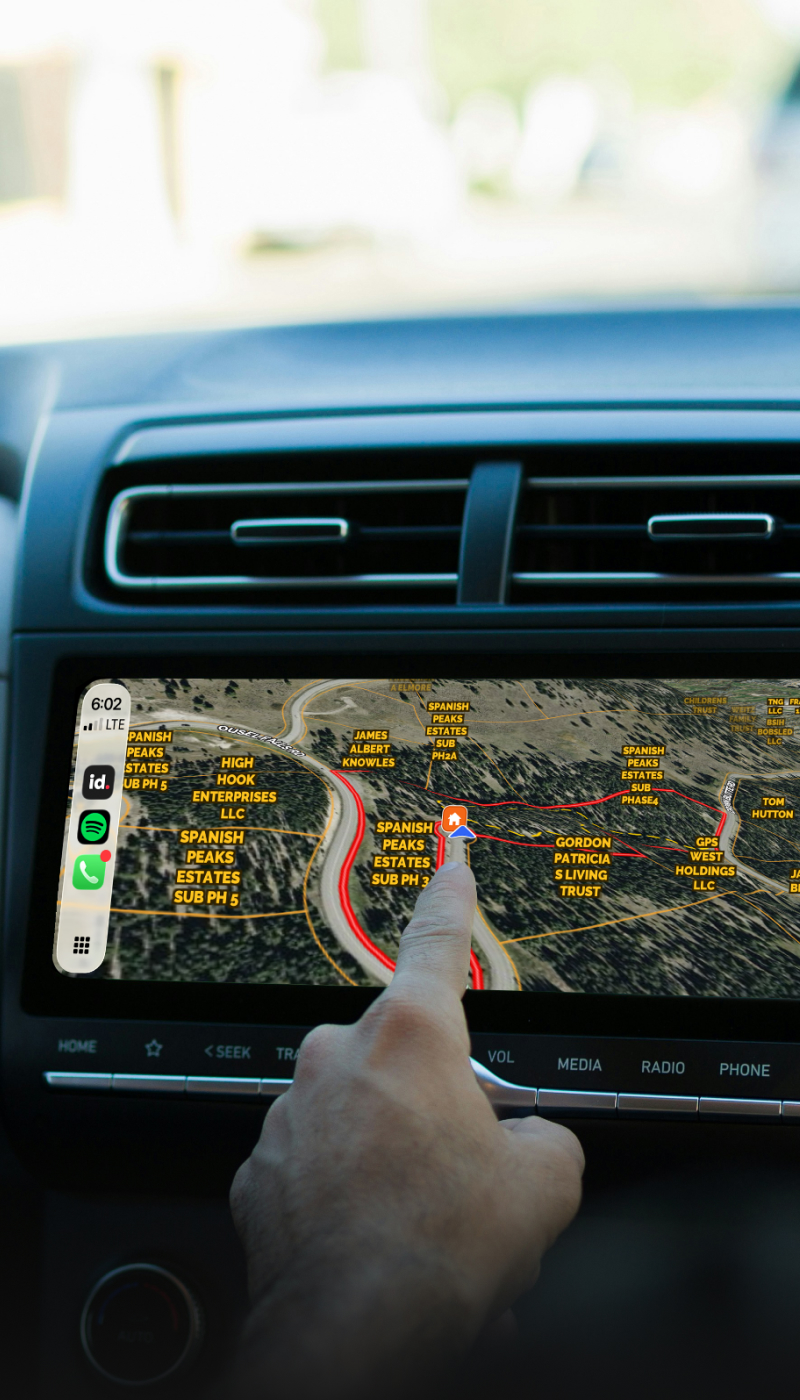
Site Selectors & Developers 

Scope viable land faster, from the data up.

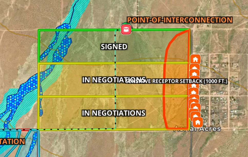
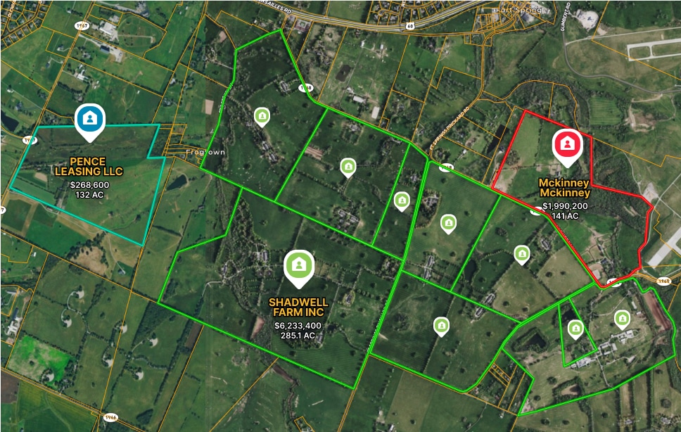
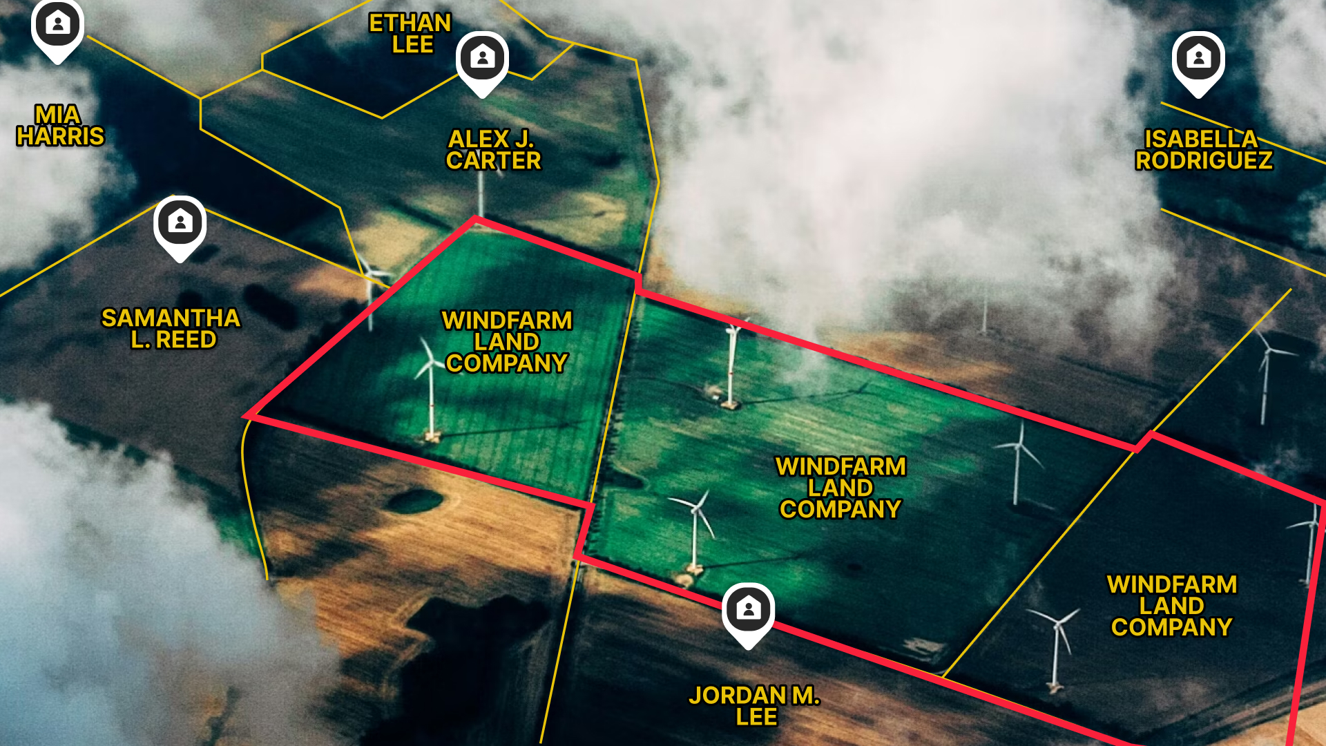
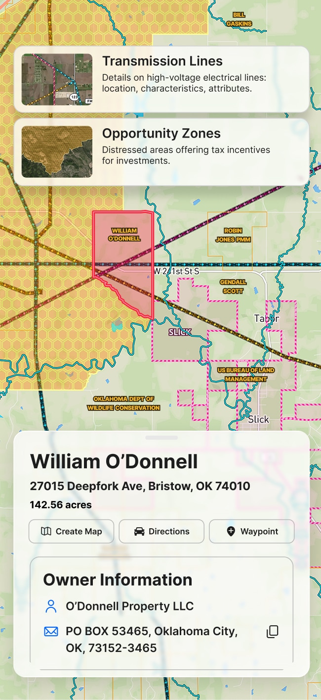
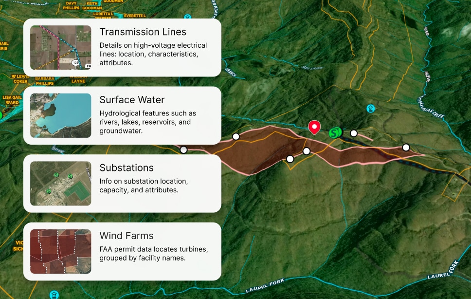
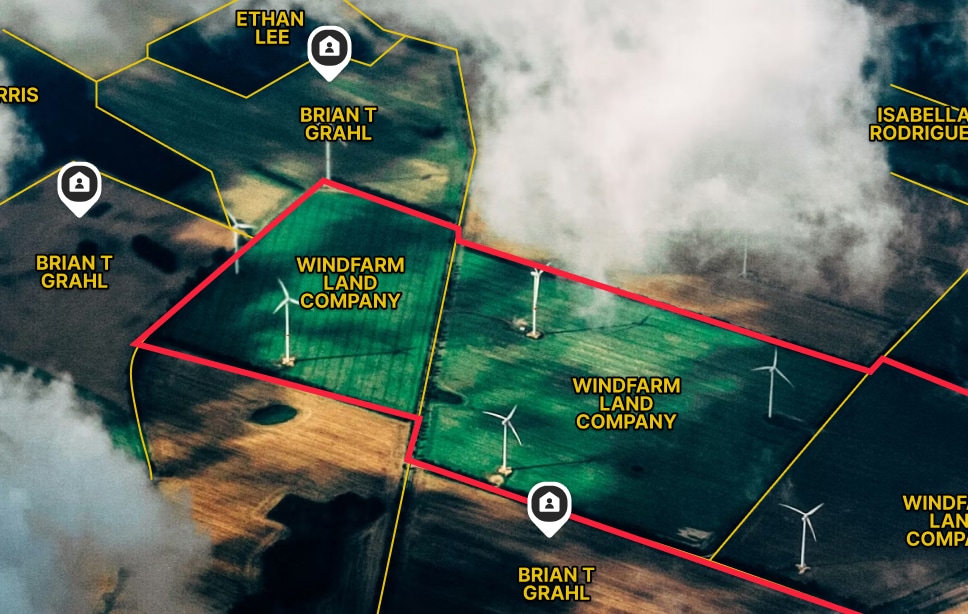
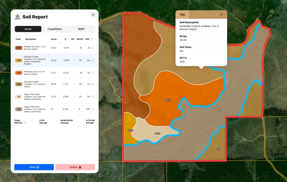
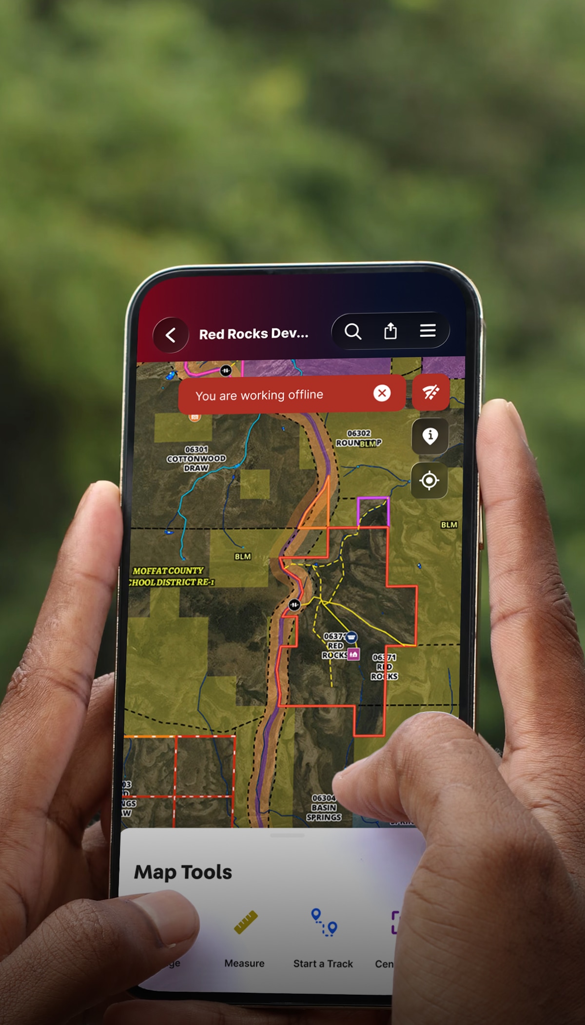
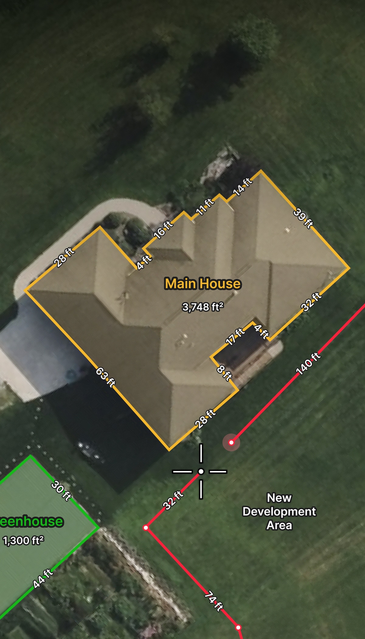
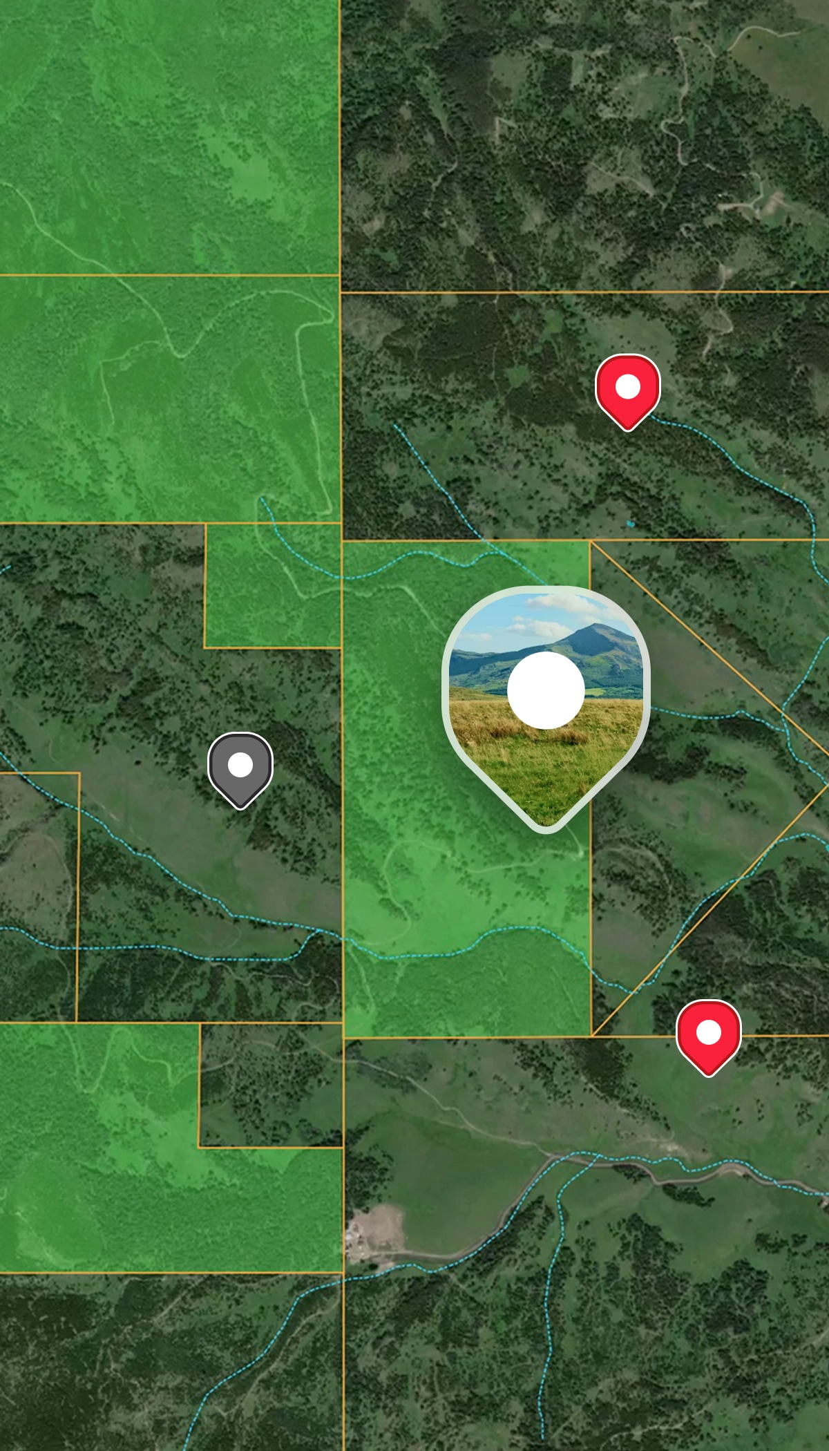
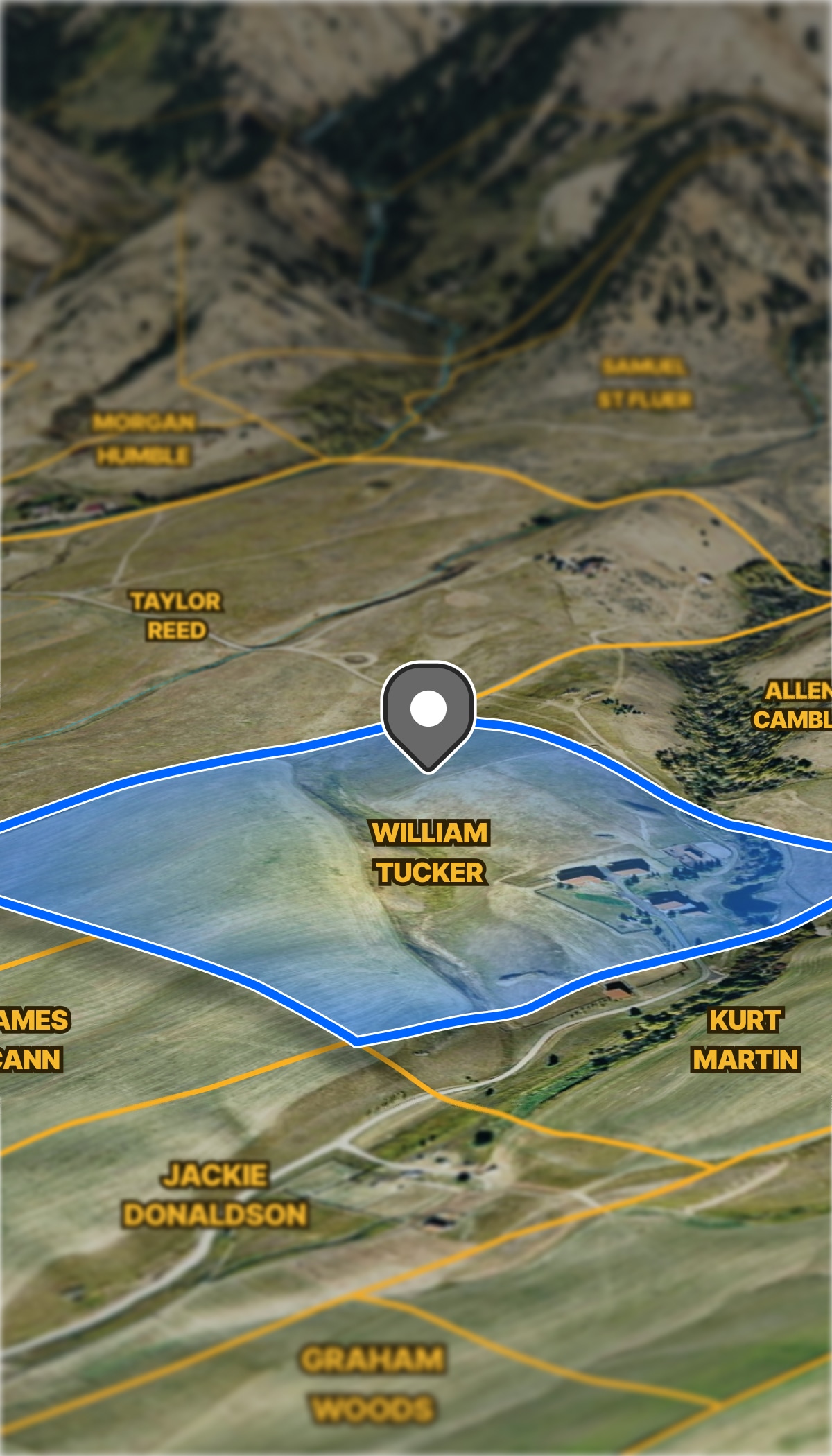
  • Overlay generation and transmission infrastructure data on parcel maps.
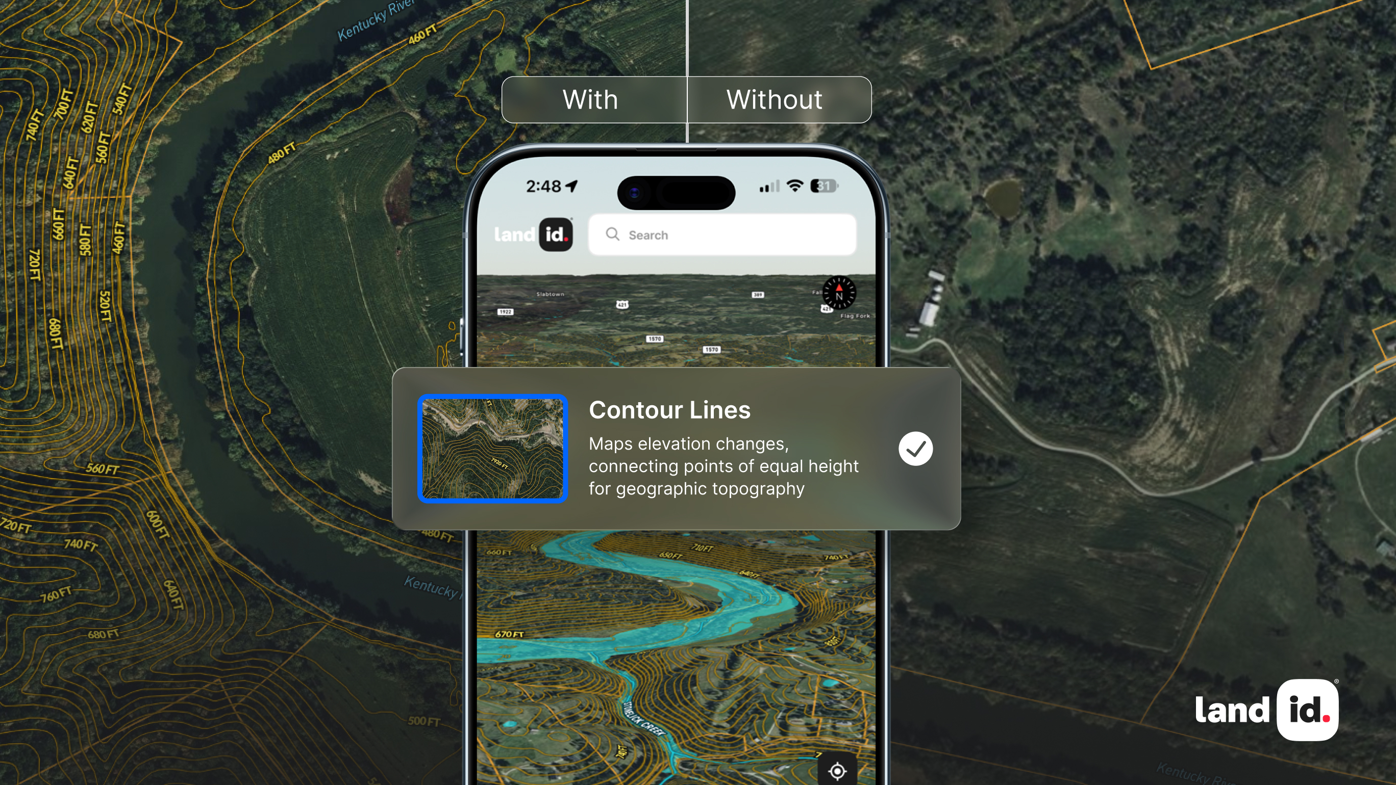
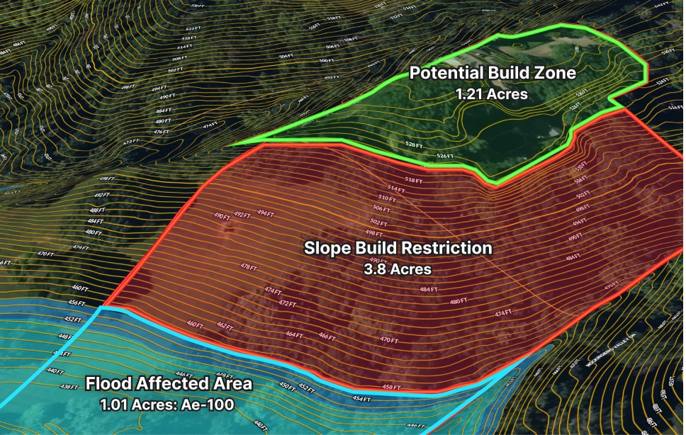
  • Flag floodplains, slopes, and setbacks to rule out bad fits.
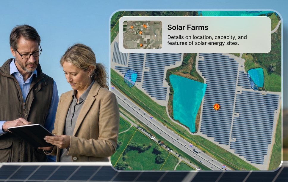
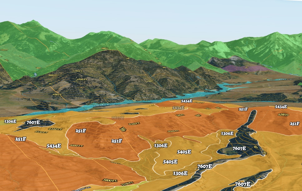
  • Map existing wind and solar projects to avoid issues.

Landmen

Walk in knowing who you’re dealing with beforehand.

  • Pull up parcel info and ownership portfolios before you reach out.
  • Track which parcels are leased, in negotiation, or still open.
  • Share updated project maps with your team so everyone's aligned.

Renewables Brokers 

Give your clients a map they can actually use.

  • Build project-area maps with custom layers and branding.
  • Share interactive maps to communicate scope and progress.
  • Manage multiple projects in one platform.

More Resources

What Are Contour Lines? Using Elevation to Understand Property Potential

Learn how contour lines reveal hills, valleys, and slopes, turning elevation data into insights you can see and use in your property decisions.

GIS Green Energy Management For The World’s Most Popular Renewable

Hydropower isn’t new by any means; humans have been harnessing the power of water for thousands of years (though back then, the energy was mostly used for tasks such as grinding wheat into flour). It wasn’t until 1880 that hydropower was first used in the U.S. industrially. And two years later, in September of 1882, a Wisconsin plant on the Fox River became the first to sell the electricity it produced.

GIS Land Planning Software in Building Renewable Resource Infrastructure

Renewable energy has been a hotly debated topic for decades, but some question whether green energy truly has the capacity to power large populations.

FAQs

What data layers does Land id have that are relevant to renewable energy site selection?

Can Land id help me identify who owns the parcels I need to lease for a wind or solar project?

How do energy developers use Land id to track lease negotiations across a large project?

Does Land id offer owner mailing lists to help with public notification requirements?

Can Land id be used for ongoing asset management after a solar or wind project is built?