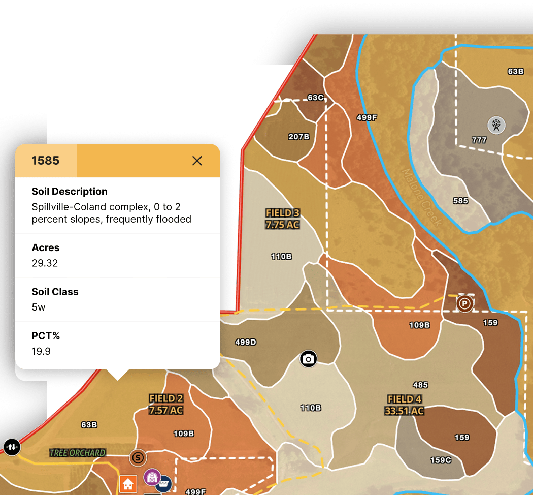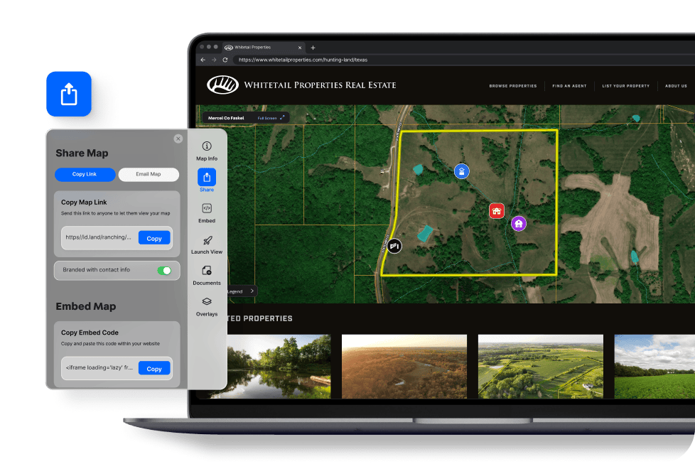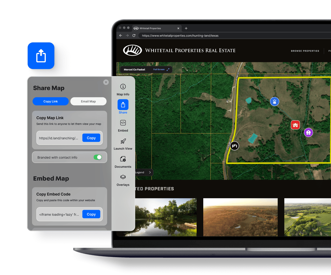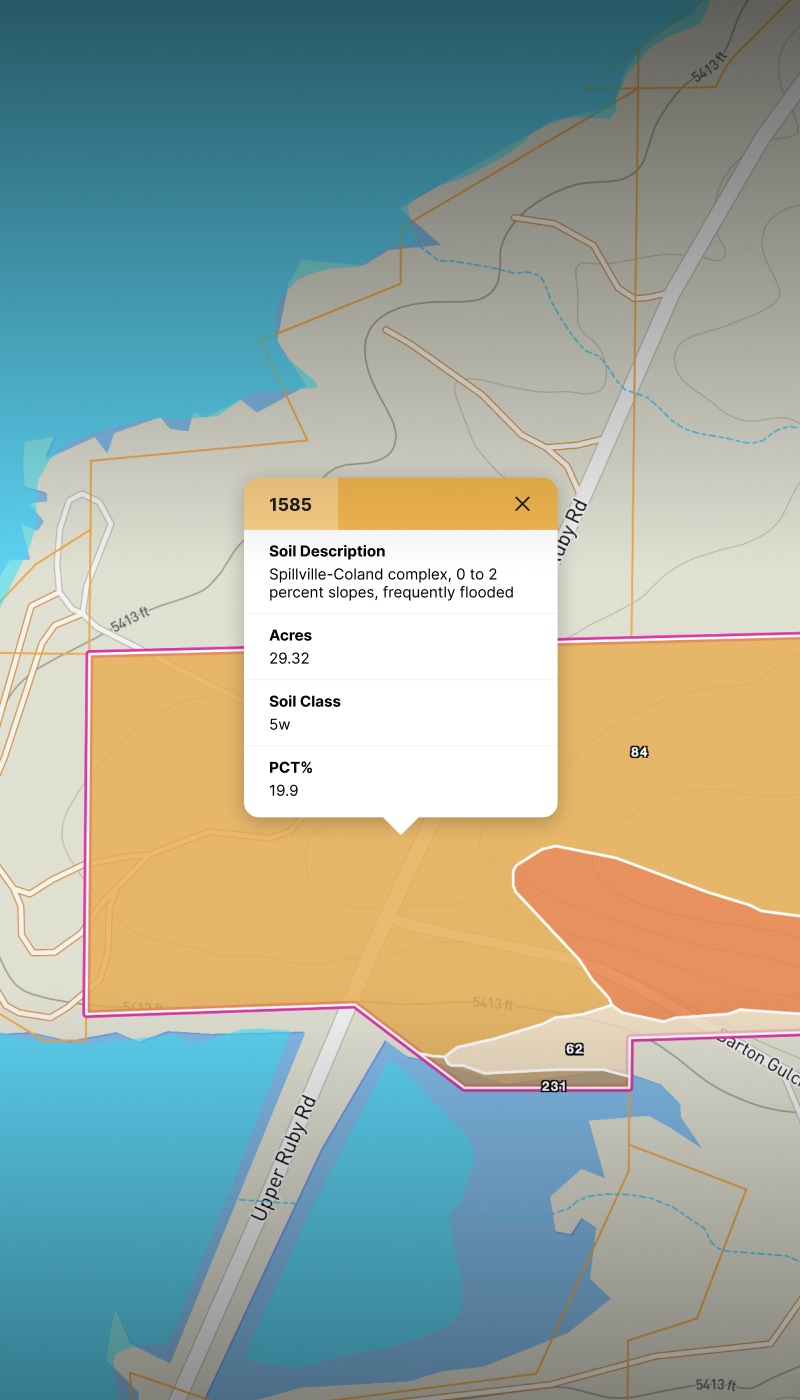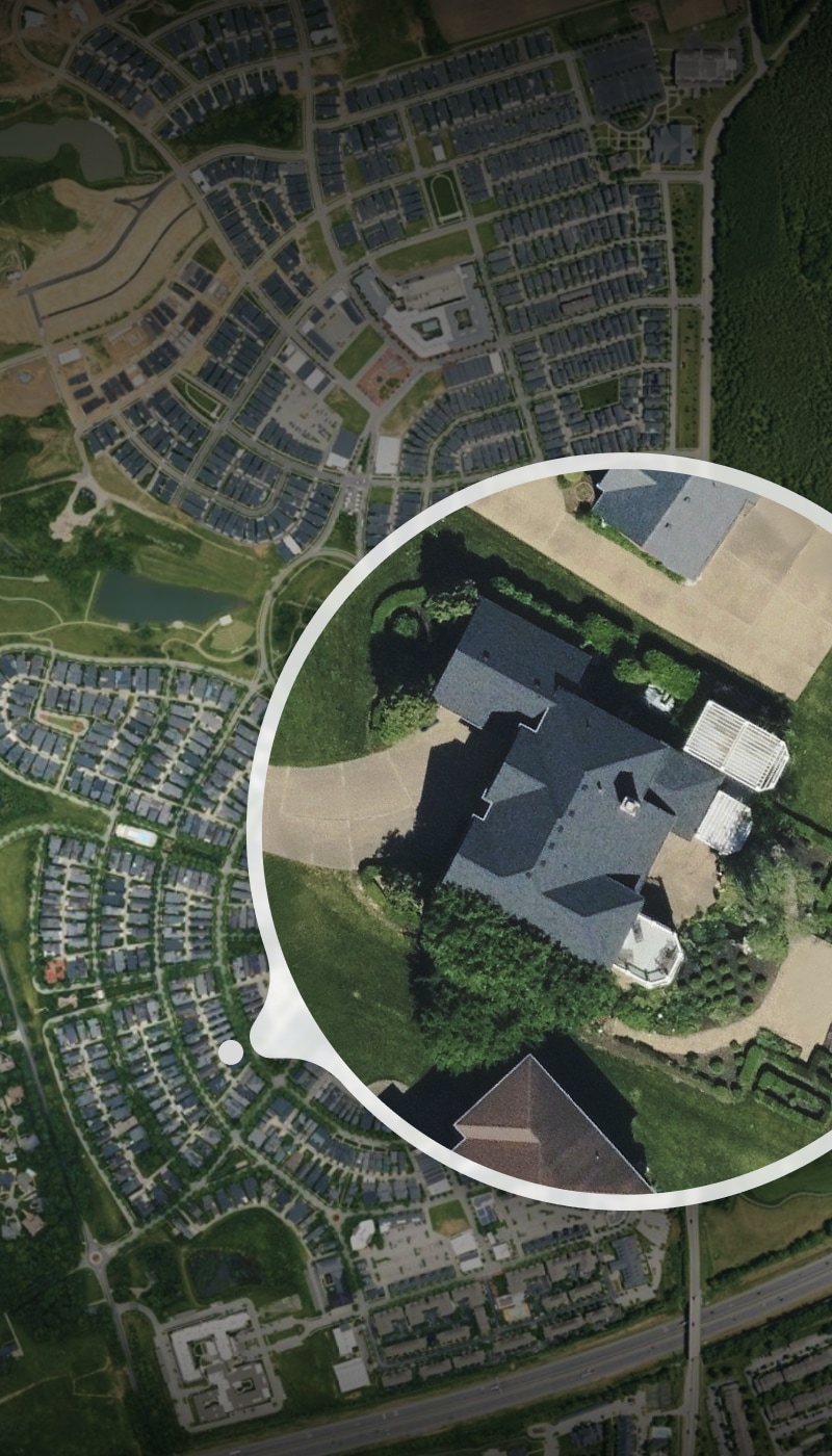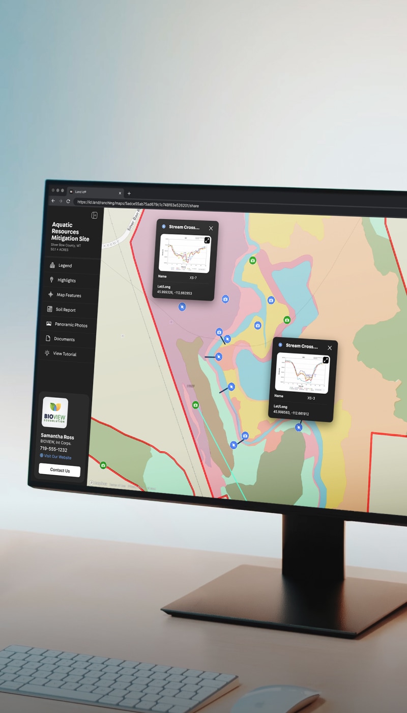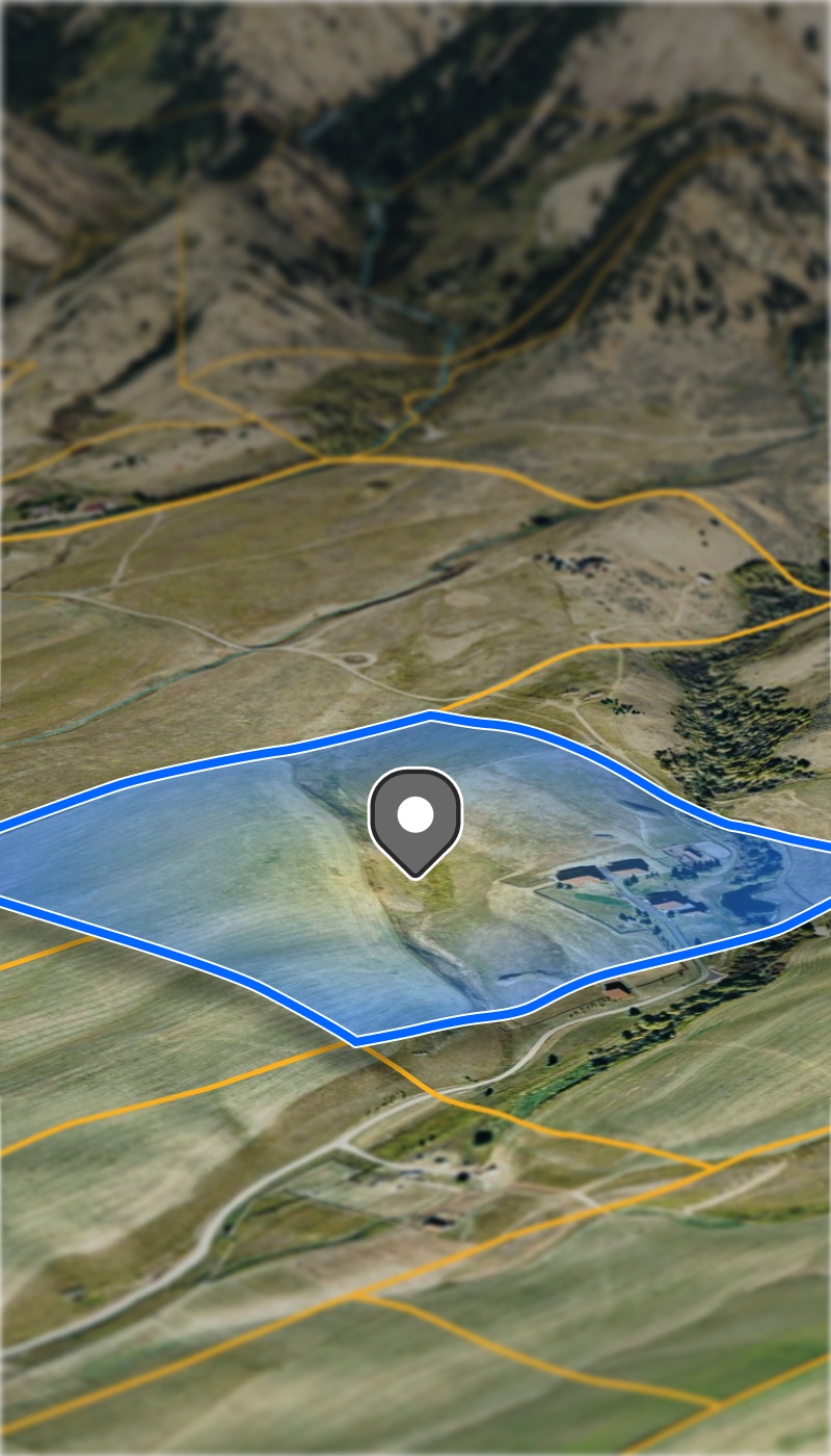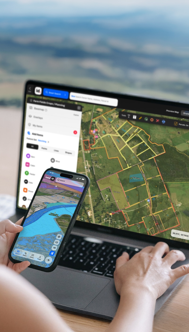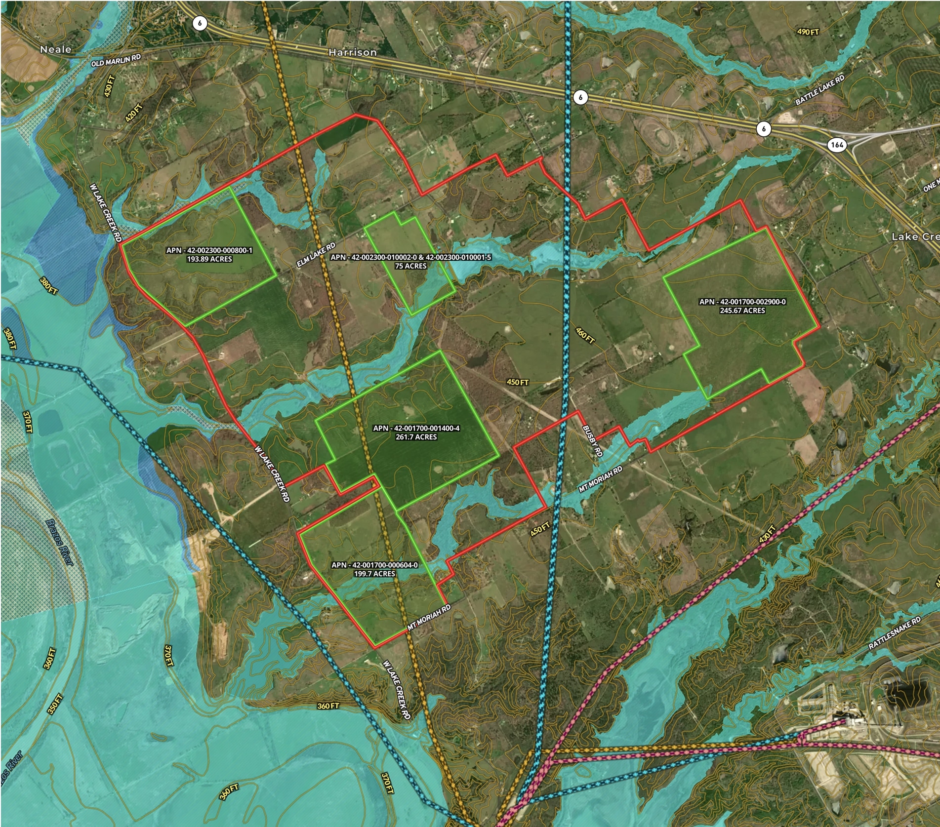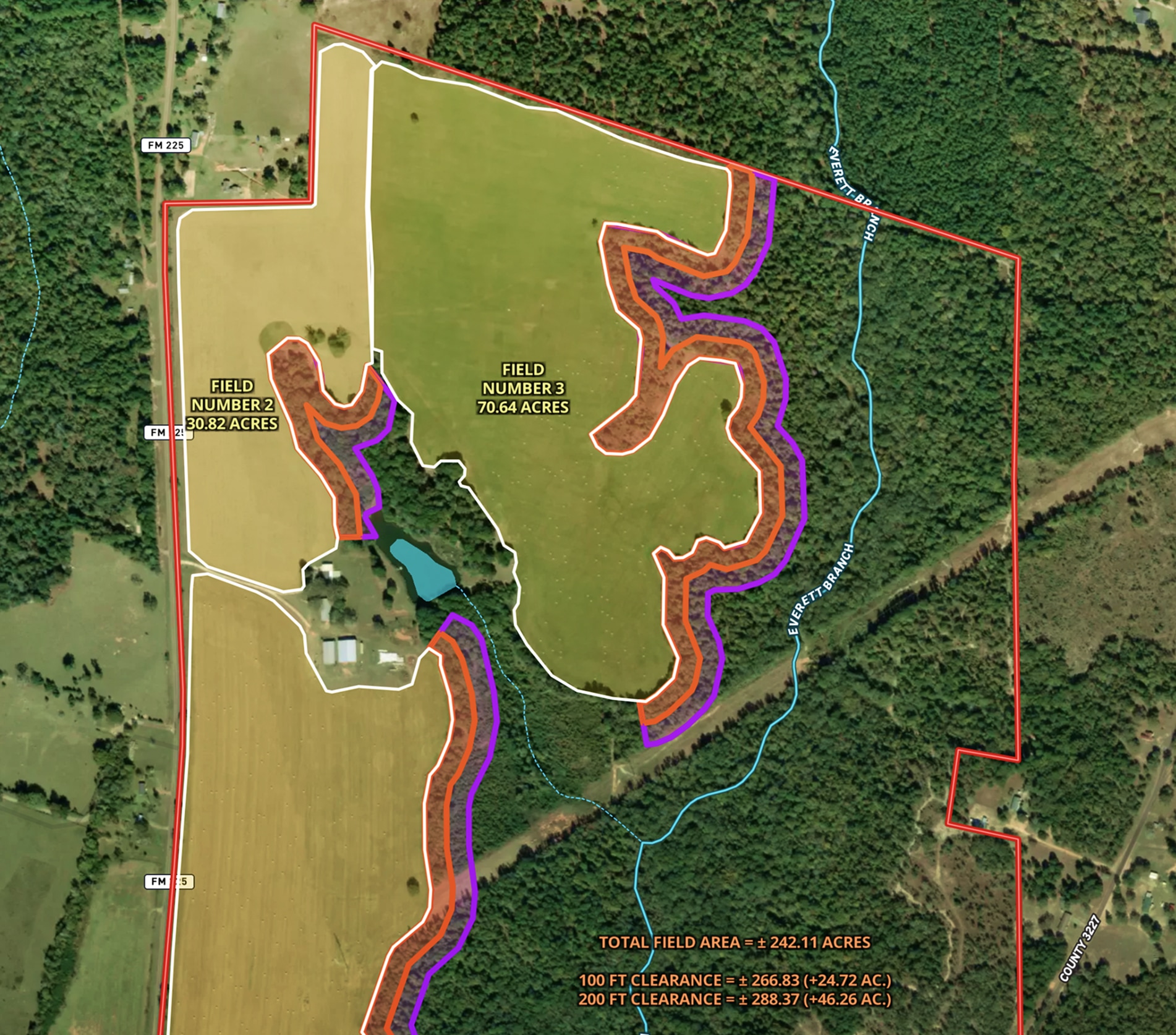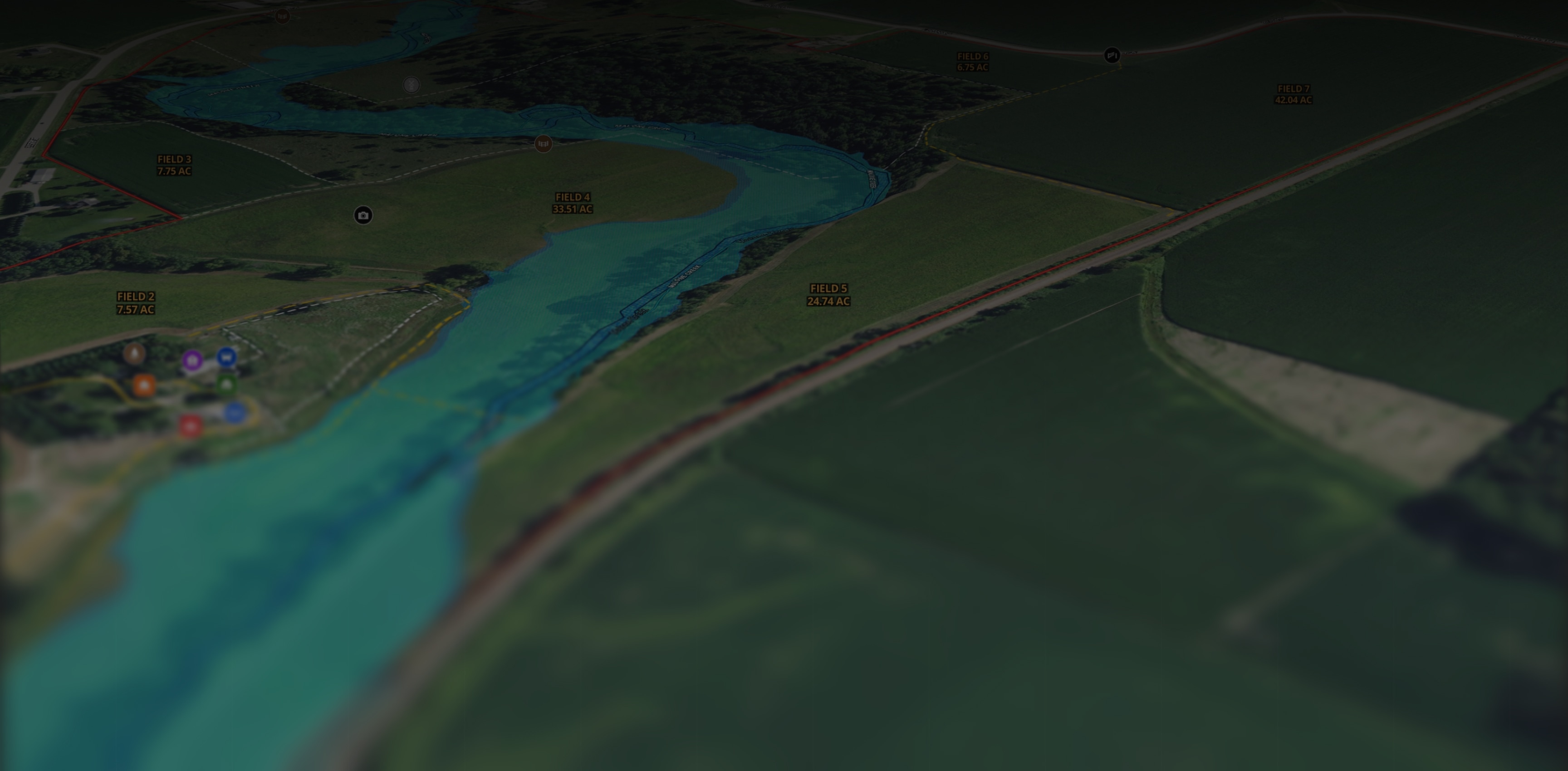
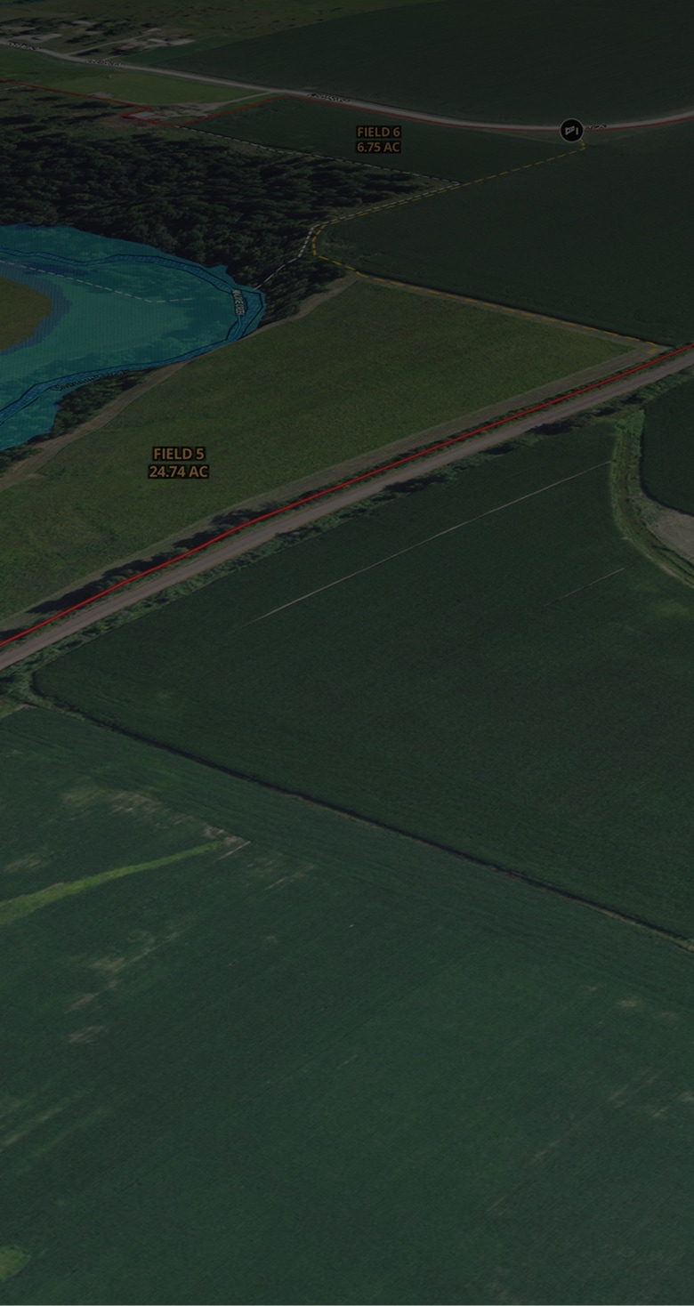


I use Land id® on every buyer and seller that I work with. Simply providing a map to every person through the process helps with all aspects — getting measurements of the property, helping the photographer know property boundaries, verifying property features and attributes, marketing those features, showing property with the buyer's agent, using the tool for property tours and giving a unique map to the buyer.

Megan Turnipseed
ALC, Broker Associate, Keller Williams Realty Lone Star
ALC, Broker Associate, Keller Williams Realty Lone Star
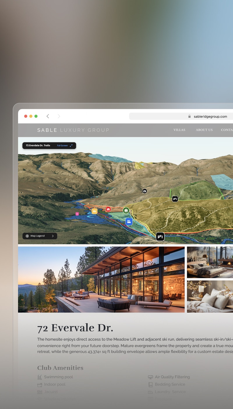
Land id®’s mapping system and technology give me a significant advantage over the competition. It’s our secret sauce for expediting the property selection process with buyers, enhancing our listings by showcasing our extensive knowledge in Farm and Ranch real estate, and providing potential buyers and agents with detailed property overviews that other mapping systems can’t match.

Lindsey Hollin
Texas Farm and Ranch Broker
Texas Farm and Ranch Broker
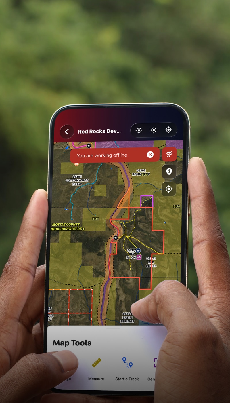
Land id® maps continue to work even when I’m not. They provide value around the clock.

Harlan Ray
Burgher-Ray Ranch Group, Briggs Freeman Sotheby's International Realty
Burgher-Ray Ranch Group, Briggs Freeman Sotheby's International Realty
There is no other mapping subscription that can compete with Land id® as far as a real estate tool.
John Fowle
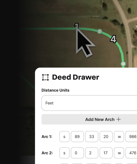
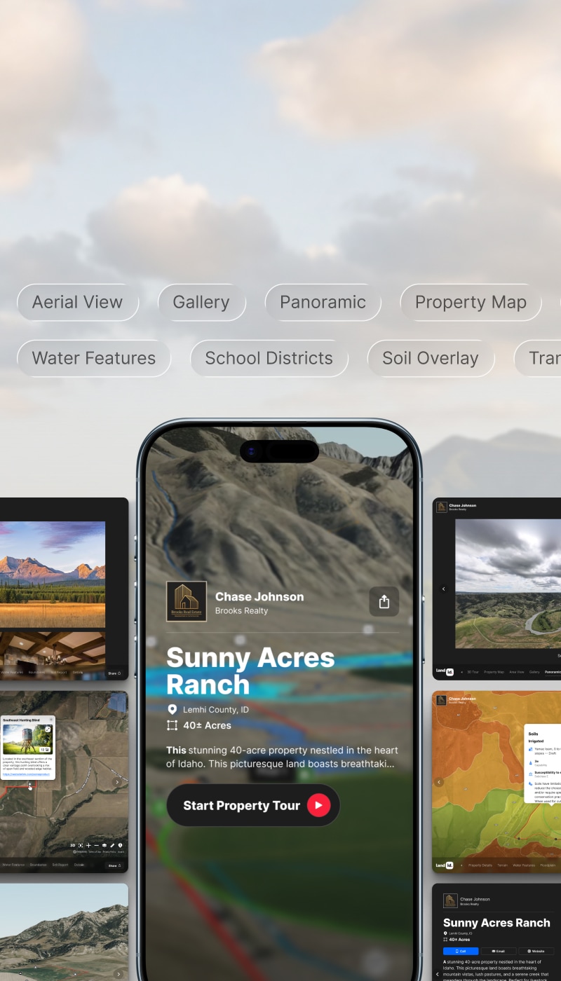
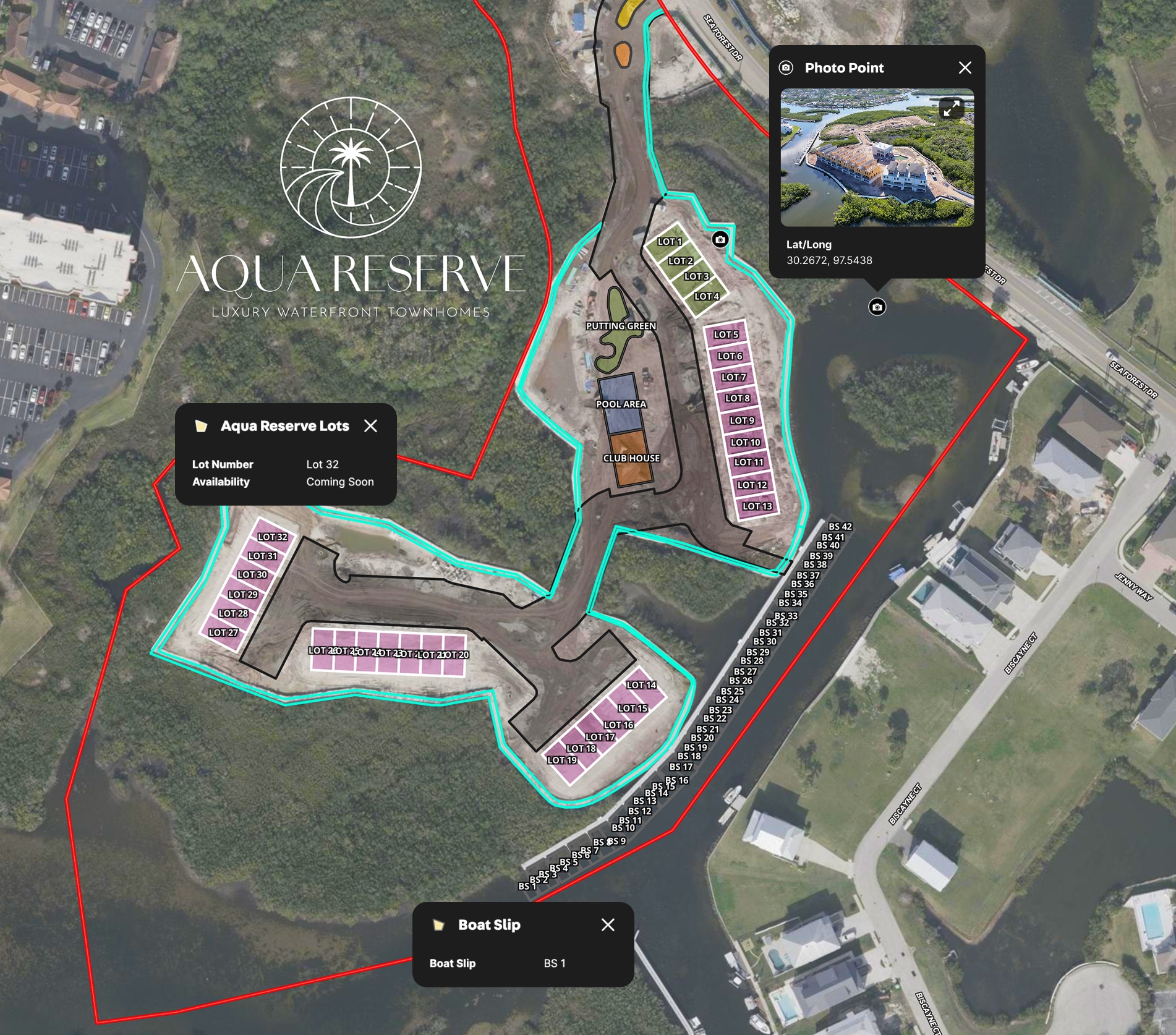
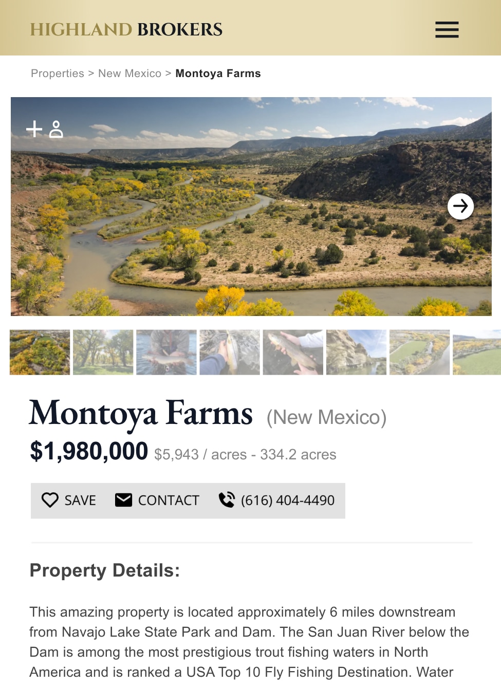
The maps are easy to create and set up, and we use them on the listing side to create high-quality listings for end buyers to understand the land as well.
Brendan Haughey
Browne Real Estate
Browne Real Estate
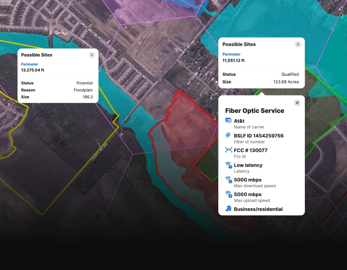
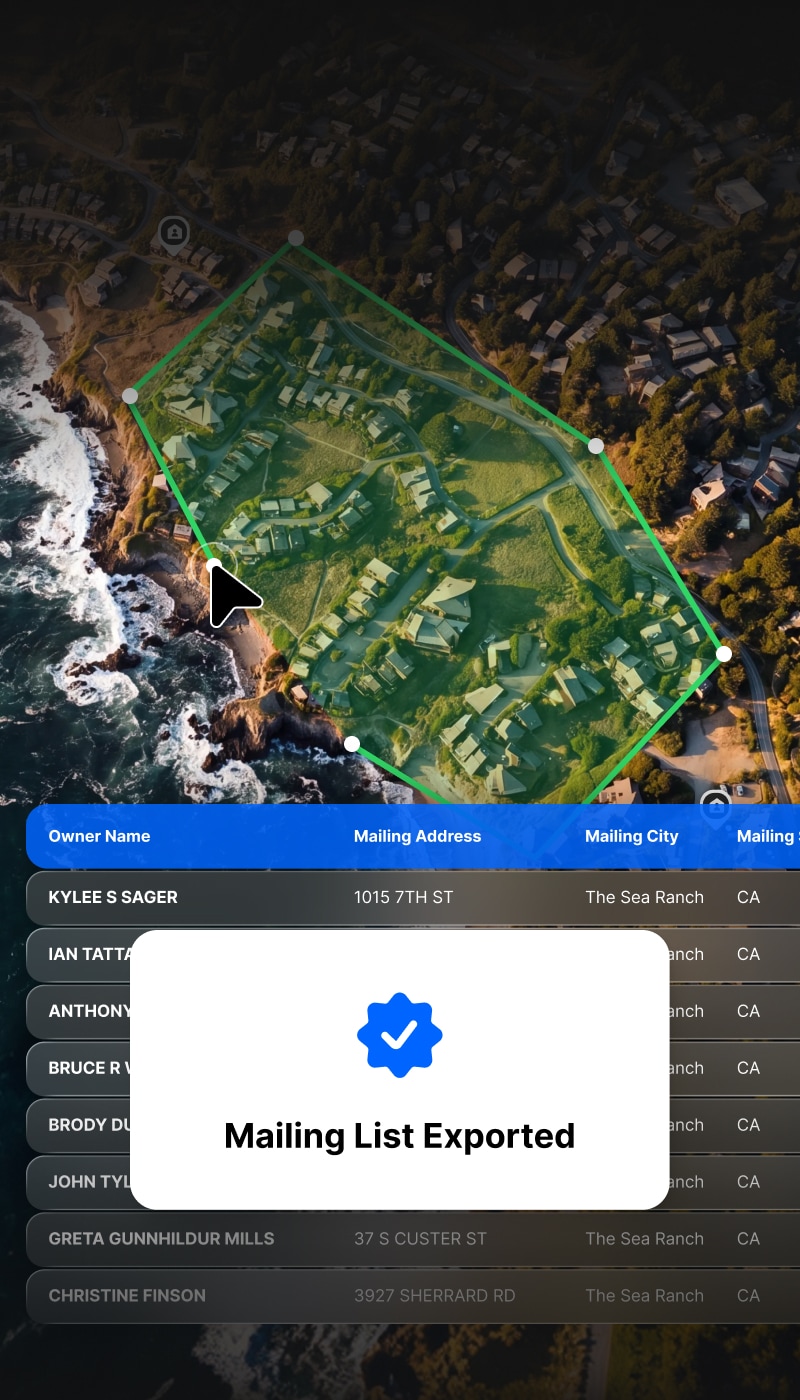
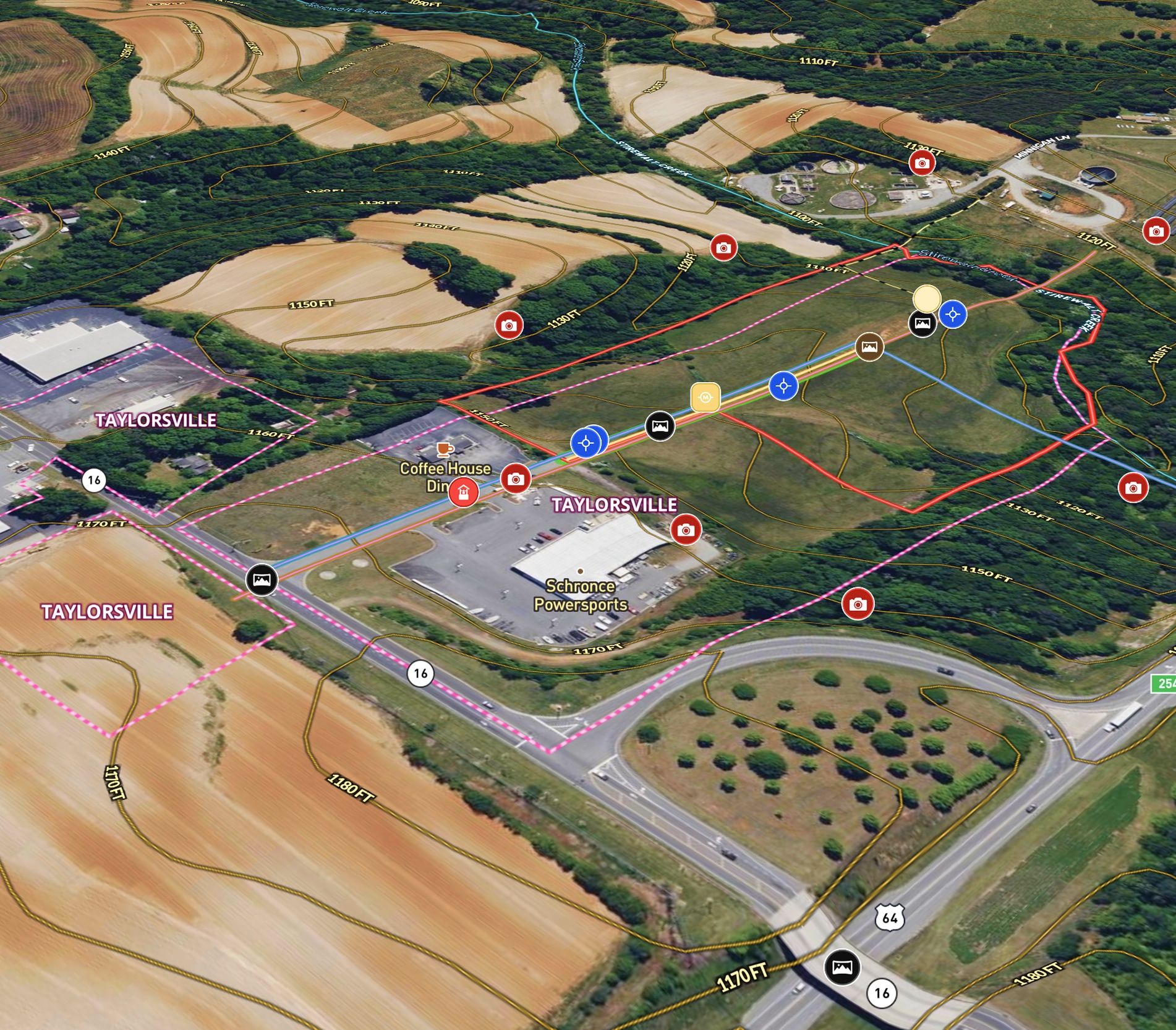
We use Land id® for every property we look at and get under contract. It tells you so much about the property without ever having to step foot onto it. We also use it to create pictures to market properties.
Chris Thomas