The AI-Driven Parcel Data & Mapping Tool for Real Estate & Land Pros

Explore in-depth land ownership and property information. AI works behind the scenes to enhance your map creation with extensive property info, map overlays, and land identity.

Discover Land Owner & Property Boundaries Nationwide

Land id® makes it easy for real estate professionals, landowners, and anyone interested in land to understand property boundaries and land ownership across the United States. AI works behind the scenes to surface valuable insights and help you make informed decisions about land use and ownership.

Contextual Layers
a Tap Away

An easy-to-explore property card brings contextual land insights to the forefront with a single tap or swipe.

Precise Measuring for Accurate Planning

Estimate costs and assess resources. Easily calculate distance, perimeter, and area of parcels and structures in any unit of measurement.

Extensive
Property Data

Discover property info and ownership across all 50 states.

View Parcel Boundaries

View detailed and accurate property boundaries nationwide.

Property Insights & Discovery Made Easy With AI Smart Search

Land id's AI Smart Search takes property discovery to the next level by delivering a fast, efficient, personalized experience. Quickly find land owner info by a variety of criteria, including address, APN & TRS number, landowner name, latitude/longitude, and more.

Download on the Apple App Store
Get it on Google Play

Combine Search With Map Layers for Deeper Context

Find properties in or out of flood zones, get details on soil composition, see proximity to public land, and much more.

Save Properties

Mark and save properties with dynamic waypoints for quick access and revisiting later.

Search
& Go

Search properties and access ownership info, boundaries, and driving directions from desktop and mobile.

Property Buyers, Owners & Pros Love Land id

I am able to increase my sales volume by vetting properties for buyer clients from the comfort of my computer chair. This saves time and miles on the truck, while selling more land!
Matt Wonser
Head of Partnerships,
L2 Realty Inc.

Take Your Projects to the Next Level With Map Creation & Sharing

Land id Premium includes everything in the Land id plan, plus the ability to make high-resolution mapping and sharing part of your decision-making workflow.

Premium

Offline
Map-Making

Download your work at home. Access and edit in the field, even without cell service.

Premium

Ultra High-Res Aerials

High-res basemaps make planning, estimating, and decision-making easier than ever.

Testimonials

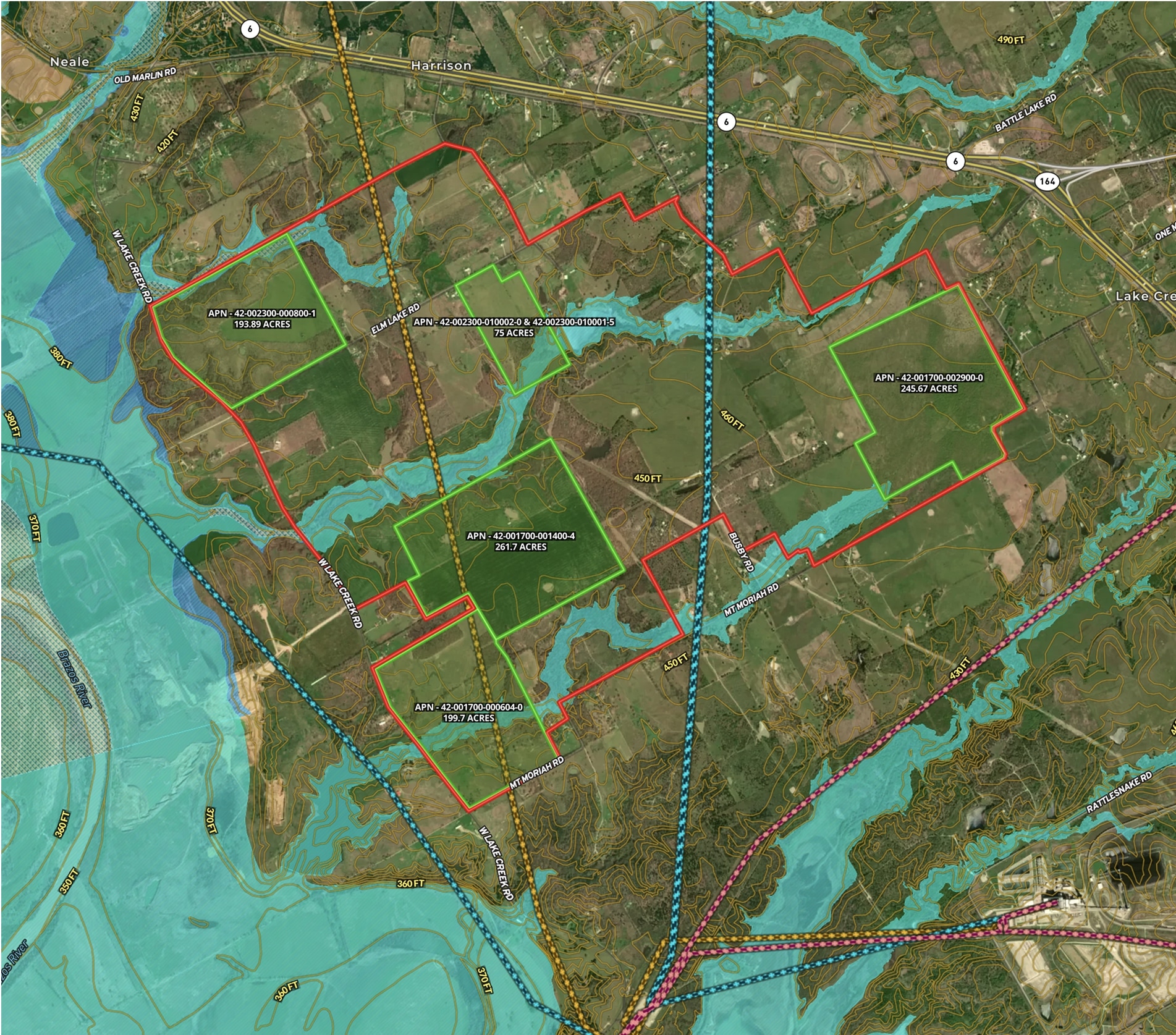
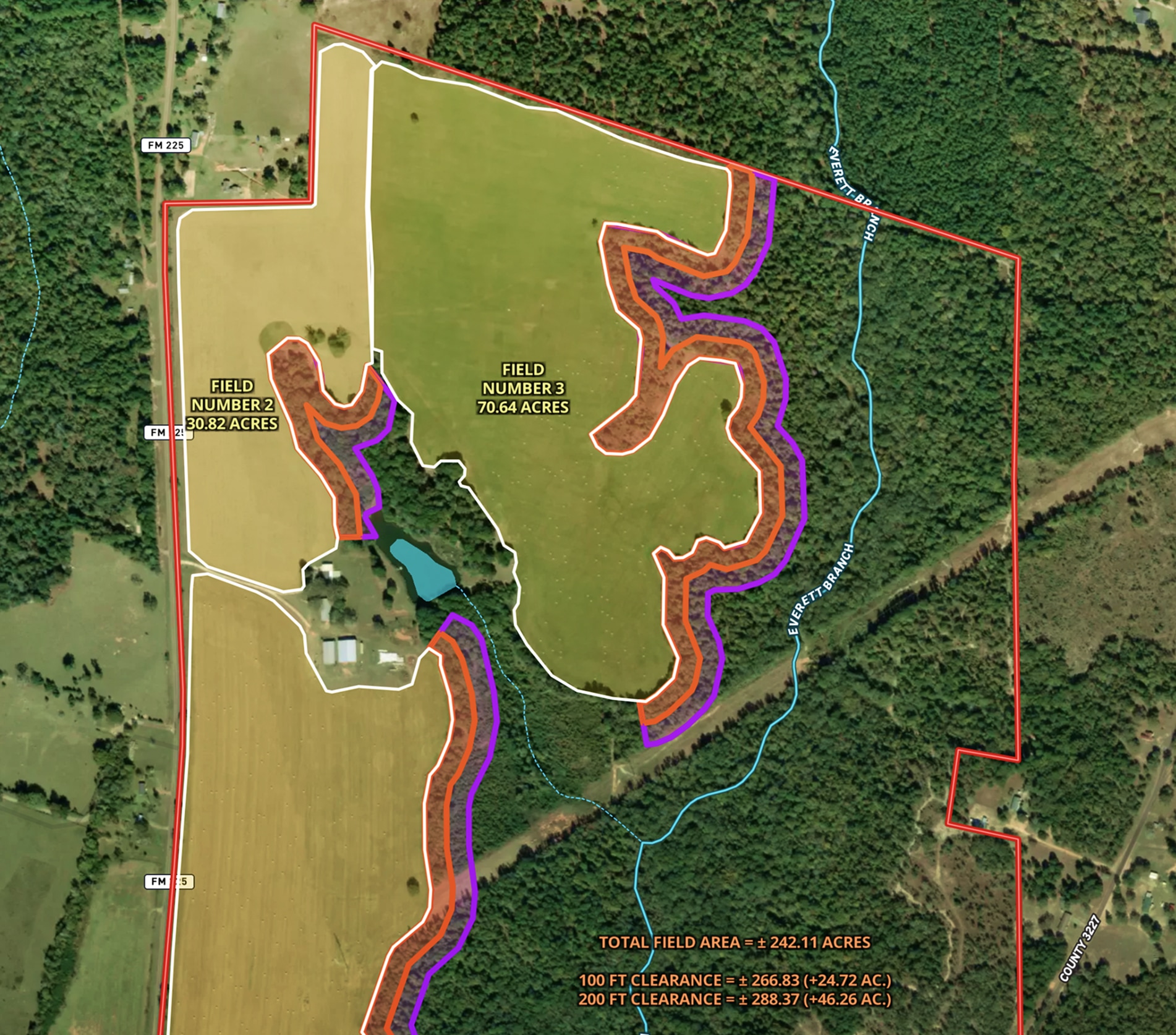
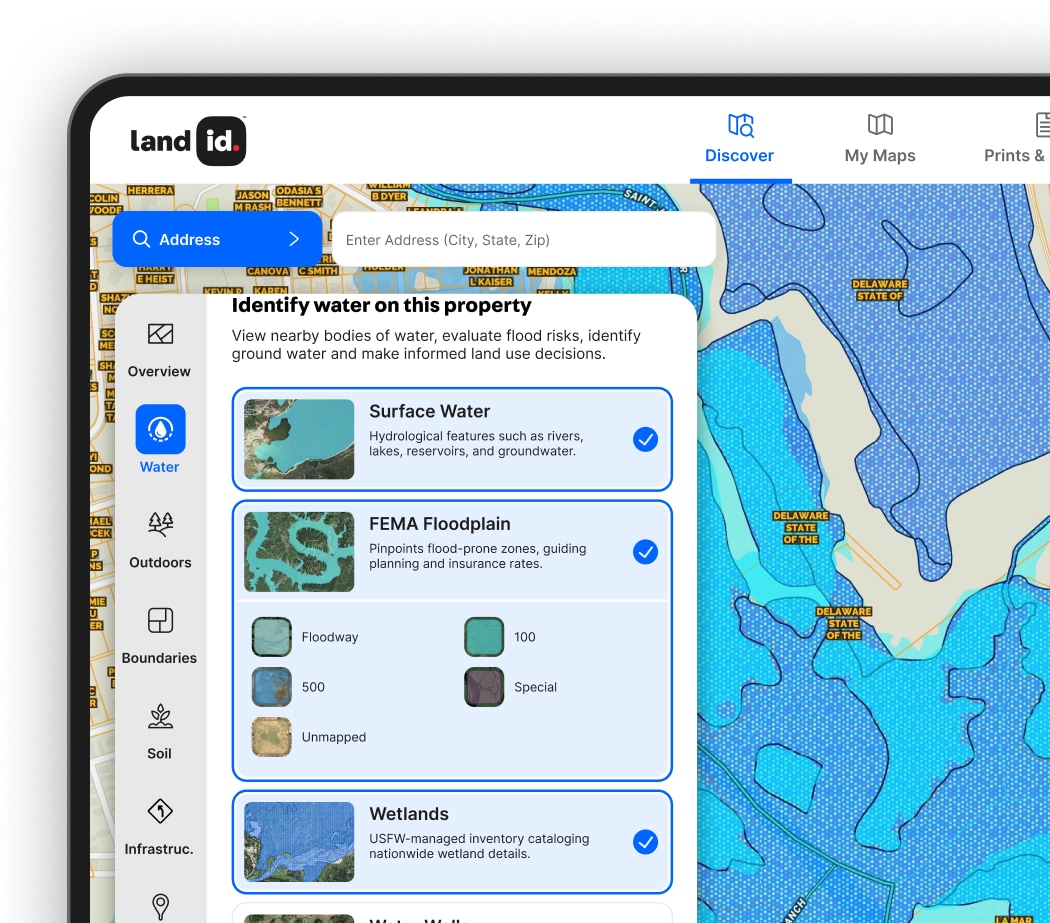
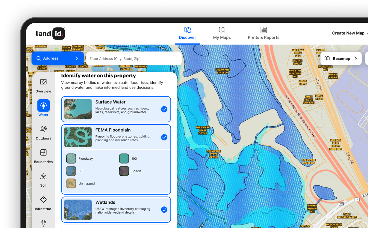
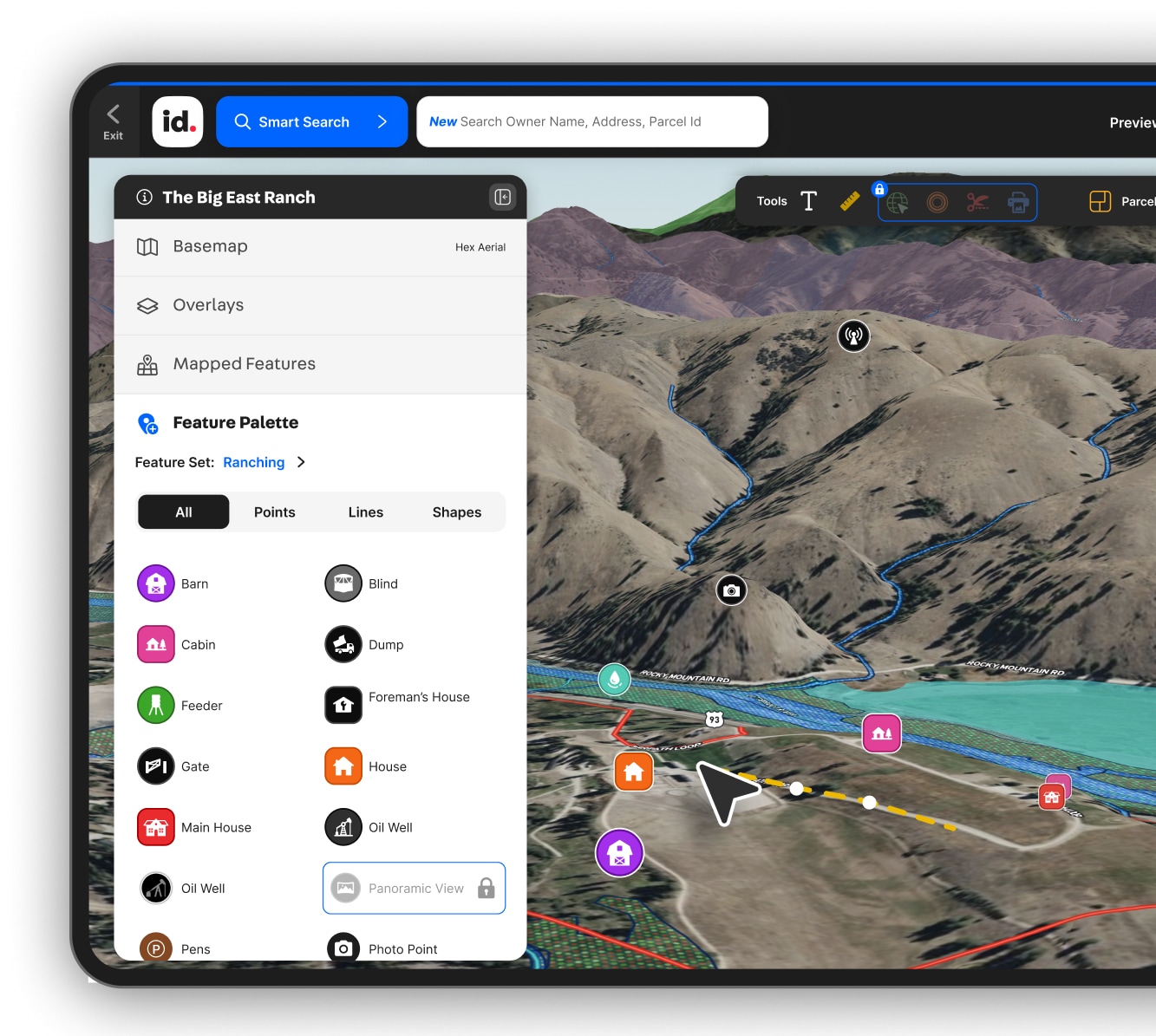
I use Land id to check for potential defects in the land I am buying and selling. Whether it be a slope or flood plane or county lines or railroad tracks or road access, the info is very accurate and helpful.
Henry van Amerongen
Land id provides a lot of the information I need all in one place and reduces my research time quite a bit.
Angela Bruno
City of Trees Real Estate
Land id has tons of data and lots if ways to search land.  I can sit on my ass and flip land in my undies. It's great.
Anonymous
Land id is amazing, and I don’t want my peers having the same advantage. I can say that this program is by far my most important tool.
Anonymous
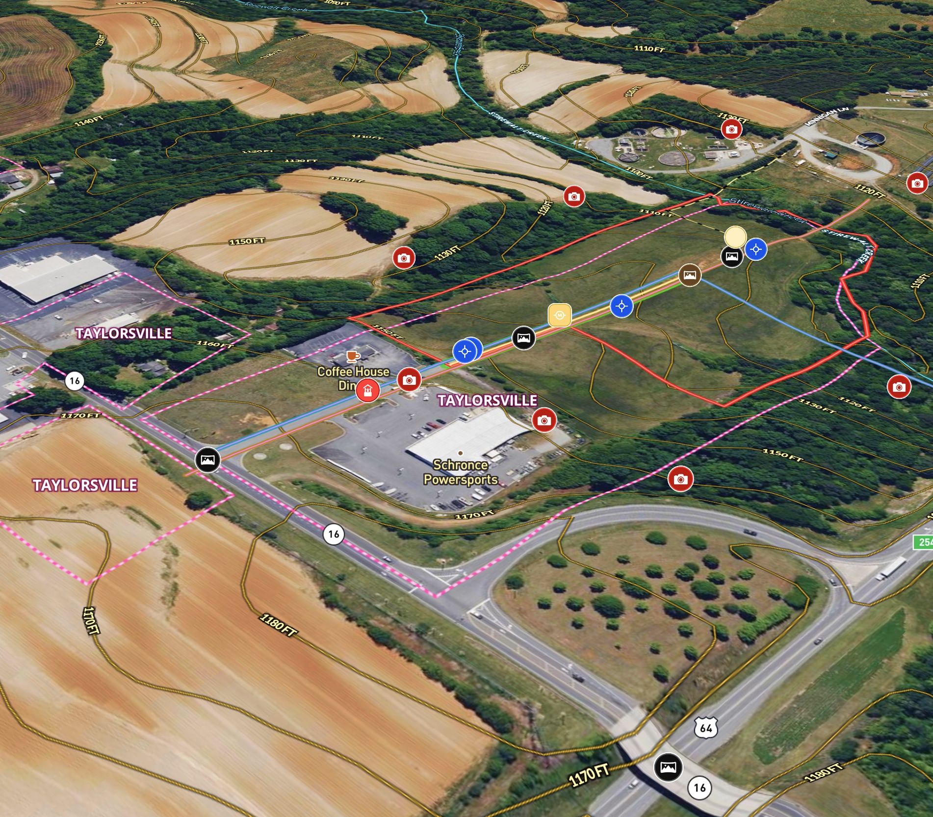
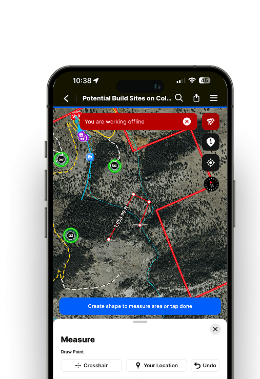
I never go look at any property before I analyze it on Land id. This has saved me countless hours of driving as I already drive 40,000+ miles per year. When I am on property, the app helps tremendously as I know exactly where I am at all times.
Loren Dickey
Everyone I work with uses Land id® — it's the industry standard. If you're not using it, it's time to upgrade your professional tools and work smarter.
JB
Family Office Real Estate Investor

FAQs

Can I use Land id Pro to manage multiple properties or projects?

Can I try Land id before upgrading to a paid plan?

When should I consider upgrading from the basic Land id plan?

Do I need GIS or technical experience to use Land id?

Can I share maps with clients or partners?

How quickly can I analyze a property?

What kind of property data can I access with Land id?

Who is the Land id plan best suited for?

What’s included in the Land id plan?