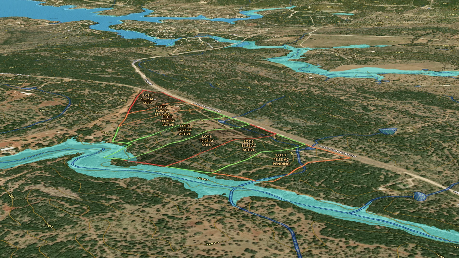
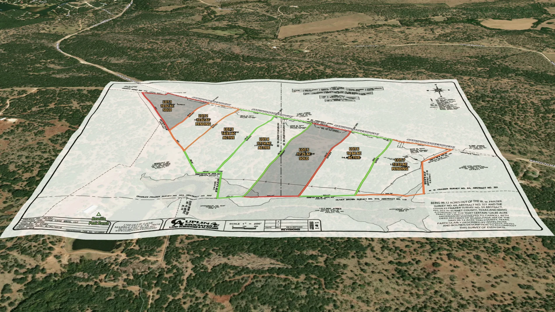
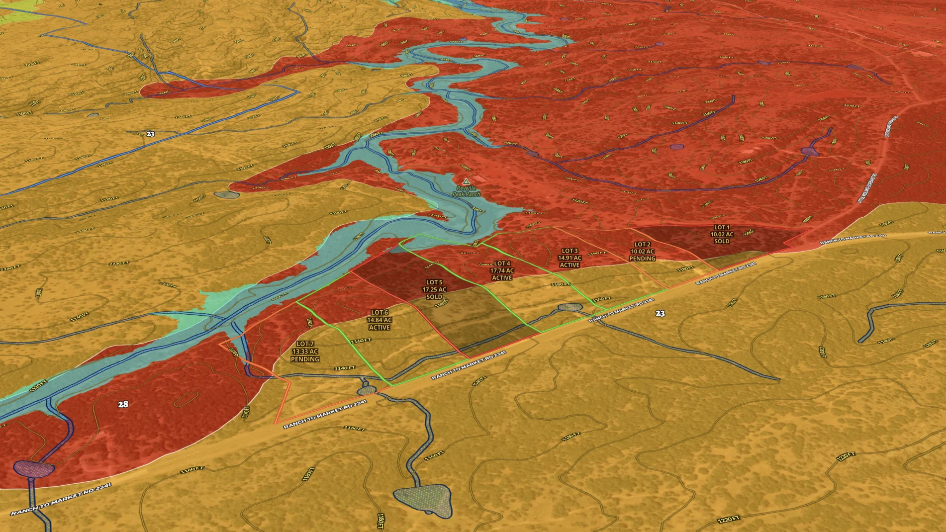
Show how a property is being subdivided with our easy-to-use cut tool. Then add acreage and status details with our attribute and labeling tools. Before long, you've quickly created a compelling map for your listings.
Land id™ GIS mapping software creates immersive real estate maps that showcase property features, land parcels, and lifestyle highlights for this Bozeman riverside retreat.
Boost your sales pipeline with Land id™'s real estate mapping software. Create property maps to track land parcels, market trends, and off-market opportunities with ease.
Use Land id™ GIS mapping software to evaluate land parcels for data centers. Create a property map with overlays for utilities, floodplains, and more using real estate maps.
LPT Realty used Land id™’s GIS mapping software to create a branded property map for new construction and show real-time availability insights.
Take Your Map Making to the Next Level
Want to know more?
All of Land id’s™ advanced mapping features is just the beginning. We want to see what you will do with the tools in each of our plans, and we are here to help you create dynamic maps for your team, every step of the way.
Get a live demo
Interested but want to see a bit more? Sign up for a live demo today.
Intrigued with Land id™ but want to see more? Sign up for a live demo of our property mapping software with one of our experts today.
By clicking “Accept All Cookies”, you agree to the storing of cookies on your device to enhance site navigation, analyze site usage, and assist in our marketing efforts. View our Privacy Policy for more information.