

Welcome to Grateful Harvest Farm, a 26+ acre Oregon Tilth Certified Organic Farm in the fertile Willamette Valley. The property features 1946-priority irrigation rights, Class 2 Newberg and Chehalis soils, and over 70 varieties of fruits and nuts, including apples, grapes, berries, and more. The property consists of two separate tax lots, includes two homes, a 54x102 Ag building with a certified organic kitchen, 4 greenhouses, and several wells for domestic and irrigation water.
Lisa Johnson, Principal Broker at Horsepower Real Estate, used Land id at every step of representing this property. She said, "Land id® is open on my computer all day when I'm at my desk and it's open on my phone when I'm out on land."
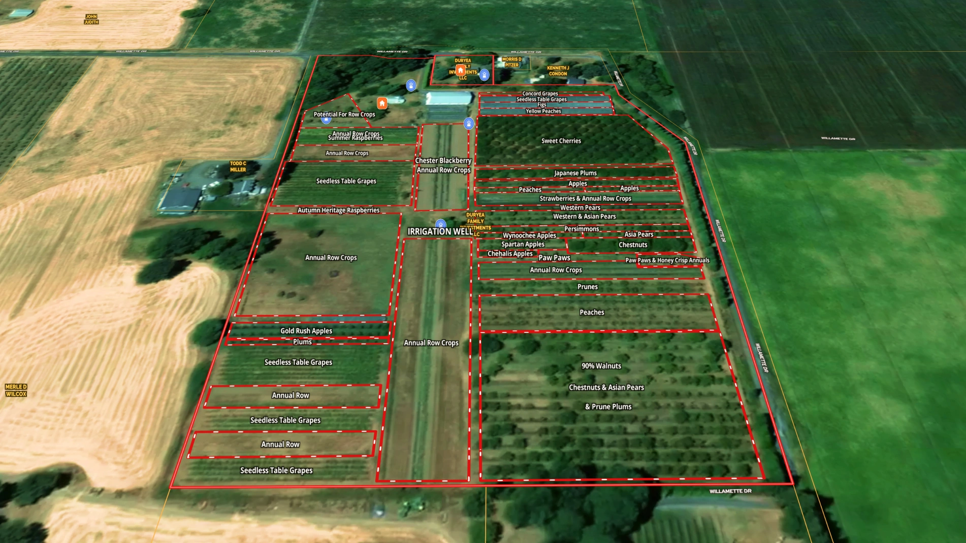
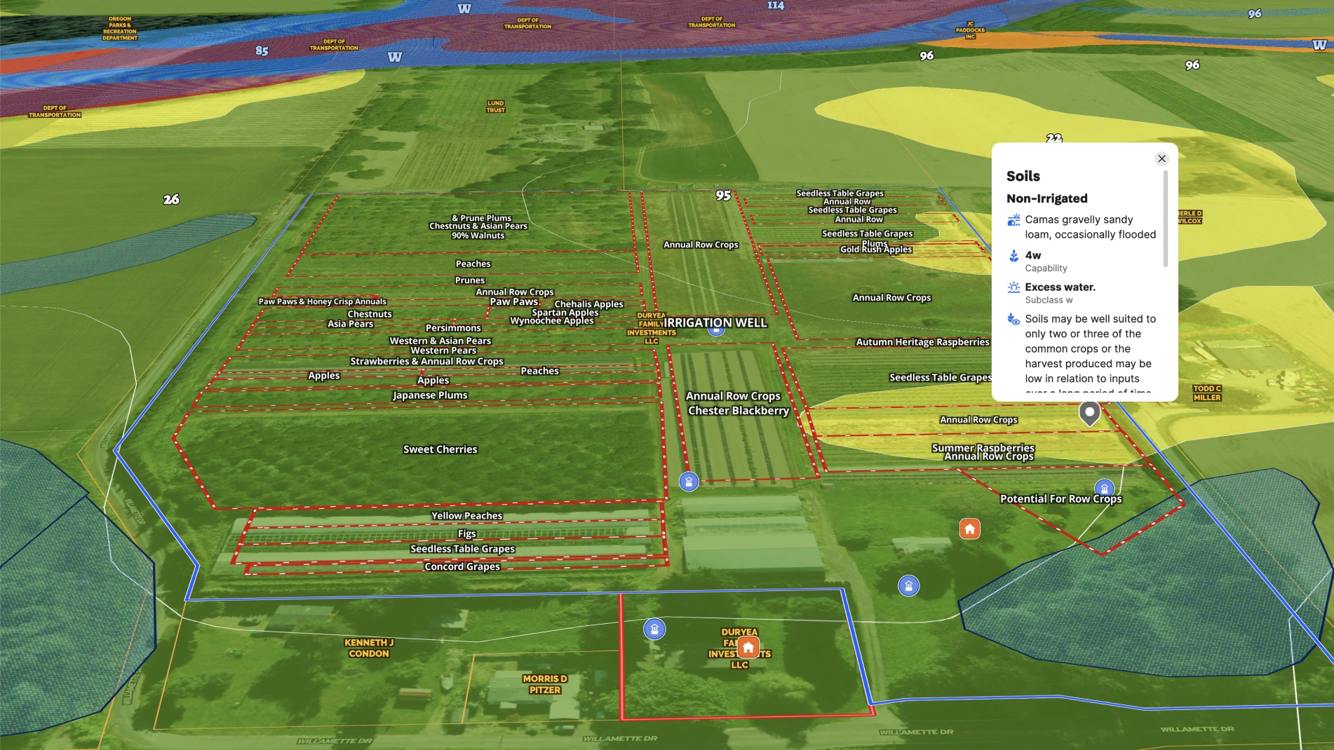
For example, Lisa leverages Land id to inform her pricing recommendation. She used the measurement tool to identify acres in each crop, combined with the soil report to create a detailed price per acre. She said, "My clients are always impressed by the fact that my price recommendation includes a detailed ag value breakdown and they often say, 'No other agent that we interviewed knew how to do that.'"
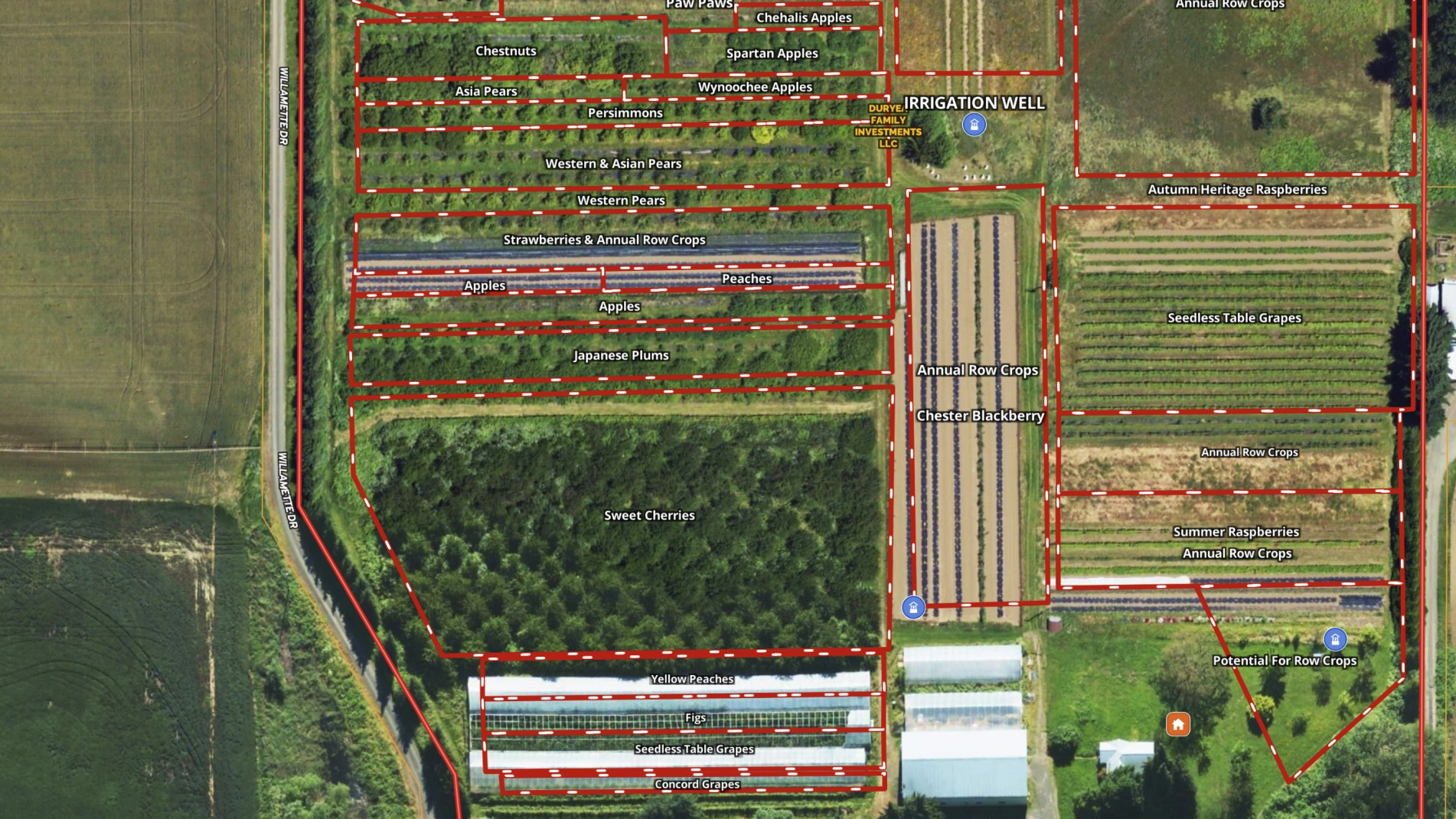
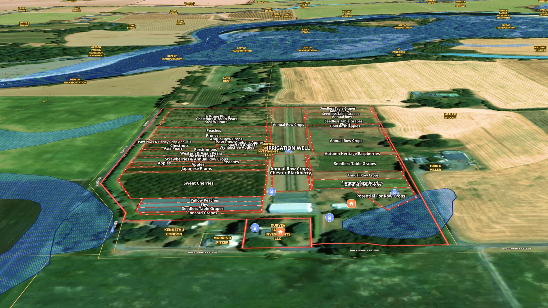
For marketing, Lisa and fellow Horsepower Real Estate Broker, Sonia Maskim create a detailed Land id map showing different crop variety locations and land allocations.
During showings on the farm, Lisa used the Locator tool to show potential buyers what their exact location was on every step of the tour. She used the measurement tool to get distances to property lines and lengths of rows.
Perhaps most important, during the transaction, the lender's appraisal came in spot on with her pricing recommendation, validating her detailed analysis!
The result? This bountiful, well-cared-for farm sold and has its new grateful steward who can now use the app for planning future production.
Learn How to Create a Map Like This:
- How to make maps in Land id
- Draw detailed maps using the feature palette
- Manage and visualize data with attributes
- Add labels to maps and mapped features
- Measurement tools
- Run soil reports
- Water wells overlay
Take Your Mapping to the Next Level
Mapping is just the beginning. Land id is the #1 tool for researching, discovering, and showcasing land, and we're here to help you make the most of it, every step of the way.

