

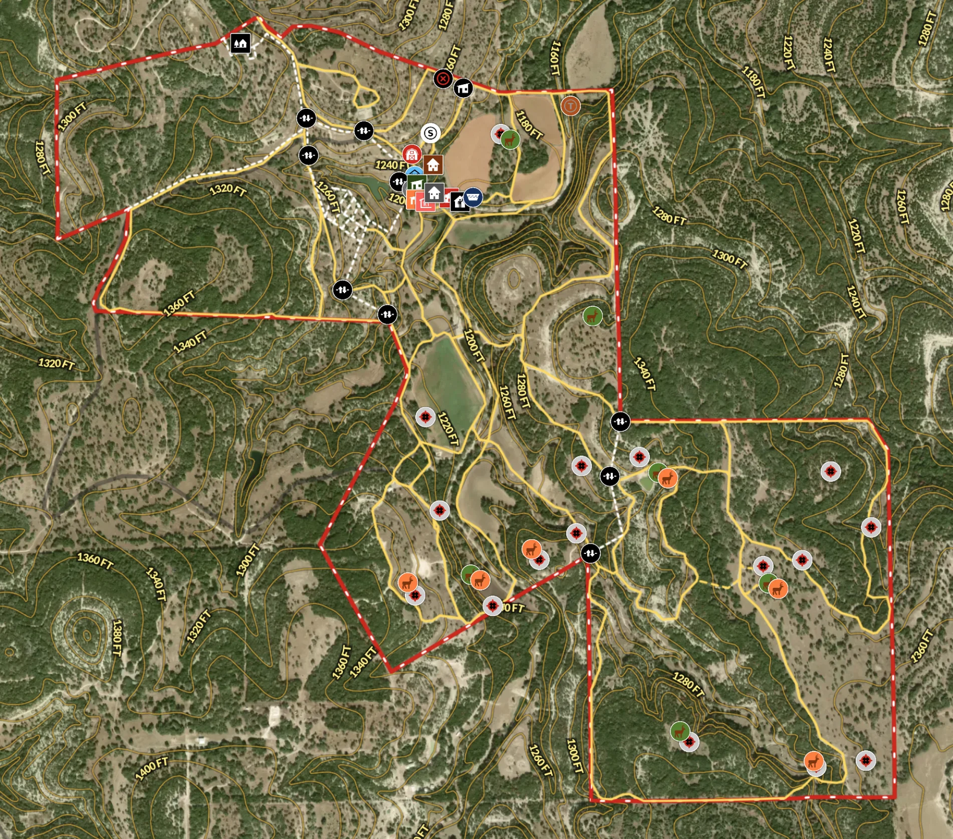
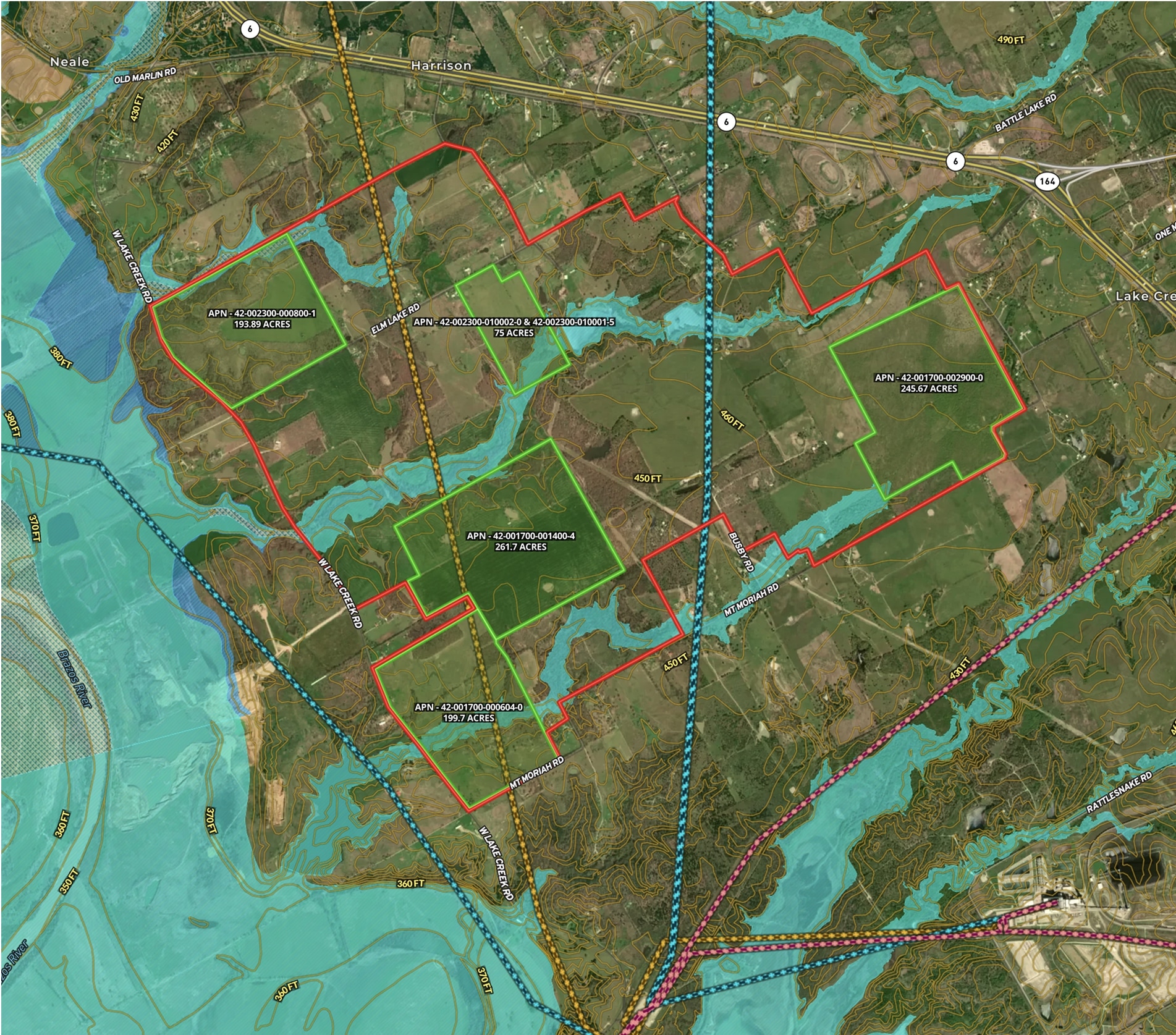
Recreational Ranch in Texas
Land id® transforms land ownership, enabling owners to craft detailed property maps of ranch amenities.
Hunt
Rural
Land owner
Land management
Developing & Assessing Timberlands
Maximize timberland potential with Land id®, featuring Infrared Basemap, soil reports, and essential forestry GIS overlays.
Timber
Soil
Listing
Rural
Forestry
Agricultural Property Appraisal Report
Streamline your land appraisal process with Land id®, where every crop, building, and land feature is captured in an interactive map.
Appraisals
Rural
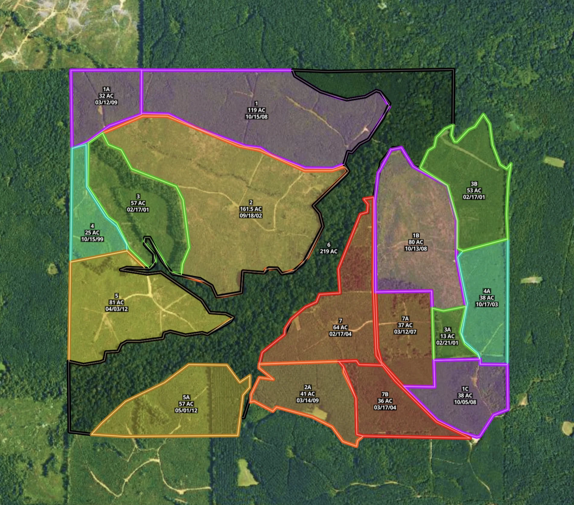
Mississippi Timber Stand Map
Boost your timber sales strategy with Land id®, creating interactive timber maps that highlight timber stand features and access.
Forestry
Timber
Soil
Listing
Rural

Wildflower Ranch in Colorado
Supercharge your listing strategy with our cutting-edge real estate mapping tools.
Campgrounds
Water
Rural
Luxury
Listing
Market Trends Overview – Interactive Comps
Use Land id® GIS mapping software to visualize property comps on a map. Simplify how you present similar land parcels and sales data.
Listing
Agricultural
Rural
Comps
Residential

Ski in/Ski out Listing in Big Sky, Montana
See the difference Land id® makes with real estate mapping that effectively demonstrated ski-in/ski-out access, leading to a quick sale
Luxury
Residential
Listing
Snow

City Bike Trails in Alameda Area
Explore Alameda's bike trails and parks on our interactive, modern city map.
Cycle
Urban
Municipality
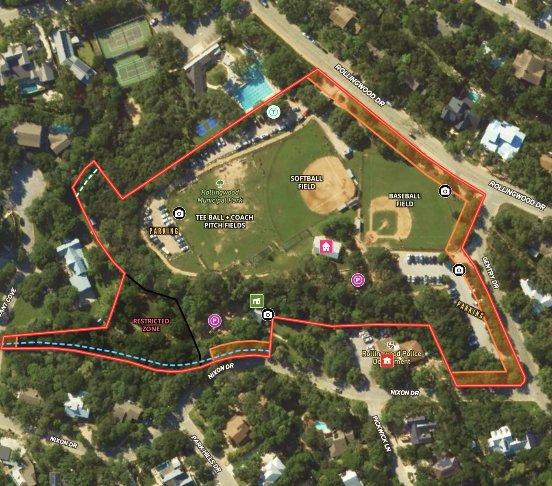
City Park in Rollingwood, Texas
Streamline city planning with comprehensive maps, highlighting features and regulatory zones for effective public and department use.
Urban
Municipality
Park

Wind Farm in Pennsylvania
Streamline renewable energy projects with Land id®, leveraging GIS mapping tools for site selection and lease management.
Wind
Renewable Resources
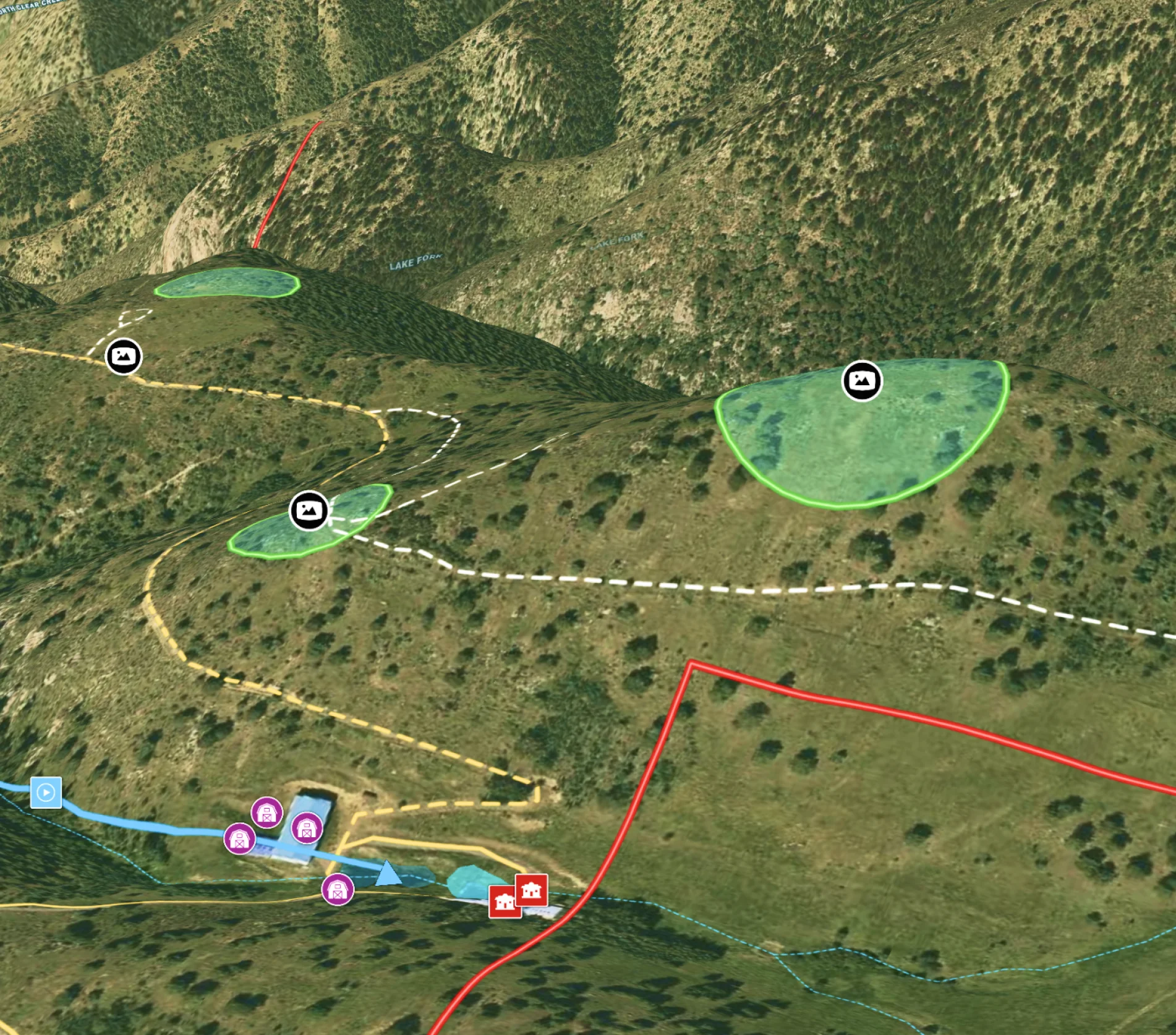
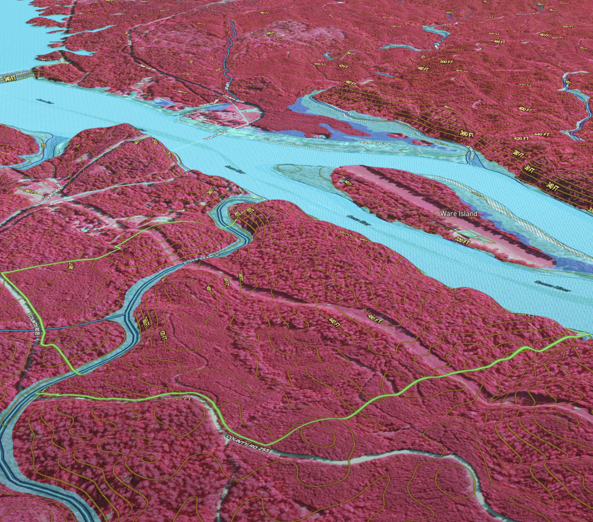
Potential Build Sites on Colorado Mountain Ranch
Enhance remote property planning with Land id®, integrating 360° views and drone paths for informed landowner choices.
Rural
Land owner
Land management
Panoramics
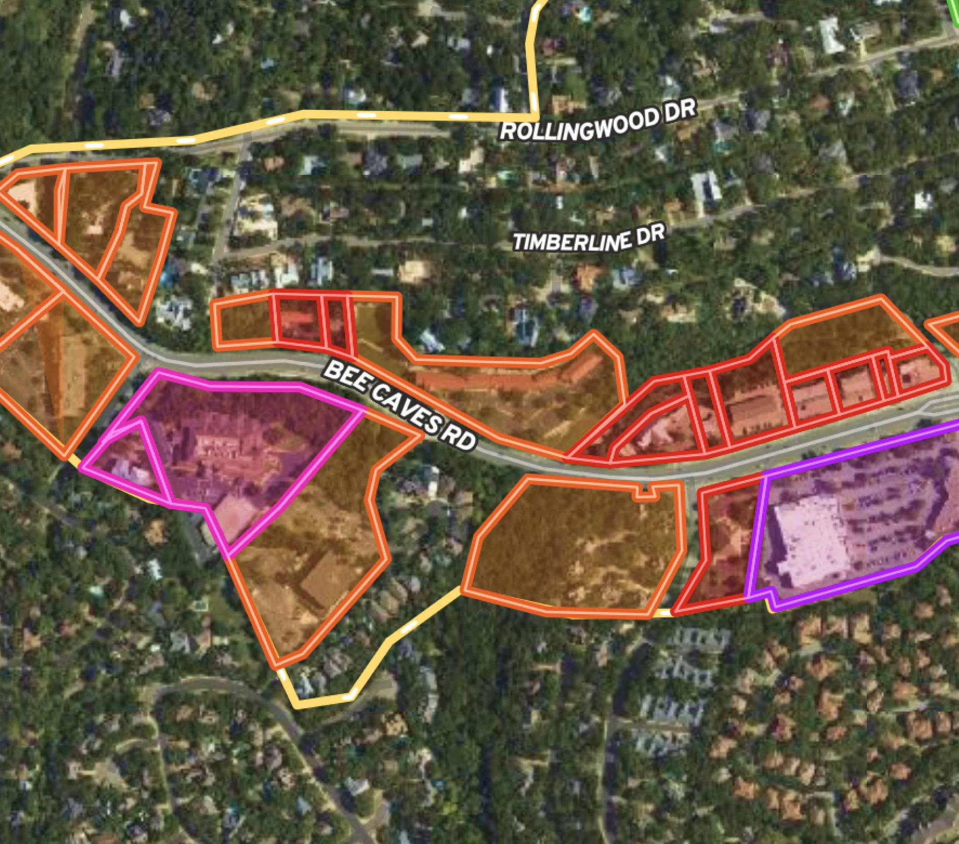
Municipality Map for Rollingwood, Texas
Use Land id® for effective city planning: map business districts, track project updates, and stretch budgets further.
Urban
Municipality
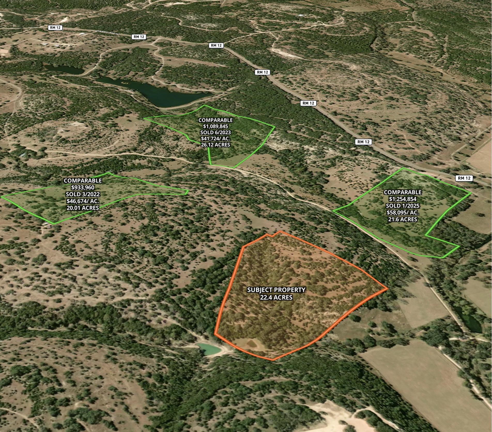
Comparable Sales
Optimize real estate pricing with Land id®. Create a visual real estate database to track and justify property values effectively.
Luxury
Residential
Agricultural
Commercial
Rural
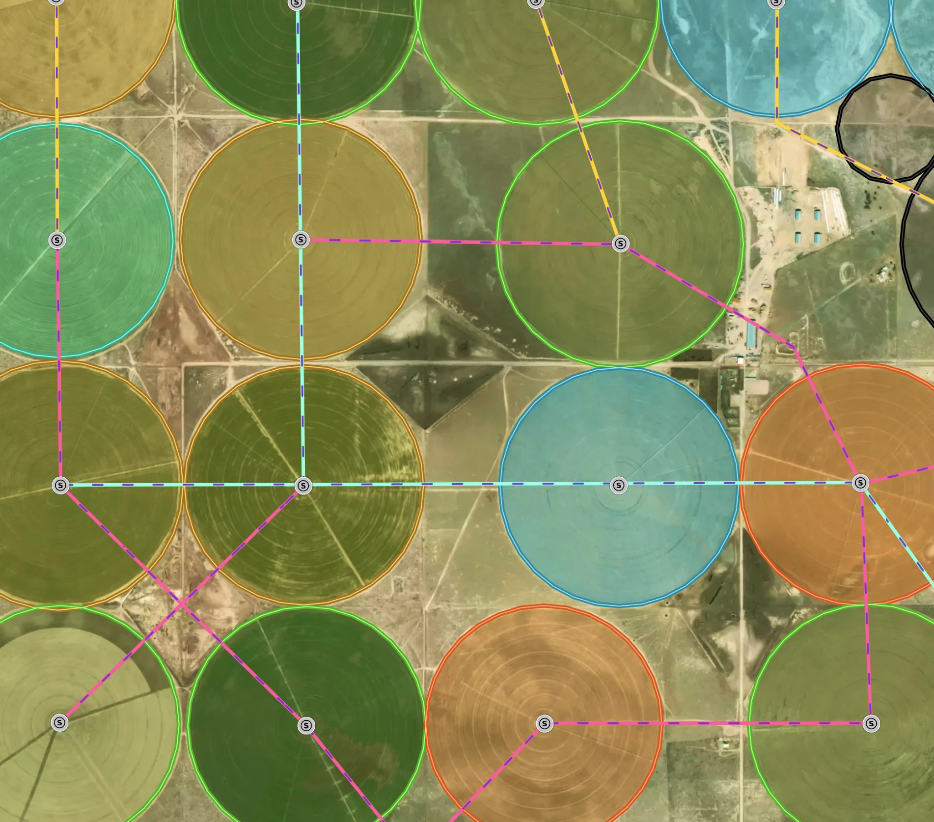
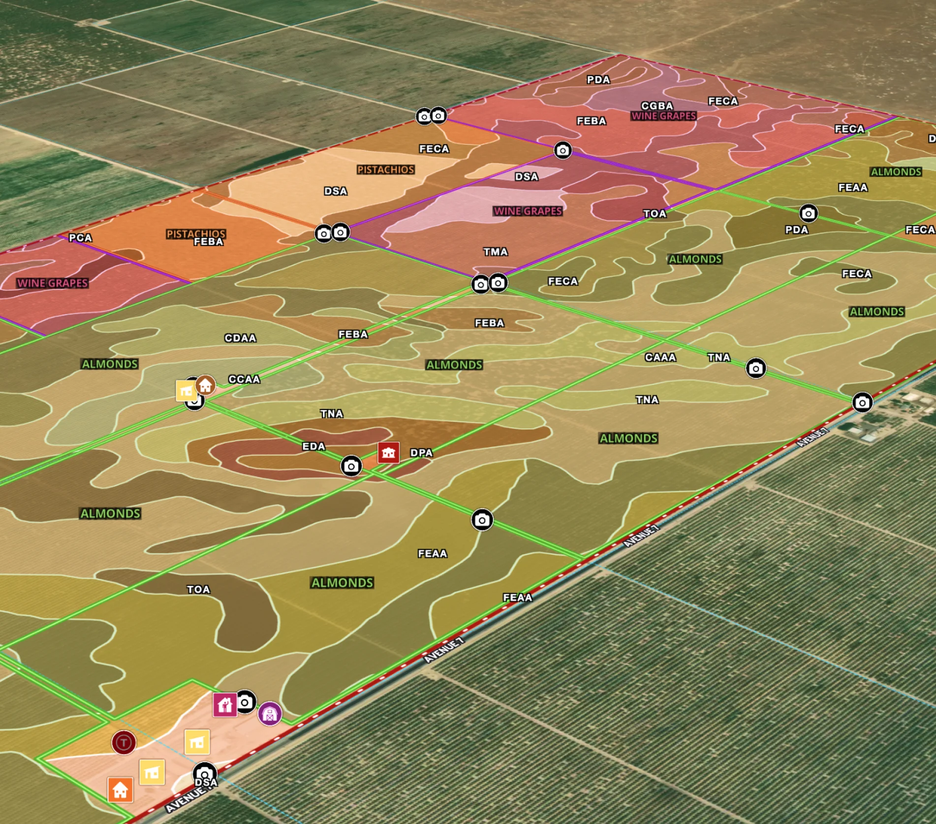
Managing a New Mexico Farm
Elevate farm efficiency with Land id®: Advanced agriculture GIS, field mapping software, and parcel maps for optimized crop and irrigation planning.
Agricultural
Soil
Water
Land owner
Land management
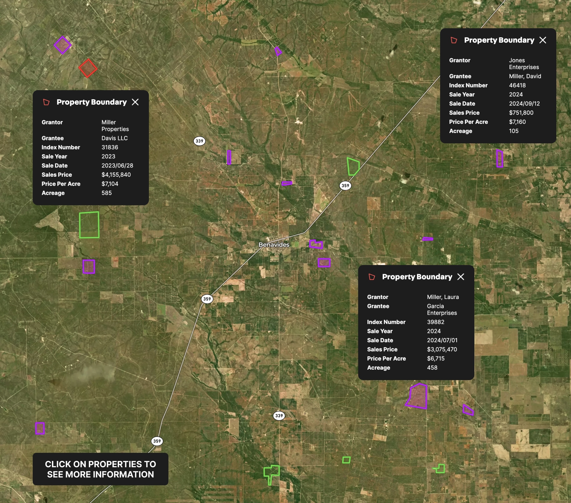
Appraisal Sales
Use Land id® GIS mapping software to create a property map of sold land parcels, analyze sales data, and streamline appraisals.
Appraisals
Comps
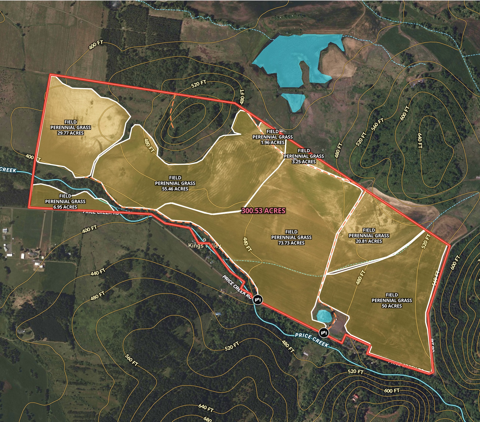
Oregon Farmland Overview – 300 Acres
Angie LaPointe uses Land id® GIS mapping software to showcase land parcels with a detailed property map, ideal for real estate marketing and topography insights.
Listing
Agricultural
Rural
Soil
Water

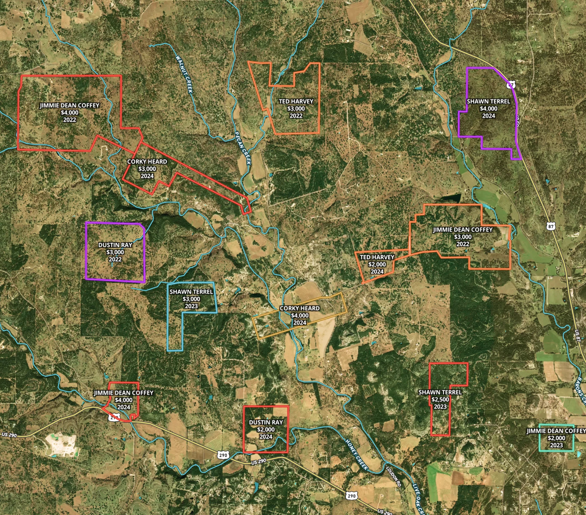
Round Mountain Ranch
Harlan Ray uses Land id®'s real estate mapping software to create property maps that build relationships. Perfect for easy real estate mapping.
Listing
Rural
Luxury
Agricultural
School Site Selection
Land id® GIS mapping software simplifies school site selection with real estate maps that visualize land parcels, floodplains, and infrastructure for smarter planning.
Municipality
Research