

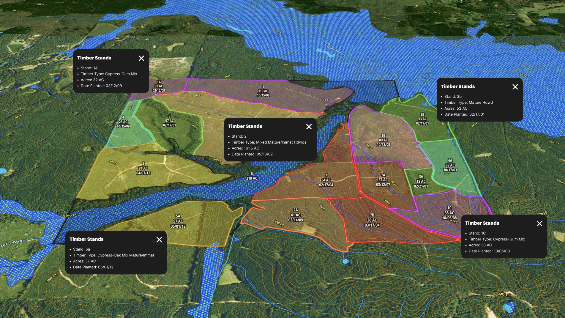
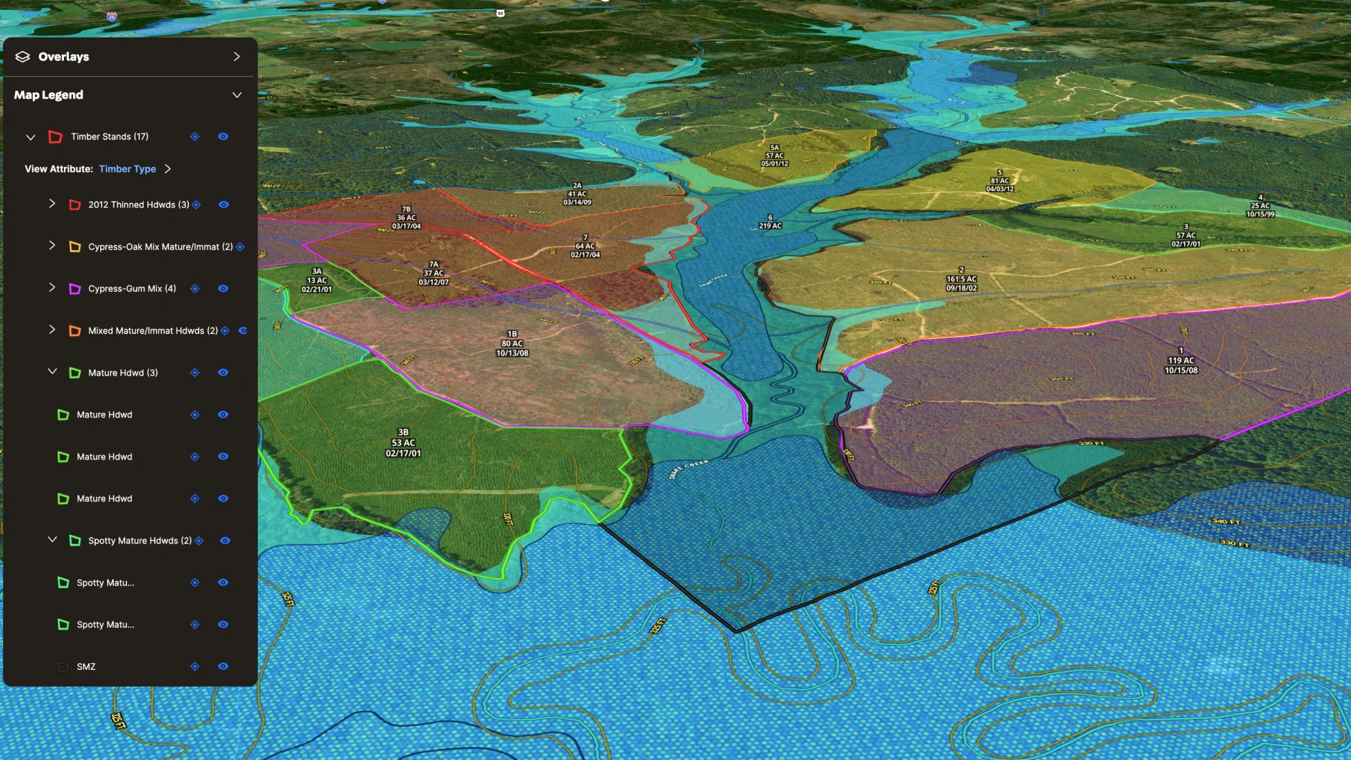
Real estate agents specializing in timber sales can easily visualize timber stand listings in Land id®.
Simply import an ESRI shape file including all of the stand attributes. Then quickly visualize and label your timber stand in a Land id map. Easily add details like age, size, class, distribution, and composition with our attribute and label tool. Highlight water features, trails, and access points. Then put all of this information at prospective investors' fingertips with a shared map.
Pricing and marketing timberlands just got easier.
Learn How to Create a Map Like This:
- How to make maps in Land id
- Import geographic files into your map
- Draw detailed maps using the feature palette
- Manage and visualize data with attributes

Take Your Mapping to the Next Level
Mapping is just the beginning. Land id is the #1 tool for researching, discovering, and showcasing land, and we're here to help you make the most of it, every step of the way.

