

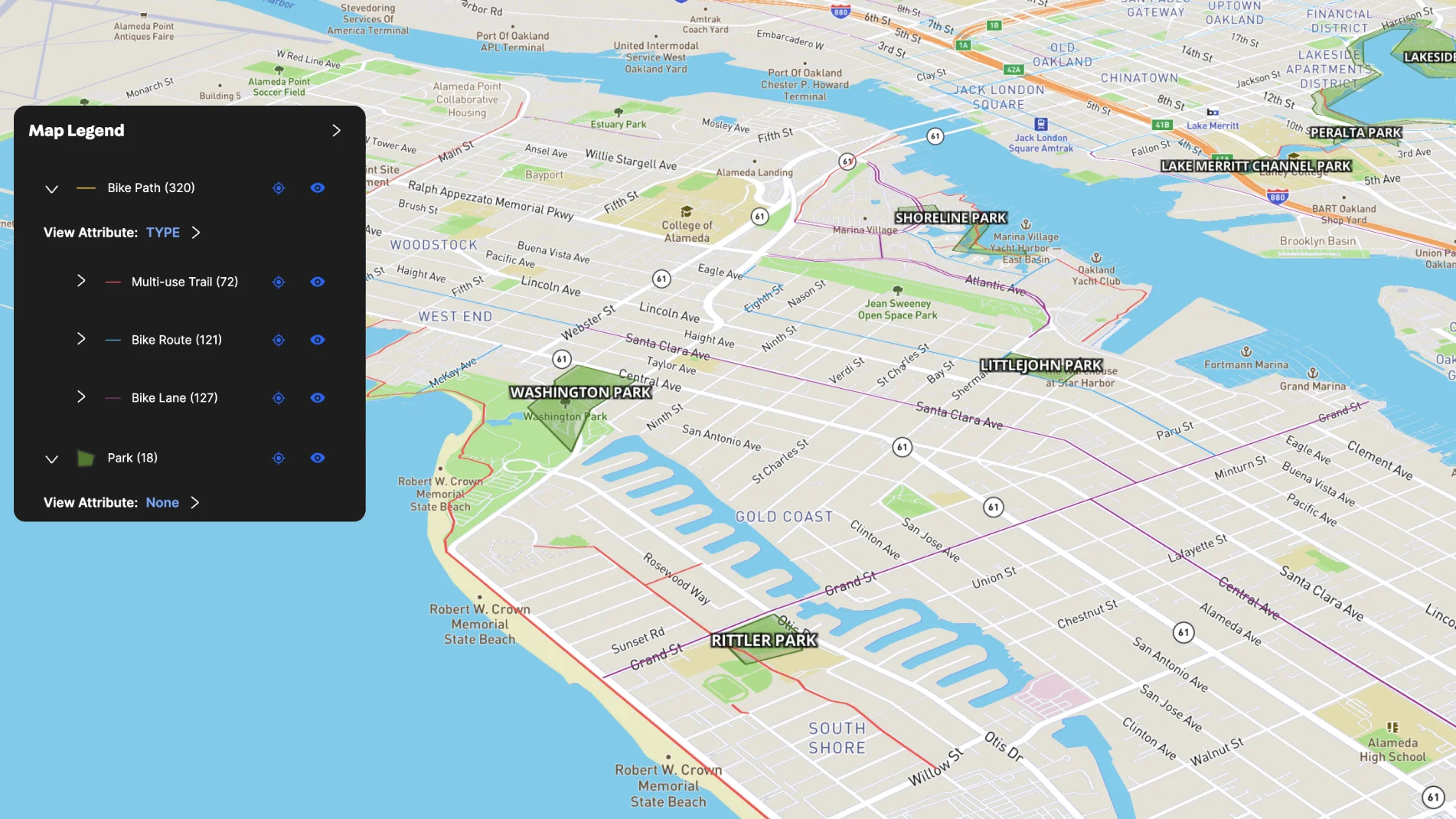
Local municipalities can use Land id® to highlight amenities—like bike trails—to its constituents and visitors. This city map shows all the local bike trails with connected parks in the Alameda area. Cyclists track their current location on this interactive map as they explore new trails.
Learn How to Create a Map Like This:
- How to make maps in Land id
- Access overlays and background options
- Use the mobile tracking tool
- Add labels to maps and mapped features

Take Your Mapping to the Next Level
Mapping is just the beginning. Land id is the #1 tool for researching, discovering, and showcasing land, and we're here to help you make the most of it, every step of the way.

