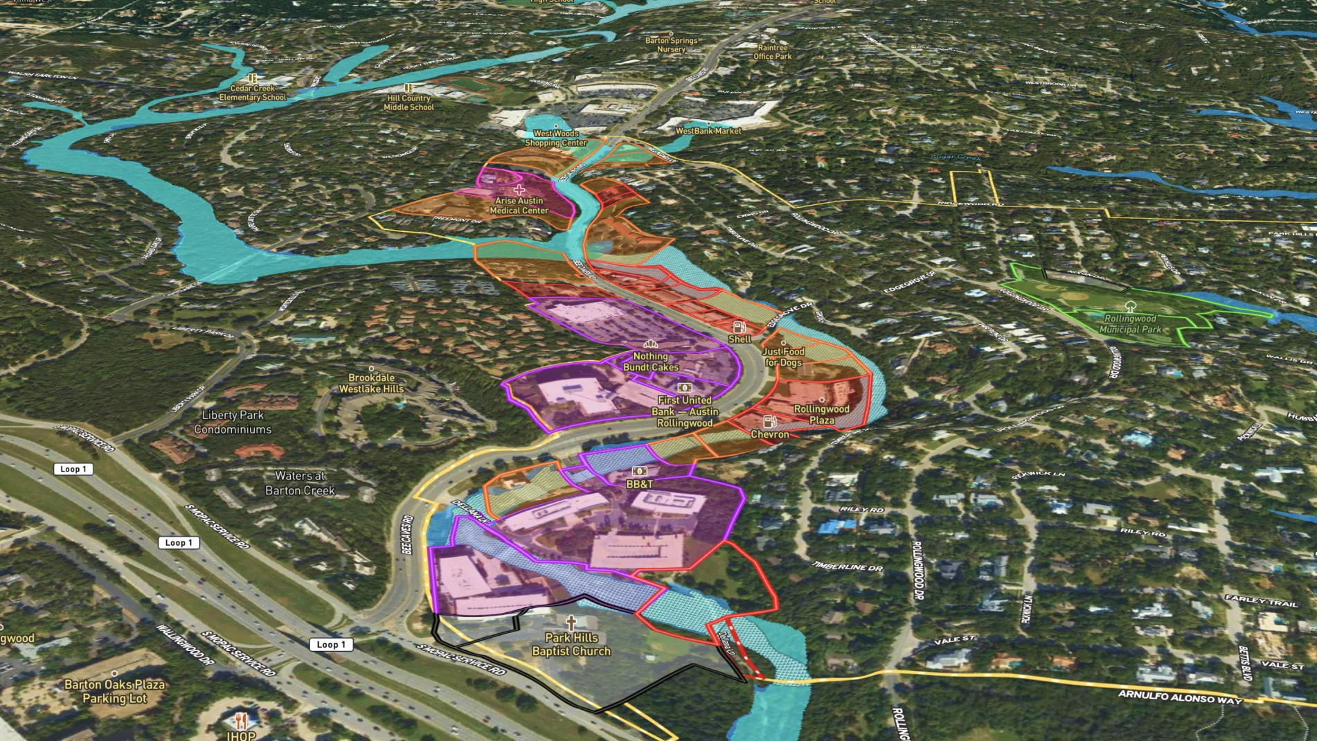
City office admins can create a city map and highlight government buildings, parks and planned developments.
Then build and share maps specific to projects, like updating maintenance schedules or organizing events. When a property or project changes, it's easy to update the map to reflect the latest status.
Learn how to make a map like this:
- How to make maps in Land id™
- Draw detailed maps using the feature palette
- Divide a parcel of land in Land id™
- Add labels to maps and mapped features
![](https://cdn.prod.website-files.com/63c95e5d2e1ac67354777789/66d9fc5f487e892390896e84_6643c9d5fb6127325fcae9da_Business%2520District%2520for%2520Rollingwood%252C%2520Texas%2520-%252001.webp)
![](https://cdn.prod.website-files.com/63c95e5d2e1ac67354777789/66d9fc5f487e892390896e77_6643c9cf8057cbb362908013_Business%2520District%2520for%2520Rollingwood%252C%2520Texas%2520-%252002.webp)
![](https://cdn.prod.website-files.com/63c95e5d2e1ac67354777789/66d9fc5f487e892390896e74_6643c9c9e1029ab74b36065d_Business%2520District%2520for%2520Rollingwood%252C%2520Texas%2520-%252003.webp)
![](https://cdn.prod.website-files.com/63c95e5d2e1ac62c14777764/63d810bc2bce520296b5db4f_Topo%20Lines.webp)
More Map Examples
Keep Exploring
Take Your Map Making to the Next Level
Want to know more?
All of Land id’s™ advanced mapping features is just the beginning. We want to see what you will do with the tools in each of our plans, and we are here to help you create dynamic maps for your team, every step of the way.
![](https://cdn.prod.website-files.com/63c95e5d2e1ac62c14777764/64146c39036e3571044bc389_Platforms%20Bacground%20Texture.webp)