

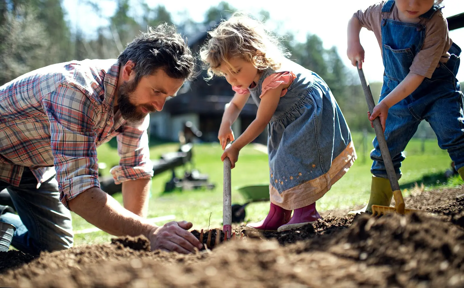
The dirt we stand on is more important than we may assume; it dictates what we can build, what we can grow, and how we should care for our land. Long story short, without a strong understanding of the property’s soil, we’d be hopelessly ill-equipped to manage it. To ensure they make the best possible decisions regarding their land, landowners can invest in a soils report, an analysis of the soil conditions at a particular site. Easy enough, right?
Unfortunately, there’s a catch - these reports can be fairly difficult to obtain. The national average to conduct a basic soils report is $1,200, and for more in-depth findings, you can expect an even heftier price tag. Another, cheaper option is to use a database, but hunting down and making sense of open-source datasets is a cumbersome feat, to say the least. Luckily, there is a third option: with Land id® (formerly MapRight), you can ditch the ridiculous price tag and view a user-friendly, comprehensive soils report in a matter of minutes.
How a Soils Report is Conducted
While there are a number of home test kits, an official soils report can only be conducted by a licensed geotechnical or civil engineer. What they look for will depend primarily on the intended use of the land, but regardless, most soils reports involve the following:
Core Sampling
The professional will start by taking small samples from the earth to identify the various types of soil and their nutrient makeup. Most essential nutrients can be determined from a 6-inch sample, with the exception of nitrogen, which requires a sample from around two feet below the surface. The number of samples they’ll need depends on the variability within the soil, which can be impacted by slopes, crops, fertilizer, drainage, and erosion. If there is a large amount of variability, they’ll likely need a larger number of samples.
Density Testing
Another characteristic of soil the surveyor will measure is density. Barring the presence of rocks or other impermeable substances, density can be tested by driving rods into the ground. The rods remove a cylinder of soil, leaving a cylinder-shaped hole in the earth. With this, you can determine density the old-fashioned way: dividing the mass of the soil by the volume of the hole. The same soil removed for the density test can then be used to measure the dirt’s water content.
What Information is Included
Hosting a billion bacteria in just one gram, 95% of which have yet to be discovered by humans, soil holds the title of the most biologically diverse material on Earth. With such variety, it’s crucial to understand precisely what you are dealing with so you can better assess the soil’s potential.
Soil Types
While many of us only learned the six main categories of soil - sand, clay, silt, chalk, peat, and loam - soil researchers recognize thousands of different soil types. In fact, soil is so unique to the location it resides in that forensic investigators say it’s comparable to a human fingerprint. Let’s just say, if you’re going to commit a crime, make sure not to bring any dirt from your property along.
With so much variety in soil, “eyeballing it” isn’t usually a great option; you want to know exactly what you’re dealing with before planting or building on potentially unsuitable earth. Once you have the names of the soils on your property, you can learn valuable information such as their permeability, the crops they can support, and any limitations.
Acreage
To make determining soil acreage as intuitive as possible, Land id® allows users to visually depict the soil directly on their map. The soil layer is divided into different sections, each representing a soil type, showing the percentage of the land that particular soil covers. By layering the soils report over your property map, you can view where the different soils are in relation to buildings, boundary lines, elevation, and more. This will allow you to see what sections of land are best for different agricultural or construction activities.
Capabilities
After gathering all of the relevant data, the next piece is figuring out how to put that information into practice. While the results of a soils report can be extremely informative, most of us don’t necessarily know how much phosphorus a legume requires or what type of dirt you can build a concrete foundation on. Fortunately, you don’t have to be a soil scientist to make use of a soil report if you have the right technology. With Land id®, you can see the land’s potential instantly on the map. At a glance, the application will show the area a soil type covers, the soil class, and whether or not the soil is suitable for the following activities:
- Wildlife / Forestry
- Grazing (limited, moderate, or intense)
- Farming (limited, moderate, intense, or very intense)
With this information at your fingertips, you don’t have to be a professional geologist to use a soils report - layered maps can give you all of the knowledge you need in a few simple clicks.
What You Can Learn From a Soils Report (And How to Use That Knowledge)
Distribution
To gain any usable knowledge from a soils report, it needs to show where each soil resides. Every crop requires different moisture, air, and nutrient levels, and not all soils are equally equipped to provide them. One major contributor to nutrient distribution is the slope. Rainfall gradually moves lightweight, rich organic matter to the base of an incline, leaving only heavy particles near the top. This means that the soil at the bottom of a slope typically contains more nutrients than the soil at the peak. On a similar note, one side of a slope may receive more wind than the other, contributing to disproportionate levels of erosion.
Nutrient Makeup
A soils report will also detail the soil’s nutrient makeup. While the specifics can vary, some common nutrients to look for are:
- Aluminum (Al) and lead (Pb): Too much of these nutrients can be toxic as aluminum can damage plant roots, and lead can have negative health consequences when consumed in large quantities.
- Phosphorus (P) and Magnesium (Mg): These nutrients are required for plants to use the energy provided by photosynthesis.
- Potassium (K) and Nitrogen (N): Many plants need high quantities of nitrogen and potassium. Without nitrogen, crops can’t make use of potassium and water, making them more prone to disease.
- Calcium (Ca): Calcium supports the plant’s cell walls and membranes
- Sulfur (S): Sulfur enables nitrogen fixation and regulates photosynthesis. Most sulfur is held in the soil’s organic matter and is transformed into its mineral form by microorganisms.
Soil Treatment
Every plant has different nutritional needs, and they can quickly leach the earth of those nutrients without proper planning - leaving the soil sick, and in extreme cases, unusable.
While nutrients are pivotal to soil and crop health, it’s good to ascertain precisely how much of these vital nutrients are present; you don’t want an insufficiency, but too much of a good thing can be just as damaging. Luckily, there are plenty of ways to treat unhealthy soil. Farmers and ranchers can choose crops that add nutrients the soil is missing, rotate crops regularly to mitigate leaching, or treat the soil in the following ways:
- Acidic soil: You can treat overly acidic dirt by adding lime to raise the pH.
- Alkaline soil: You can make alkaline dirt (often found in low-rainfall regions) more acidic by adding compost, nitrogen fertilizer, or sulfur.
- Polluted soil: you can remove pollutants from the soil by:
- Soil washing: Involves dissolving or suspending contaminants in a washing solution, then screening the soil to remove them.
- Bioremediation: Involves breaking down contaminants with living organisms such as bacteria and fungi.
- Thermal desorption: Involves heating the soil to increase the volatility of the pollutants, separating the contaminants, then either removing or destroying them.
- Nutrient deficient soil: You can add nutrients back to the earth with fertilizer or organic materials such as compost, animal droppings, or crop residue.
- Weed and pest infected soil: You can use pesticides and herbicides to kill off weeds and other pests damaging the crop or soil
Capacity Bearing
While nutrient content has major implications for crop health, for builders, perhaps the most important part of a soils report is the capacity bearing - how much weight the ground can hold. If bearing capacity is incorrectly measured, the earth below could be incapable of holding the weight of a structure, leading to crumbling buildings, leaking landfills, fallen bridges, and other disasters of that nature.
We do have one reason to be grateful for capacity bearing failures; without them, the Leaning Tower of Pisa would just be… the Tower of Pisa. Counter to what we see, the problem this Italian attraction faced didn’t stem from the tower itself, the problem was the foundation; the 14,700-ton building wasn’t suitable for the soft ground it was constructed on. To make a building that lasts, the soil’s capacity bearing should inform which type of foundation to employ, how deep the footers need to go, and which slab types to use. On unstable grounds, the right foundation can be the difference between a new home and a million-dollar pile of bricks.
Get to Know Your Soil With Land id®
Soils reports can be complex, and making sense of them isn’t always easy. Luckily, the right technology can make understanding these findings a breeze. With Land id®, you can instantly view the types of soil on your property, how far each type expands, and even what that soil is capable of. Thinking of investigating your soil and improving your land management abilities? Sign up for your 7-day free trial of Land id® today, and make your first map in minutes!
FAQs
Continue Reading
Craig Rowe
How Factory-Built Housing Can Reshape America’s Housing Market
.png)
By Land id
The U.S. housing industry’s decade-plus-long inventory challenge could see its first true sign of resolution should the 21st Century Road to Housing Act become law.

Craig Rowe
Can Refurbishing Schools Help Solve Housing Issues?
By Land id
Old public schools are becoming apartments as enrollment drops. See why school-to-apartment conversion is adaptive reuse's fastest-growing niche.


Explore Private Parcel Data & Property Boundaries
Download the Land id app and try for free.
