

What if you could give every property viewer a helicopter tour—without leaving their house?
You're trying to explain a property's unique topography to a potential buyer over email. You send a traditional map, but they can't grasp the gentle slope that makes it perfect for their dream home. Or maybe you're presenting an investment opportunity to partners, but your flat aerial view fails to showcase the dramatic elevation changes that create the property's true value.
Sound familiar?
The Problem with Flat Property Presentations
Most property presentations rely solely on static, 2D maps that leave viewers guessing about the most important details. Clients struggle to understand slopes, terrain features, and spatial relationships from flat images. They can't visualize how boundaries flow across the landscape or appreciate the natural contours that make a property special.
The cost of this disconnect is real: lost deals, confused stakeholders, and endless back-and-forth explanations that eat up your valuable time. In today's fast-moving market, when people can't truly visualize the land, opportunities slip away to competitors who can paint a clearer picture.
Whether you're closing a sale, securing project funding, or planning development work—when your presentation falls flat, so do your results.
The Game-Changing Solution
Here's where everything changes. Meet Sarah, a selling agent who was struggling to market a beautiful hillside property. Traditional maps made the terrain look challenging and confusing. Potential buyers couldn't visualize how the natural slope would be perfect for their architectural plans.
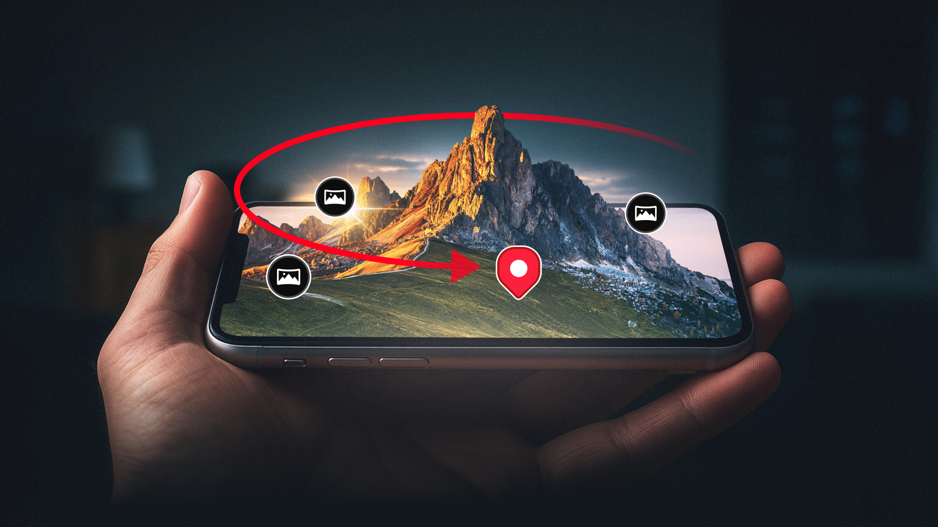
Then Sarah discovered Land id's 3D mapping feature.
With one click, she transformed her static property map into an immersive, auto-spinning 3D experience. Suddenly, that "challenging" hillside became a stunning showcase of rolling terrain and natural beauty. The property's boundaries flowed across the landscape, and the elevation changes that once seemed problematic now highlighted the land's unique character.
The result? Her first viewer called within hours to schedule a showing. "I can see exactly why this property is special," they said. "When can we visit?"
How It Works (It's Ridiculously Simple)
Creating your first 3D map presentation takes less than two minutes:
- Open your saved Land id map and click Share, and then click Launch View.
- Select "Start with 3D Tour" to activate the feature.
- Position your view by dragging and zooming to center on the key area.
- Customize the experience using simple sliders to adjust rotation speed and camera angles.
- Preview and share your immersive 3D tour with an auto-generated link.
No technical skills required. No expensive software to learn. No complicated exports or uploads. Just drag, drop, spin, and share your way to presentations that wow every viewer.
Ready to Transform Your Property Presentations?
3D mapping is available exclusively for Land id Pro users—because the most powerful visualization tools should be in the hands of the professionals ready to showcase their properties to the world.
Turn your next presentation into a virtual helicopter tour that showcases every property's true potential. While your competitors are still sending static screenshots, you'll be delivering immersive experiences that close deals.
Try Land id Pro and start creating 3D experiences that turn viewers into buyers →
Land id Pro includes 3D mapping capabilities, plus unlimited map creation, high-resolution imagery, advanced sharing options, and all the professional tools you need to showcase properties like never before.
FAQs
Continue Reading
Craig Rowe
5 Real-World Land id Workflows Worth Borrowing
.png)
By Land id
See helpful examples of how real estate pros use Land id to win listings, market properties, plan developments, and make smarter data-driven decisions.
Alyssa Toohey
Off the Map & In Person: The Land id Team Gets Together

By Land id
The Land id team came together in Montana for collaboration, connection, Big Sky views, PBR, Yellowstone, and plenty of memorable moments.


Explore Private Parcel Data & Property Boundaries
Download the Land id app and try for free.
