
Latest
Luxury on the Slopes
By Land id
In real estate, value isn’t just about where a property sits—it’s about the location of features and amenities, too!

No results
Sorry, we don't have any articles that match your search. Try resetting your filters.
GIS Green Energy Management For The World’s Most Popular Renewable
By Land id
Hydropower isn’t new by any means; humans have been harnessing the power of water for thousands of years (though back then, the energy was mostly used for tasks such as grinding wheat into flour). It wasn’t until 1880 that hydropower was first used in the U.S. industrially. And two years later, in September of 1882, a Wisconsin plant on the Fox River became the first to sell the electricity it produced.

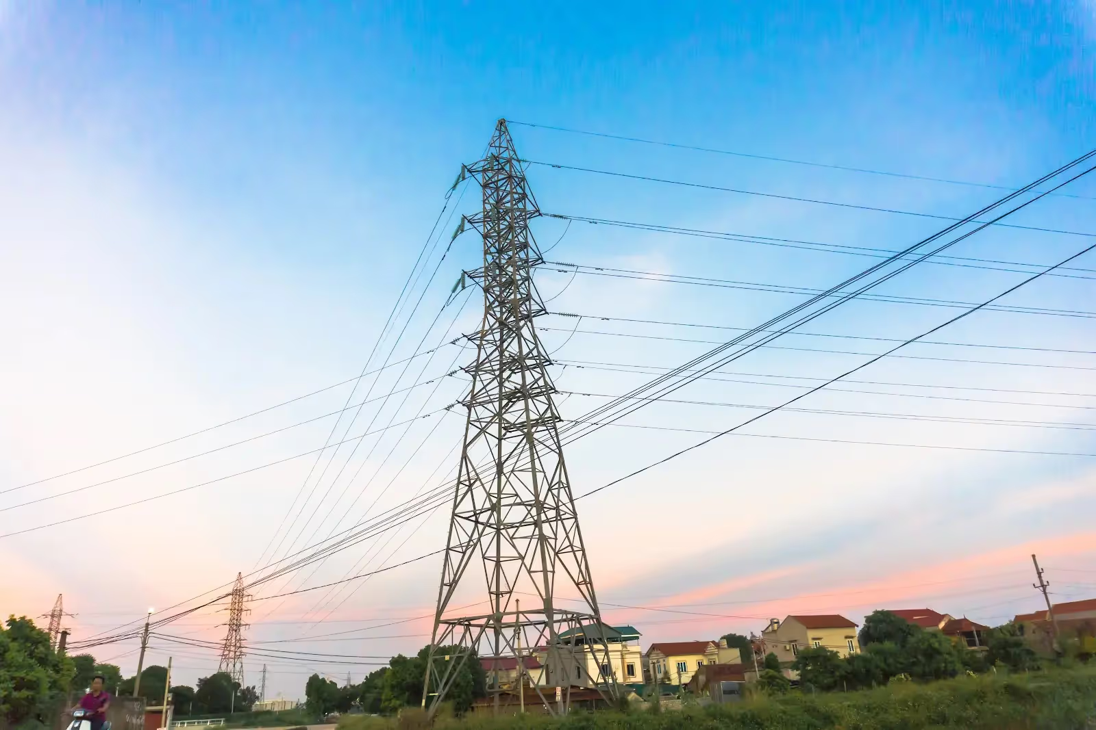
Substations, And Transmission Lines, And Grid Mapping Software, Oh My!
By Land id
On September 4th, 1882, Thomas Edison permanently altered history. Late afternoon in lower Manhattan he flipped the switch on the Pearl Street Station’s generators, and thus, the electric grid was born. In those days, we did not have the slightest of clues what the future of energy looked like, all we knew was that something revolutionary had occurred - and we were right. Today, the grid supplies electricity across the nation, powering everything from homes, to factories, to electric cars.

The Choice Is Yours: Build It Yourself Or Turn To The Mapping Experts
By Land id
Life would be wildly different if we didn’t have maps. From highlighting important trends to helping us find our way to new places, these visualizations shape our perception of the world. Accordingly, cartography is a great career to be in; the work is interesting, travel is frequent, and it’s a highly creative occupation. Occasionally, cartographers will even sneak a fictional city into their maps to catch copycats (Google Maps does it too - ever heard of Argleton, England?). All of that is to say, mapping experts contribute a great deal to society.

Giving Back With Forestry Mapping Software
By Land id
The humble tree provides more than just beautiful scenery, considering forests account for 80% of the Earth’s terrestrial biodiversity, they are an essential part of our natural world. However, these gentle giants need our help in order to survive. According to One Tree Planted, 46% of the world’s forests have already been destroyed, and every 1.2 seconds we destroy another football field worth of forests. However, it’s not all doom and gloom; it’s certainly a tall order, but with forestry mapping software, we have all of the tools we need to begin giving and restoring our forests to their former glory.

Land id™ Announces the Release of New Transmission Lines and Substations Layers
By Land id
Dallas, TX — July 15, 2021 — Land id™ (formerly MapRight) is thrilled to announce the release of two new layers, Transmission Lines and Substations. With the addition of these new features, users can now easily view critical data on the major transmission lines and substations across the nation, and even identify the substations closest to them.
Land id™ Announces the Release of New Land Use GIS Layer
By Land id
Dallas, TX — July 14, 2021 — Land id™ (formerly MapRight) is delighted to announce the release of our new Land Use Layer. With this new feature, users can determine instantly whether a parcel is being used as a residential, commercial, industrial, agricultural, vacant, or exempt property.


Explore Private Parcel Data & Property Boundaries
Download the Land id™ app & try for free
