Technology isn’t typically the first thing people associate with ranching, but perhaps it should be. Keeping a ranch involves intensive organization, a good deal of physical labor, a vast knowledge of the natural world - and after all that, there’s still a business to run. Needless to say, managing a large property is a big job, but there are ways to reduce the burden. By offering powerful insights into the land, modern mapping technology can transform the way ranchers conduct their business, make decisions and show off their property.
The applications of a well-made ranch map are endless. The modern American values transparency from the organizations they support and the business world values innovation; with every detail accounted for in your maps, you can deliver both. One company that has capitalized on this is Vital Farms. Every carton of eggs they sell includes the name of the farm the eggs came from, which buyers can tour on their website. This simple feature positions the brand as honest, fun and ultimately, as trailblazers for food transparency.
Regardless of what your ranch produces, or if it produces anything at all, GIS map making technology can help you stand out from the crowd, share secrets of your property with others, make well-informed decisions and free you of the extra work error-laden maps drum up. The best part? This powerful technology is already at your fingertips.
Step One: Design It Yourself
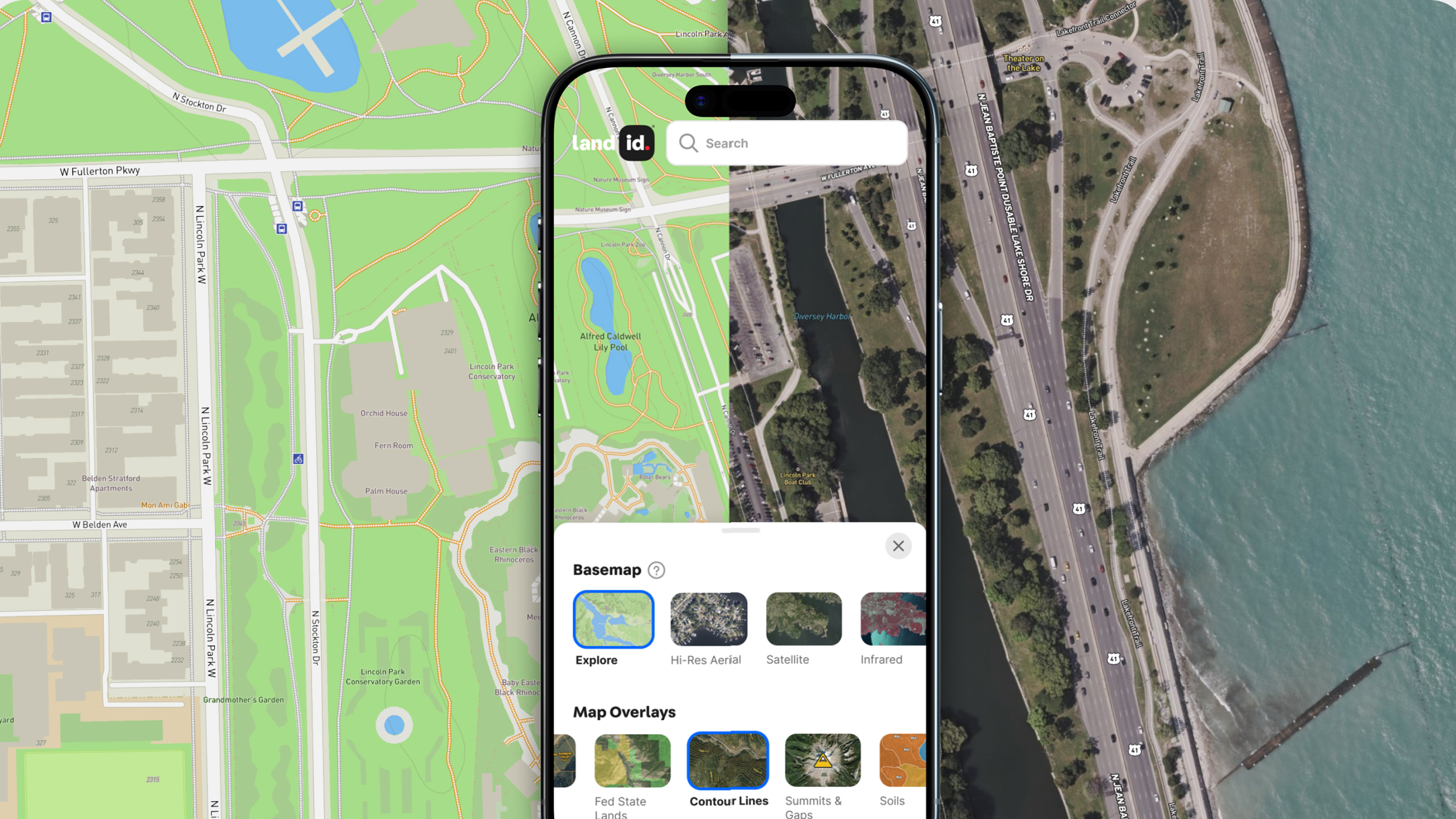
You don’t have to be a professional cartographer to build impressive ranch maps if you have the right tools; with Land id® (formerly MapRight), anyone can build beautiful, interactive maps.
Choose Land Management Layers
The first step in building a ranch map is to create layers for all of the relevant information you’d like to include. Ranchers can create layers themselves, or utilize the plethora of existing GIS layers to gain accurate, up-to-date information. With the vast range of data available, such as soil reports, waterways and topography (just to name a few), identifying important patterns and trends is a piece of cake.
Manage Irrigation With Layers for Water and Topography
As a whole, farms and ranches use a great deal of water. According to the USDA, agriculture accounts for about 80% of the nation’s water use, and in many western states, that number jumps to 90%. This is somewhat inevitable - humans need food and our food needs water - but there are ways to minimize water use without impacting productivity. By adding layers for topography, FEMA floodplains, wetlands and water features on your ranch map, you can clearly identify sources of water, analyze the land’s slope, and use those insights to better address irrigation.
Not only can mapping topography and watercourses conserve water, but it can also prevent toxins from seeping into nearby areas. Excess water, whether that be from rain, snow, or an irrigation system, shapes the earth as it’s pulled downward by gravity - all the while collecting debris, minerals, and pollutants. Toxins in runoff can wreak havoc on the ecosystems they interact with, but we can prevent toxins such as fertilizer from causing issues by opting for more strategic irrigation systems - ones that work with the Earth’s curves instead of despite them.
Manage Grazing Rotations With Data on Soil and Livestock
Grass isn’t the flashiest crop, but as the life source for goats, llamas, cows, and many other ranch animals, it’s certainly important. Problems arise when these animals eat faster than grass can grow. In fact, according to the National Institute of Health, overgrazing contributes to the loss of about 20% of the world’s grasslands. To prevent permanent damages to the land, ranchers need to regularly rotate their livestock.
Crops also require nutrients, and grazing crops are no exception. While different varieties have different needs, most grasses require nitrogen, phosphorus, potassium and even sulfur. By analyzing the health of the soil, ranchers can add precisely the right amount of fertilizer to the exact locations where it’s needed.
Organizing grazing rotations can be a complex task, involving not only managing livestock but the health of the soil as well. Becasue of this, ranchers can benefit from planning these rotations by adding layers to their ranch map for soil health and grazing patterns, guaranteeing that no area gets depleted.
Choose Additional Layers
Boundaries
Managing the land is a big piece of owning a ranch, but it’s not the only piece. A ranch is a business, and as a business, it’s important to make sure that your ranch’s boundaries match those in legal documents, such as the deed. This is especially true if you plan to build on or sell the land. It would be a shame to construct a new barn on your neighbor���s land, and no one wants to be surprised by inaccurate property lines during a sale. Additionally, it’s important for visitors and employees to know where your land ends and your neighbor’s starts, lest they unwittingly trespass.
Roads and Trails
In order to bring the necessary equipment into the ranch and export the resources you produce, the people you work with will need to know where roads are in relation to your property. What’s more, if you plan on having visitors, prospective buyers or vendors to the ranch, they’ll need to know how to access it as well. On Land id®, that can be done in a flash; you can create layers for roads and access points, measure distances, send driving directions to visitors, and even track your location within the property on the mobile app.
And Don’t Forget Map Annotations
To help those viewing your map instantly understand spatial relationships within the property, you can also add map annotations such as icons and imagery.
Add Icons
Icons are a great way to highlight any features or recreational activities your ranch offers. You can add icons to identify water sources, fences, barns, hiking trails or activity areas such as horseback riding, river rafting, archery, riflery and more. While the main point of icons is to identify key features, they also add a personal flair to your ranch map.
Imbed Images
To further personalize your map, you can embed photos and videos to show off features in the context of location. Viewers could take a virtual tour of the property, look over aerial photos of pastures, and even view 3D images of barns or other improvements to the property. This can be extremely useful if your ranch profits from visitors or if you plan on selling the property; people want to know what they are getting into, and embedding beautiful imagery is a great way to show them.
Step Two: Work With Our Professionals
While you always have the option to build a ranch map yourself, you don’t have to go it alone. Whether you’ve hit a stumbling block, want a professional touch or simply don’t have enough time to build a map, Land id® professionals are happy to take over at any point in the process. Plus, we charge on an hourly basis, so whatever work you do beforehand is money back in your pocket.
Step Three: Share Your Ranch Map
Once you’ve put the finishing touches on your ranch map, the final step is sharing it. If you want it professionally printed, Land id® is happy to print it for you (we’ll even upload it to your account so you always have it on hand). Because your maps are always stored on the Land id® app, they can be accessed from virtually anywhere. Email or text your ranch map to visitors, export driving directions; even embed them onto your website. Any edits you make after the fact will automatically update in all digital versions of the map, so you can rest assured that the maps you’ve shared are always up-to-date.
Build a Ranch Map With Land id® Today
Expressing the wide range of benefits your ranch has to offer and keeping track of land management can be tricky, especially if you want to be concise. Unlike traditional maps, layered maps offer an organized, interactive way of communicating everything you need. With easy-to-use features, GIS data to inform decisions, and numerous ways to share your findings, why wait another day to build an impressive ranch map? Sign up for your 7-day free trial, and see your ranch like never before.
FAQs

Continue Reading


