

While topographic maps are nothing new, having been around for over a hundred years, the way a topographic land survey is completed has changed dramatically. From field surveyors hiking through rough terrain and taking detailed measurements to scientists using advanced computer systems to generate maps, the techniques used to complete a topographic land survey are constantly evolving.
Today's topographic maps use GIS (geographic information systems) technology to create more accurate maps than ever before. Here we'll outline why you need a topographic survey and how GIS makes the process easier.
What is a Topographic Land Survey?
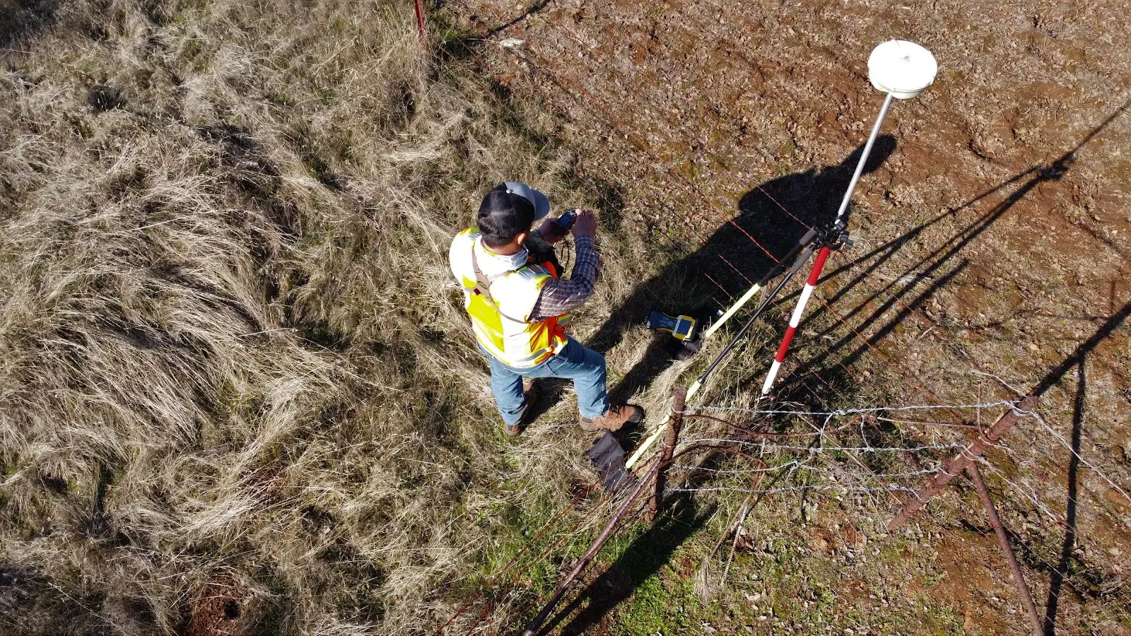
A topographic land survey is a site investigation that uses a variety of different surveying techniques and equipment to gather information about the physical characteristics, location, and boundaries of real property. These measurements are then used to create a topographic map by combining contour lines representing elevation with symbols or colors representing different land cover types. Topographic maps are then used to provide information about the shape and features of the earth, such as mountains, valleys, and plains, along with other features, such as buildings or utilities.
Unlike a boundary survey which focuses only on where boundaries lie relative to each other (for example: "my lot line runs parallel with this tree line"), a topographic survey shows all aspects of shape, size, and position relative to other features within your landscape while providing information about slope angles and elevations across any given area.
When are they used?
Utilized in everything from construction projects, scientific studies, conservations, military planning, and hiking, a topographic land survey is a vital tool for many groups. Having a topographic land survey can help you in a variety of ways. It can help you determine the best way to build on your land, where to put roads and other infrastructure, how much it will cost, and more. Utilized in everything from construction projects, scientific studies, conservations, military planning, and hiking, a topographic land survey is a vital tool for many groups. They can be used for many different things, including:
- Assessing property for development purposes
- Planning construction projects and renovations
- Identifying any environmental concerns
- Confirming the boundaries of a parcel
- Determining the location of existing buildings and structures
- Locating underground utilities
- Identify potential hazards
Besides these uses, topographic surveys are also beneficial for any land owner or potential buyer who wants to learn more about their property.
How Can GIS Help With A Topographic Land Survey?
Surveying can be a very time-consuming task if done manually by measuring out every inch of your property line with surveying equipment and marking it on paper with a compass. With GIS technology at your disposal, however, this process becomes much simpler and more accurate.
Improves Accuracy
When conducting any survey, accuracy is crucial. An inaccurate survey can result in spending more money than you planned because of unforeseen issues or disputes. Traditional topographic land survey methods are less accurate than those that utilize GIS technology. This can be costly for you, especially if the surveyors need to go back and make corrections. With GIS, you have access to a database of topographic data and other relevant information, which allows you to get an accurate map of what is on your property before any construction starts.
GIS technology can also improve the accuracy of a topographical land survey by reducing the number of possible human errors in the data. Topography, for example, includes a lot of minute details about not only what's on the surface but also the ground beneath it. Errors made when creating these maps can skew results in a variety of ways, from making them inaccurate to having them exclude important information.
Easily Share Date
Topographic maps are made using a lot of data collected by surveyors using various means like aerial imagery or fieldwork. In the past, this information was confined to the logbook the surveyor was using or to a folder, but with GIS, that information can be shared in real-time. By utilizing GIS, data is constantly updated as surveyors move, which means that surveys can be completed more efficiently than ever before, allowing them to be completed more quickly.
Increase Efficiency
GIS software can also help streamline the way topographical land surveys are conducted. By using mapping software, surveyors will have a better idea of what’s needed for the job at hand. Mapping programs enable surveyors to see contour lines, water features, and other environmental features for an area in order to get an accurate picture of what’s on the ground around them. This makes surveying less time-consuming while making it safer for those doing the work since they know how far away cliffs, rivers, and other hazards are.
Reduce Costs
GIS reduces how much it costs to complete a survey because fewer people are required to complete the job, which means fewer labor costs are involved. Additionally, using GIS technology allows for more accurate data collection and makes mistakes less likely, as well as making it easier to correct them if they do occur. All of this combined results in an overall reduction in cost when compared with traditional methods of collecting data during land surveys.
Take Control of Your Survey Process with Land id®
Whether you are an expert surveyor or a beginner, GIS makes gathering and manipulating data significantly less complicated. We know how important it is for professionals to get their work done quickly, so we designed our platform with speed and ease of use in mind. No matter what level of experience you have with geospatial technology, Land id® (formerly MapRight) will help you make sense of your data faster than any other solution available today.
With Land id®, you can upload any data you need—prior surveys, coordinate locations, parcel data, topographic maps, etc.—and easily manipulate it on a 2D or 3D plane to make your calculations faster than ever before. Land id® also allows you to integrate pictures and videos, draw lines, plot deed calls, create databases, choose to show or hide layers, and customize the geographical coordinate of your map. Our maps use cutting-edge GIS technology, which provides more reliable and more detailed data. In addition to topographic data and contour lines, Land id® also provides information about water features, ownership information, neighboring properties, and more.
Sign up for a free trial of Land id® today, and experience how GIS can improve your surveying process.
FAQs
Continue Reading
Craig Rowe
Can Refurbishing Schools Help Solve Housing Issues?
.png)
By Land id
Old public schools are becoming apartments as enrollment drops. See why school-to-apartment conversion is adaptive reuse's fastest-growing niche.

Prospecting, Part 2: Find Off-Market Properties
By Land id
Find off-market properties before your competition does. 8 proven strategies for real estate agents—from absentee owner lists to parcel data.


Explore Private Parcel Data & Property Boundaries
Download the Land id app and try for free.
