

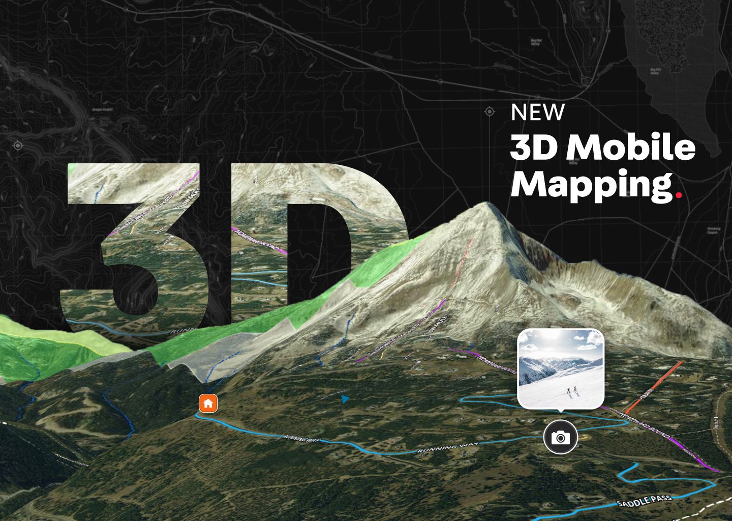
Elevating Property Exploration: The Power of 3D Mapping
In the dynamic landscape where real estate and technology converge, Land id® continues to set new standards with its latest feature release - bringing the 3D map view capability to mobile app users. This transformative addition is more than just an upgrade; it's a paradigm shift in the way we explore and understand land while on-the-go.
The Tech Behind the Magic
Mobile Optimization
In an era where efficiency is paramount, Land id® recognizes the importance of delivering a seamless experience on mobile devices. The 3D mapping feature is not just an extension; it is an optimization, catering to professionals who are always on the move. Whether in the field, during client meetings, or simply exploring properties on-the-go, users can now unlock the full potential of 3D mapping from a simple tap.
Precision at Your Fingertips
Behind the scenes, Land id® employs cutting-edge technology to deliver a precise and accurate 3D representation of the land. The integration of advanced mapping algorithms ensures that users can trust the visual data presented, whether they are assessing property boundaries, topography, or the relationship of different waterways within the landscape.
Device Compatibility
Land id® ensures that the 3D mapping feature is responsive and compatible across various mobile devices. Whether on a tablet or smartphone, Apple or Android device, users can expect a seamless 3D mapping experience.
Practical Applications: Unleashing the Potential
Revolutionizing Property Showcasing
For real estate professionals, the 3D mapping capability on Land id® is a game-changer in property showcasing. The ability to provide a three-dimensional representation of the land, adds a distinct layer of sophistication to client presentations. Potential buyers can now virtually step into the property and its surrounding areas, gaining a comprehensive understanding of its features, layout, neighborhood and more.
Informed Decision-Making with Enhanced Insights
The depth provided by 3D is not just for show; it's a practical tool for making informed decisions. Real estate and land development professionals can now gain enhanced insights into the terrain, enabling them to assess factors such as slope, elevation changes, and the overall visual depth of the land. This level of detail fosters more thorough analysis, enabling proper due diligence.
The arrival of 3D on the Land id® mobile app is a leap forward, redefining the standards of property exploration in the mobile realm. It encapsulates the essence of innovation, providing professionals in real estate with a tool that is not just cutting-edge but also profoundly practical. As Land id® continues to evolve, one thing is certain: the future of property exploration has arrived, and it's breathtakingly three-dimensional.
FAQs
Continue Reading
Alyssa Toohey
Off the Map & In Person: The Land id Team Gets Together

By Land id
The Land id team came together in Montana for collaboration, connection, Big Sky views, PBR, Yellowstone, and plenty of memorable moments.

Craig Rowe
Prospecting, Part 3: Find Land Faster
.png)
By Land id
How real estate investors and developers can use Land id to discover and analyze land-buying opportunities in less time.
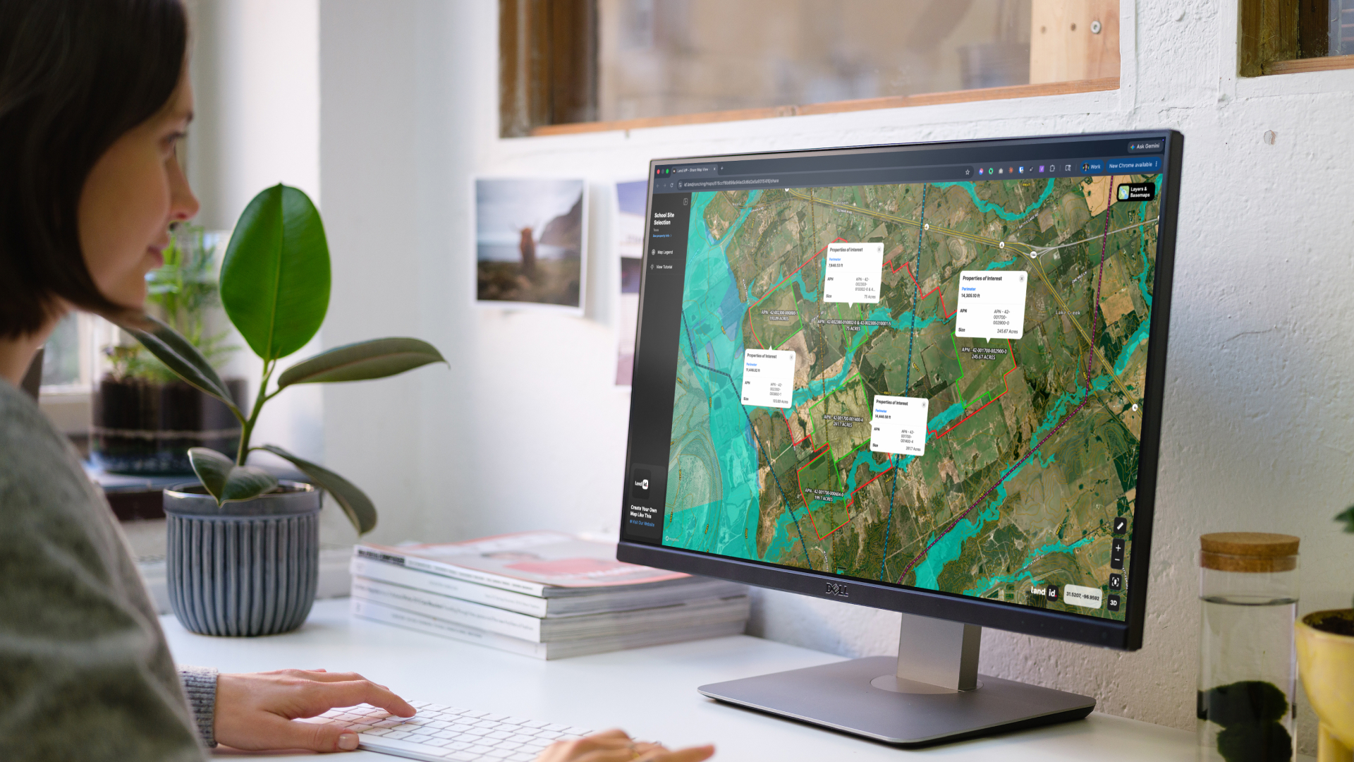

Explore Private Parcel Data & Property Boundaries
Download the Land id app and try for free.
