

Land id® (formerly MapRight) is a custom mapping platform that makes it unbelievably easy to produce industry-specific, professional-quality maps. It’s great for land owners and managers, oil and gas drill site managers, and land brokers and agents.
Farm and Ranch professionals have really figured out how to make Land id® their own, because it simplifies their work, boosts their credibility with clients and saves them a ton of time. This is partly due to the fact that, on average, you can make a detailed map in half the time it would normally take, and the Land id® template looks twice as good as other industry maps.
But it’s also due in large part to the unique combination of specialty layers that are available with Land id® maps.
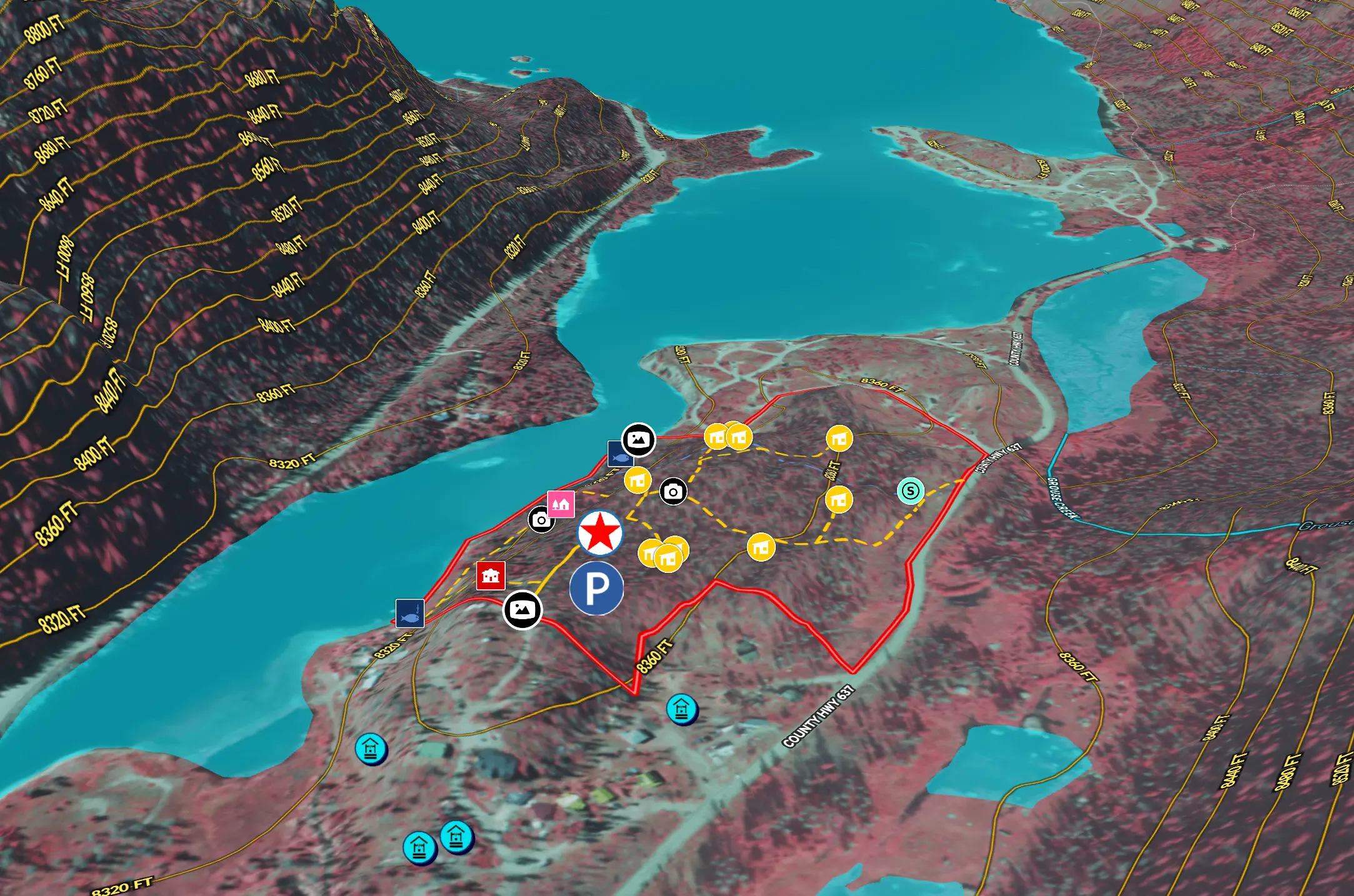
How Map Layers Work
Land id®’s property maps include three standard background layers, and eight fantastic, time-saving, custom layers. And, there’s no software installation or map downloading. Every map is created and saved online using our pre-loaded toolkit. A few clicks and you’re good to go.
Interactive Background Layers:
- Google or Bing-based aerial imagery
- USGS topographic map with hillshade
- Street map
Land id® Custom Layers:
- National FEMA Floodplain: 100-year and 500-year DFIRM floodplains
- National NHD Hydro: Surface water features
- Abstracts: Original Texas Land Survey
- PLSS: Public Land Survey System (section, township, range)
- Fed/State Lands: Federally-owned and state-owned areas
- FSA (CLU): Field boundaries with acreage
- National Parcel Boundaries: With ownership information
- National Soils: SSURGO soils with capability indexes
All property maps are printable, and they’re easy to share online. You can email them, embed them on your website or access them through the Land id® mobile iPad app. When you share a map, you can choose which layers are or are not visible to viewers.
About Land id®
Land id® is the leading provider of land identity™ and interactive property mapping applications for real estate. Land id® solutions are used by professionals across multiple industries including land, residential and commercial real estate brokerages, property appraisals, agricultural farm and ranch management, forestry, building and development, government, engineering and renewables.
FAQs
Continue Reading
Craig Rowe
5 Real-World Land id Workflows Worth Borrowing
.png)
By Land id
See helpful examples of how real estate pros use Land id to win listings, market properties, plan developments, and make smarter data-driven decisions.
Alyssa Toohey
Off the Map & In Person: The Land id Team Gets Together

By Land id
The Land id team came together in Montana for collaboration, connection, Big Sky views, PBR, Yellowstone, and plenty of memorable moments.


Explore Private Parcel Data & Property Boundaries
Download the Land id app and try for free.
