

Map Categories
Thank you! Your submission has been received!
Oops! Something went wrong while submitting the form.
000
,
000

Farm & Ranch
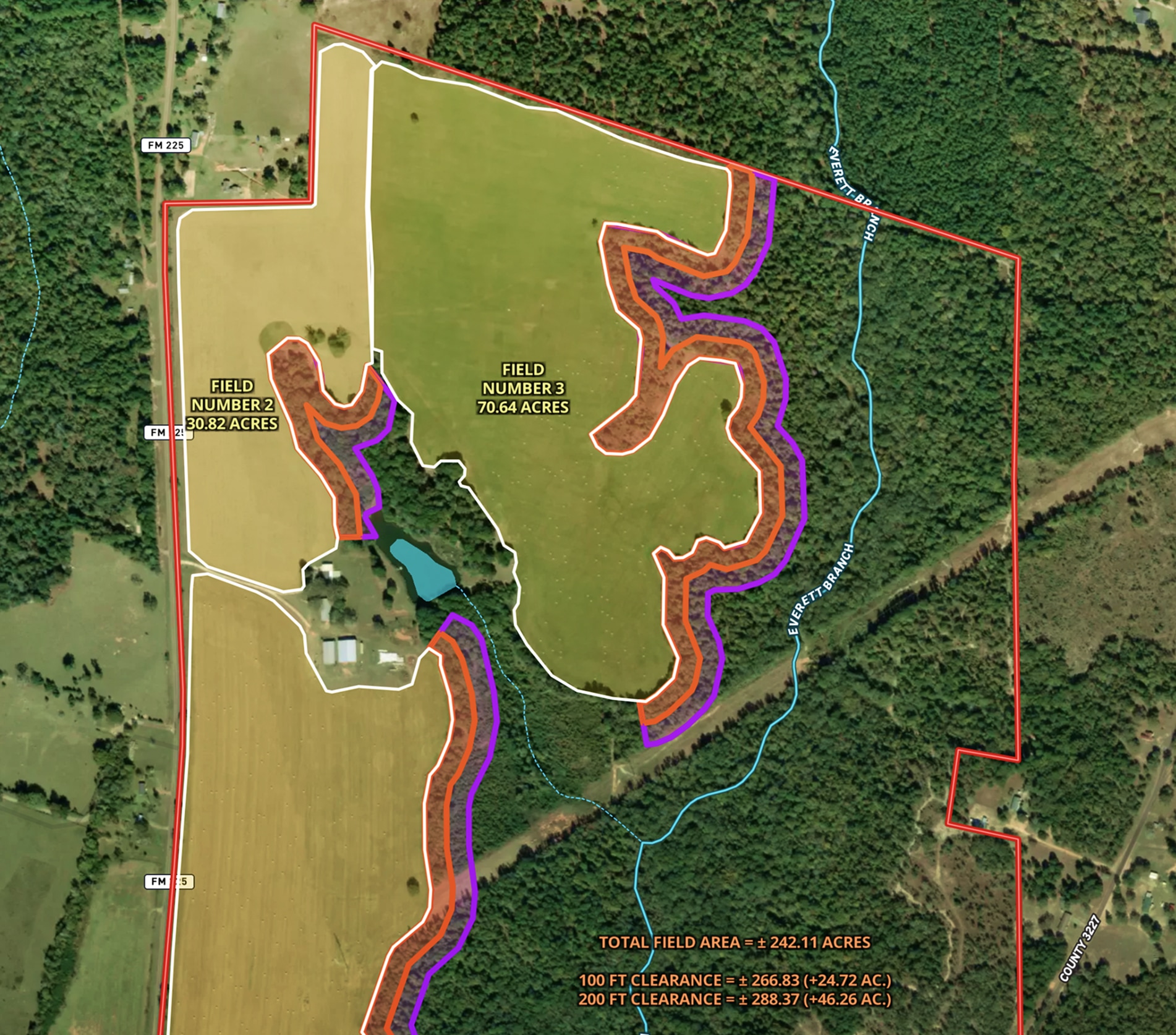
Land Clearing Analysis Map
Land id® GIS mapping software helps landowners visualize field expansion with property maps, buffer zones, and acreage gains—making land clearing plans easy and clear.
Land owner
Land management
Timber
Renewable Resources
Farm & Ranch
Land Trust Baseline Documentation
Land id® streamlines baseline documentation for land trusts with easy GIS mapping software. Create and share property maps in minutes, empowering efficient land conservation.
Land owner
Land management

Farm & Ranch
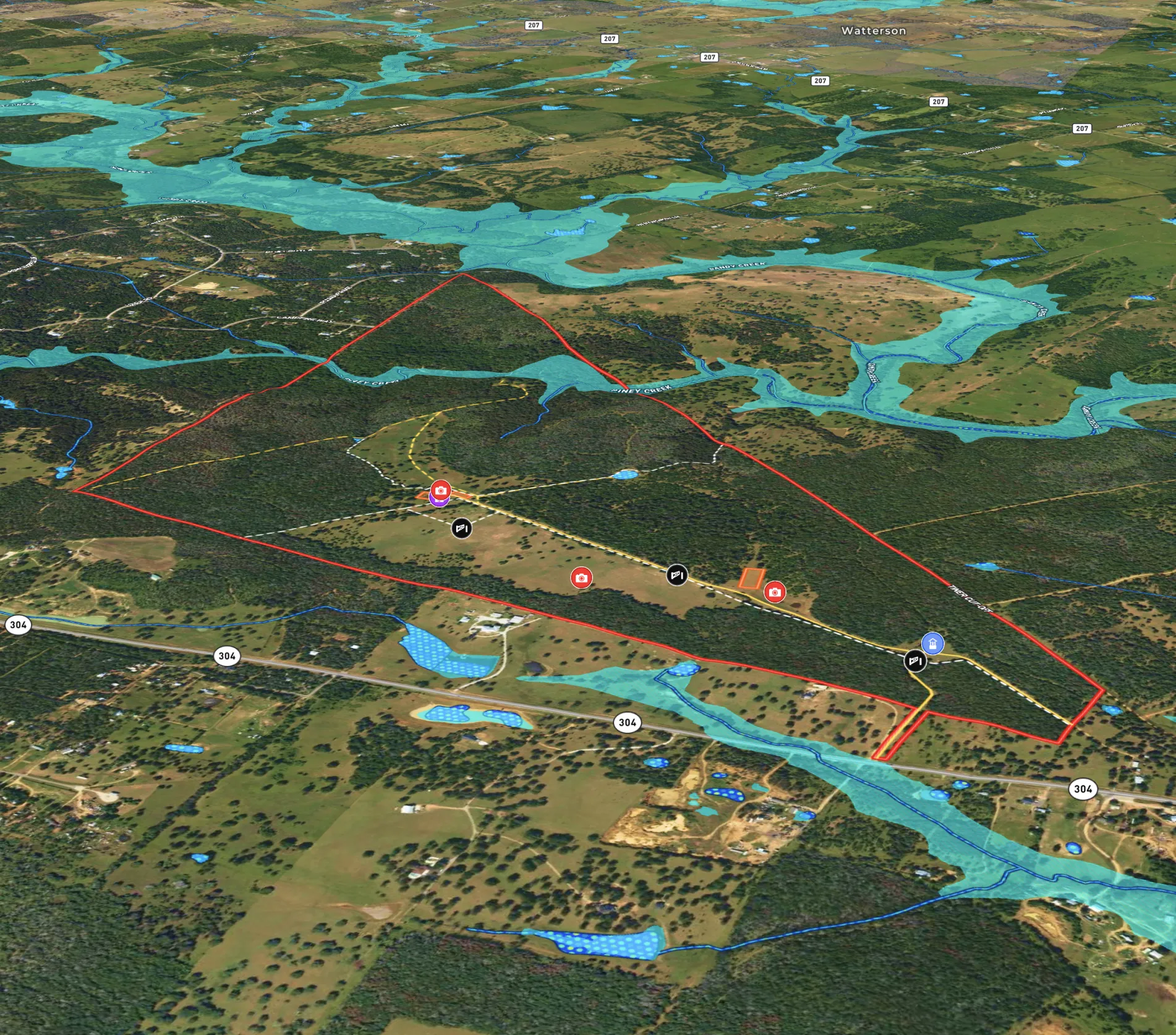
Fencing for Texas Red Deer Ranch
Jimmy Banks uses Land id's real estate mapping software to map his Texas ranch, get land measurements to plan fencing projects, and integrate new land parcels with precision.
Rural
Land owner
Land management
Farm & Ranch
Hill Country Property
Landowners use Land id®'s real estate mapping software to create and update property maps effortlessly. Ideal for property owners managing land parcels.
Rural
Land owner
Land management

Planning
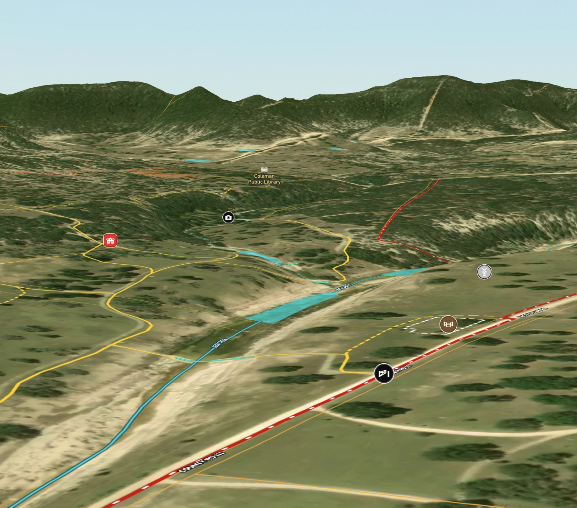
Potential Build Sites on Colorado Mountain Ranch
Enhance remote property planning with Land id®, integrating 360° views and drone paths for informed landowner choices.
Rural
Land owner
Land management
Panoramics
Farm & Ranch
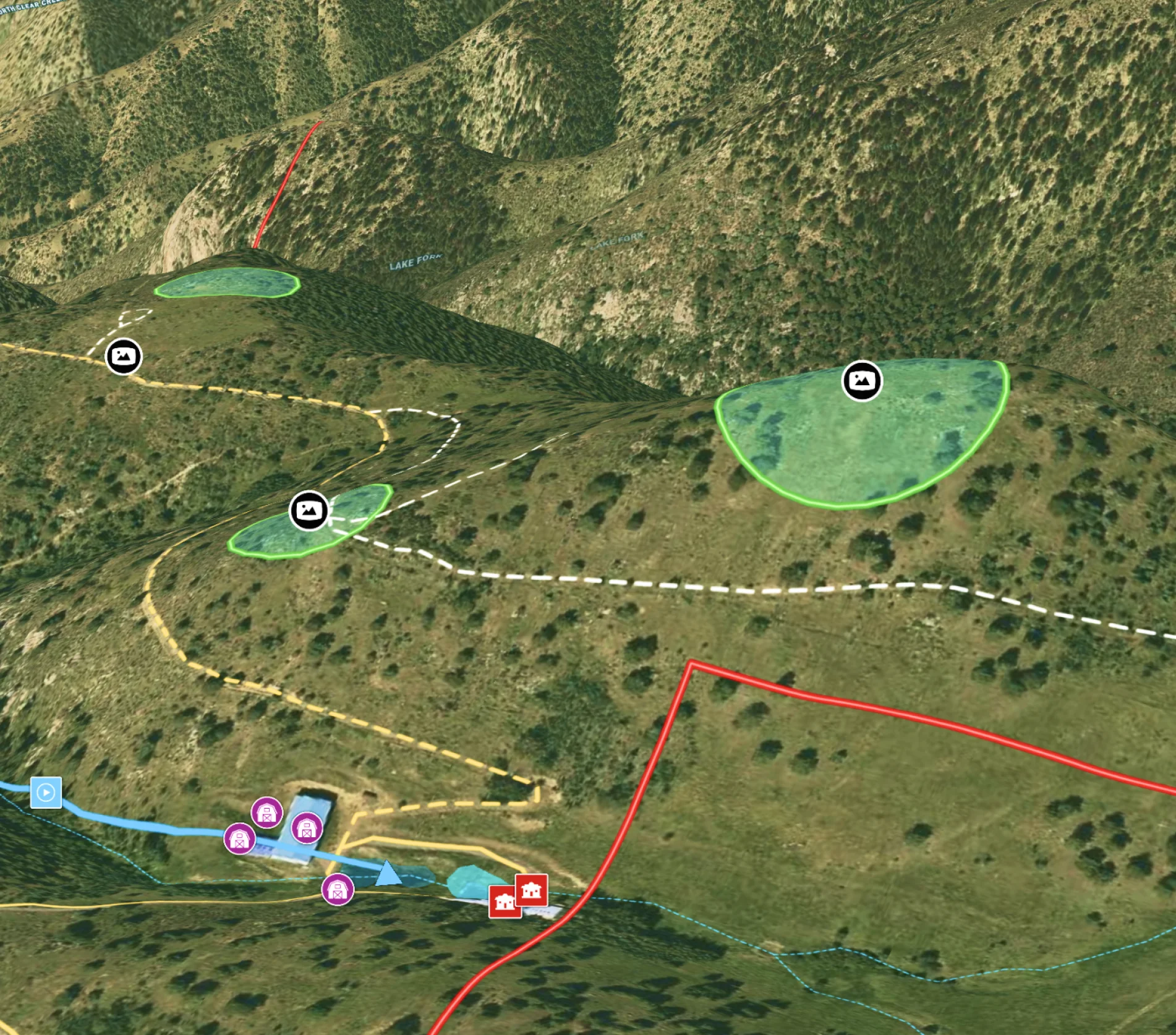
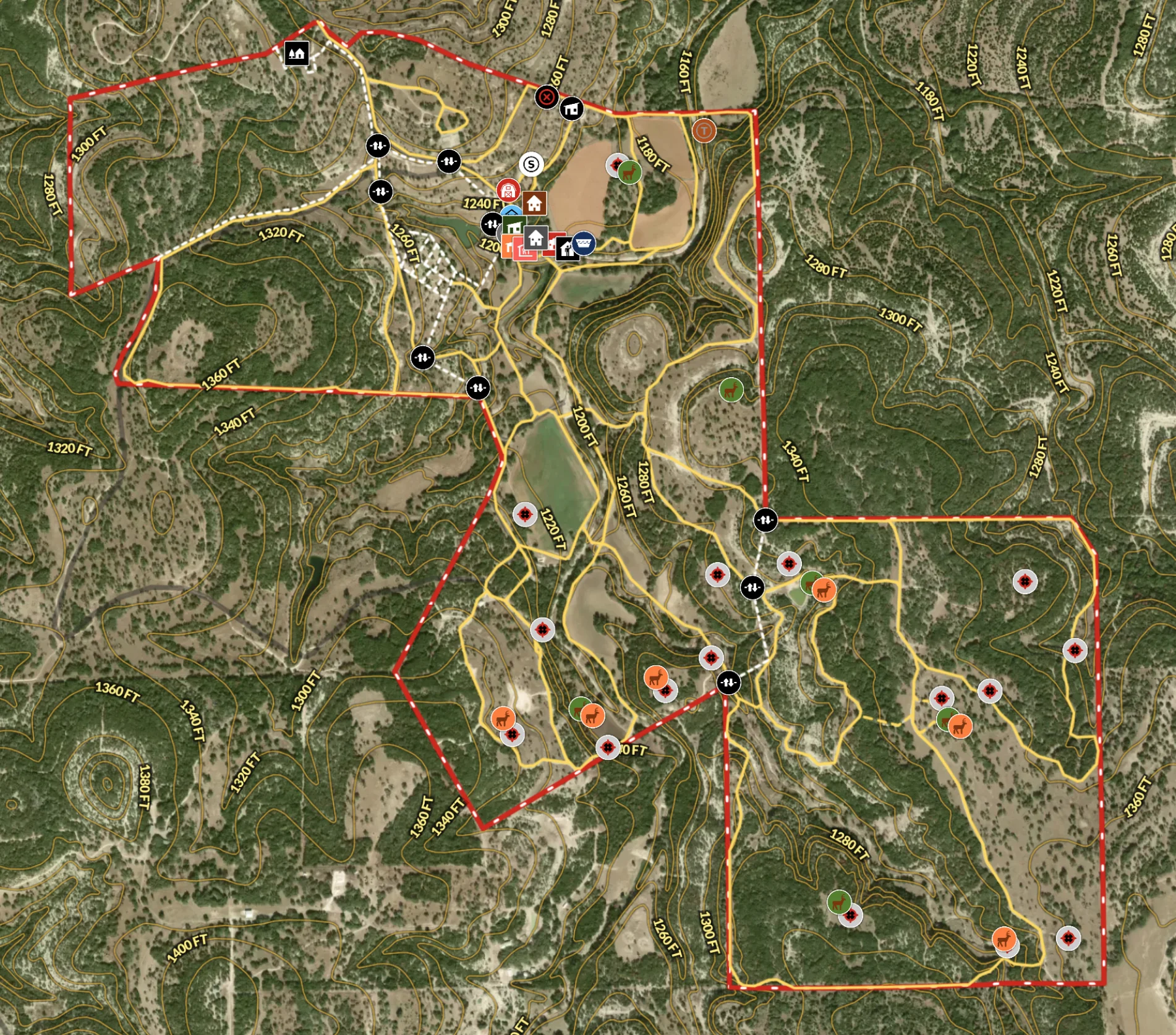
Recreational Ranch in Texas
Land id® transforms land ownership, enabling owners to craft detailed property maps of ranch amenities.
Hunt
Rural
Land owner
Land management
Farm & Ranch
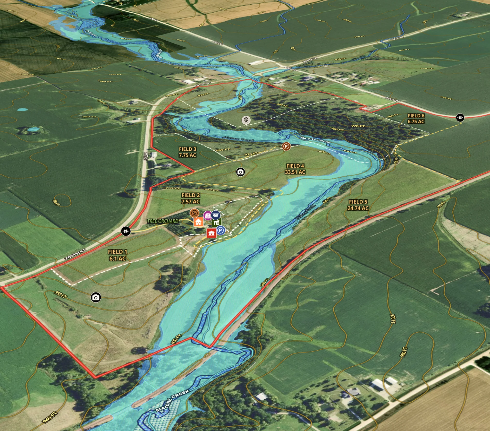
Agricultural Listing for Iowa Farm
Revolutionize farm listings with our real estate mapping software, integrating soil reports and multimedia for a standout presentation.
Agricultural
Listing
Rural
Water
Soil
Farm & Ranch
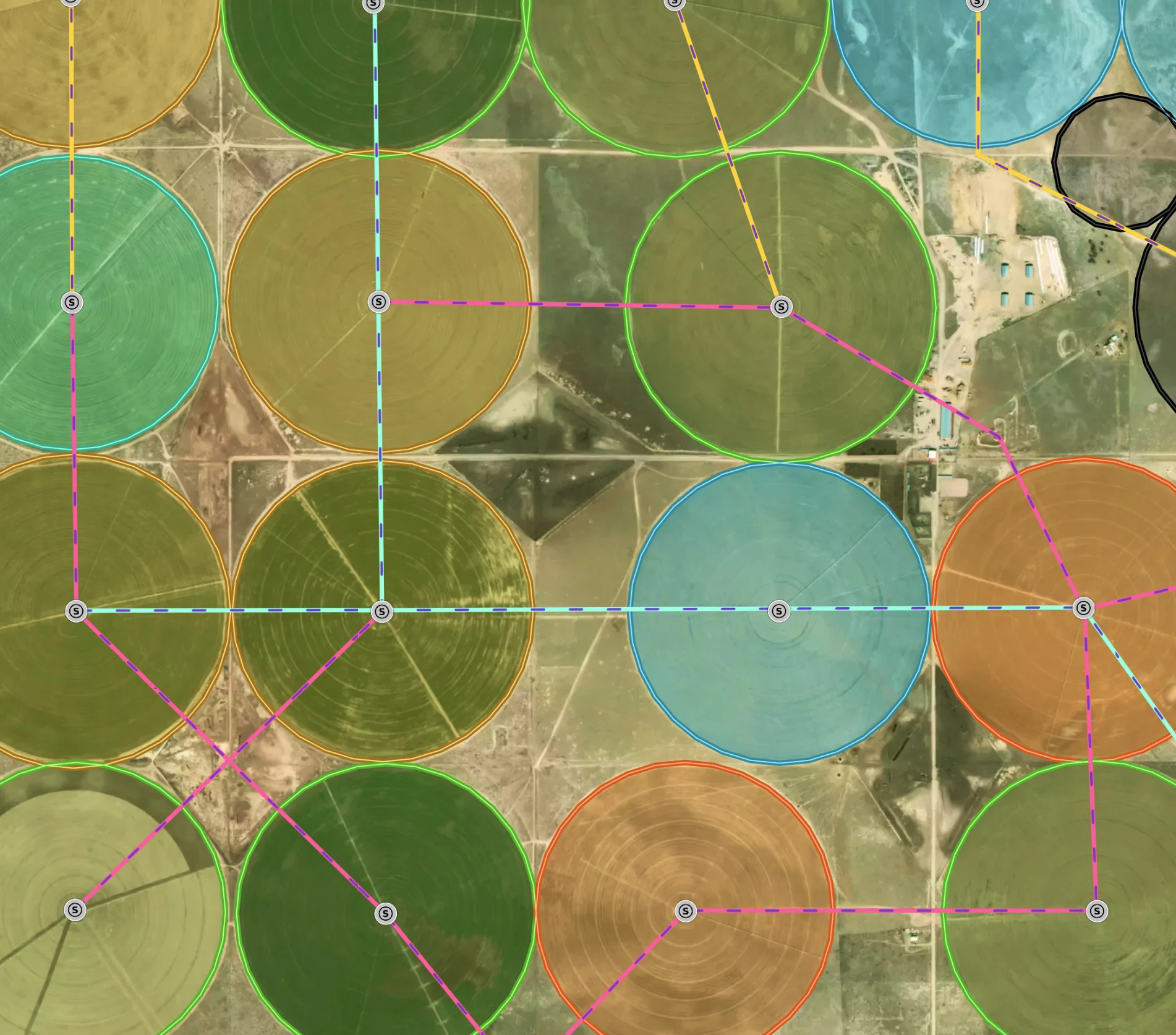
Managing a New Mexico Farm
Elevate farm efficiency with Land id®: Advanced agriculture GIS, field mapping software, and parcel maps for optimized crop and irrigation planning.
Agricultural
Soil
Water
Land owner
Land management