When it comes to making confident property decisions, the quality of your data matters. Incomplete coverage or inaccurate boundaries can lead to wrong assumptions, wasted time, and costly mistakes.
That’s why we’re continuously improving the data that powers Land id—so you can research, market, and manage property more efficiently and confidently. We firmly believe clean, accurate, up-to-date data is worth every investment.
Here's the property data that’s changing—and what you can do with it.
Know Where Public Land Ends & Private Property Begins
Public land adjacency can be a major selling point, especially for ranches and recreational properties. But if the boundaries on your map don't line up with the property itself, how confident can you be in what you're looking at?
Government land datasets sometimes show public land overlapping private parcels. Other times, small gaps appear that look like access corridors or separate properties.
How We Fixed It
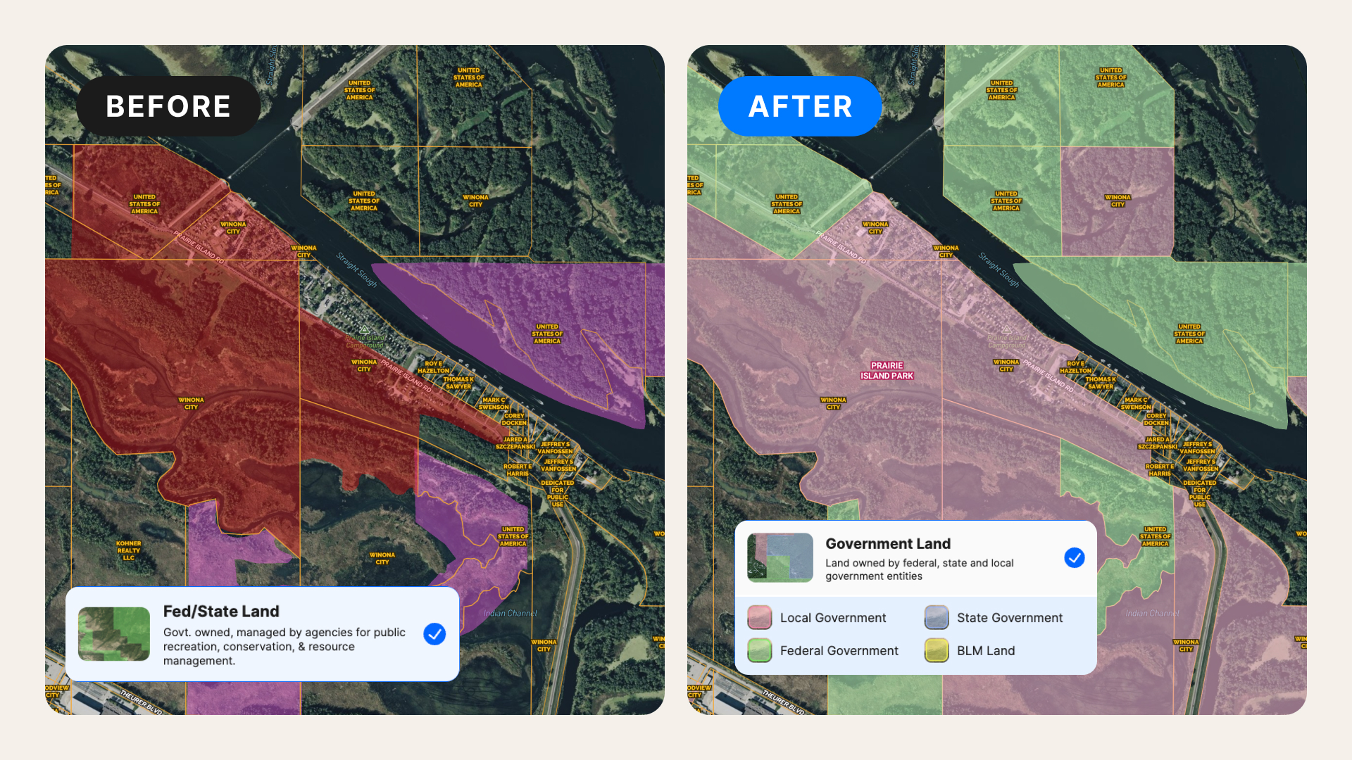
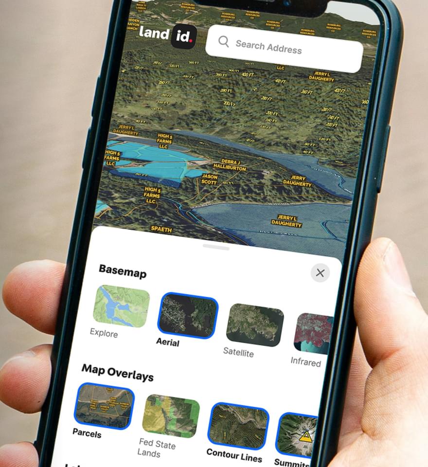
We've rebuilt the Federal & State Lands Overlay using public land information from multiple government sources, then cleaned it against our extensive parcel data.
The result is a clearer view of where public land begins and ends, with misleading overlaps and gaps resolved.
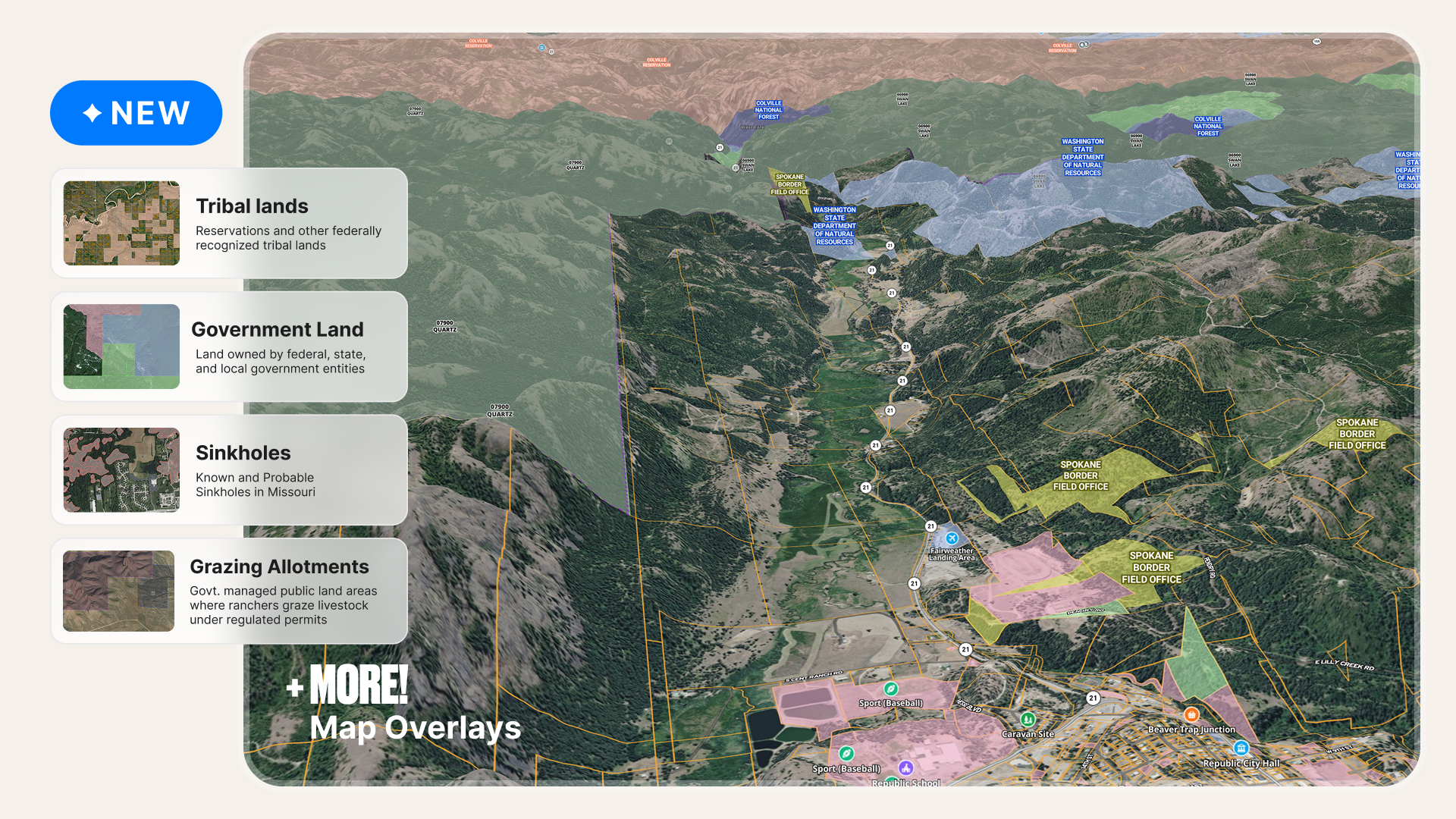
Tribal lands now have their own dedicated overlay, too, reflecting the distinct sovereignty and jurisdiction of tribal nations rather than grouping them with general public lands.

What It Means for You
Now you can:
- Show public land adjacency more clearly. Present a ranch or recreational property alongside neighboring public land without misleading boundary overlaps.
- Investigate potential access issues earlier. See whether a parcel appears to touch public land or is separated by another property, then verify legal access.
- Identify jurisdictional considerations. See when a property is on or near tribal land, where different permitting or land-use requirements may apply.
- Understand who manages neighboring land. Identify the responsible public agency to guide further research.
Remember: Our map boundaries are informational, not survey-grade. Public land adjacency does not establish legal access. Tribal land boundaries and jurisdiction should be verified with the relevant tribal authority or Bureau of Indian Affairs.
See More of the Land That Matters to Your Property
A ranch bordering national forest may have access to important grazing opportunities, but that context isn't always visible in traditional property data.
Until recently, our Grazing Allotments Overlay included Bureau of Land Management (BLM) allotments but left out U.S. Forest Service allotments. That meant entire areas of federal grazing land were missing from the picture, particularly in forested and mountainous regions.
How We Fixed It
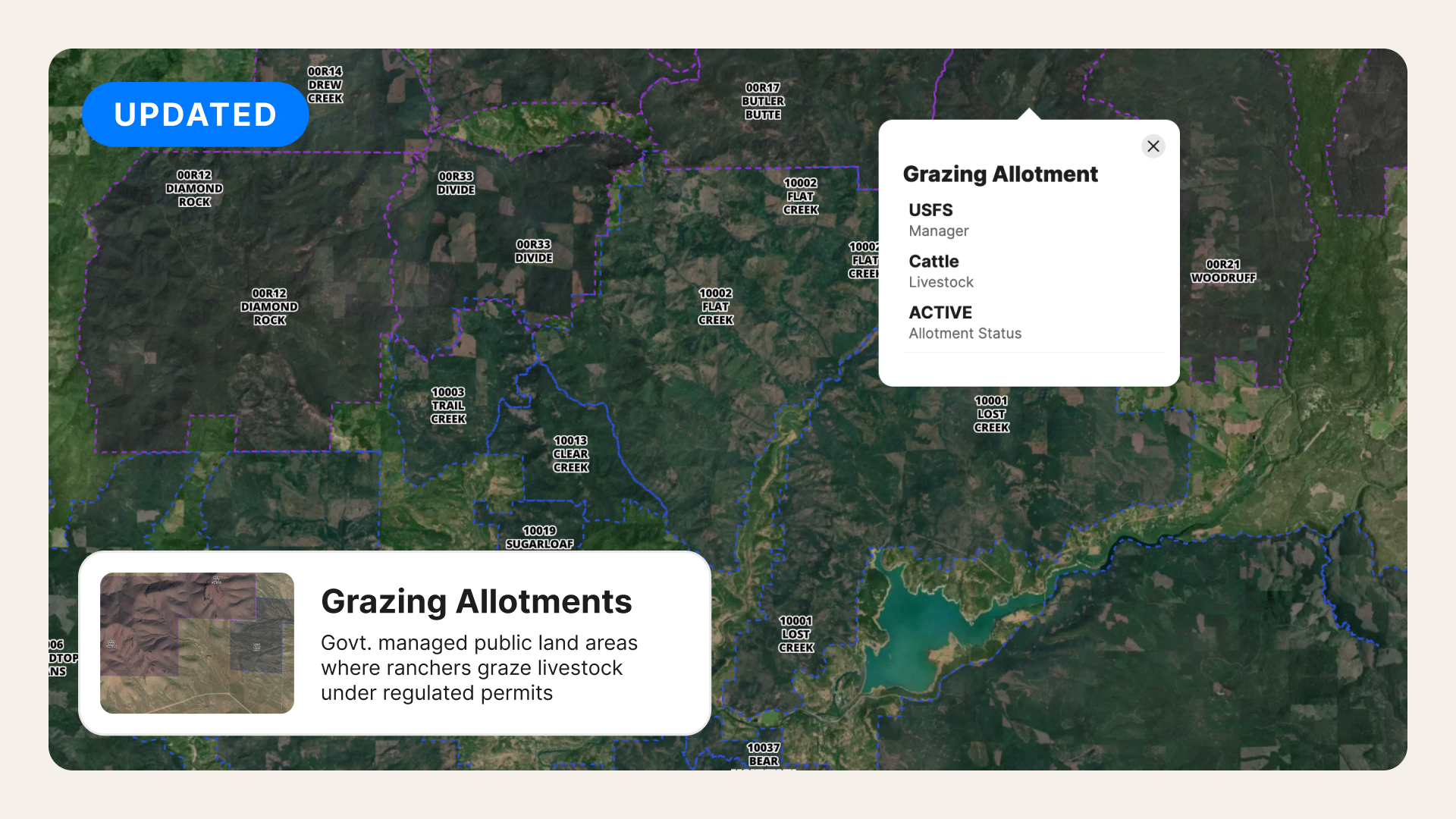
You asked, we listened. We've expanded the Grazing Allotments Overlay to combine BLM and U.S. Forest Service allotments into one layer. This customer-requested improvement makes it easier to evaluate grazing land across agency boundaries without consulting separate maps.
What It Means for You
Now you can:
- Market ranch properties with more context. Show nearby federal grazing allotments alongside parcel boundaries and ownership information.
- Evaluate potential ranch purchases. Identify BLM and Forest Service allotments around a property and investigate relevant grazing arrangements.
- Research mountain and forest ranches. See allotments in regions where the previous BLM-only layer had limited coverage.
- Compare grazing areas across agencies. View both agencies' allotments on one map instead of piecing together separate sources.
Keep in mind, grazing allotments don’t automatically convey grazing permits or rights with a property sale. Confirm permit status and transfer requirements with the managing agency.
Find the Information You Need, With Less Manual Work
Some property questions require specialized information. Others depend on finding the right parcel or interpreting multiple datasets.
We're expanding the data available in Land id and making it easier to use, so you can spend less time gathering information.
How We Fixed It
Alongside improvements to existing layers, we're adding more detailed geographic information and making additional datasets accessible to our AI Smart Search and AI Insights.
Here's a snapshot of the latest work:

What It Means for You
Now you can:
- Locate land more efficiently. Work from detailed PLSS legal descriptions without manually determining where smaller subdivisions fall within a section, once the expanded data is available.
- Research specialized properties. Identify relevant hunting management units, mapped sinkholes, and other geographic conditions that may affect your plans.
- Get more from AI Insights. Benefit from a growing foundation of environmental and terrain data that supports property-specific analysis as these integrations become available.
Whether you're preparing a listing or evaluating a purchase, having more relevant information in one place makes the work easier.
Better Property Data. Better Property Decisions.
You now have access to 50+ map overlays and basemaps, covering everything from parcel boundaries to environmental conditions and specialized land-use information.
But the number of overlays is only part of the story.
Behind each one is the ongoing work of sourcing, cleaning, and updating data so it can support your property research, insights, projects, and decisions.
Because when you're answering a client's questions or evaluating a property, you need trustworthy information you can put to work.
Learn more about our data overlays and basemaps, and start a free 7-day trial today.