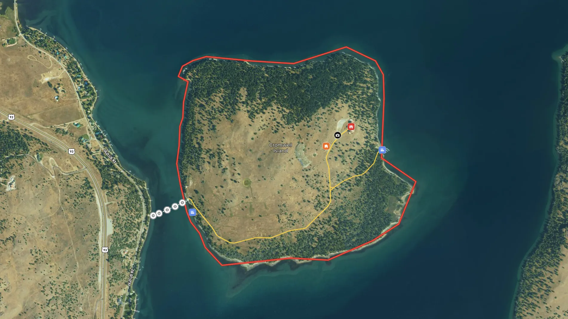
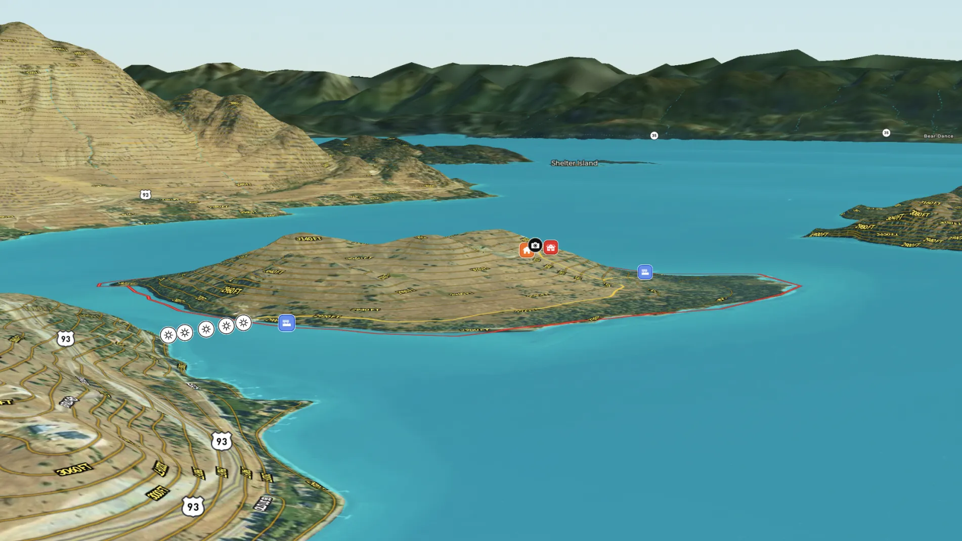
Cromwell Island, presented by Hall and Hall and listing agent Bill McDavid, is a truly unique offering in the heart of Montana, comprising 348 acres of pristine beauty surrounded by the crystal-clear waters of Flathead Lake. Accessible only by boat, this private island features approximately 15,000 feet of scenic shoreline and is home to an unfinished stone mansion that offers stunning panoramic views of the lake and surrounding mountains. The island’s diverse terrain, including open meadows, forests, and shoreline, provides a blank canvas for outdoor enthusiasts and conservationists alike. With its unparalleled privacy and natural beauty, Cromwell Island offers endless possibilities for a luxurious retreat, conservation project, or investment in an untouched Montana landscape.
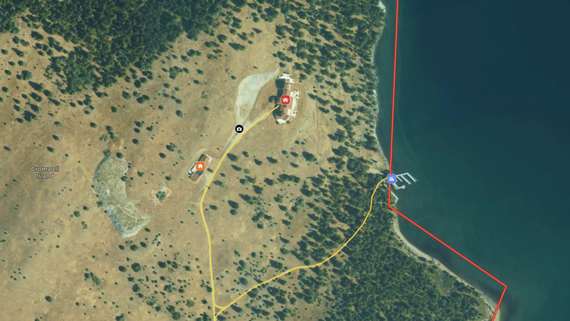
To fully showcase Cromwell Island's potential, Bill McDavid leverages Land id®’s interactive map, providing prospective buyers with a comprehensive spatial understanding of the property. With the island’s expansive landscape, Land id allows McDavid to efficiently create maps, adding key features like the mansion's location, shoreline access points and the varied terrain, enabling buyers to explore the island from a detailed, bird's-eye view.
Bill noted, “Quick and easy, that’s what I love most. I can get it done quick and be ready to hit the truck. We wanna make maps, make them quick, and get out in the field where we belong.”
He also emphasizes the value of Land id’s photo mapping capabilities. “One of the things I love with Land id is that I can plot exactly where the photo was taken on the property.” This feature allows potential buyers to visually connect with specific locations on the island, whether they’re exploring the shoreline or viewing panoramic vistas from the mansion.
By using Land id, Hall and Hall and Bill McDavid offers buyers an interactive experience that brings the property’s unique features to life. This efficient, real-time mapping solution enhances property tours, ensuring buyers can track their real-time location and have an informative and engaging experience as they tour this extraordinary Montana landscape.
Learn How to Create a Map Like This:
- How to make maps in Land id
- Draw detailed maps using the feature palette
- Embed photos, videos, 360° walkthroughs, and more onto your map
Keep Exploring
Take Your Mapping to the Next Level
Mapping is just the beginning. Land id is the #1 tool for researching, discovering, and showcasing land, and we're here to help you make the most of it, every step of the way.


