

What will the future of agriculture look like?
Well, for one thing, it will probably have robots. It will also prioritize sustainability in land management practices that will help increase productivity and decrease waste. Most importantly, though, is how modern technology such as sensors and geographic information systems (GIS) will be available to all farmers. In fact, this future is already being realized as more and more people have the ability to implement field mapping agriculture techniques into their operations.
Because farming is a firmly location-based activity, GIS is proving to be especially helpful in allowing us to fine-tune our planting, watering, fertilizing and harvesting procedures. In order to maintain sustainable agriculture practices, we are all increasingly aware of the importance of preserving and conserving our natural resources, which has to begin by obtaining a clear understanding of the resources at our disposal. GIS is a cost-effective way to help us accomplish this.
Of course, understanding the natural inputs of your environment does not mean you can control them. It only means you will be able to make more informed decisions moving forward.
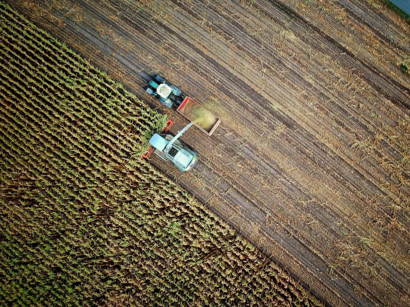
Field Mapping Agriculture
Agricultural field mapping is an increasingly important way to both monitor your land and manage future activities. It helps you understand and map different types of information including data regarding soil health and nutrition, slopes, water and irrigation systems. When done accurately, it enables you to employ different practices on your land that are designed to maximize land use, increase productivity, use resources more efficiently and reduce potentially damaging activities. It also allows you to correct or modify current behaviors.
GIS in Precision Agriculture
Precision agriculture is a type of land management that focuses on tailoring your activities to meet the needs of a specific site on a parcel of land. It involves observing and measuring variables about your fields such as the type of soil, the capabilities of each type of soil, water movement, sloping and even how much sun each area receives.
If you have very uniform fields, precision agriculture wouldn’t be very effective, but that is usually not the case. Variations in slope, for instance, affect how rainfall - and by extension, fertilizer - run off your fields and collect in certain places. This can result in overwatering and over-fertilization in certain areas and negatively impact crop yield. Field mapping agriculture lands allows farmers to deploy resources more sparingly while ultimately improving harvests.
Geospatial tools are the best place to begin this process. GIS, which was once a tool only allotted to professionals with the right expertise, is now widely available and can provide anyone with soil surveys, satellite imagery, infrared data, topography, information on water features and more. In minutes you’ll understand the contours of a field, areas where water is likely to collect during heavy rains, which parts of your land receive the most direct sunlight and where you should be planting specific types of crops for best results.
GIS in Contour Farming
Contour farming has been practiced for centuries, but the advent of new technology makes it more effective and easier to implement than ever. The concept is relatively straightforward. Instead of plowing and planting crops in uniform, straight rows, you perform these same operations along the contours of a slope.
Plowing and planting along contours does a lot of good things for your field. It helps to keep topsoil from eroding and taking important nutrients with it, it increases water infiltration, giving rainfall and fertilizer time to soak into the soil rather than running off and increases water storage on a slope. Your farming operations can even be enhanced by incorporating other practices such as strip cropping (alternating rows between different crops to prevent soil erosion), digging ditches to divert rain water and mulching certain areas to protect the soil.
Contour farming requires some preparation to get started. First, you’ll need to perform a topographic survey of your field. This can be achieved in minutes with a GIS tool, and if it’s mobile capable you’ll even be able to take your maps into the field with you. You’ll need to determine the length of slopes, ridge height and the minimum and maximum row grade. You should also remove any potential obstructions and make sure there will be enough room for farm equipment to operate and turn around.
Field Mapping Agriculture Practices With GIS
Farming may seem a million miles away from the land of modern tech and gadgets, but the agricultural sector is increasingly coming around to the benefits of utilizing GIS. The fact is that our farmland is continually pushed to its limits to meet global demands, and without taking advantage of tools that can help us increase output and reduce and better manage our inputs, our agricultural activities won’t be sustainable.
Land id® (formerly MapRight) delivers the power of GIS mapping software to anyone who needs it, whether you’re an owner of a small independent farm or a farm manager of a large operation. The ability to understand every aspect of your land and effectively map out resources is invaluable to maximizing productivity and ensuring the continued health of every plot of land. We have a variety of features designed to help farmers get the most out of mapping software. Visually analyze all of your resources, retrieve soil reports and learn what kind of activities types of soil can tolerate, view topography and contour lines, map out water features and FEMA floodplains, and build custom databases for anything from crop yields to irrigation pipelines.
Download our mobile app and take your maps with you anywhere, even if you have spotty cell service. With our app, you can take photos and embed them in your maps, track your location and save the tour to your map and even share maps with others.
What will the future of farming look like? Well for you, we hope it involves more sustainable and productive practices, and for that, you’ll need an affordable, easy-to-use GIS solution. Start a 7-day free trial of Land id® now and discover all the ways a modern mapping software can aid you in your agricultural activities.
FAQs
Continue Reading
Craig Rowe
5 Real-World Land id Workflows Worth Borrowing
.png)
By Land id
See helpful examples of how real estate pros use Land id to win listings, market properties, plan developments, and make smarter data-driven decisions.
Alyssa Toohey
Off the Map & In Person: The Land id Team Gets Together

By Land id
The Land id team came together in Montana for collaboration, connection, Big Sky views, PBR, Yellowstone, and plenty of memorable moments.


Explore Private Parcel Data & Property Boundaries
Download the Land id app and try for free.
