


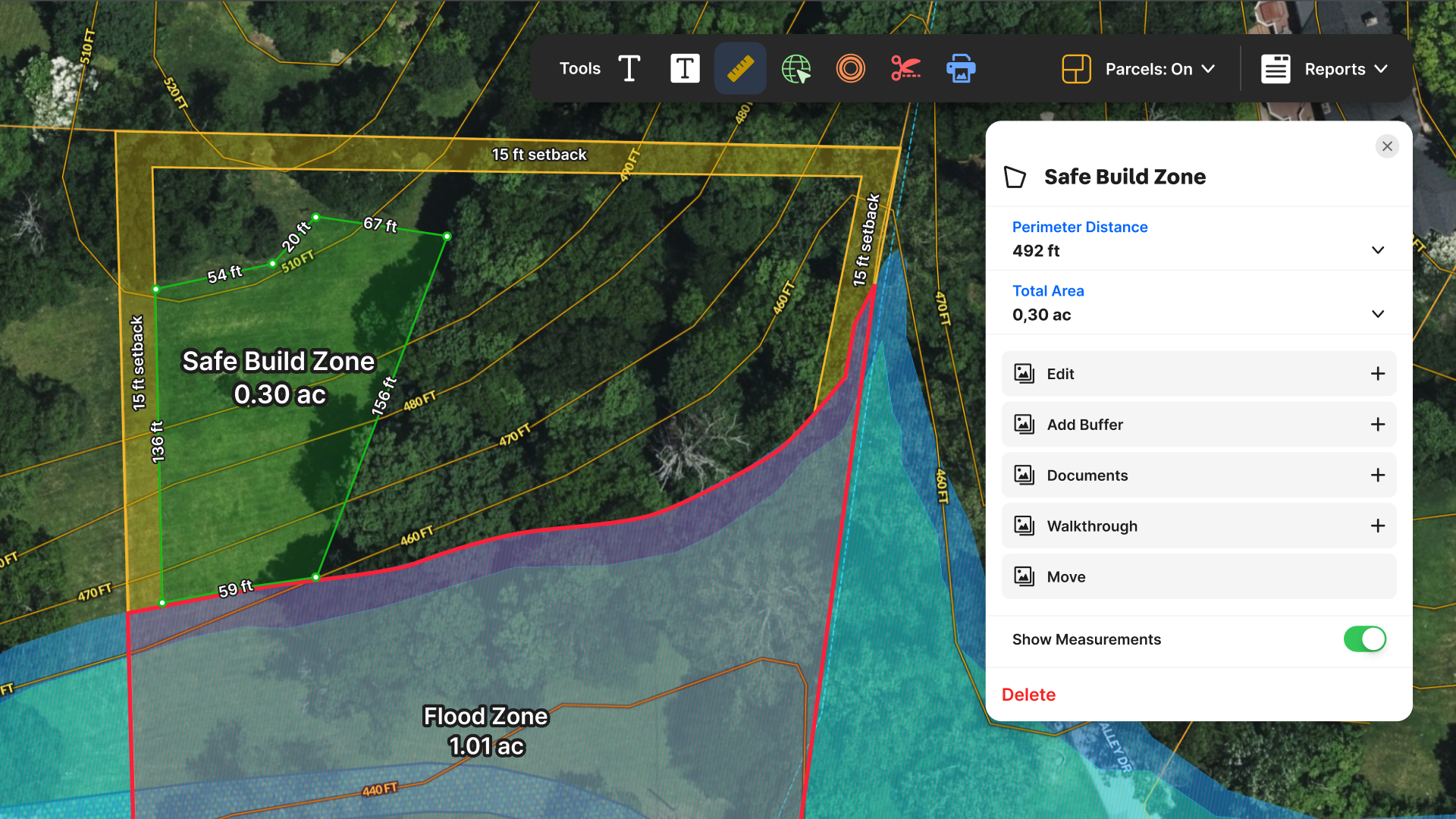
You're prepping a listing presentation and the seller wants to know exactly how much land they're selling—but the county records say "approximately 0.42 acres."
Approximately isn't going to cut it. Here's how to measure land area on a map yourself, in under two minutes, with tools you can access right now.
What Is Online Land Area Measurement?
Online land area measurement is the process of calculating the total square footage or acreage of a parcel using digital mapping tools. It's essential for accurate listings, land valuation, and buyer due diligence—and it's a skill every real estate agent should have in their back pocket.
In this guide, we'll walk through exactly how to measure property area online, compare the best tools available (free and paid), cover the mistakes that trip up most agents, and show you how to save and share your measurements so they actually end up in your listing presentation.
Whether you're measuring a suburban lot or a 40-acre ranch, the process is the same, especially when you understand how a dedicated measurement tool supports accurate area and distance calculations.
Why Accurate Land Measurements Matter in Real Estate
When a listing says "approximately" anything, it signals uncertainty. And uncertainty makes buyers hesitate. Here's why getting your land measurements right matters more than you might think.
Listing Accuracy & Legal Exposure
Overstating lot size—even unintentionally—can lead to legal headaches. According to the National Association of Realtors® guidelines on property disclosure, agents have a duty to provide accurate property information. If a buyer closes on what they thought was a half-acre lot and discovers it's actually 0.38 acres, you've got a problem. Measuring the property yourself (and documenting how you did it) gives you a defensible number.
Buyer Confidence & Faster Closings
Buyers who trust the listing details move faster. When you can show them exactly how you arrived at your acreage figure—ideally with a visual map they can interact with—you eliminate one more reason for them to pause. That's especially true for properties where land is a significant part of the value: rural homes, lots with outbuildings, or parcels with development potential.
Appraisal Alignment
Nothing stalls a closing like an appraisal that contradicts your listing. If your listed acreage doesn't match what the appraiser calculates, you'll spend time explaining the discrepancy instead of moving toward the closing table. Starting with an accurate measurement keeps everyone aligned.
Tools You Can Use to Measure Land Area Online
You don't need surveying equipment or a math degree to measure property area. Several online tools make it straightforward—though they vary widely in accuracy, usability, and what you can do with your measurements afterward, especially if you want to discover land and create interactive property maps you can reuse across multiple listings.
Google Maps (Free, Limited)
Google Maps has a built-in measurement tool that lets you plot points and calculate area. It's free and accessible, but there are significant limitations: you can't save your measurements, you can't share them, and you're relying on base imagery that may be outdated. It works in a pinch, but it's not built for real estate professionals.
County GIS Portals (Free, Clunky)
Most counties offer free GIS viewers with parcel data and measurement tools, but they rarely match the depth of nationwide parcel data available in dedicated platforms.
The upside: you're working with official parcel boundaries. The downside: every county's system works differently, the interfaces are often outdated, and exporting or sharing your work usually isn't an option. If you work across multiple counties, you'll spend more time learning each system than actually measuring.
Dedicated Property Tools
Purpose-built real estate mapping software offers the best combination of accuracy, usability, and workflow integration.
The key difference isn't whether a tool can measure—most can. It's whether your measurements persist after you close the browser, and whether you can share them with clients. If you're measuring for a listing presentation, you need both.
How to Measure Land Area on an Online Map—Step-by-Step
Here's the process for measuring land area using Land id. The general workflow applies to most property mapping platforms.
Step 1: Navigate to the Parcel
Open your mapping tool and search for the property by address, coordinates, or APN (Assessor's Parcel Number) using nationwide property owner and boundary line data. Land id's Smart Search lets you search all three in one field. Zoom in until you can clearly see the property boundaries—if parcel overlays are available, toggle them on for reference.
Step 2: Select the Measurement Tool
Look for a measurement or drawing tool in the toolbar. In Land id, it's a single unified measure tool that handles both lines (for distances) and polygons (for areas). Select polygon or area mode to measure lot size.
Step 3: Click to Draw Boundary Points
Click on each corner of the area you want to measure. Each click creates a vertex, and the tool draws lines connecting them. For a standard rectangular lot, you'll need four points. For irregular shapes, add as many as you need to trace the boundary accurately.
Step 4: Close the Polygon
Complete the shape by clicking on your starting point or double-clicking to auto-close. The tool will calculate the enclosed area and display it.
Land id's measuring tool includes an area calculator tool and supports both metric and imperial units, including:
- Distance: feet, yards, miles, meters, and kilometers
- Area: acres, hectares, and square feet, yards, miles, meters, and kilometers
In Land id, you can easily switch between measurement units with simple drop-down options. Each leg of the perimeter also displays distance between points.
Step 5: Review the Calculated Area
Check that your polygon actually traces the boundary you intended. A common mistake is placing a point on the road centerline instead of the property edge (more on that below). If something looks off, most tools let you drag vertices to adjust.
Step 6: Save & Export
This is where not all land measurement tools are created equally. In Land id, you can save your measurement as a map item with a label—so it stays on your map and appears in any shared links or PDF exports using the Print Map feature. In Google Maps or most GIS portals, your measurement disappears the moment you close the tab.
That's it. Six steps, under two minutes, and you have a defensible acreage number for your listing.
Common Mistakes When Measuring Property Area
Even with good tools, there are a few errors that trip up agents regularly. Knowing what to avoid will save you from embarrassing corrections later.
Forgetting to Close the Polygon
If you don't close your polygon—by clicking your starting point or using the tool's auto-close function—you won't get an area calculation. You'll just have a series of connected lines with no interior. Always verify the polygon is closed before trusting the number.
Measuring to the Road Centerline
Roads often appear to be part of the property on satellite imagery, but the legal boundary typically stops at the right-of-way, not the center of the pavement.
If parcel overlays are available, use them. For rural tracts and larger holdings, a Public Land Survey System (PLSS) overlay can also help you orient the parcel within its township and section. PLSS is the common system for measuring large areas of land in the U.S. to determine accurate land areas. If not, err on the conservative side and measure to where the property clearly ends, not where the road begins.
Relying on Parcel Overlays Without Verifying
Parcel overlays are helpful, but they're not surveys. They're derived from assessor data, which can be outdated or imprecise—especially in rural areas. Use overlays as a reference, but don't assume they're legally accurate.
For anything high-stakes, recommend that your client get a professional survey. The ALTA/NSPS Land Title Survey standards define what a legally defensible survey includes, and a digital measurement isn't a substitute.
Measuring at the Wrong Zoom Level
At low zoom levels, it's hard to place points precisely. Zoom in enough to see property features clearly—fences, driveways, tree lines—before you start measuring. Small placement errors get magnified when you're calculating area.
High-res aerials, found in Land id, can make your work significantly easier. They’re higher-res and more up-to-date than satellite imagery.
How Land id's Measure Tool Helps Agents Get It Right
Land id built its measure tool specifically for the workflow real estate agents actually use: measure something, save it, show it to a client, and leverage full mapping software for discovering land as you evaluate multiple properties. Here's what that looks like in practice.
One Tool for Lines & Areas
You don't need to switch between separate distance and area tools. Land id's unified measure tool lets you draw either—so you can measure the lot area, then measure the road frontage, then measure the distance from the house to the property line, all without changing modes.
Measurements Save as Map Items
When you save a measurement in Land id, it becomes a named item on your map. That means it's there when you come back tomorrow, and it's there when you share the map with someone else. No re-measuring every time you revisit a property.
Share a Link or Export to PDF
Every map you create in Land id can be shared via link—including your measurements. Send a client an interactive map they can explore on their phone, with your acreage calculation right there. Or export a polished PDF for your listing presentation with crisp labels and clean borders.
Full Mobile Parity
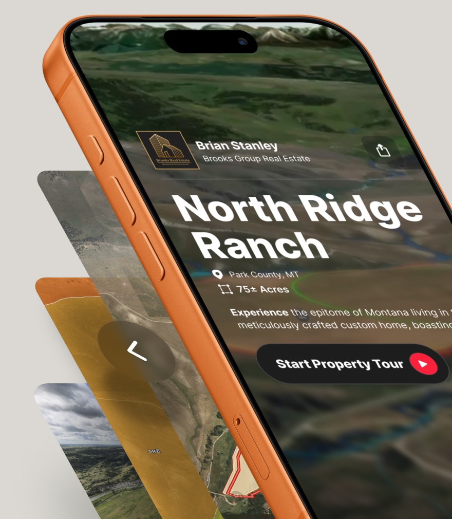
Land id's mobile app has the same measurement capabilities as the desktop version, including the ability to create and edit boundaries accurately while you're in the field. Measure a property from your truck, save it, and text the shareable link to your client before you leave the driveway. Same tools, same results, any device.
For agents who want to see how Land id compares to other options, the difference often comes down to what happens after you measure. If your measurements can't be saved or shared, you're doing the same work twice.
Get Ready to Measure
Accurate land measurements aren't just about getting the number right—they're about presenting listings with confidence, giving buyers information they can trust, and avoiding the "approximately" language that signals uncertainty.
The process itself is simple: navigate to the parcel, draw your boundary, review the area, and save your work. The difference between a frustrating experience and a smooth one comes down to choosing a tool built for how real estate agents actually work.
If you're tired of re-measuring properties because your last calculation disappeared, or you want to share an interactive map with your clients instead of describing acreage over the phone, it's worth trying a tool designed for the job.
FAQs
How accurate is Land id’s Measurement tool?
Can I measure acreage and distances on a property without hiring a surveyor?
Can I measure acreage on any parcel?
Does the Measurement tool work offline or in the field?
How accurate are online land measurements?
Does Land id's measurement tool support metric and imperial units?
Can I measure land area on Google Maps?
Catch Deal-Breakers Early
Save time and avoid expensive mistakes. Use Land id to evaluate deal-killing constraints before you leave your desk.
Continue Reading
Craig Rowe
Real Estate’s Super El Niño Problem


By Land id
Just some rain...or real estate catastrophe? With months before winter hits, some states are already feeling the effects of this year's so-called Super El Niño. Here's how agents can help their clients.

Craig Rowe
How to Work With Out-Of-State Buyers: Tips for Real Estate Agents
By Land id
Agents in emerging markets will benefit from an influx of aspiring buyers. Get tips on how to make the most of these potentially lucrative leads.

Explore Private Parcel Data & Property Boundaries
Download the Land id app and try for free.


