

Dallas, TX — April 08, 2021 — Land id® (formerly MapRight) is thrilled to announce a new partnership with Hexagon resulting in the release of two new high resolution aerial options. Our users will now have access to the most superior resolution and up-to-date data available.
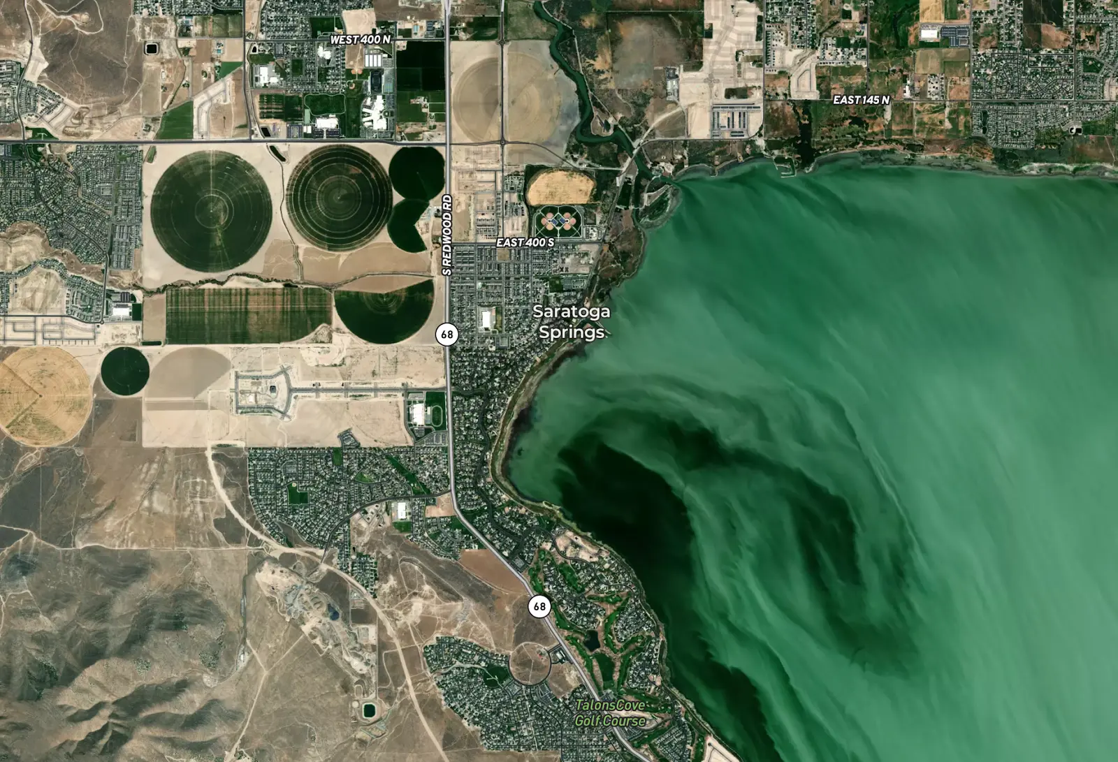
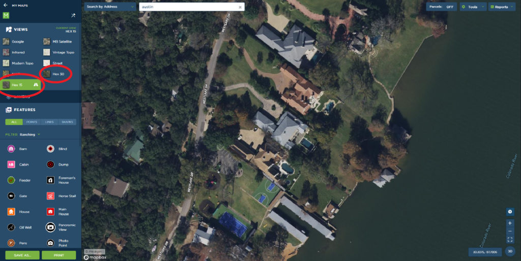
Land id® has released two Hexagon aerial options. Their 15 cm super high resolution imagery covers most major and mid-sized urban areas across the U.S. The other newly released aerial, Hexagon’s 30 cm high resolution imagery, covers the entire country. This will be your default aerial moving forward for all new Land id® maps.
“We’re very excited to release these new aerials to our users,” says Steve Roberson, Managing Partner at Land id®. “Hexagon delivers the most reliable and consistent imagery of any provider out there. They ensure that rural areas are never more than three years out of date and urban areas are refreshed every 18 months, so we know it will always be current.”
Hexagon is a top global provider of geospatial data. Their aerial data program, the HxGN Content Program, offers the largest library of aerial imagery and digital surface models across the U.S., Europe and parts of Canada. The program follows rigorous acquisition and processing standards to offer the highest positional accuracy and exceptional data consistency.
These new aerial options are now available to Land id® users in their web and mobile applications. You’re encouraged to log in and check them out when you get a chance!
About Land id®
Building on several decades of education and experience working with GIS, Land id® was founded in 2014 to help companies and individuals gain a better understanding of properties and land features and be able to more intuitively communicate them with others. Land id® offers nine different GIS base layers and nearly two dozen Land id® layers, countless styling and customization options, and several easy ways to share your maps. A 7-day free trial helps users get started on the web app and companion mobile app.
About Hexagon
Hexagon is a global leader in sensor, software and autonomous solutions. We are putting data to work to boost efficiency, productivity, and quality across industrial, manufacturing, infrastructure, safety, and mobility applications. Our technologies are shaping urban and production ecosystems to become increasingly connected and autonomous — ensuring a scalable, sustainable future. Hexagon's Geospatial division creates solutions that visualize location intelligence, delivering a 5D smart digital reality with insight into what was, what is, what could be, what should be, and ultimately, what will be. Hexagon (Nasdaq Stockholm: HEXA B) has approximately 21,000 employees in 50 countries and net sales of approximately 4.6bn USD. Learn more at hexagon.com and follow us @HexagonAB.
FAQs
Continue Reading
Craig Rowe
Can Refurbishing Schools Help Solve Housing Issues?
.png)
By Land id
Old public schools are becoming apartments as enrollment drops. See why school-to-apartment conversion is adaptive reuse's fastest-growing niche.

Prospecting, Part 2: Find Off-Market Properties
By Land id
Find off-market properties before your competition does. 8 proven strategies for real estate agents—from absentee owner lists to parcel data.

Explore Private Parcel Data & Property Boundaries
Download the Land id app and try for free.
