


We recently had a chance to tour this amazing property with Ryan Bramlette of Fay Ranches. He gave us a firsthand look at the incredible terrain and wildlife that make this property so special.
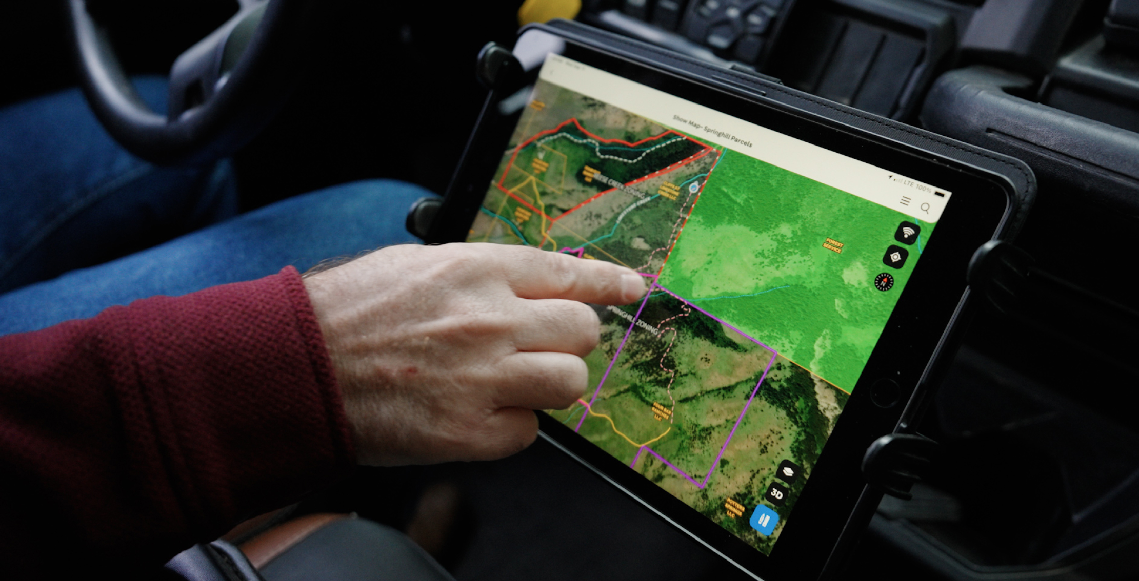
During our tour Ryan also highlighted the custom Land id map that he created to showcase this property to prospective buyers. Everything from the property’s distinct parcels, recorded easements, 2-track trail system, and forest service boundary allow him to tell the unique story of this beautiful place.
Situated just 20 minutes from downtown Bozeman, this property is truly a rare find, bringing together the serenity of rural Montana with the conveniences of city living.
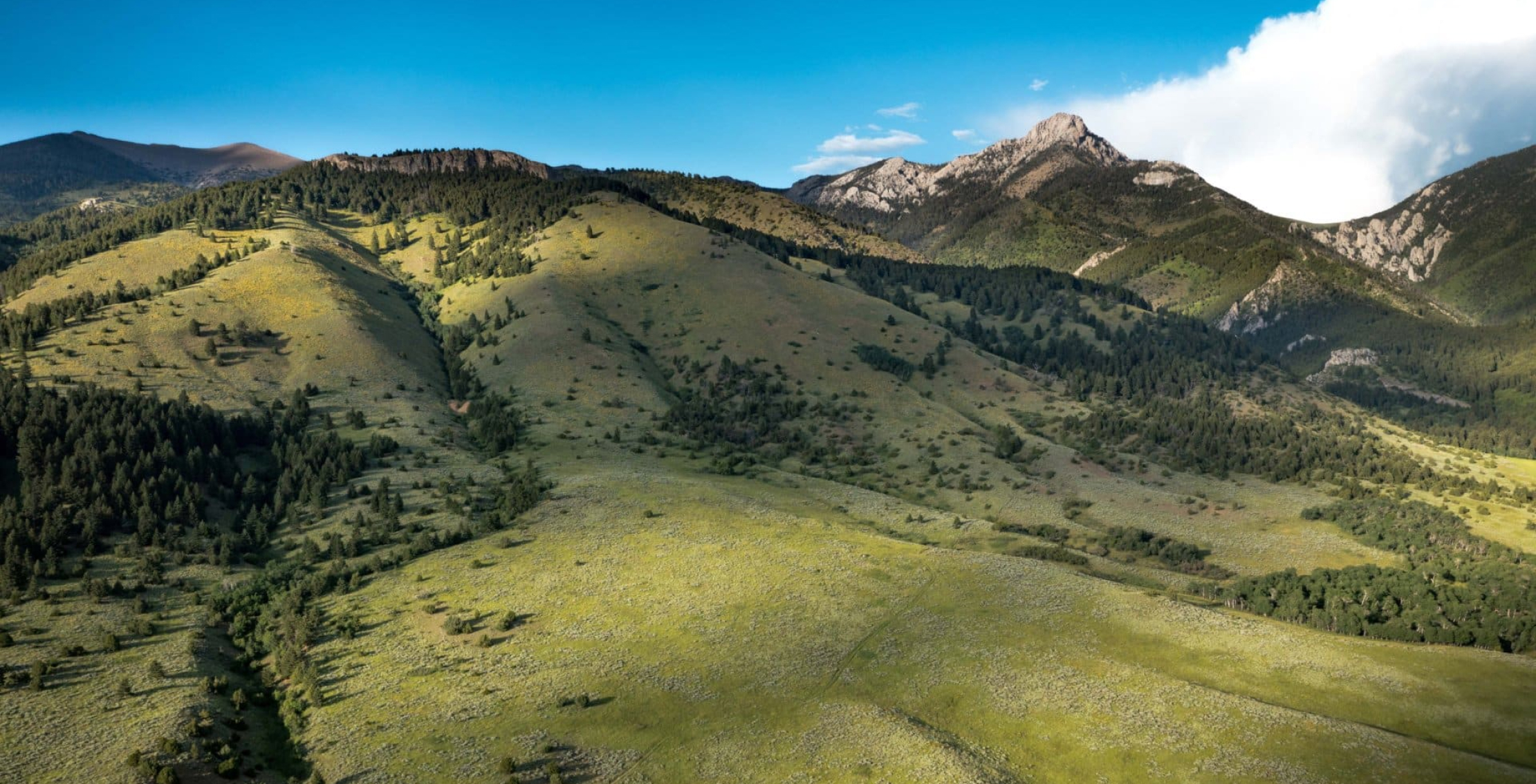
Although the appeal of this land is unparalleled when the parcels are combined, each plot is also offered separately.
Parcel 1: 200± acres for $6.8M
Parcel 1, shown in purple on our map, is home to 200± acres of hills, meadows, and dense tree cover. This parcel already has an impressive initial concept for improvements and landscaping, with renderings created by NVS Architects based out of Bozeman.
A two-track trail provides quick access to Custer Gallatin National Forest, while the proposed building site offers amazing views of the Bridger Mountains. A new road is also in place, allowing the buyer to envision and construct their dream design with ease.
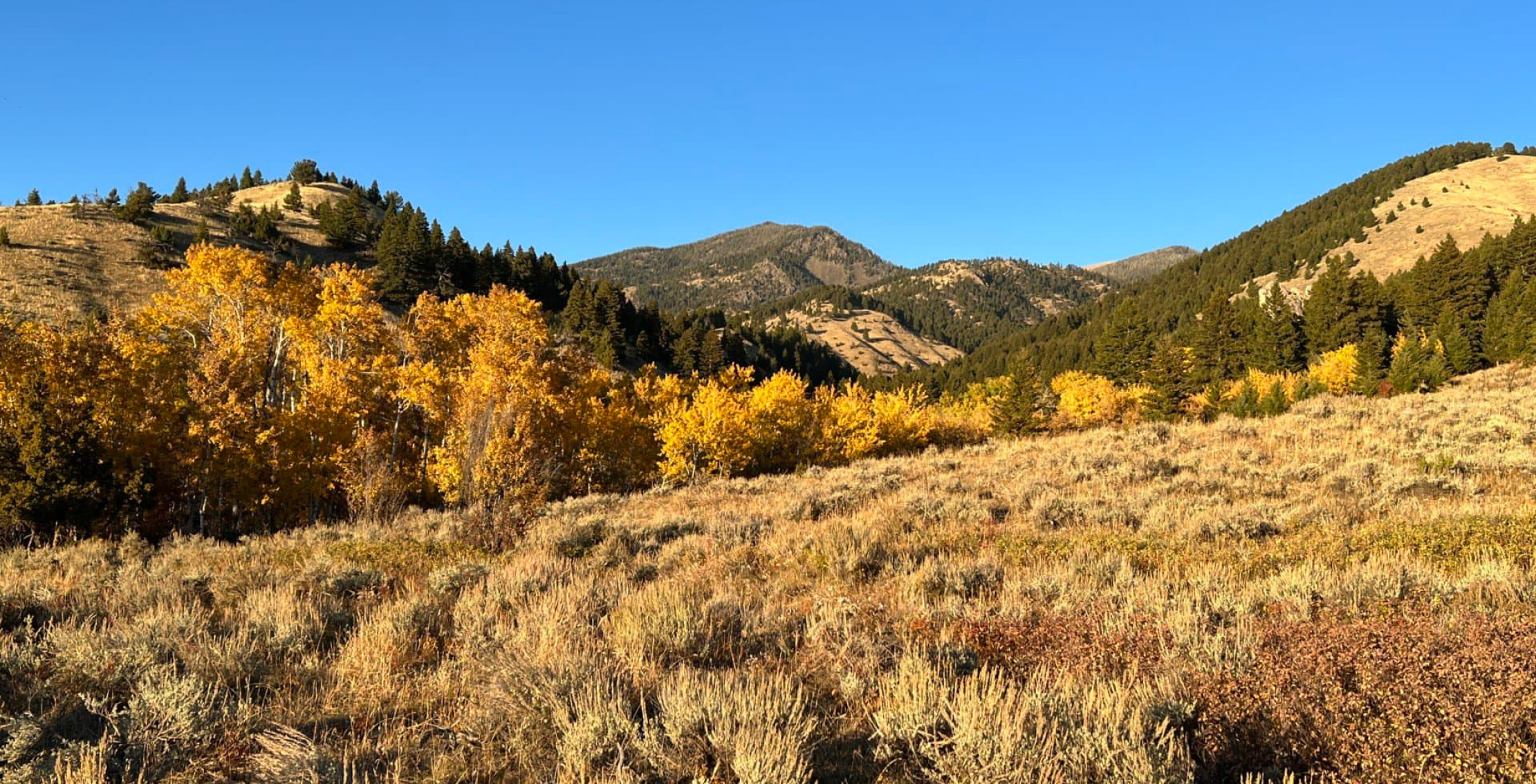
Parcel 2: 142± acres for 4.96M
Parcel 2, outlined in pink on our map, encompasses 142± acres and comes with equally charming views as Parcel 1.
Limestone Creek winds its way along the northern boundary for over 1,000 feet, while the land itself is decorated with rolling hills and aspen groves. And because this parcel borders approximately 150 feet of National Forest, it’s a prime choice for outdoor recreation.
Aside from its spaciousness, what really makes this property stand out are its unique features that encourage enjoyment of the land.
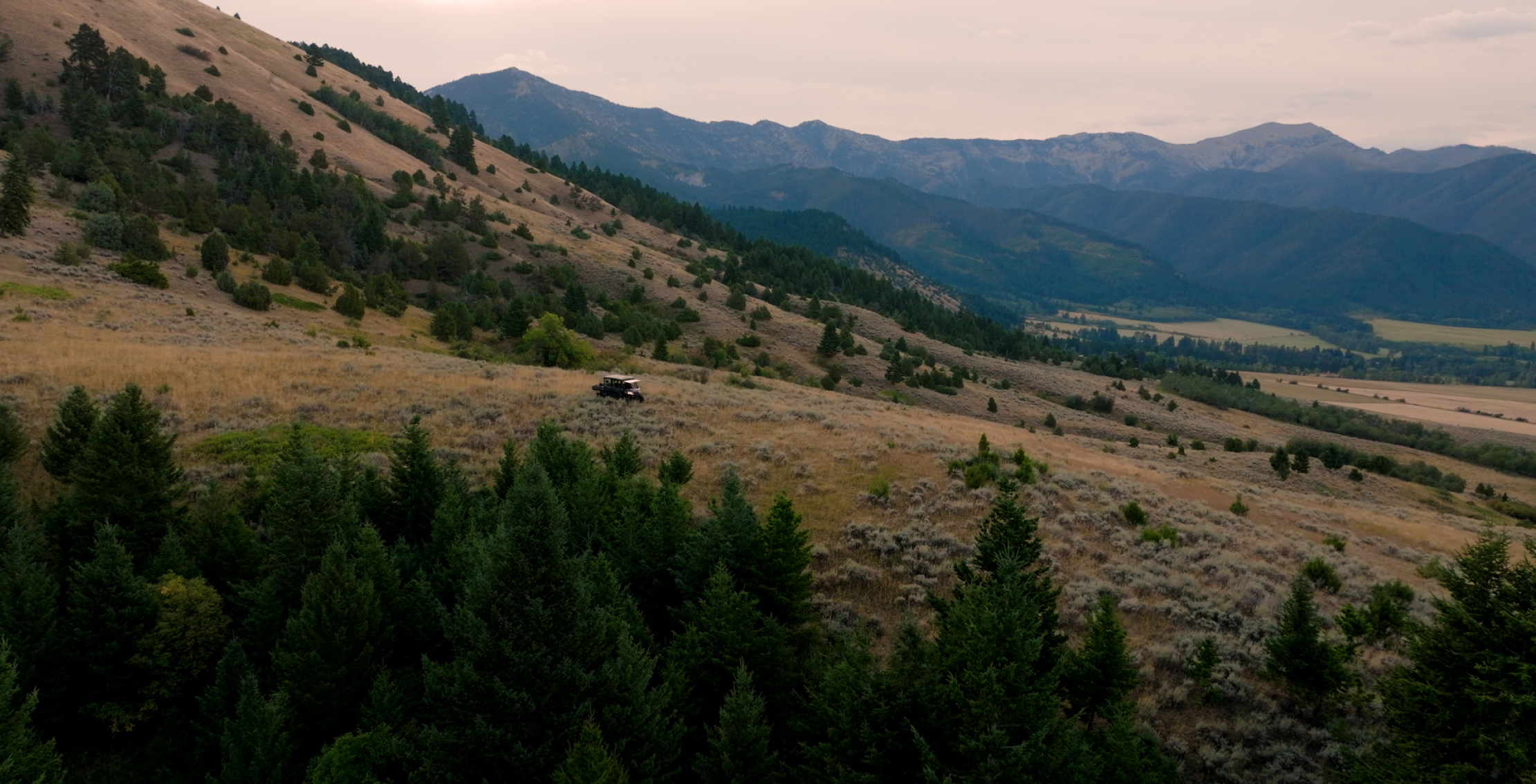
Direct access to the National Forest
- The Bridger Foothills property has 0.5± miles of National Forest boundary, opening up a world of adventure on some of the most pristine public lands anywhere in the country.
Shared border with Limestone Creek
- Stretching 1,000 feet along the northern edge of the property, Limestone Creek adds a tranquil element to this already serene environment.
Two-track easement into the forest
- Represented by a dashed pink line on our map, there’s a two-track easement through the neighboring property that provides access to a prominent National Forest entry point.
Panoramic views from sunrise to sunset
- From the awe-inspiring Bridger Mountain ridgeline to the photoworthy Gallatin Valley, this area offers panoramic views that are nothing short of breathtaking.
Free from conservation easements
- This property doesn't have any restrictive covenants or conservation easements—so you have complete freedom to shape the land how you like.
Two-track network of trails
- Throughout both parcels is a network of trails that connects to the Custer Gallatin National Forest and well-loved routes like College ‘M’ and Sypes Canyon.
Our video of the Bridger Foothills reveals not only the beauty of this listing, but also the transformative capabilities of Land id. By combining our robust tools with the natural allure of these parcels, Ryan creates a compelling narrative that helps potential buyers envision all the possibilities for this land.
The rarity of finding large parcels of land within minutes of Bozeman, boasting a National Forest boundary, live water features, and iconic Montana views, is truly exceptional.
To learn more about this listing head over to Fay Ranches—and if you’re interested in having us fly out and feature YOUR property, mapped with Land id, click the button below.
FAQs
Continue Reading
How to Create a Polished Property Marketing Asset in Under 3 Minutes
By Land id
Stop manual property marketing work. Learn how to create professional, polished property assets in under 3 minutes with Land id's Property Tour.

Prospecting, Part 1: Find More Seller Leads
By Land id
Part one of our prospecting series helps real estate professionals uncover untapped seller leads using Land id.

Explore Private Parcel Data & Property Boundaries
Download the Land id app and try for free.
