Finding undervalued rural land is one thing. Knowing how to divide it, vet it for constraints, and get it to market fast is another—and that's exactly where Land id fits in Geoff Hurdle's process.
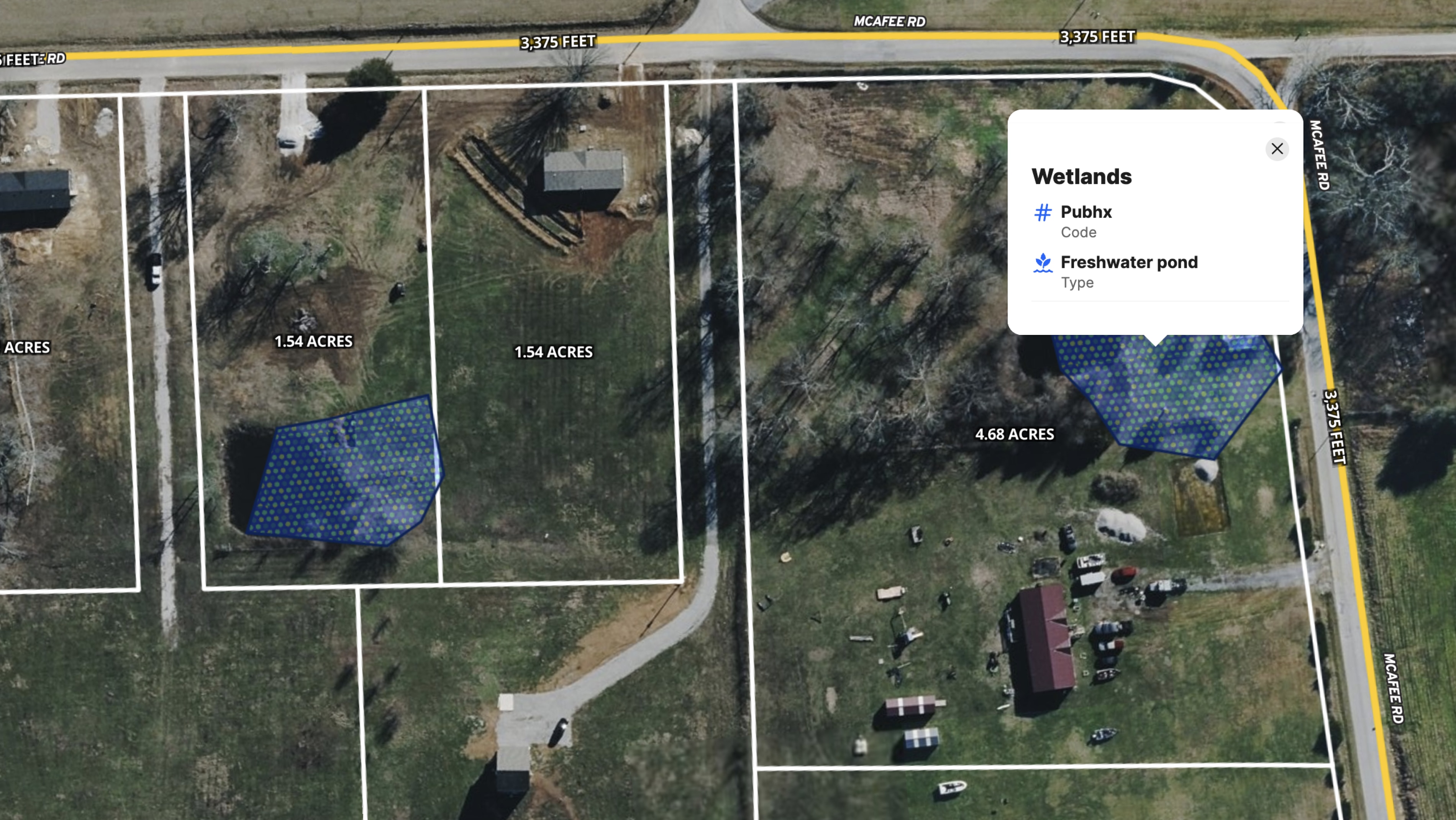
Geoff Hurdle of Hurdle Land & Realty uses Land id from the very first step of a land deal. Before committing to a property, he evaluates it on the map: checking topography, confirming the absence of floodplains using the FEMA Floodplain Overlay, and identifying any wetland constraints that could limit usable acreage.
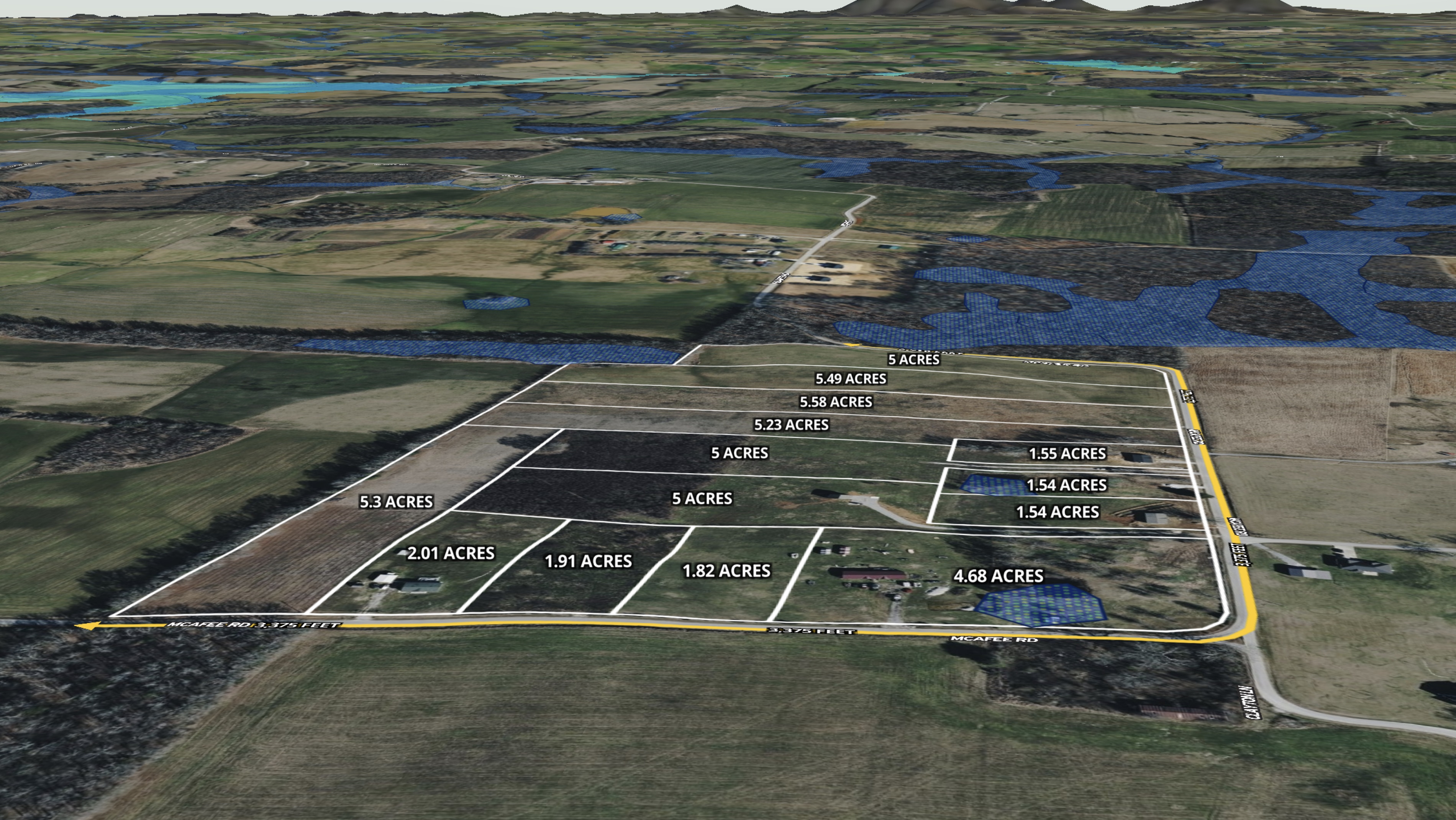
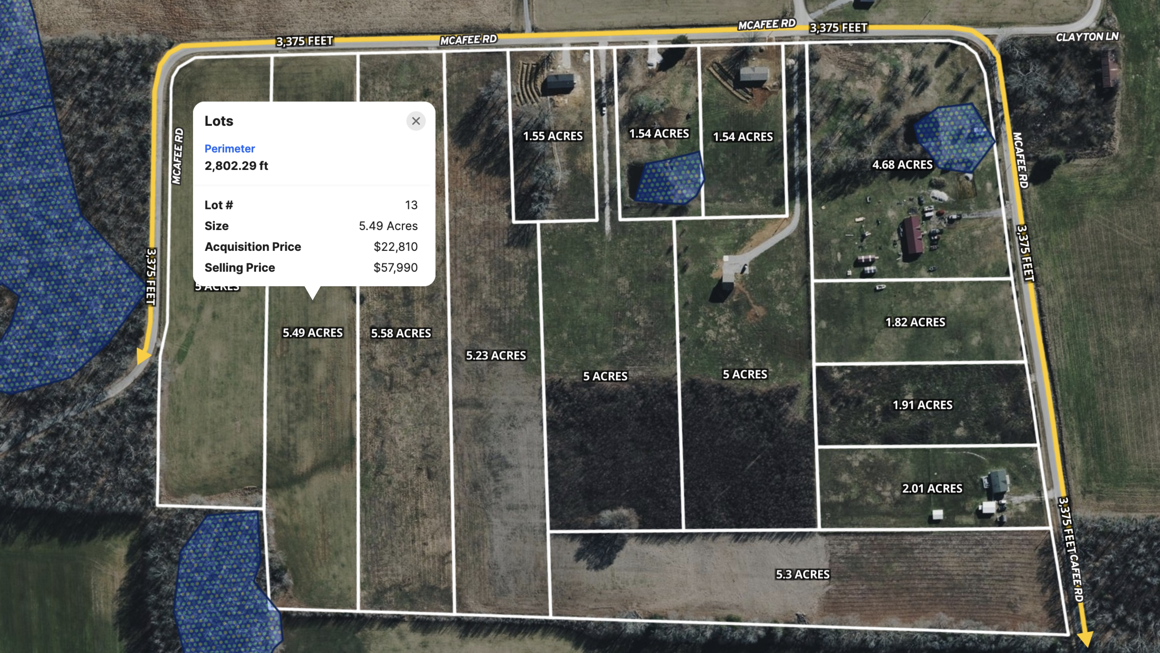
Once the land passes that screen, he uses Land id's Cut tool and measurement capabilities to plan how to divide the parcel in line with county requirements, then shares the finished map with his surveyor. Attribute data and labels make it easy to track and communicate lot details throughout the process.
The Bell Acres Development is a case study in that workflow working exactly as designed. The original tract was purchased at roughly $4,000 per acre and subdivided into 14 lots, which later sold for over $10,000 per acre. With no water, sewer, or power infrastructure required, the only prerequisites were a soil test and a survey.
For land investors and rural developers, the takeaway is clear: A well-mapped property moves faster and commands more per acre. Land id is the tool that makes that possible from first site evaluation through close.
Learn How to Create a Project Like This
- Land id for land and ranch agents
- Quick start: Create and share a map in Land id
- FEMA floodplain overlay
- Divide properties with the cut tool
- Manage and visualize data with attributes
- Add labels to maps and mapped items
- Import surveys and site plans with the Georeference Tool
Take Your Mapping to the Next Level
Mapping is just the beginning. Land id is the #1 tool for researching, discovering, and showcasing land, and we're here to help you make the most of it, every step of the way.