MLS areas are essential for data accuracy—but for agents new to a market, navigating dozens of minor areas across a large geographic region is a slow, error-prone process. The solution isn't a longer training doc. It's a better visual tool.
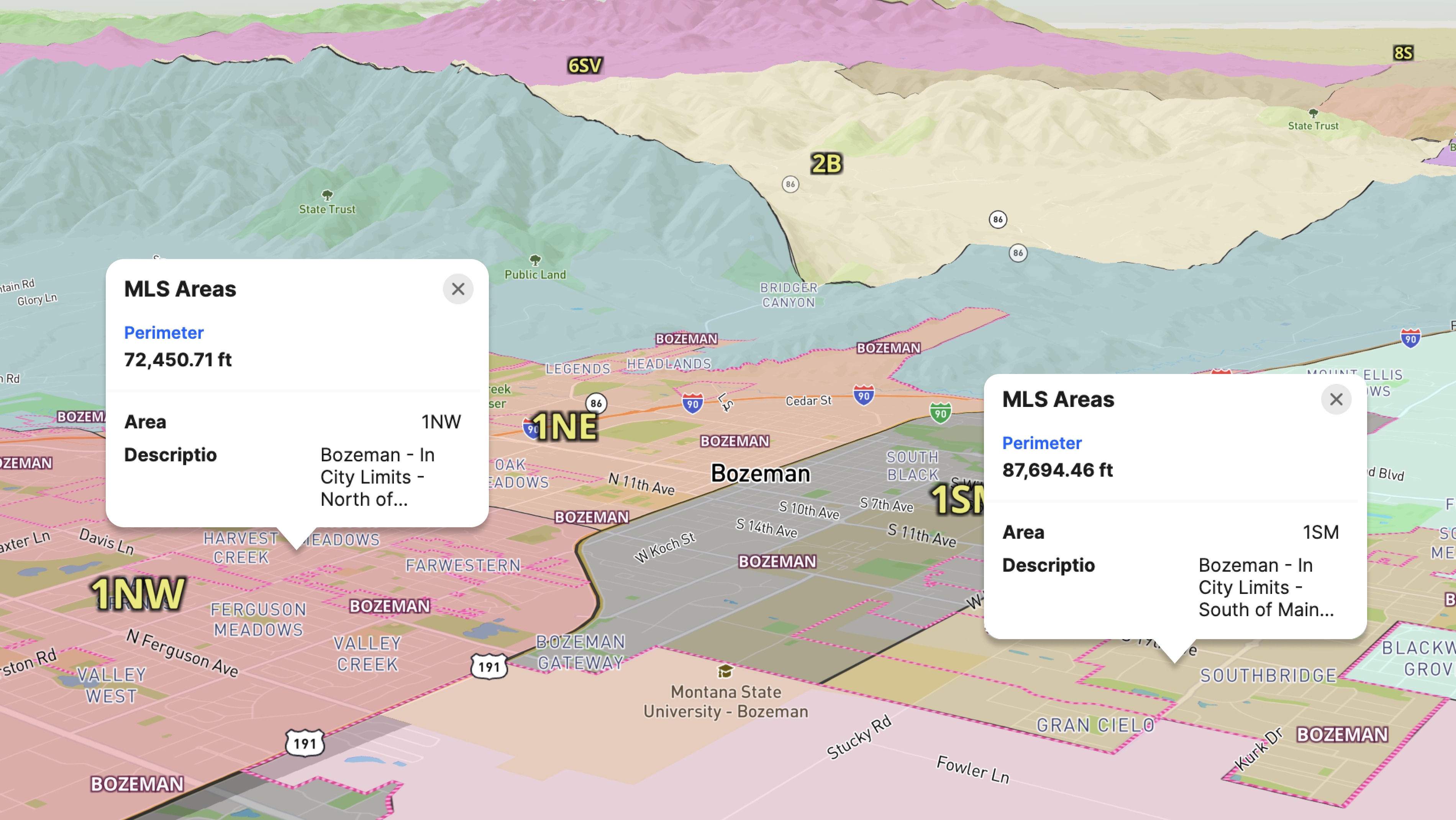
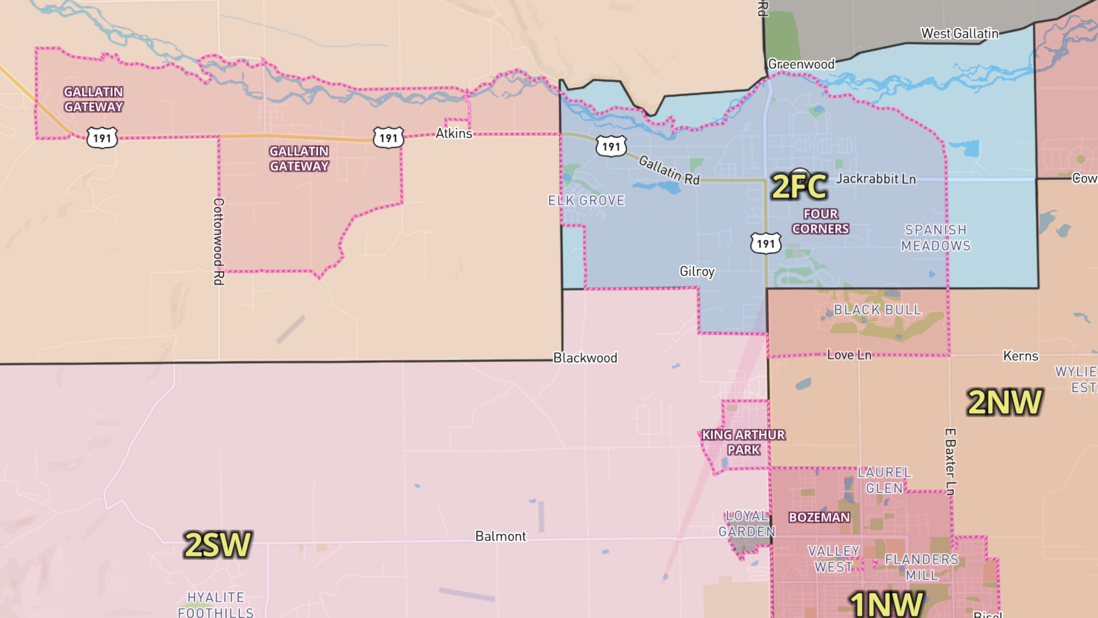
Big Sky Country MLS partnered with Land id to build a custom map that turns complex minor areas into something any agent can understand at a glance. The map covers the full MLS territory, with each area clearly defined as an interactive boundary. Agents can click any section of the shaded map to see its minor area and description, and zoom in to distinguish closely nested subdivisions like the Four Corners region, where major and minor Areas sit side by side.
The map is now a live resource on the Big Sky Country MLS website, used daily by agents to verify and assign correct minor areas before submitting listings.
When the stakes are accurate listing data across a large, complex market, Land id gives MLS organizations a way to standardize knowledge and give every agent a reliable reference they can actually use.
"Land id's custom mapping solution turned our complex minor areas into a simple visual tool. It helps our agents identify the correct location, ensuring accurate data for the MLS and a seamless search experience for buyers. It's an essential resource for the Big Sky Country MLS." — Mike Lake, Big Sky Country MLS
Learn How to Create a Project Like This
- Explore Land id partnerships for MLSs
- Quick Start: Create and share a map in Land id
- Create and edit boundaries
- Manage and visualize data with attributes

Take Your Mapping to the Next Level
Mapping is just the beginning. Land id is the #1 tool for researching, discovering, and showcasing land, and we're here to help you make the most of it, every step of the way.