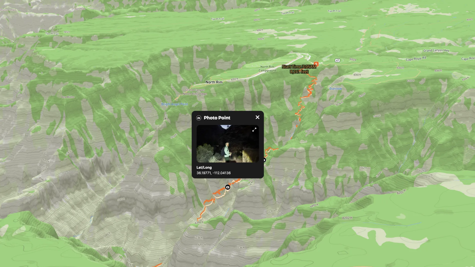
A former Land id® employee Ryan Phillips recently completed the iconic Rim to Rim hike in the Grand Canyon, spanning 24 miles from the North Rim to the South Rim. As someone who loves both adventure and technology, this grueling yet rewarding trek was the perfect opportunity to combine the two.
Throughout the hike, Ryan used Land id® to create a custom map that captured the entire route. He added photo points along the way, marking significant locations such as the dramatic descent into the Inner Canyon, the Colorado River crossing, and the final climb to the South Rim. These photo points now serve as a visual artifact of his adventure, tying each breathtaking view and landmark to its precise location on the map.
The map didn’t just help him track his progress; it became a detailed record of the journey itself. By integrating photos and key points, Ryan transformed the map into a vivid story of the hike—one that he can now share with others. The result is more than just a memory of the Rim to Rim experience; it’s a visual and interactive keepsake that brings the Grand Canyon’s grandeur to life through the lens of Land id's powerful mapping tools.
Learn How to Create a Map Like This:
- How to make maps in Land id
- Use real-time tracking
- Embed photos, videos, 360° walkthroughs, and more onto your map
- Draw detailed maps using the feature palette
- Add labels to maps and mapped features


Keep Exploring
Take Your Mapping to the Next Level
Mapping is just the beginning. Land id is the #1 tool for researching, discovering, and showcasing land, and we're here to help you make the most of it, every step of the way.


