


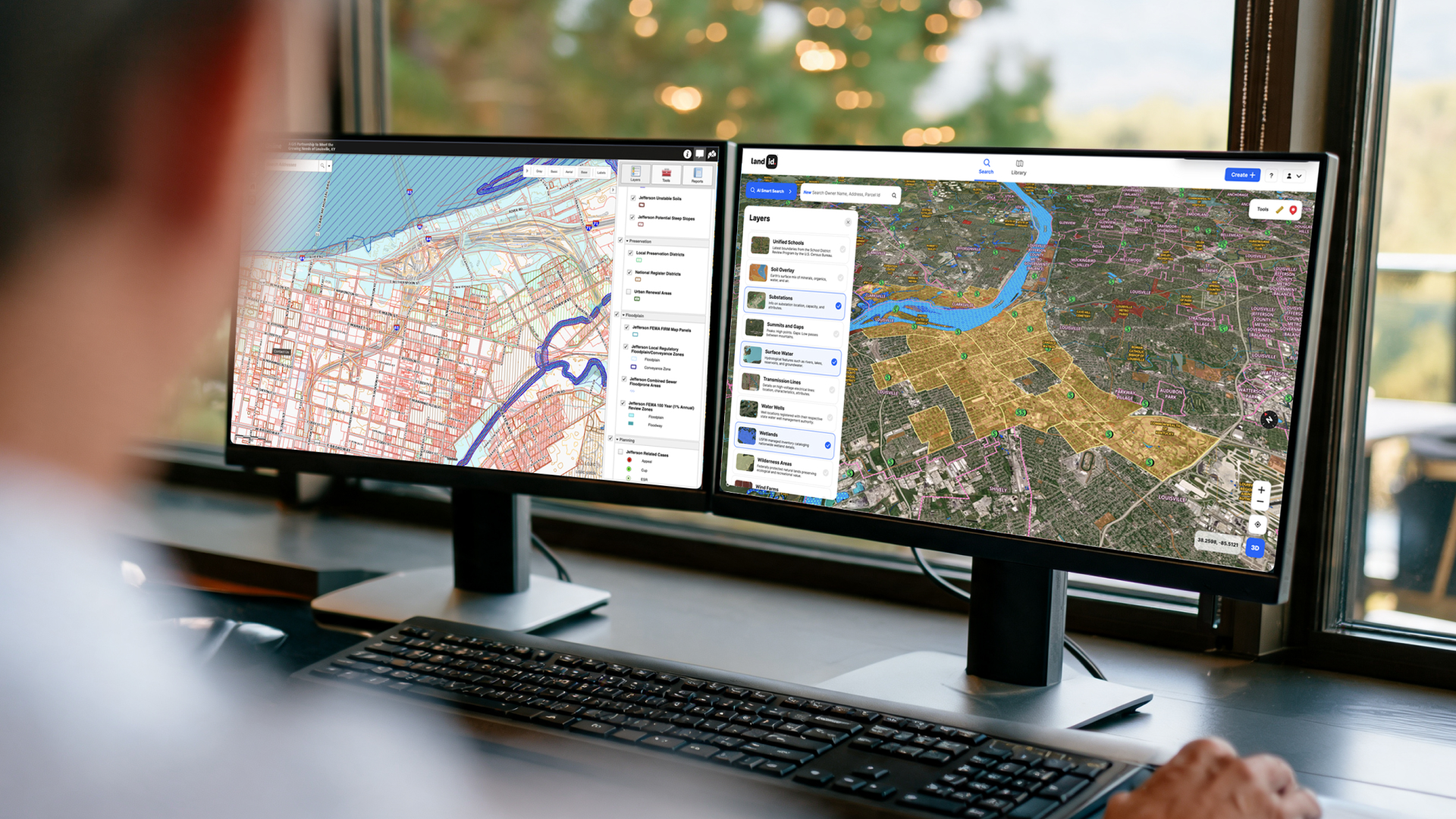
If you've spent any time researching land data tools, you've probably run into county GIS portals. They're free, government-run tools built for public records access. They show parcel boundaries, ownership data, and basic map layers.
Land id does some of that, too, but it’s built for a different job: giving real estate and property professionals one place to analyze land, layer in relevant data, annotate maps, create virtual property tours, access instant AI insights, and share work that keeps decisions moving forward.
So what's the actual difference, and why would you pay for one when the other is free?
The short answer: They're built for different jobs. Understanding that distinction will save you a lot of time and frustration.
What Is County GIS Software & Who Is it For?
County GIS portals are public-facing tools maintained by local government agencies. Their primary purpose is records management and public access to geographic data. Think of them as a digital extension of the county assessor's or recorder's office.
They're useful for looking up basic parcel information: ownership name, acreage, tax ID, sometimes a recorded deed or plat. Most counties publish this data for free because in many states, they’re required to provide public access to property records, and counties often satisfy this via free web portals.
Limitations of County GIS
County GIS sites are primarily repositories of local government data. They’re built for record-keeping, not for real estate pros.
They vary wildly from one jurisdiction to the next. Some are modern and functional. Others haven't been updated in a decade or more. Few of them let you do much beyond zooming in and clicking a parcel to see who owns it. You can't layer in flood data, soil composition, or topography. You can't draw a boundary, drop a pin, or share a map. And if you're working across multiple counties, you're opening multiple browser tabs and manually reconciling data that was never designed to work together.
For a real estate professional building a picture of a property or a portfolio, relying on county GIS quickly runs out of functionality.
What Is Land id & Who Is It For?
While county GIS offers official property records, Land id brings 40+ datasets from federal, state, county, and commercial sources into one place.
Land id is built for real estate professionals who need to understand, present, or transact on property—from land and ranch brokers to residential agents, commercial brokers, developers, and appraisers.
Advantages of Land id vs. County GIS
Search Beyond a Single County
Land id’s AI Smart Search lets you search by address, coordinates, owner name, or APN. You can also view an owner’s entire property portfolio and pull parcel data across county lines without jumping between GIS websites.
See More Than Parcel Boundaries
Layer parcel data with soil composition, flood zones, elevation, wetlands, surveys, and other property information. Instead of simply looking up a parcel, you can see the factors that shape how a property can be used.
Turn Property Data Into Maps & Virtual Tours You Can Share
Build custom property maps that help communicate what matters to a buyer, seller, or partner. You can also create a shareable virtual outdoor property tour in minutes.
Take Property Data Into the Field
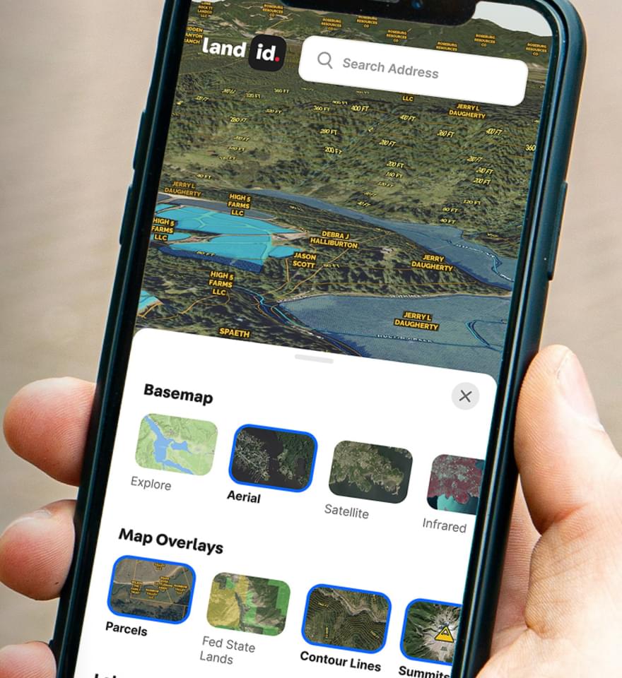
The Land id mobile app keeps your maps and property data with you in the field. Pull up parcel information on-site, even if you’re offline, instead of waiting until you’re back at your desk.
Everything stays in one place, so you spend less time bouncing between county websites and more time actually working.
Where Land id & County GIS Overlap in Property Data
Both tools display parcel boundaries and ownership data. Both are map-based. And for a quick ownership lookup on a single property in a county with a functional GIS portal, either one will get you there.
That overlap is also where the confusion starts.
Because they look similar on the surface, it's easy to assume one is just a fancier, paid version of the other. They're not. The similarity stops at the parcel lookup.
Differences Between Land id & County GIS
The real difference comes down to what happens after you find the parcel. County GIS ends at the lookup. Land id starts there.
Once you've identified a property, Land id lets you build on that foundation: annotate, layer, calculate, share, and present. It's designed around the workflows that real estate professionals actually run, start to finish:
- Researching a property before you go onsite
- Pre-qualifying buyers with a shared map of a property of interest
- Walking a property with the mobile app showing your live location
- Driving a custom map with a survey or plat map overlaid live via CarPlay
- Accessing saved maps offline while out in the field to continue customizing
- Packaging a listing with a custom map that shows off what the land data actually reveals about a parcel
County GIS also doesn't travel well. It's jurisdiction-specific, browser-based, and built for one-at-a-time lookups. Land id is built for professionals who work across geographies, deals, and teams.
Here’s a more detailed breakdown of the differences between Land id and county GIS records.
Water
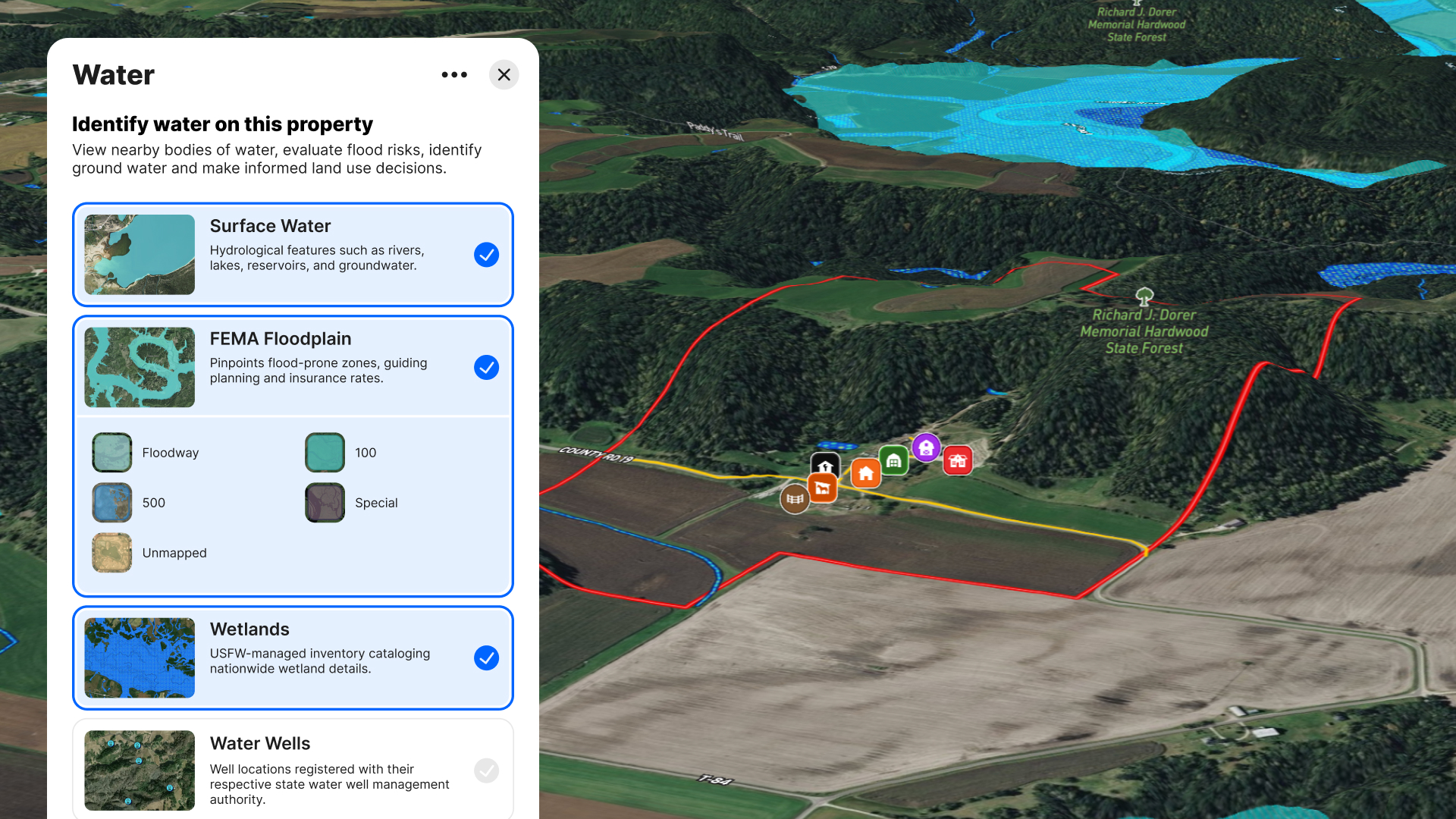
County GIS often includes only a handful of water-related layers, and they vary widely from county to county.
Land id brings together:
- Surface Water
- FEMA Floodplain
- Wetlands
- Water Wells
- Principal Aquifers
- Major Aquifers
- Minor Aquifers
- Water Districts
These datasets help answer questions like:
- Is there groundwater nearby?
- Is the property inside a utility service area?
- Where are nearby wells?
- Is it located in a floodplain?
- Are wetlands likely to affect development?
Terrain & Natural Resources
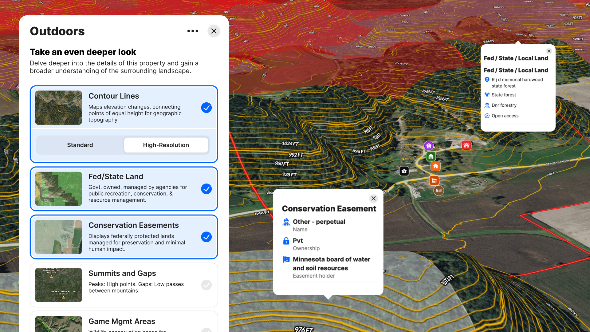
Many counties provide contours—if they provide them at all.
Land id combines:
- Standard contour lines
- High-resolution 2-foot contours (currently at ~95% national coverage)
- Elevation visualization
- 3D terrain
- Soils
- Surface water
- Public lands
This makes it much easier to evaluate:
- Buildable sites
- Steep slopes
- Drainage
- Viewsheds
- Access
- Recreation potential
Boundaries
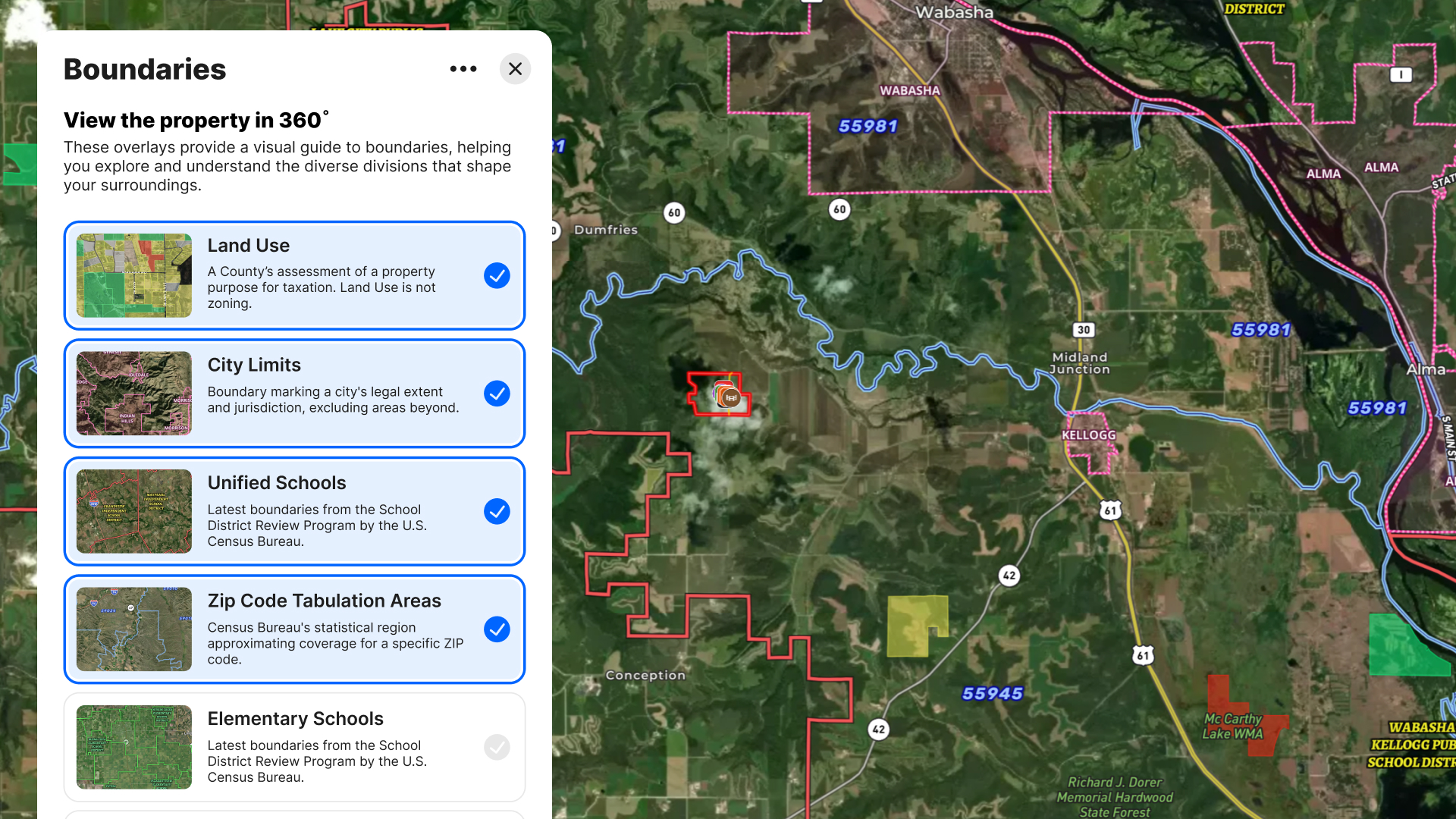
County GIS generally focuses on boundaries maintained by that county.
Land id adds many additional jurisdictional and planning boundaries, including:
- Property parcels
- City limits
- School districts
- Land use
- Opportunity zones
- Public lands
- Conservation easements
These become especially useful for developers, investors, and brokers who need broader planning context.
Infrastructure
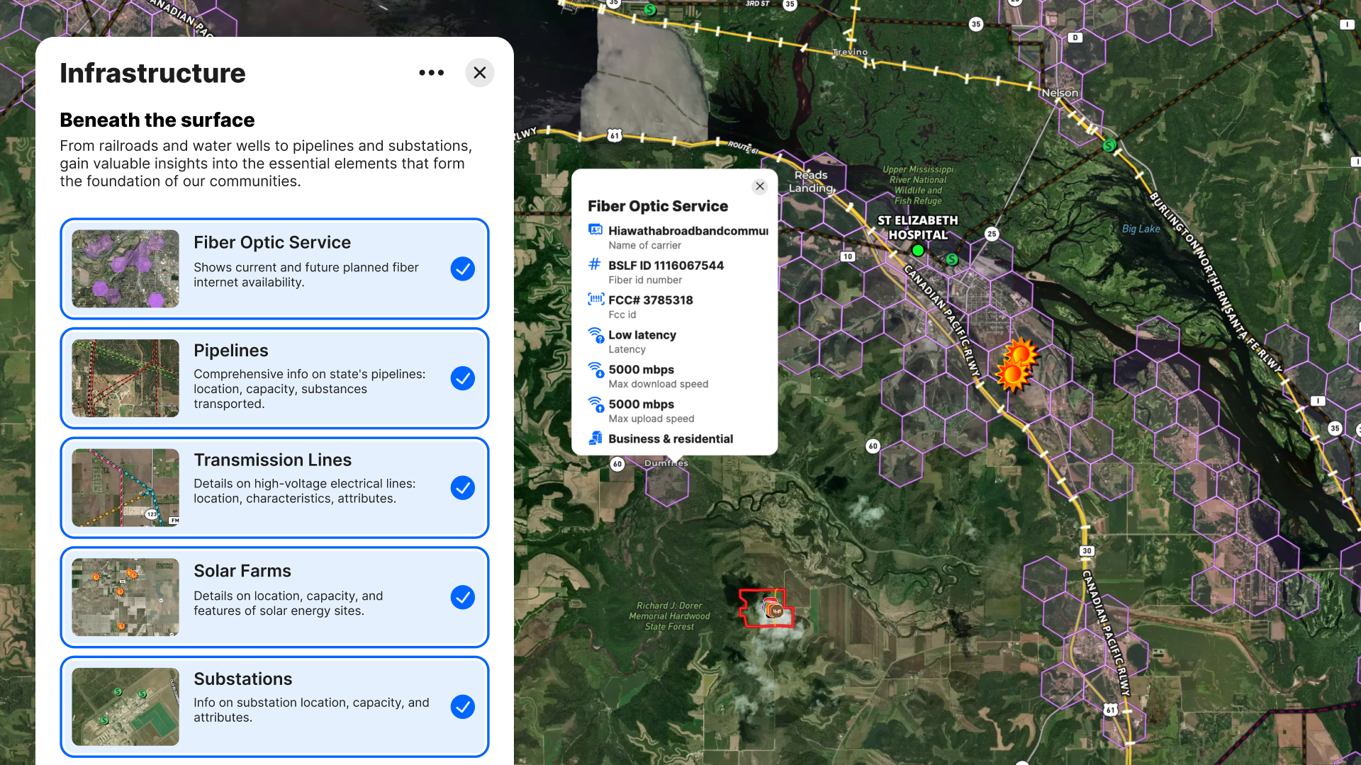
County GIS often has roads and perhaps utilities owned by that county.
Land id layers together infrastructure from many sources, including:
- Roads
- Railroads
- Electric transmission lines
- Pipelines
- Electric substations
- Wind farms
- Solar farms
- Airports
These layers are valuable for:
- Energy development
- Site selection
- Due diligence
- Easement planning
- Access evaluation
Very few county GIS systems present all of these datasets together.
Nearby & Community Context
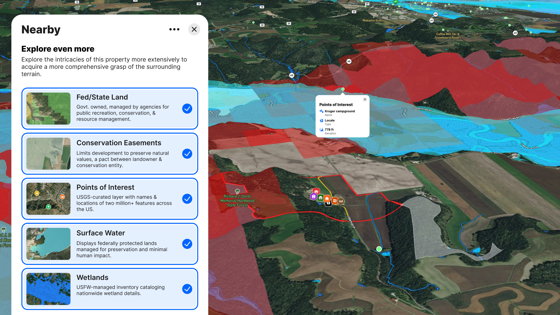
Land id also includes overlays that help users understand what surrounds a property.
Examples include:
- Housing developments
- Points of interest
- Public lands
- Airports
These are particularly helpful for:
- Real estate marketing
- Development feasibility
- Buyer presentations
County GIS websites often stop at parcel-level information and provide little surrounding market context.
Soil Intelligence
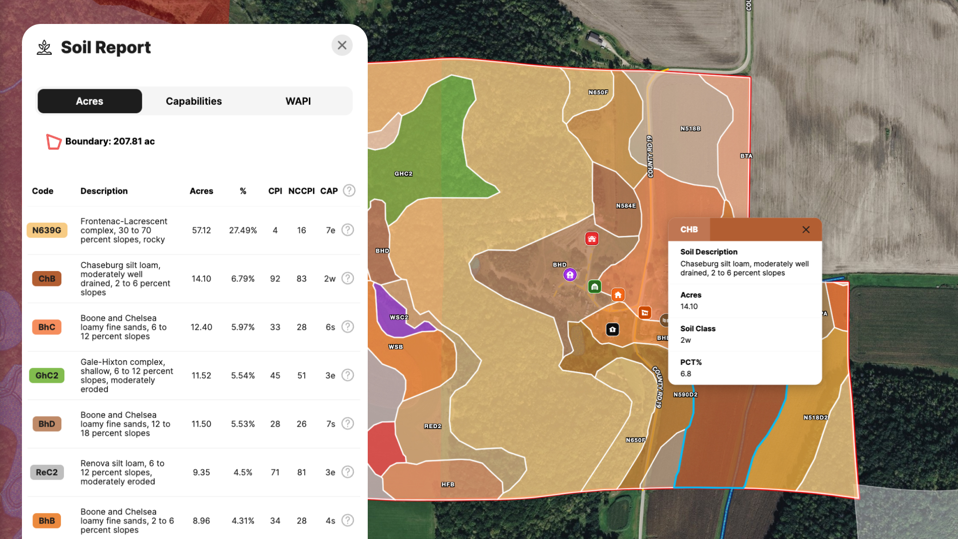
Most county GIS websites either don't include soils or simply link users to the USDA Web Soil Survey.
Land id integrates:
- SSURGO soils
- Soil capabilities
- Soil limitations
- Soil reports
- Printable soil maps
How This Plays Out in Practice
The gap between the two tools becomes clear when you look at what real estate professionals actually need to get a deal done.
Imagine researching a property for development.
A county GIS might require you to visit:
- County Assessor
- County GIS
- FEMA Map Service Center
- USDA Web Soil Survey
- State/federal wetlands database
- State water resources department
- Utility maps
- USGS elevation tools
Land id combines deep property data with custom mapping and marketing tools to tell the whole story of a property in one view.
- A land and ranch real estate agent preparing for a buyer tour needs a clean, shareable virtual property tour or map that shows parcel lines, topography, water features, and access points, put together quickly before the appointment.
- A residential real estate agent working with buyers can send a link to the Land id, showing insights around proximity to amenities, neighborhood profile, nearby schools, and other livability factors to help clients pre-qualify properties.
- A commercial broker evaluating a site for retail or mixed-use development needs to visualize traffic corridors, parcel footprints, and infrastructure proximity in one place, not across three county portals.
- A property developer assessing a large parcel needs to layer flood zone data, wetland boundaries, slope analysis, and utility infrastructure, then cross-reference that with a survey image overlay to validate what's on the ground.
In each of these scenarios, a county GIS portal might be the first stop for a quick ownership confirmation. It's rarely the last stop for anyone doing real work on the deal.
Where County GIS Has the Advantage
It's important to recognize that county GIS remains the authoritative source for many local government records.
County GIS may provide:
- Official parcel geometry
- Tax assessment records
- Property tax status
- Recorded plats
- Local zoning maps (where available)
- Building permits
- Address assignments
- Election precincts
- Local utility assets
- County-maintained infrastructure
- Planning and permitting information
Those are official government records, and Land id is not intended to replace them.
So, Do You Need Both?
For most real estate professionals, county GIS portals are a free resource worth knowing about, especially for quick lookups when you're in a county with a solid portal. They're one data source among many.
Land id consolidates those data sources into a single platform and adds the tools you need to actually use that data in your work. It's not redundant with county GIS. It builds on it.
County GIS tells you what the county knows about a property. Land id combines what the county knows with dozens of additional nationwide datasets to help you research, evaluate, understand, and communicate the full story of a property.
If your work involves real estate, and you're spending time stitching together data from multiple county portals, switching between browser tabs, and sending clients screenshots instead of shareable maps, Land id is worth a closer look.
FAQs
See Land id In Action
Research, analyze, share, and showcase real estate, all in one place.
Continue Reading
Prospecting, Part 2: Find Off-Market Properties

By Land id
Find off-market properties before your competition does. 8 proven strategies for real estate agents—from absentee owner lists to parcel data.
Absentee Owner Lists: What They Are, Why They Convert & How to Get Them
By Land id
Absentee owner lists are one of the most reliable ways to find off-market opportunities before your competition does. Here's how to do it in Land id.

Explore Private Parcel Data & Property Boundaries
Download the Land id app and try for free.


