


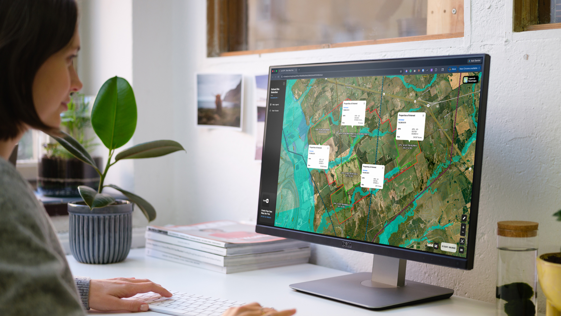
Live Interactive Map
Jason Carrico uses Land id® to map out high-value properties like this Ski-in Ski-out listing, so that viewers can get an in-depth perspective on its features and further explore the land. Take a look at this Land id® interactive map that Jason Carrico has created down below to get a better view. (Try toggling on some overlays to view the owner names of neighboring properties, land use, water features, and more!)
My favorite tool on Land id® is the Geo Referencing Tool. I've enjoyed learning about how it works to accurately pinpoint the boundaries and location of a property."

Jason Carrico Sales Associate with The Big Sky Real Estate Company

Wildlife, Terrain, & Improvements
Nestled beneath the expansive Montana sky, Big Sky offers a haven for diverse wildlife and some of the most breathtaking terrain in the world. The region is teeming with indigenous fauna, from elusive elk and majestic moose to the occasional glimpse of deer. The sprawling landscapes, framed by the iconic Lone Peak, present a picturesque backdrop for those seeking a harmonious blend of natural beauty and upscale living. With an array of outdoor activities such as hiking, fishing, and wildlife photography, the area provides a unique opportunity to immerse oneself in the untamed wilderness.
The luxurious residences and world-class golf courses create an oasis against the rugged backdrop of the mountains. As the sun dips below the horizon, the thriving cultural scene in Big Sky comes to life, offering a vibrant social experience. Life extends beyond the property lines, encompassing a community where every moment is an exploration of refined living in the heart of the American West.
FAQs
Continue Reading
Craig Rowe
Prospecting, Part 3: Find Land Faster
.png)
By Land id
How real estate investors and developers can use Land id to discover and analyze land-buying opportunities in less time.
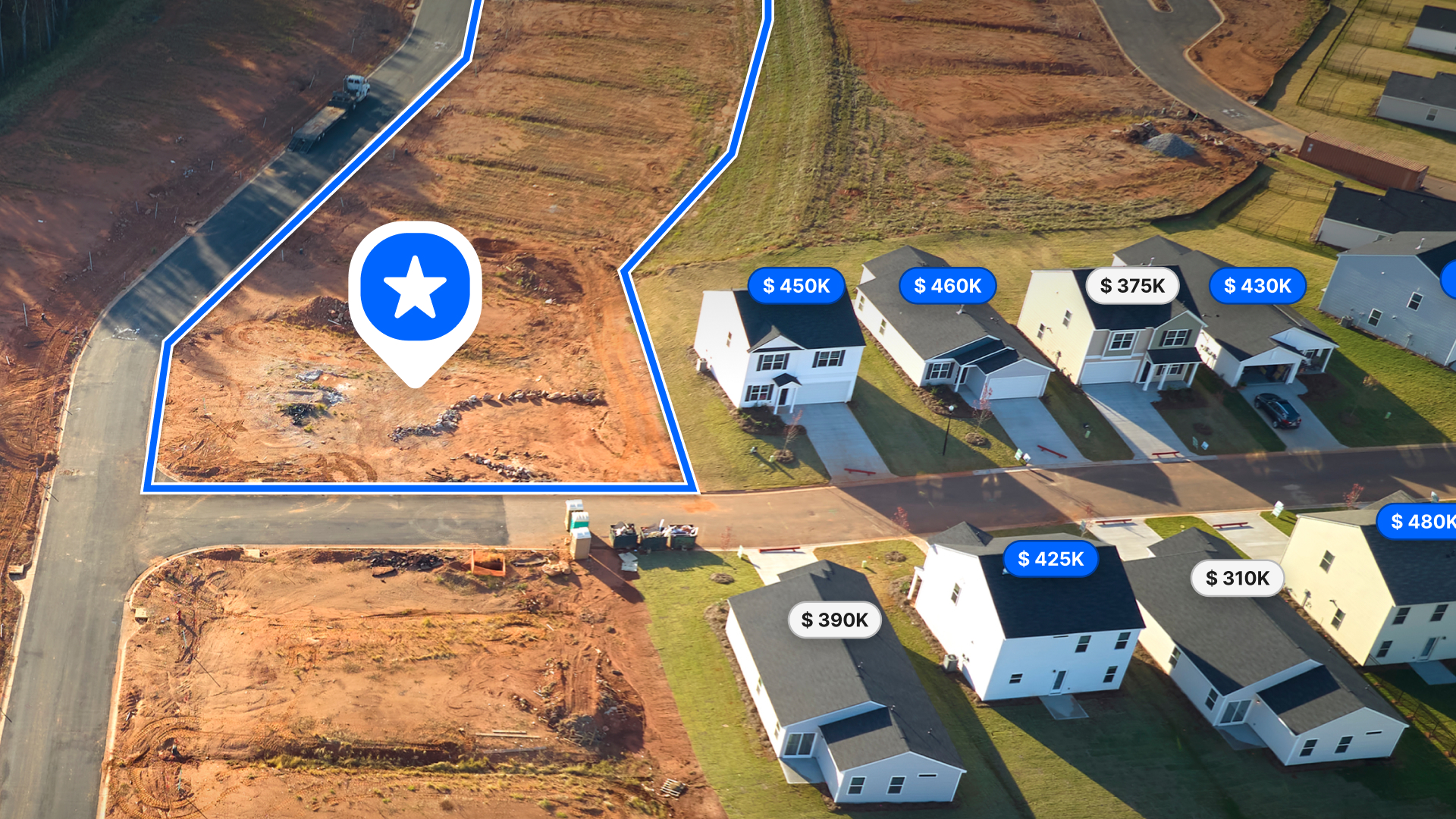
How to Price Land for Sale Using Comparable Sales Data
By Land id
Learn how to price land using comparable sales. Find, analyze, and adjust vacant land comps to price listings accurately and sell with confidence.

Explore Private Parcel Data & Property Boundaries
Download the Land id app and try for free.
