

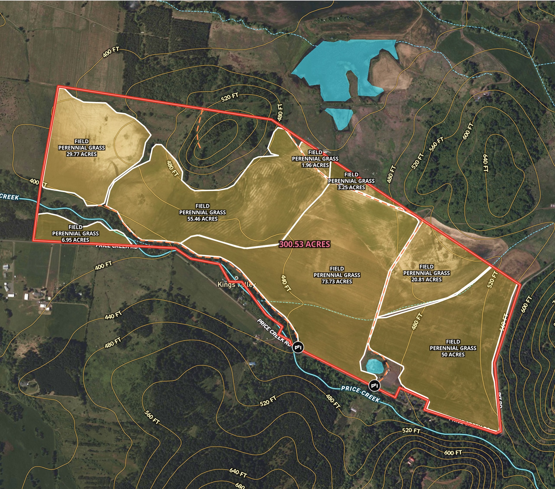
Oregon Farmland Overview – 300 Acres
Angie LaPointe uses Land id® GIS mapping software to showcase land parcels with a detailed property map, ideal for real estate marketing and topography insights.
Listing
Agricultural
Rural
Soil
Water
Trusted by Industry Pros


