When you're selling a development site, the property itself is only part of the story. Buyers want to know what's happening around it: Are other developers already active in the area? Is this a market on the move?
Chris Pfau, a licensed commercial and residential real estate broker at Coldwell Banker Pro West Real Estate in Southern Oregon, built this companion map alongside his Normal Neighborhood Development listing to answer exactly those questions.
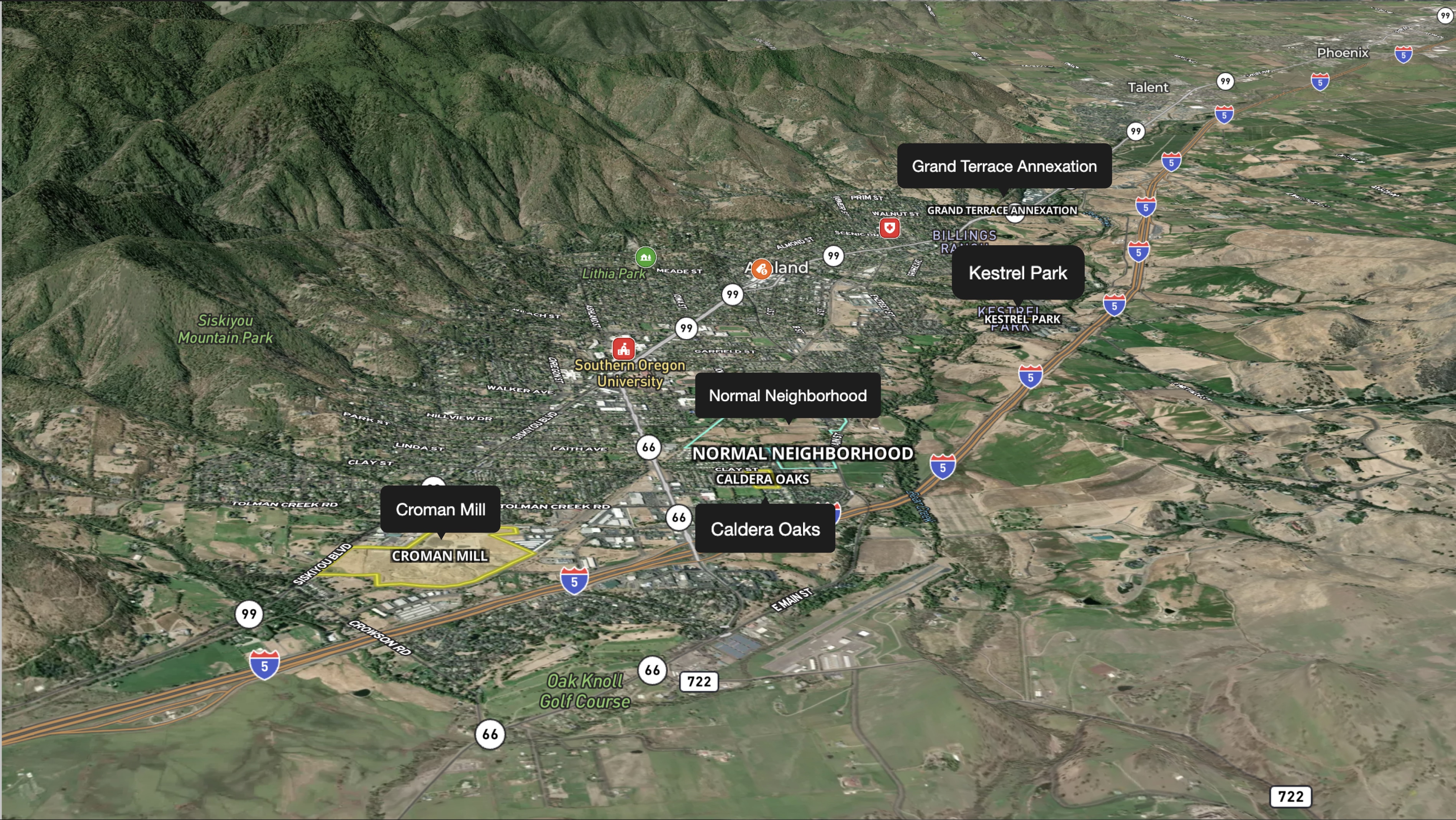
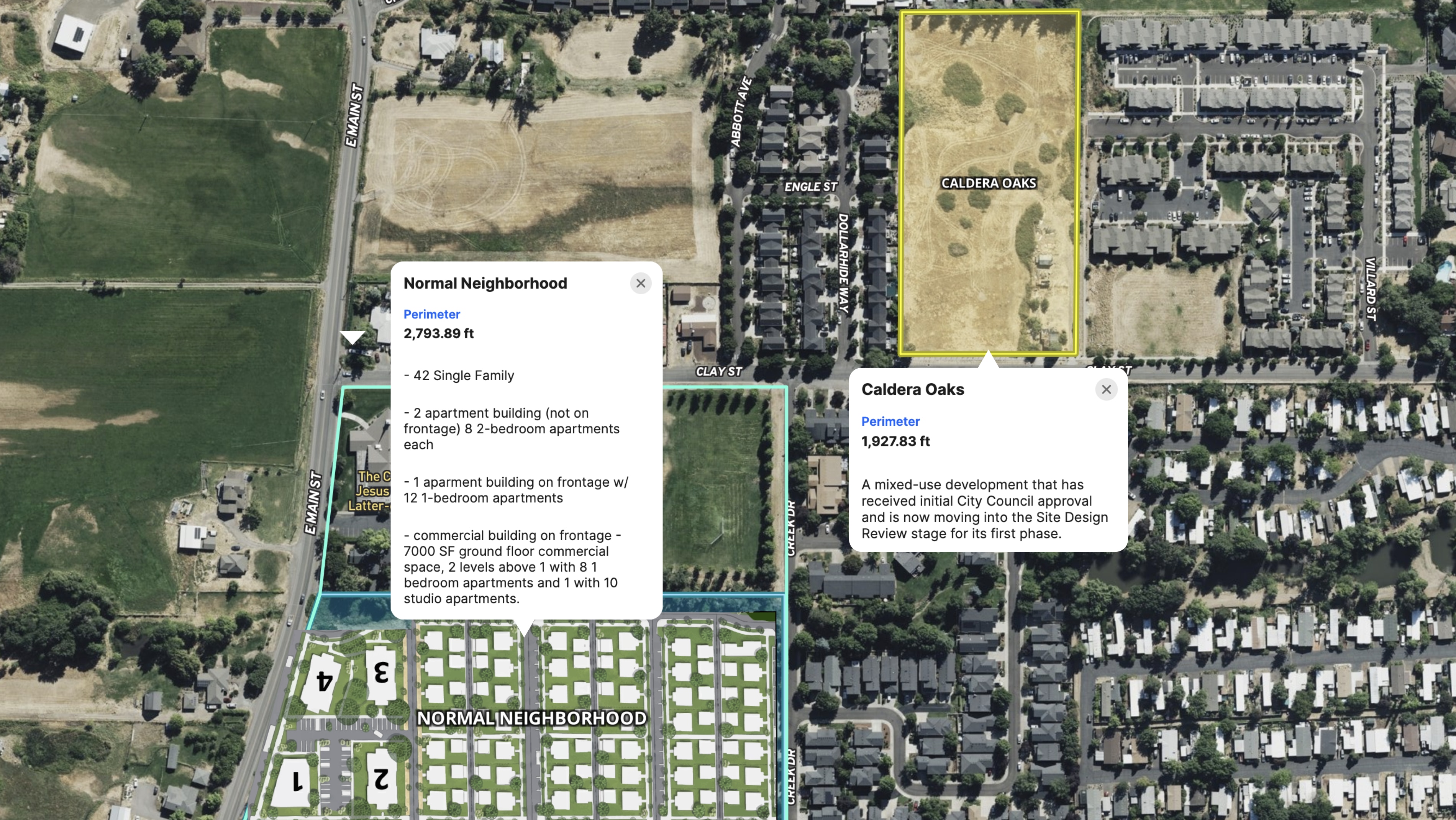
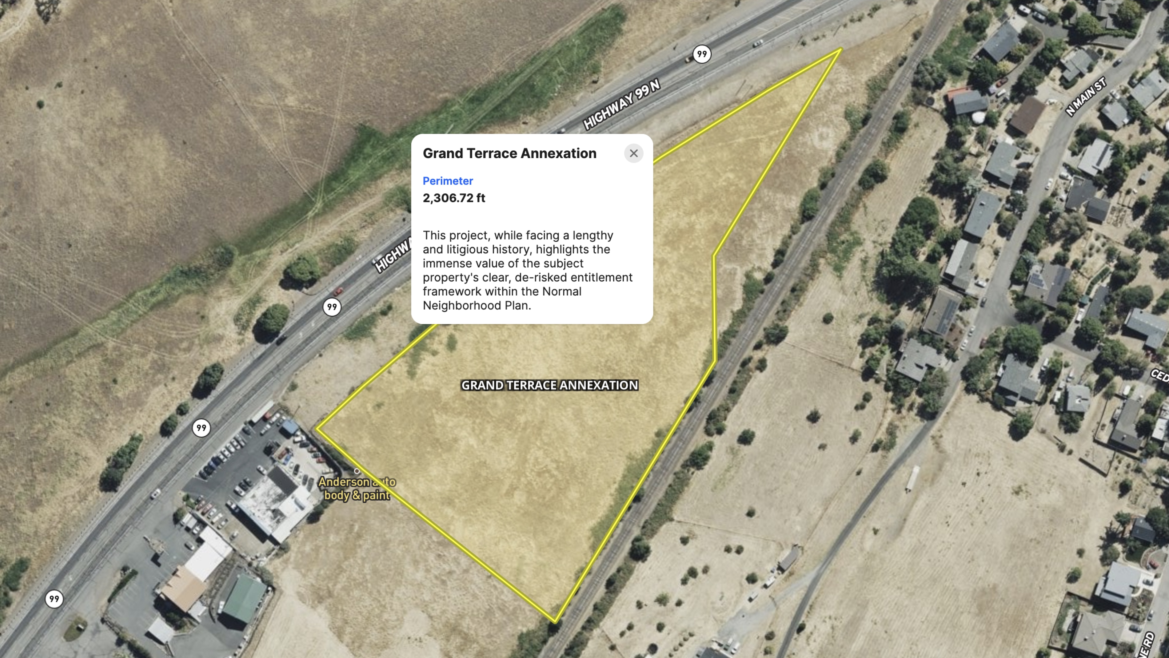
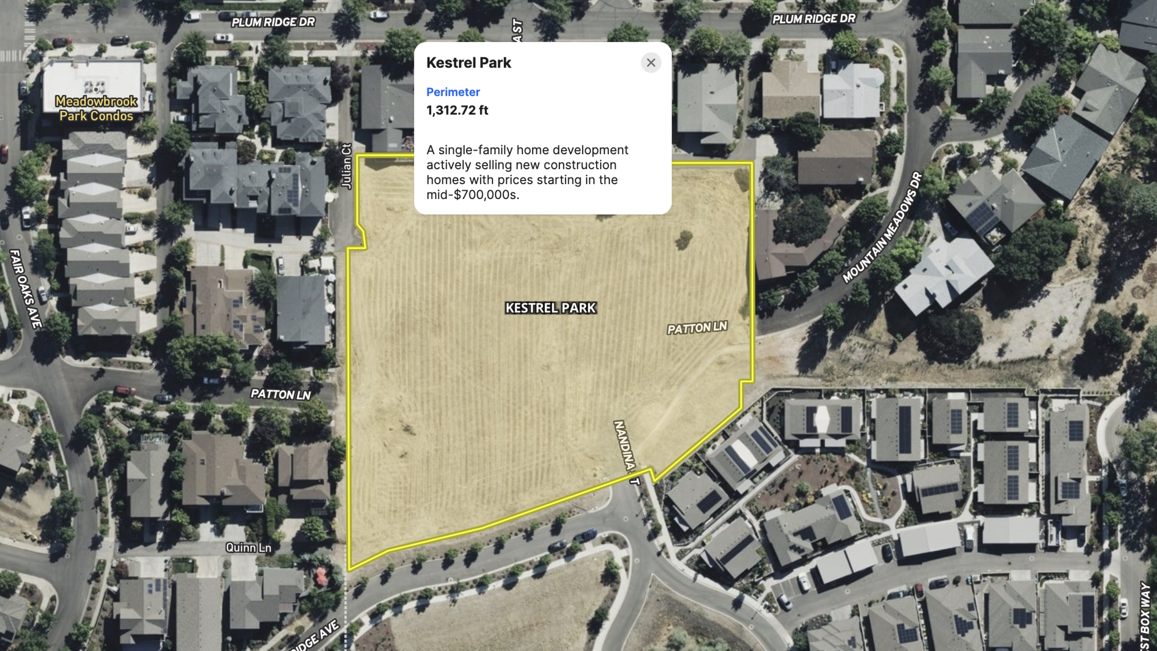
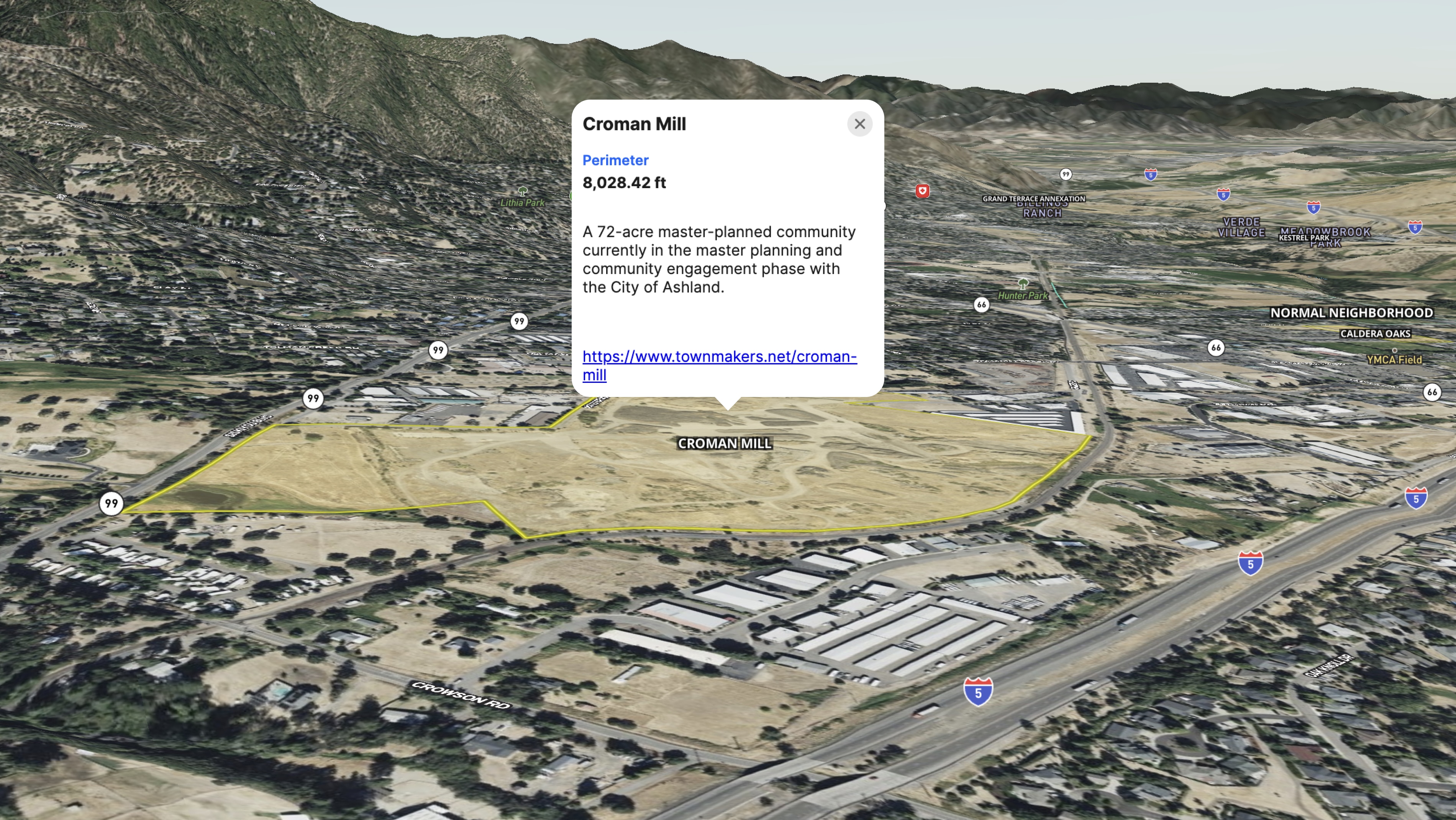
The map shows where the listed property sits in relation to other active developments in Ashland, OR—including proximity to Southern Oregon University, downtown, the hospital, and key corridors.
Built using Land id's drawing tools and labels, the map gives buyers spatial context they can't get from a listing description or a satellite image. It tells the larger story: This site isn't isolated. It's in the middle of an active, growing market with identifiable demand drivers.
Together with the detailed Normal Neighborhood Development Map, this context map gives prospective buyers and investors a complete picture of the opportunity. Land id makes it easy to build both views—one for the property itself, one for the market around it—and share them as part of a cohesive listing package.
Learn How to Create a Project Like This
- Land id for commercial real estate
- Quick start: Create and share a map in Land id
- Draw detailed maps by adding items
- Add labels to maps and mapped items
- Airports Overlay
- Points of Interest Overlay
Take Your Mapping to the Next Level
Mapping is just the beginning. Land id is the #1 tool for researching, discovering, and showcasing land, and we're here to help you make the most of it, every step of the way.