Commercial land listings live or die on context. A buyer evaluating an outparcel on a main corridor needs to understand the road frontage, traffic exposure, neighboring tenants, and how the parcel could be subdivided.
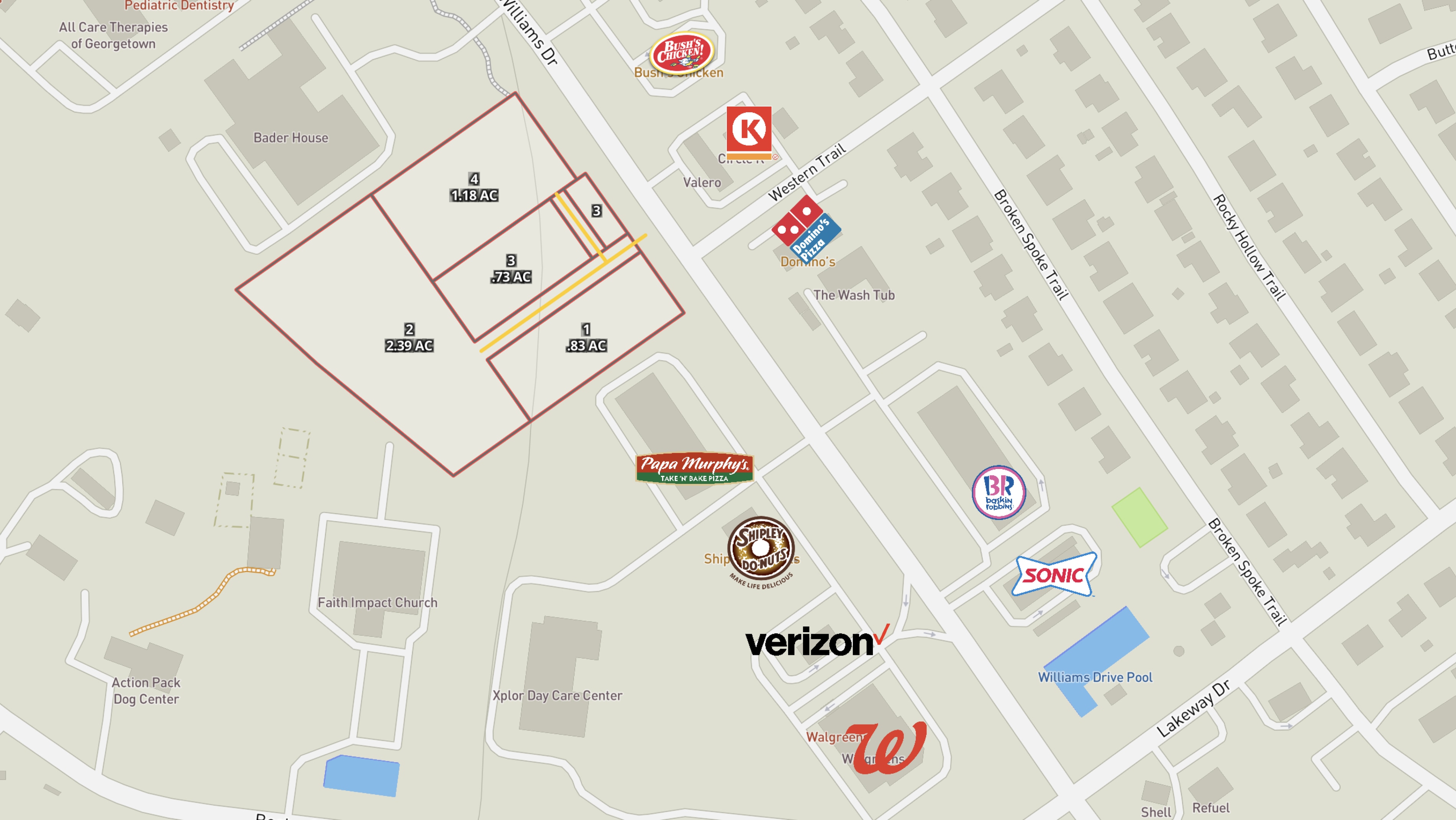
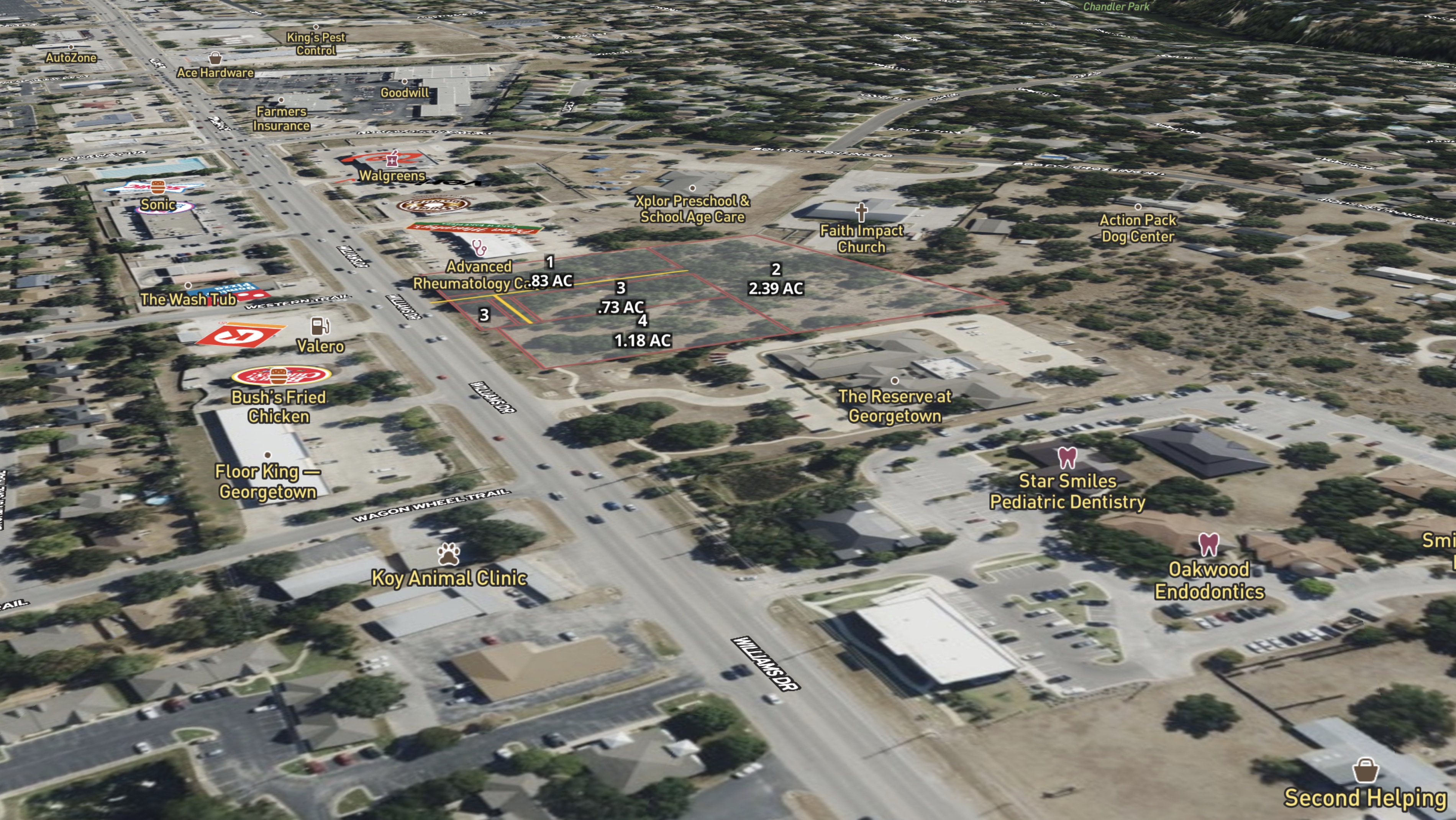
Mason Turner, CRE Broker at Turner Commercial Properties, uses Land id to market a commercial land opportunities, like this one at 3400-3500 Williams Dr. in Georgetown, TX. The site sits on one of Georgetown's main commercial corridors—a high-visibility location suitable for a range of commercial ventures—and the map communicates exactly why.
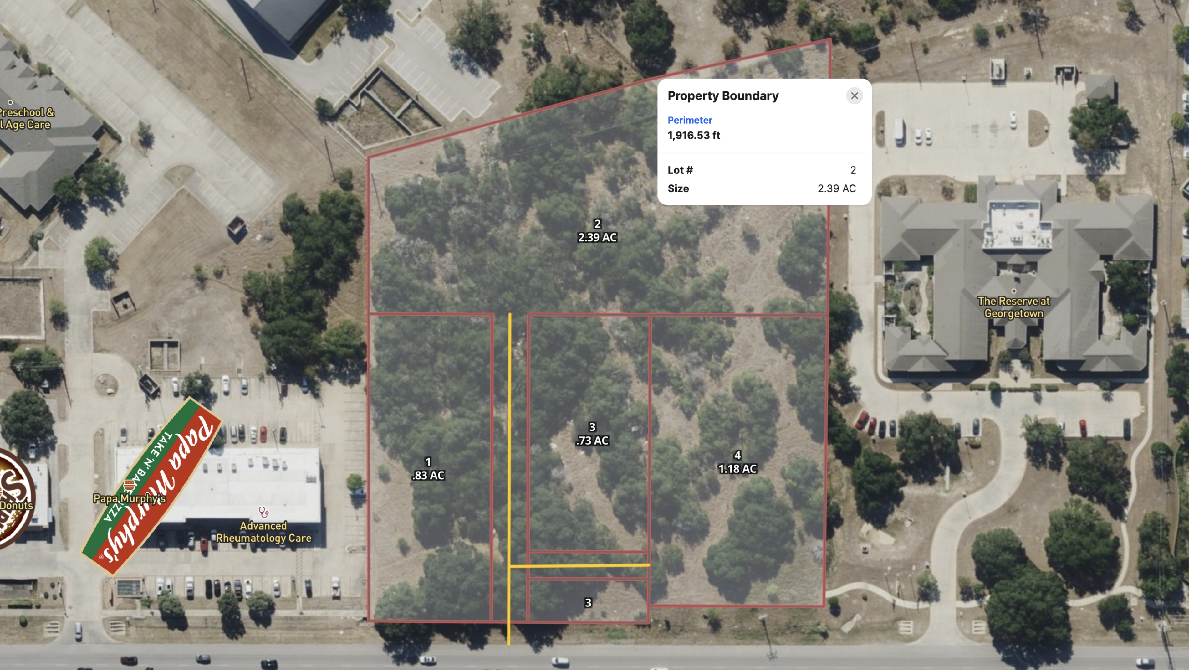
Turner used the drawing tool, georeference tool, and measurement tool to mark boundaries, import site plans, and quantify dimensions and road frontage. The resulting map gives buyers an immediate visual grasp of the property's shape, size, and potential.
Adjacent national tenants are visible in context, reinforcing the site's commercial credentials. Proposed subdivision lines show how the parcel could be split into smaller outparcels, thereby opening the investment to a broader pool of buyers.
For CRE brokers, Land id makes it possible to put every piece of the pitch—location, dimensions, access, and development potential—into a single interactive map that buyers can explore on their own terms.
Learn How to Create a Project Like This
- Land id for commercial real estate
- Quick start: Create and share a map in Land id
- Draw detailed maps by adding items
- Import surveys and site plans with the Georeference Tool
- Add labels to maps and mapped items
- Measurement tool
Take Your Mapping to the Next Level
Mapping is just the beginning. Land id is the #1 tool for researching, discovering, and showcasing land, and we're here to help you make the most of it, every step of the way.