A development lands better when the people who'll live next to it understand the vision early. That’s why John Hillman uses Land id.
Hillman and his wife founded Cabana Lane, a full-service brokerage, interior design firm, home builder, and development consultancy built around placemaking and historic architecture. Over a three-decade career, John has helped bring 12 communities to life.
Since 2024, Land id has been part of nearly every step of that work, from live-tracking his location in the field while walking lot corners to marketing finished communities with interactive maps, overlays, and media.
"We love [Land id]," John said. "It's a huge time saver because everything is in one space."
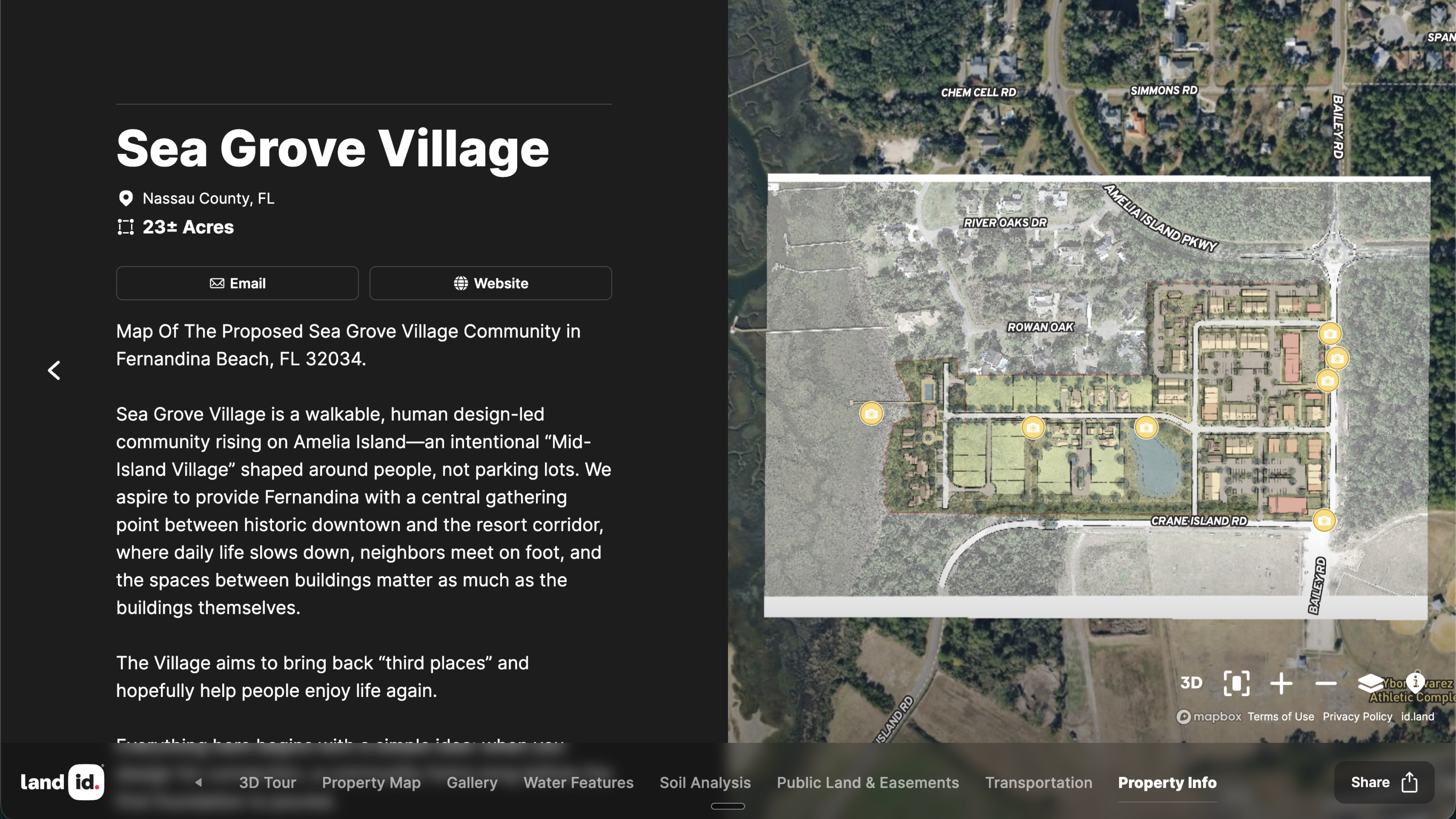
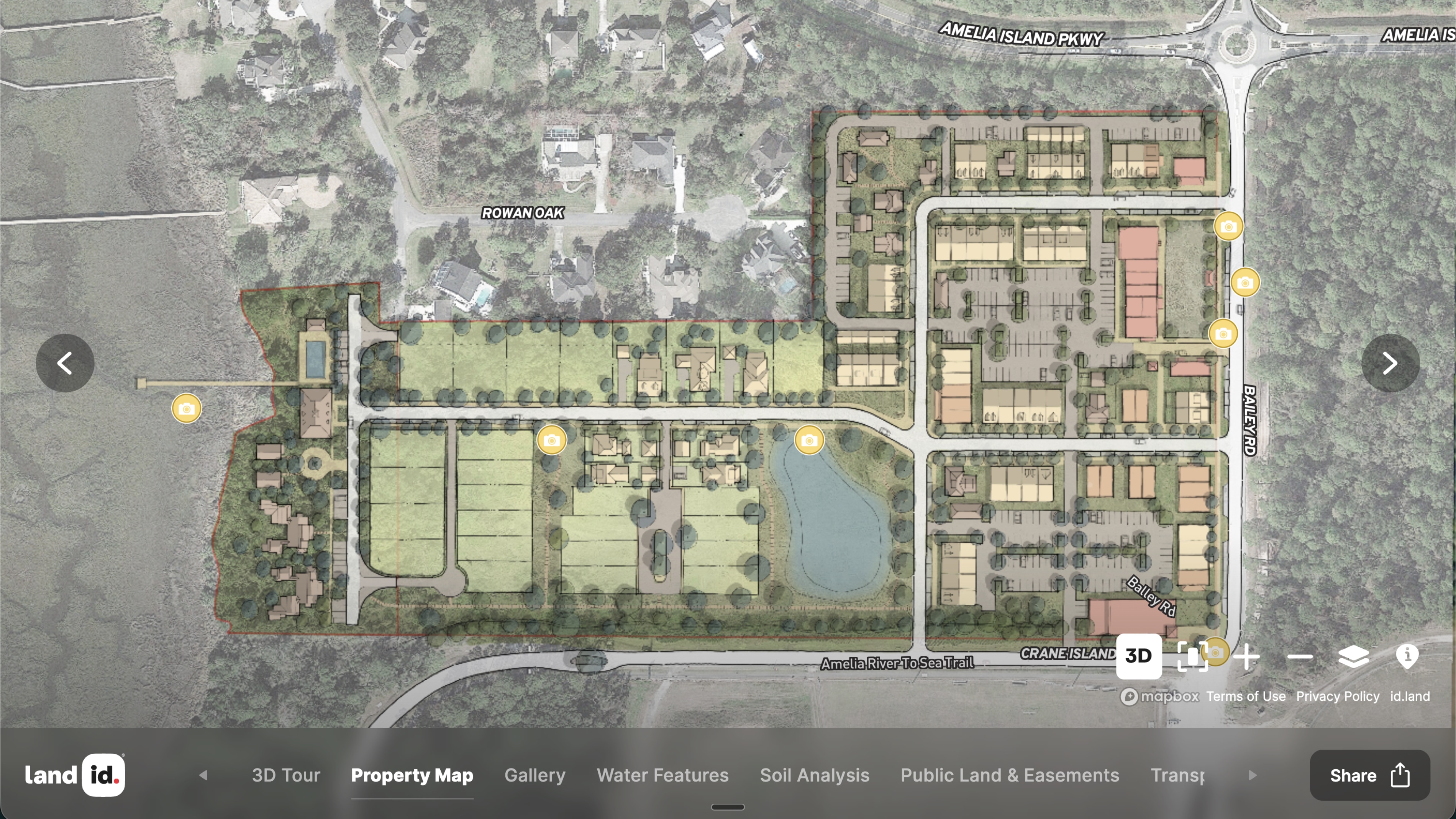
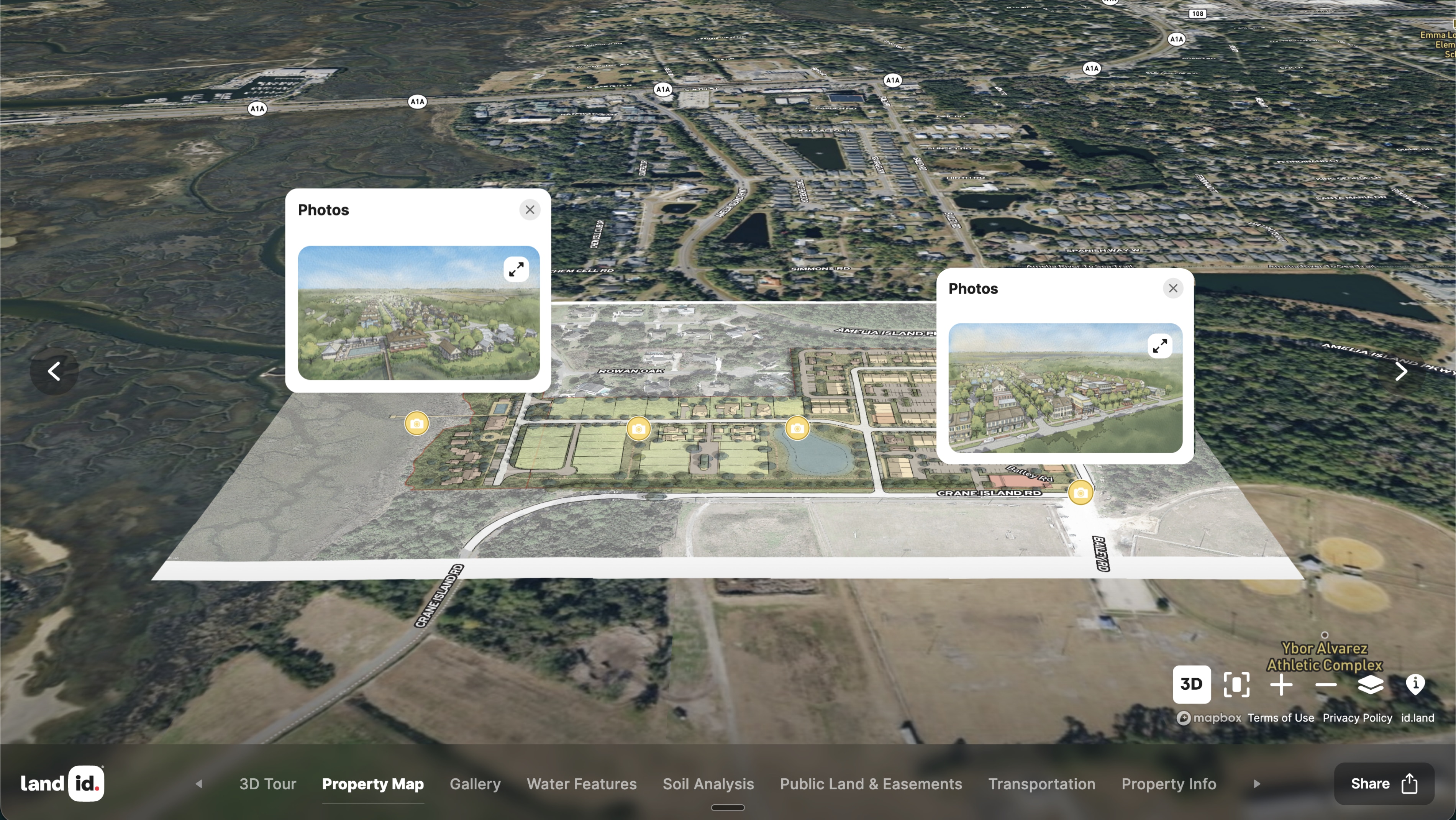
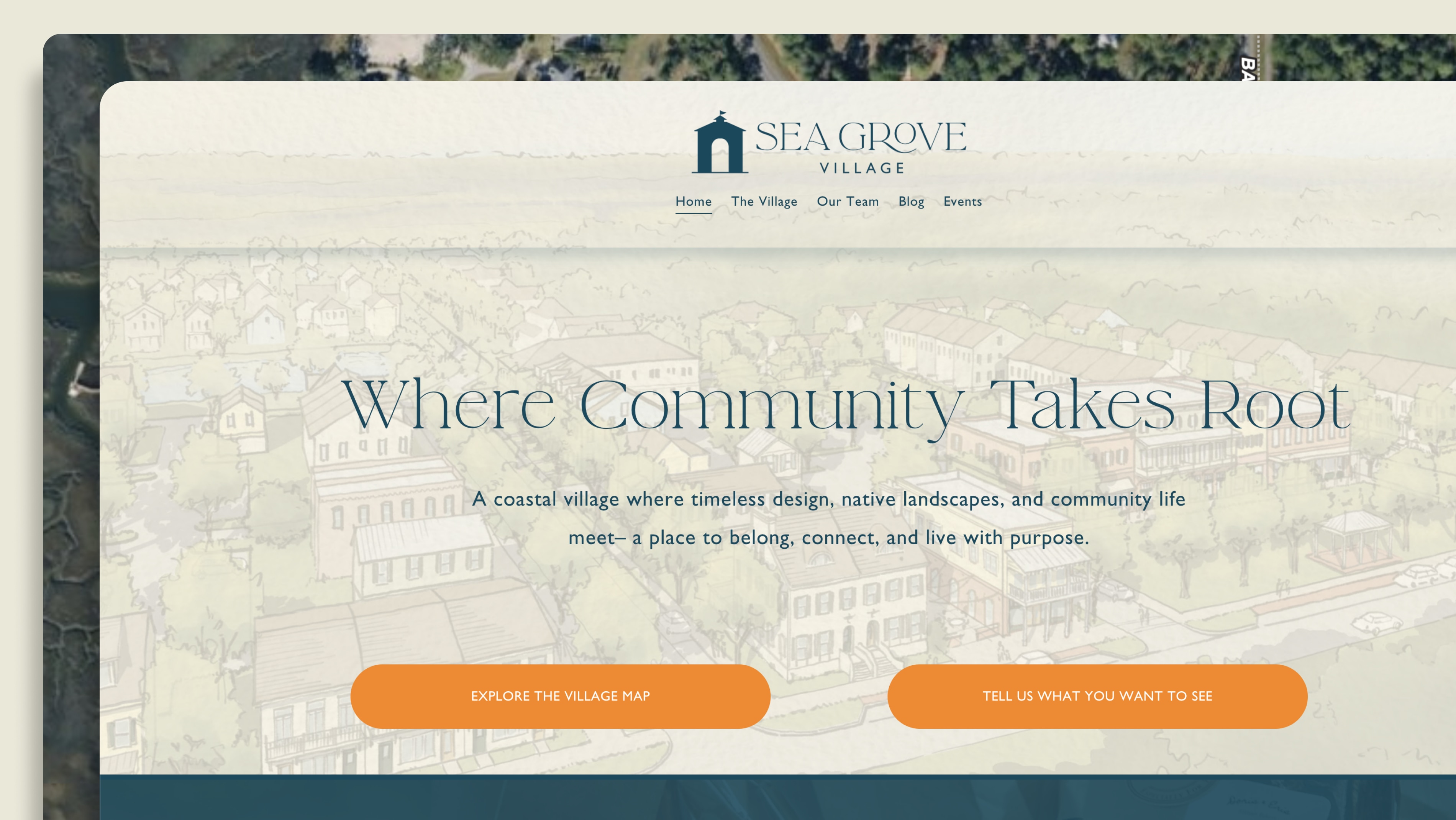
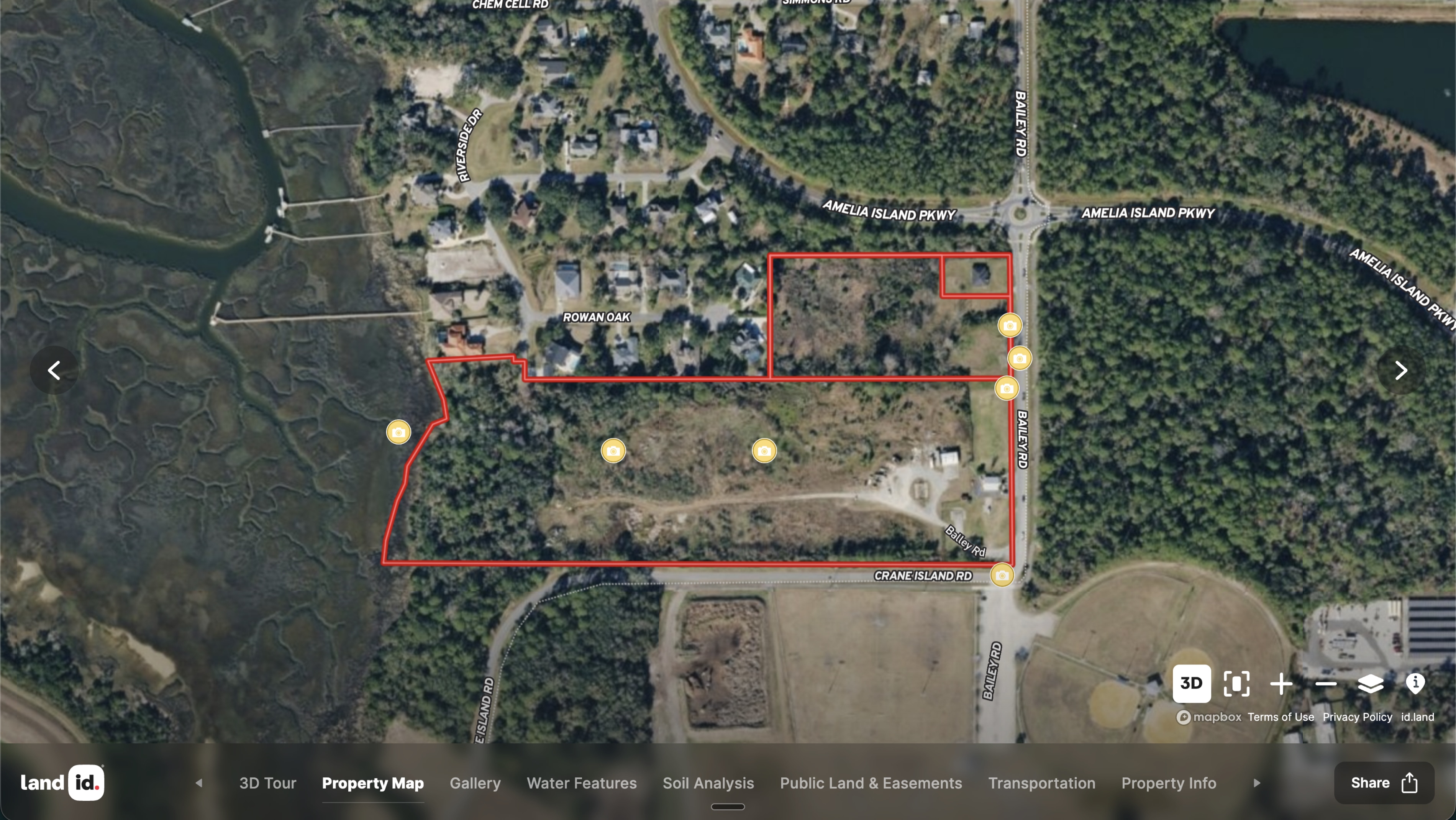
For Sea Grove Village, a new development in Florida, John and his team are using the map to bring the community itself into the process. It's linked directly from the development's neighborhood website alongside a survey asking residents how they'd like to see the project come together, so neighbors can see the vision and help shape it before it's built.
One map, doing double duty: a field tool for John's team, and an open door for a neighborhood to help design its own future.
Learn How to Create a Project Like This
- Land id for Property Development
- Create, Customize, and Publish a Virtual Property Tour
- Create detailed maps by adding items
- Add labels to maps and map items
- Embed photos, videos, 360-degree walkthroughs and more to maps
- Embed Land id maps or property tours onto your website
- Import surveys and site plans with the Georeference Tool
Take Your Mapping to the Next Level
Mapping is just the beginning. Land id is the #1 tool for researching, discovering, and showcasing land, and we're here to help you make the most of it, every step of the way.