

Map Categories
Thank you! Your submission has been received!
Oops! Something went wrong while submitting the form.
000
,
000

Planning
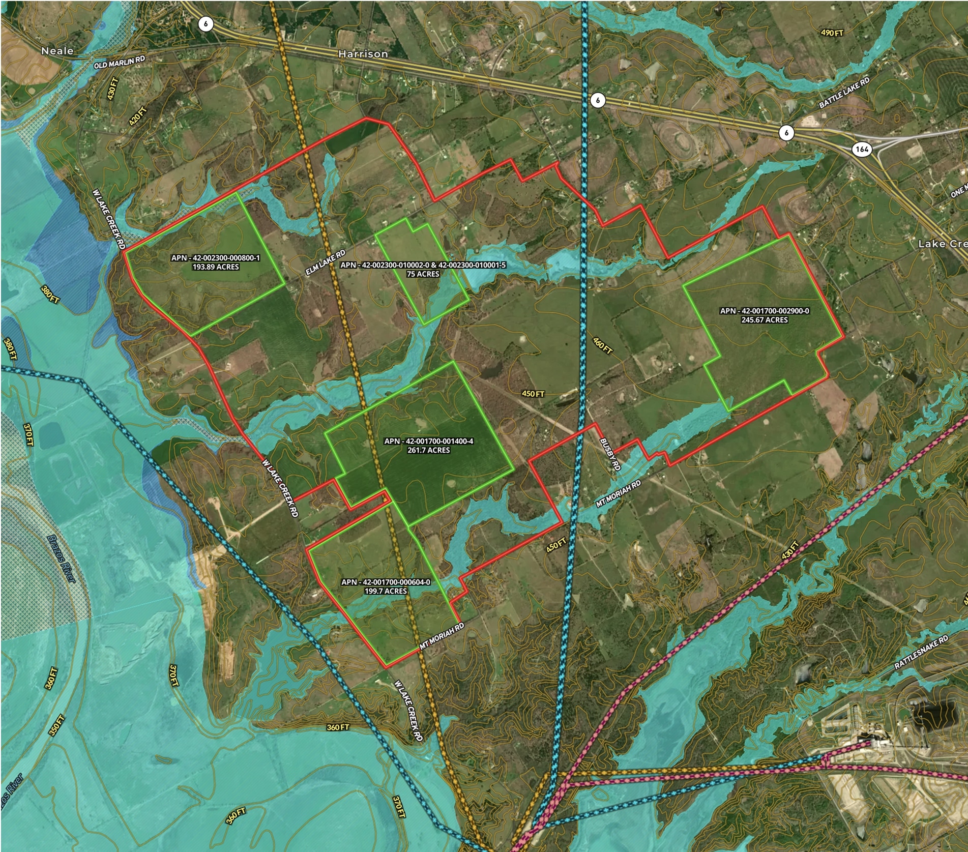
School Site Selection
Land id® GIS mapping software simplifies school site selection with real estate maps that visualize land parcels, floodplains, and infrastructure for smarter planning.
Municipality
Research
Planning
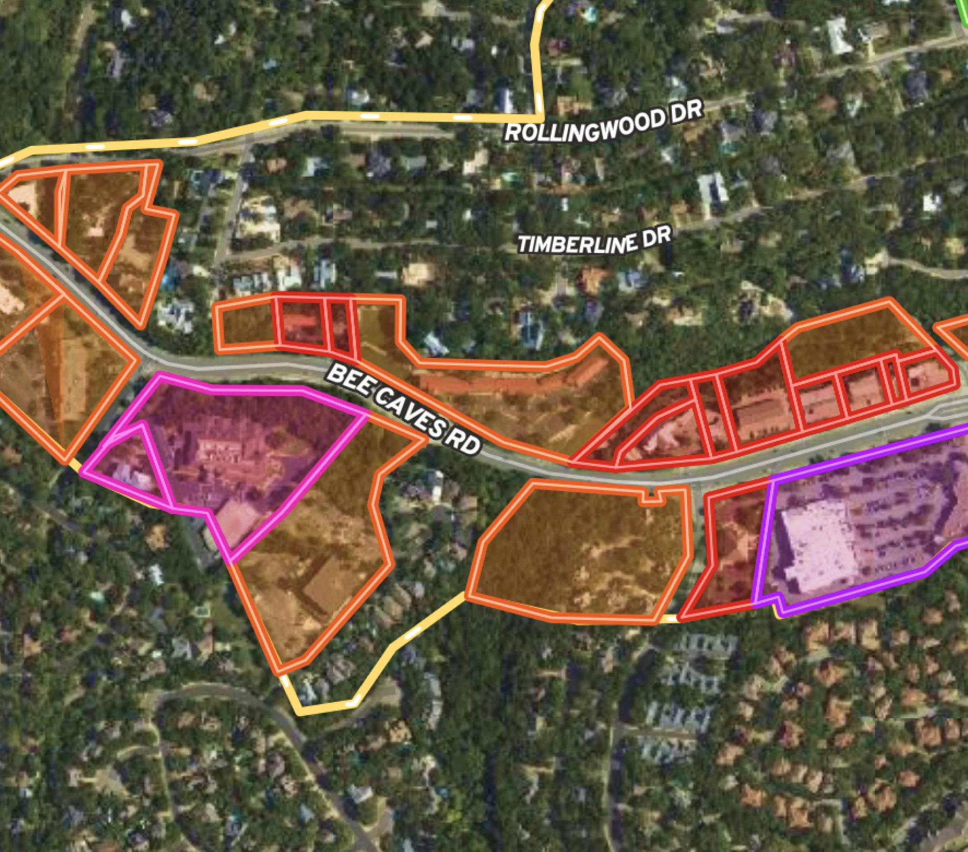
Municipality Map for Rollingwood, Texas
Use Land id® for effective city planning: map business districts, track project updates, and stretch budgets further.
Urban
Municipality


Recreation & Fun
City Bike Trails in Alameda Area
Explore Alameda's bike trails and parks on our interactive, modern city map.
Cycle
Urban
Municipality
Planning
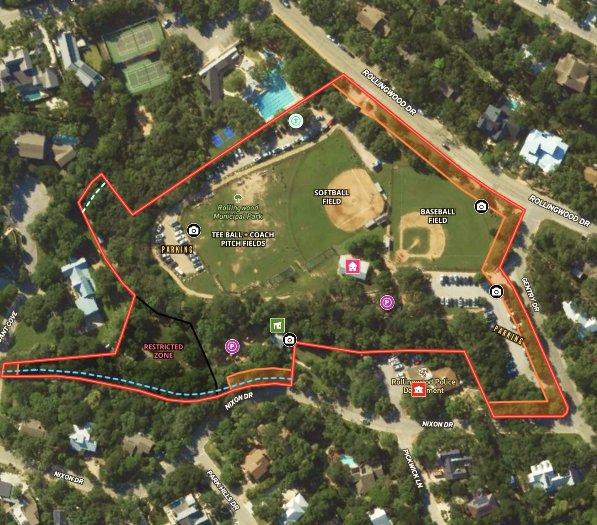
City Park in Rollingwood, Texas
Streamline city planning with comprehensive maps, highlighting features and regulatory zones for effective public and department use.
Urban
Municipality
Park