


We’ve been busy here at Land id, with four big updates now live—including major improvements to how you’ll market your property and map any project. Let’s see what’s new and why it matters for you.
Property Tour: The Easiest Marketing You’ll Ever Do
In about 3 minutes, Property Tour auto-generates a polished marketing slideshow—pulled directly from our extensive parcel data—that communicates a property's story quickly, easily, and intuitively.
Why It Matters
Property data is only useful if the person looking at it quickly understands what they're seeing. With Property Tour, your clients get it instantly (and you look like you prepared for hours).
Read more about Property Tour and how it works.
2-Foot Contour Lines: Catch Terrain Problems Before They Cost You
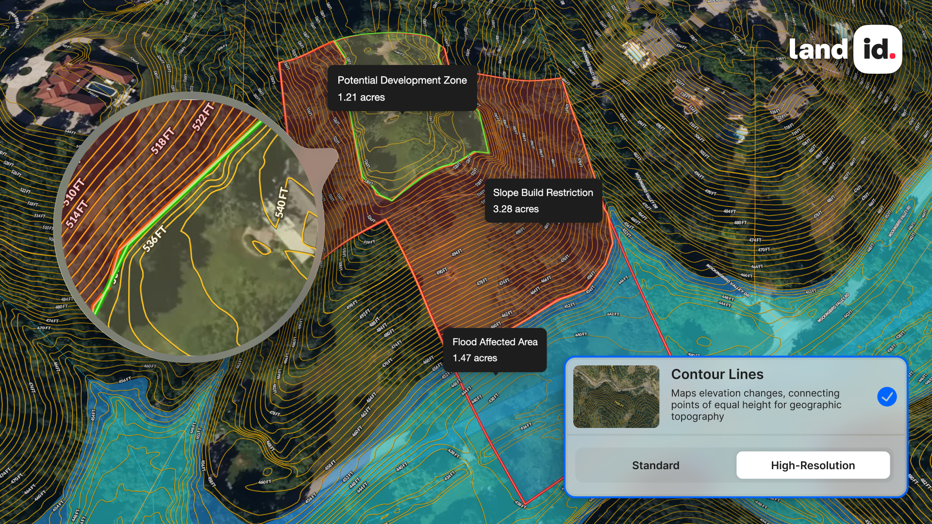
Land id now shows contour lines at 2-foot intervals—the highest resolution available from any property intelligence platform. (Other platforms stop at 3-foot intervals.)
Why It Matters
When it comes to pricing land projects, accurate slopes mean the difference between a confident cost estimate and a ballpark that comes back to bite you.
Design Better Property Marketing With Land id + Canva
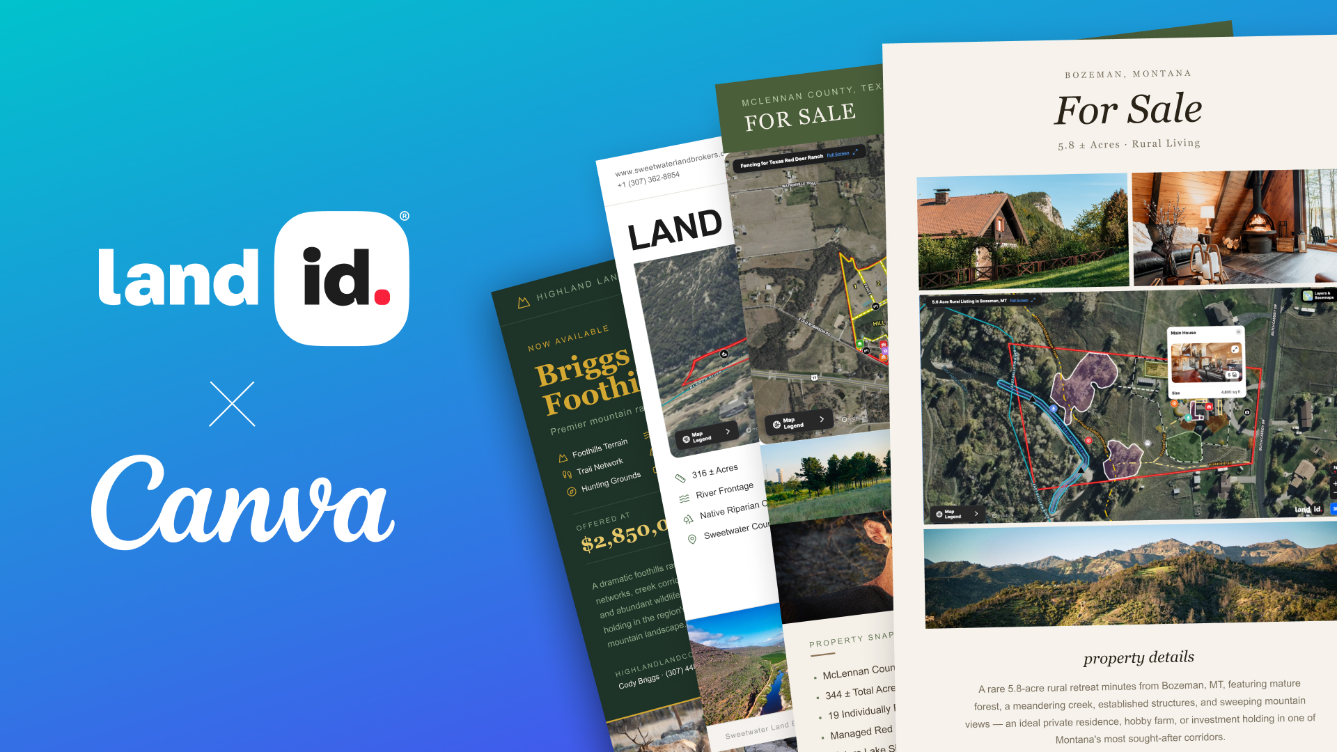
If you or your marketing team lives in Canva for creating flyers, brochures, social posts, websites, or pitch decks—your Land id maps and Property Tours can now live there, too.
Install the Land id add-on in Canva and drop real Property Tours, interactive maps, and map images directly into whatever you're building.
Why It Matters
Canva is real estate’s most popular design and marketing platform. With Land id available where you already work, you’ll can create more compelling assets in less time.
Find Better Comparable Sales Faster With Filtering
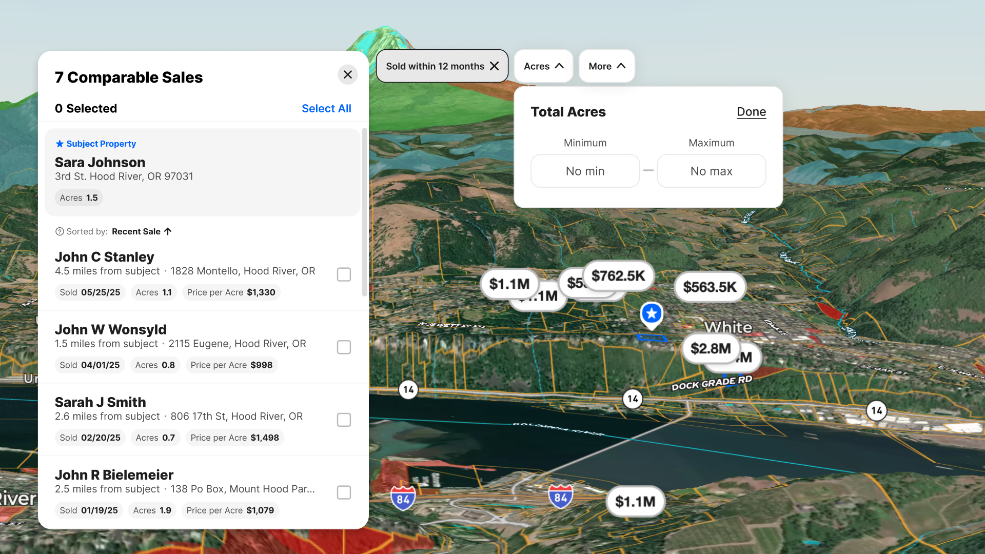
You asked, we delivered. New filters on comparable sales reports are now fully available on the web. Reduce noise and find more accurate comps faster with new filters for acreage, sales date, land use, and vacant land.
Why It Matters
Now you can easily build a comp report that matches the deal you're working, not the closest approximation or a guess.
Learn about comparable sales reports in Land id.
Ready to Get Started?
These features are available now in Land id Pro. Not a Pro subscriber? Log in to your account to upgrade, or start a free 7-day trial today.
FAQs
Continue Reading
Alyssa Toohey
Off the Map & In Person: The Land id Team Gets Together

By Land id
The Land id team came together in Montana for collaboration, connection, Big Sky views, PBR, Yellowstone, and plenty of memorable moments.

Craig Rowe
Prospecting, Part 3: Find Land Faster
.png)
By Land id
How real estate investors and developers can use Land id to discover and analyze land-buying opportunities in less time.

Explore Private Parcel Data & Property Boundaries
Download the Land id app and try for free.
