

Map Categories
Thank you! Your submission has been received!
Oops! Something went wrong while submitting the form.
000
,
000

Farm & Ranch
Agricultural Property Appraisal Report
Streamline your land appraisal process with Land id®, where every crop, building, and land feature is captured in an interactive map.
View this map
Farm & Ranch
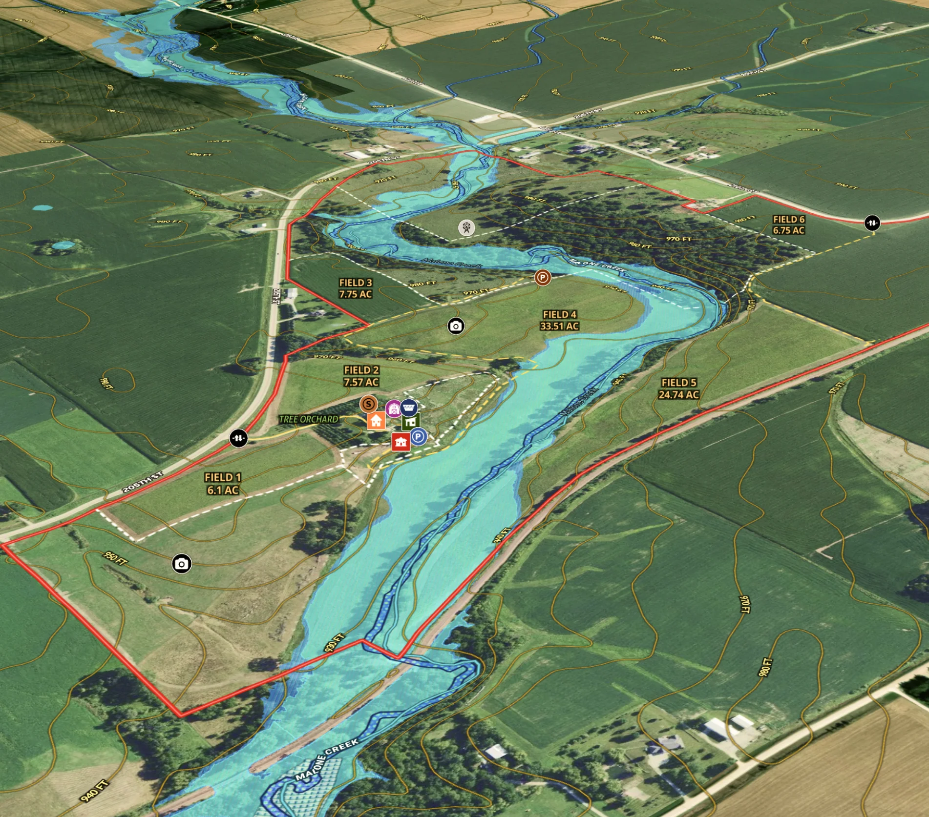
Agricultural Listing for Iowa Farm
Revolutionize farm listings with our real estate mapping software, integrating soil reports and multimedia for a standout presentation.
Agricultural
Listing
Rural
Water
Soil
Farm & Ranch
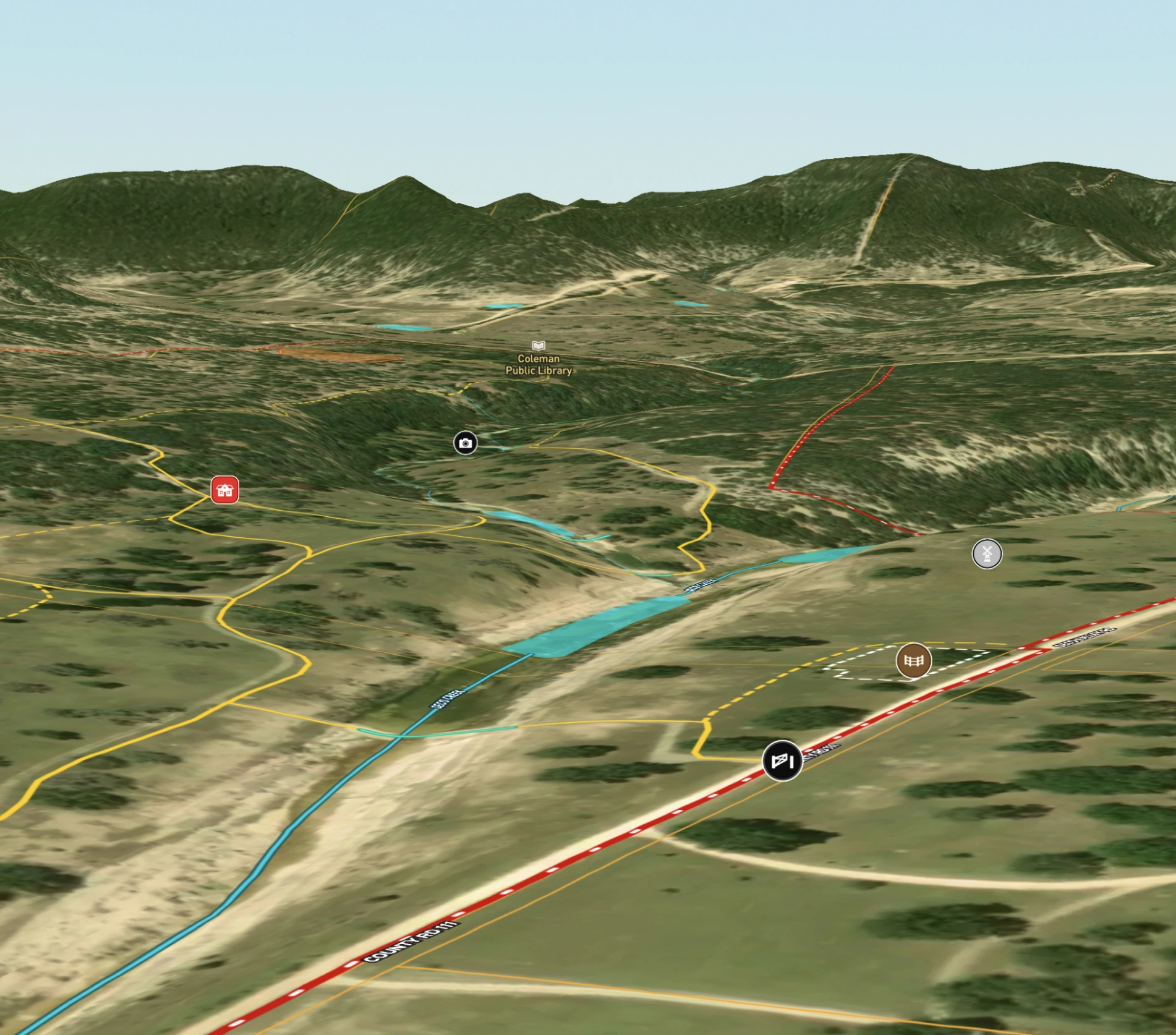
Hill Country Property
Landowners use Land id®'s real estate mapping software to create and update property maps effortlessly. Ideal for property owners managing land parcels.
Rural
Land owner
Land management
.webp)

Recreation & Fun
Paulina Lake & East Lake Recreation
Help visitors plan their trip with our campground map maker, showcasing trails, boat launches and campgrounds.
Fish
Campgrounds
Hike
Park
Rural

Real Estate
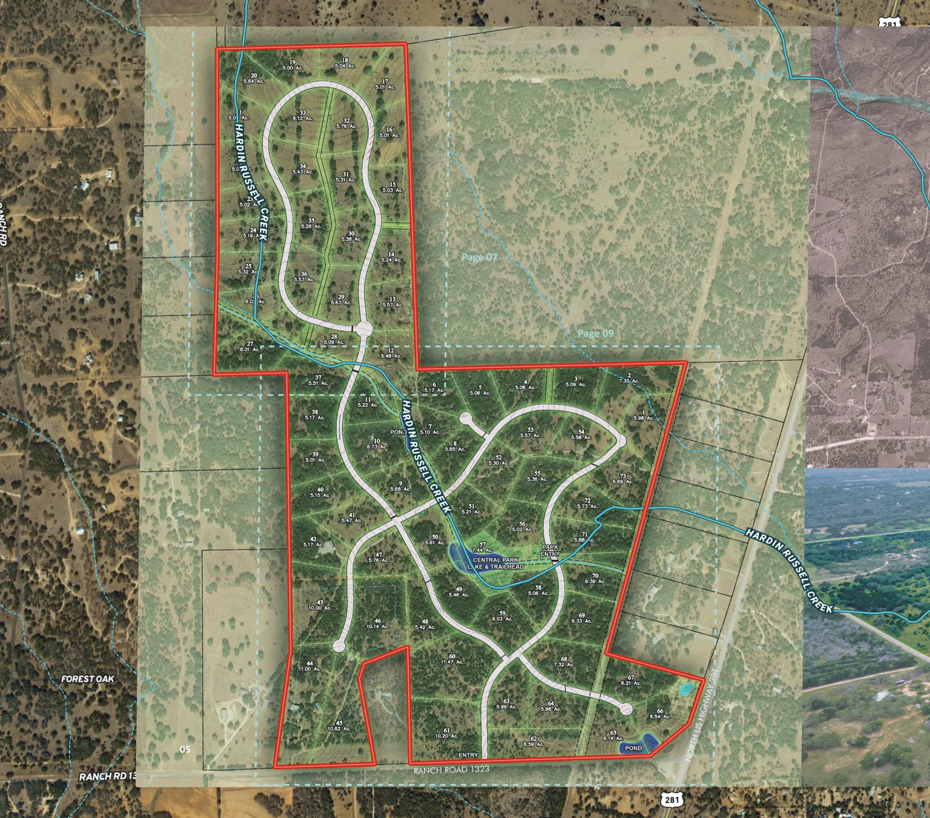
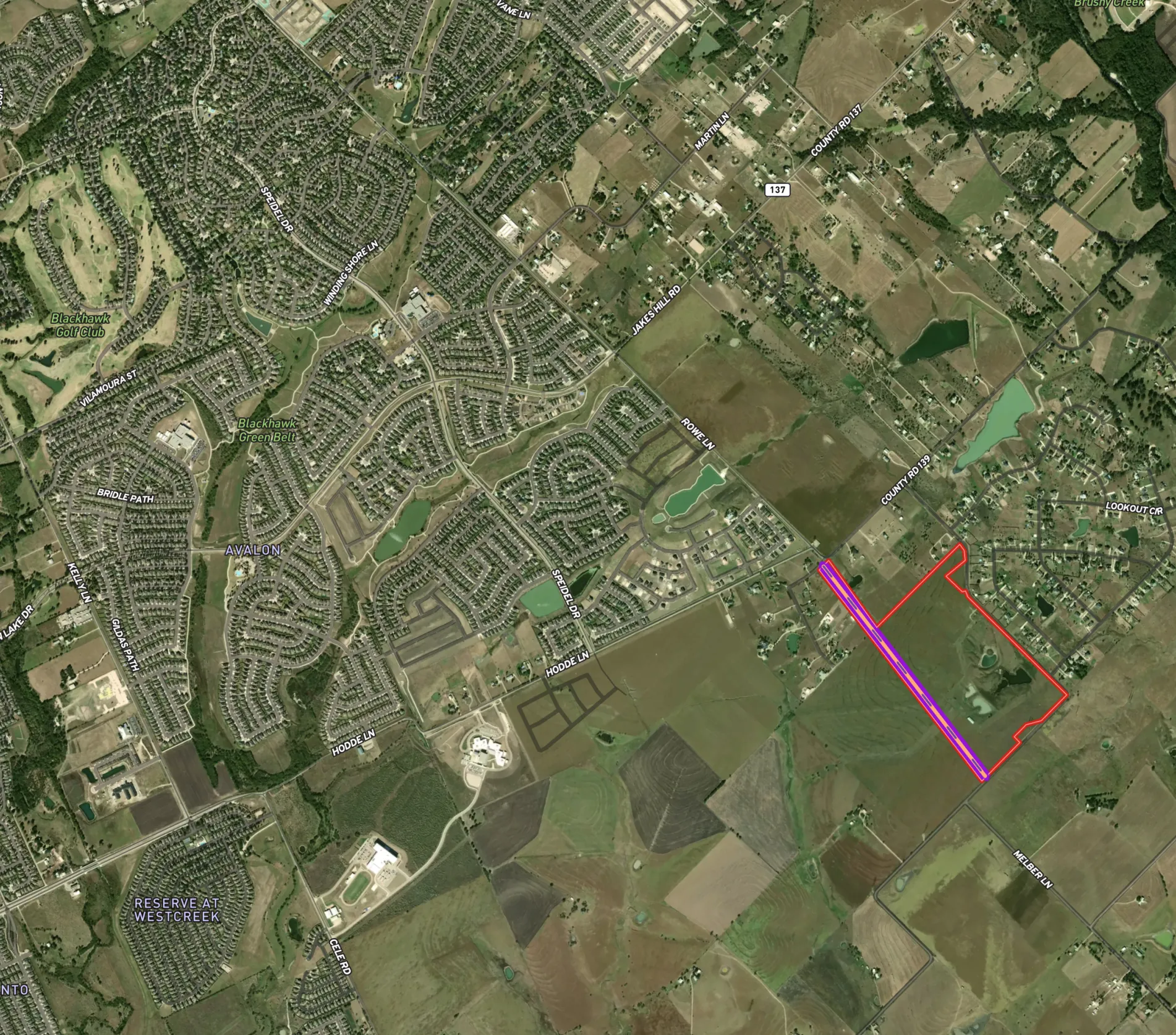
Neighborhood Development Project in Texas
Use Land id's real estate map maker to vividly present new developments, from trails to parks, enhancing buyer understanding.
Homebuilders
Property Development
Rural
Residential
Listing

Real Estate
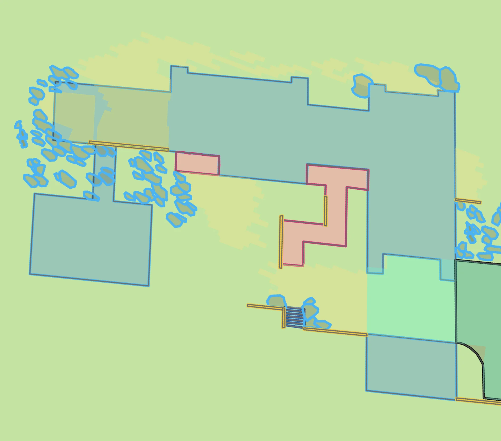
Diamond A Hickory Farm
Harlan Ray uses Land id®'s real estate mapping software to create clean, engaging property maps for real estate listings, enhancing buyer experiences, and showcasing key land parcels.
Listing
Rural
Luxury
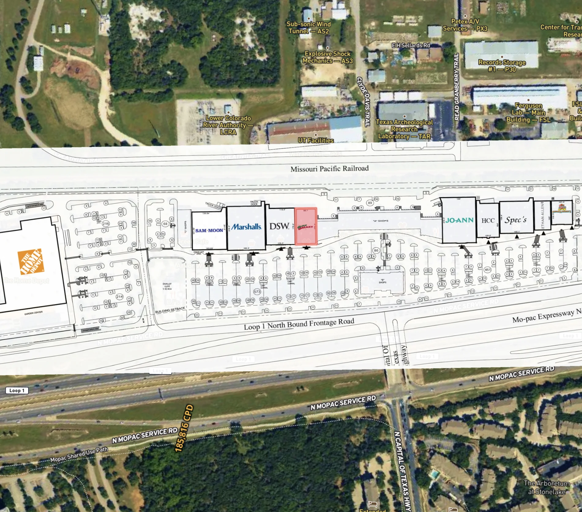
Real Estate
Marketing a Commercial Lease
Enhance tenant site selection with our property mapping tool.
Commercial
Listing
Urban

Recreation & Fun
RV Campsite Near Glacier National Park
Use our campground map maker to dynamically showcase campground amenities and site details.
Campgrounds
Rural
Real Estate
Buyer Representation Map
Save time with our mapping tool for real estate, allowing buyers to filter potential properties interactively before visiting.
Rural
Agricultural

Planning
Developing a Dream Home in Utah
Streamline high-end property planning and client communication with our real estate mapping software.
Rural
Land owner
Property Development
Luxury

Real Estate
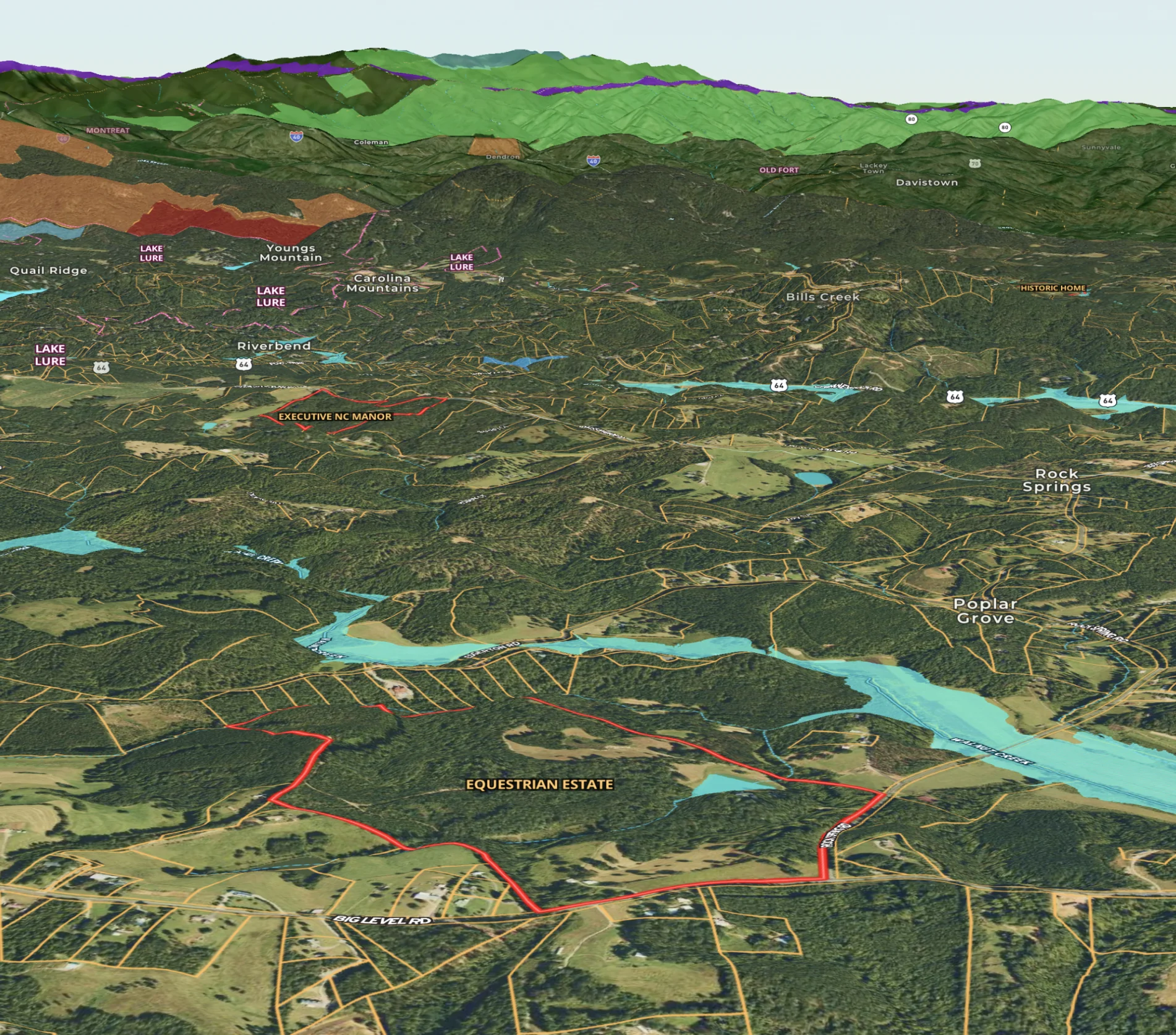
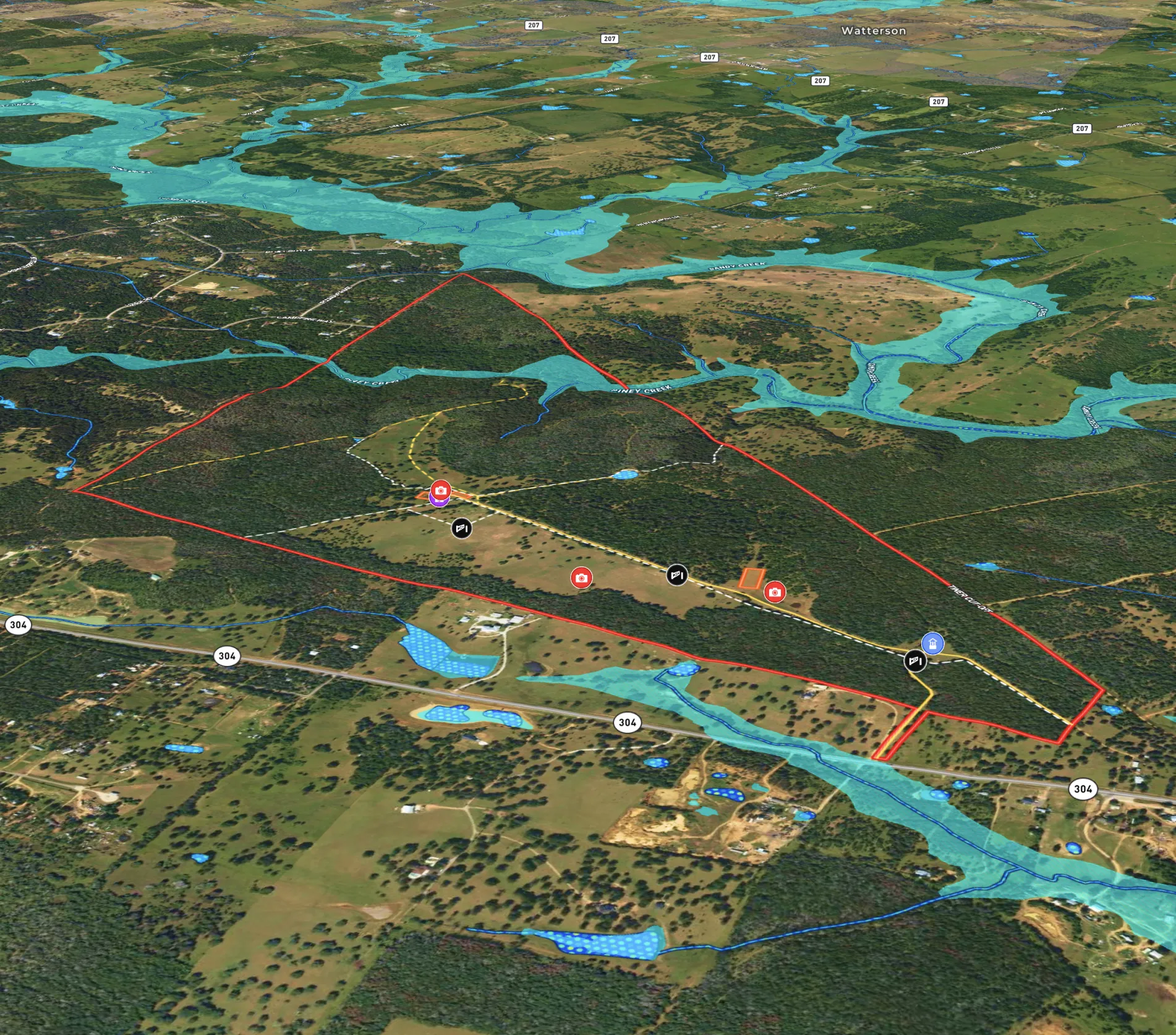
Sandy Creek Ranch
Harlan Ray uses Land id®'s real estate mapping software every day to create detailed property maps, build relationships and showcase expertise.
Listing
Rural
Luxury
Hunt
Agricultural

Recreation & Fun
My Rim to Rim Hike in the Grand Canyon
An adventurer used Land id®'s GIS mapping software to create a custom Rim to Rim Grand Canyon map, combining photo points and key landmarks for an interactive keepsake.
Hike
Real Estate
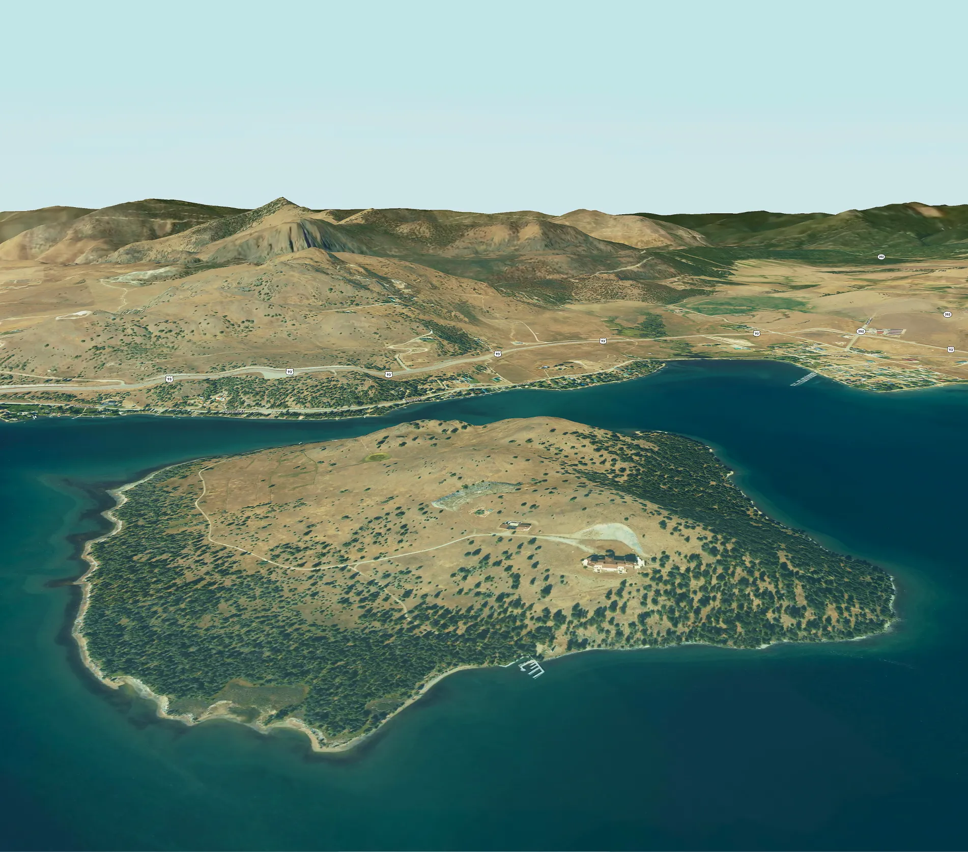
Cromwell Island
Explore Cromwell Island with Land id®'s GIS mapping software. Create property maps to showcase land parcels, shoreline, and terrain for an engaging real estate experience.
Residential
Luxury
Listing
Rural
Planning
Eminent Domain
Land id® empowers eminent domain projects with easy GIS mapping software, creating property maps to assess land parcels, visualize impacts, and ensure fair negotiations.
Property Development
Government
Farm & Ranch
Land Trust Baseline Documentation
Land id® streamlines baseline documentation for land trusts with easy GIS mapping software. Create and share property maps in minutes, empowering efficient land conservation.
Land owner
Land management
Recreation & Fun
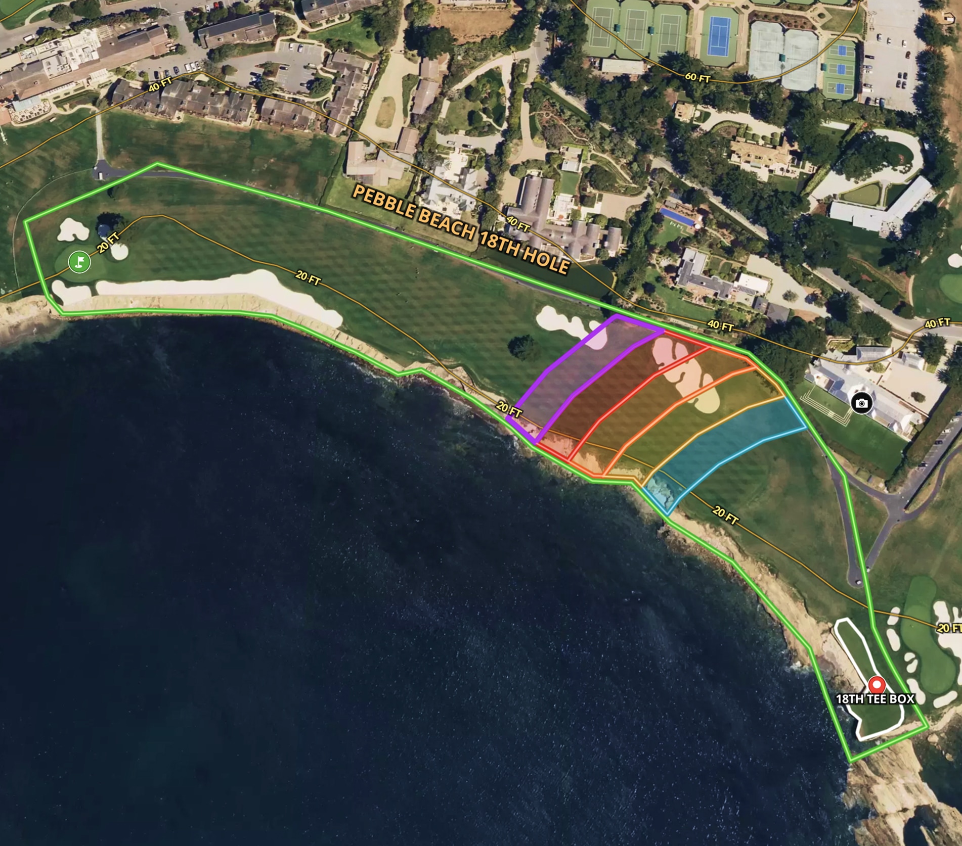
The 18th Hole at Pebble Beach
Land id® easy map maker and GIS mapping software created a custom real estate map of Pebble Beach’s 18th hole, showcasing land contours and shot placements.
Recreational
Farm & Ranch
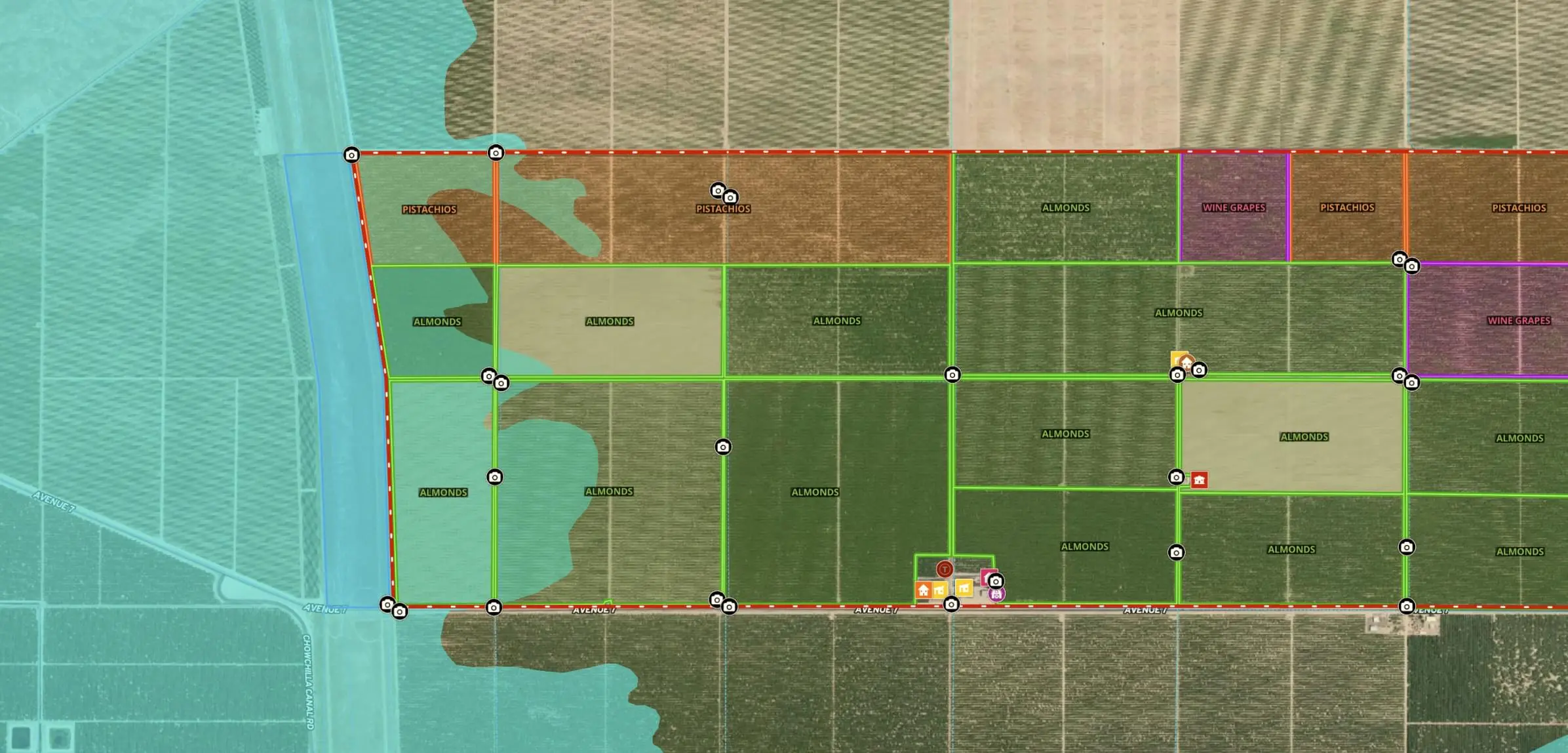
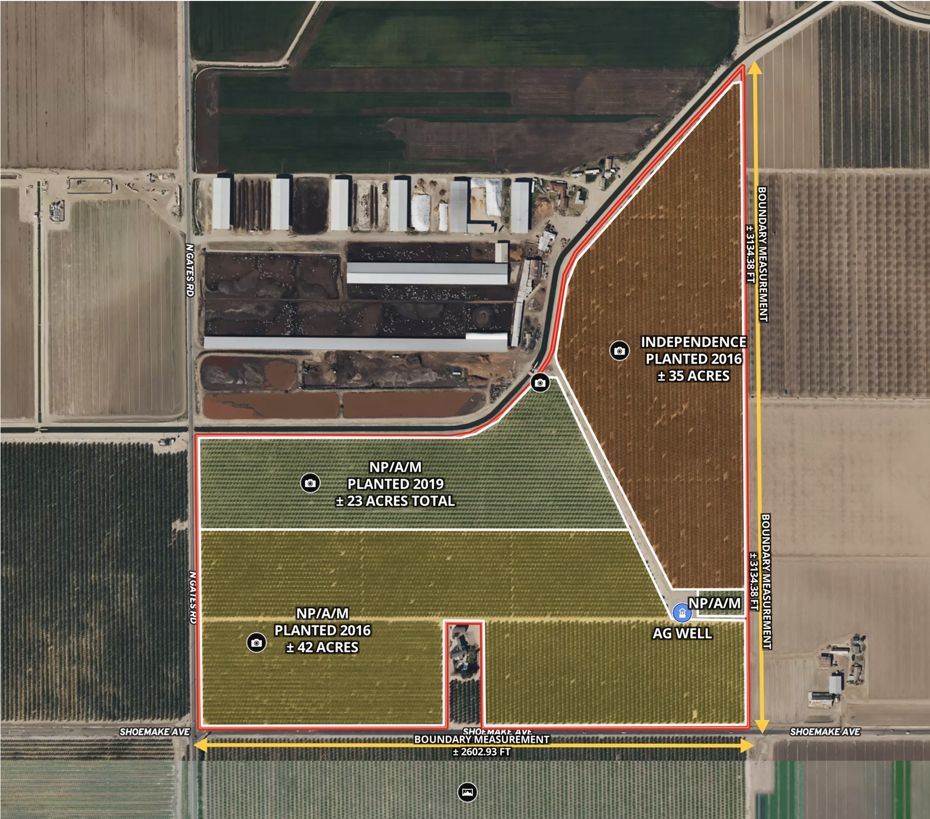
CA Almond Farm – 107 Acres
Todd Peterson uses Land id® GIS mapping software to embed real estate maps that showcase an almond farm details for a standout listing experience.
Listing
Agricultural
Rural
Soil
Water
Farm & Ranch
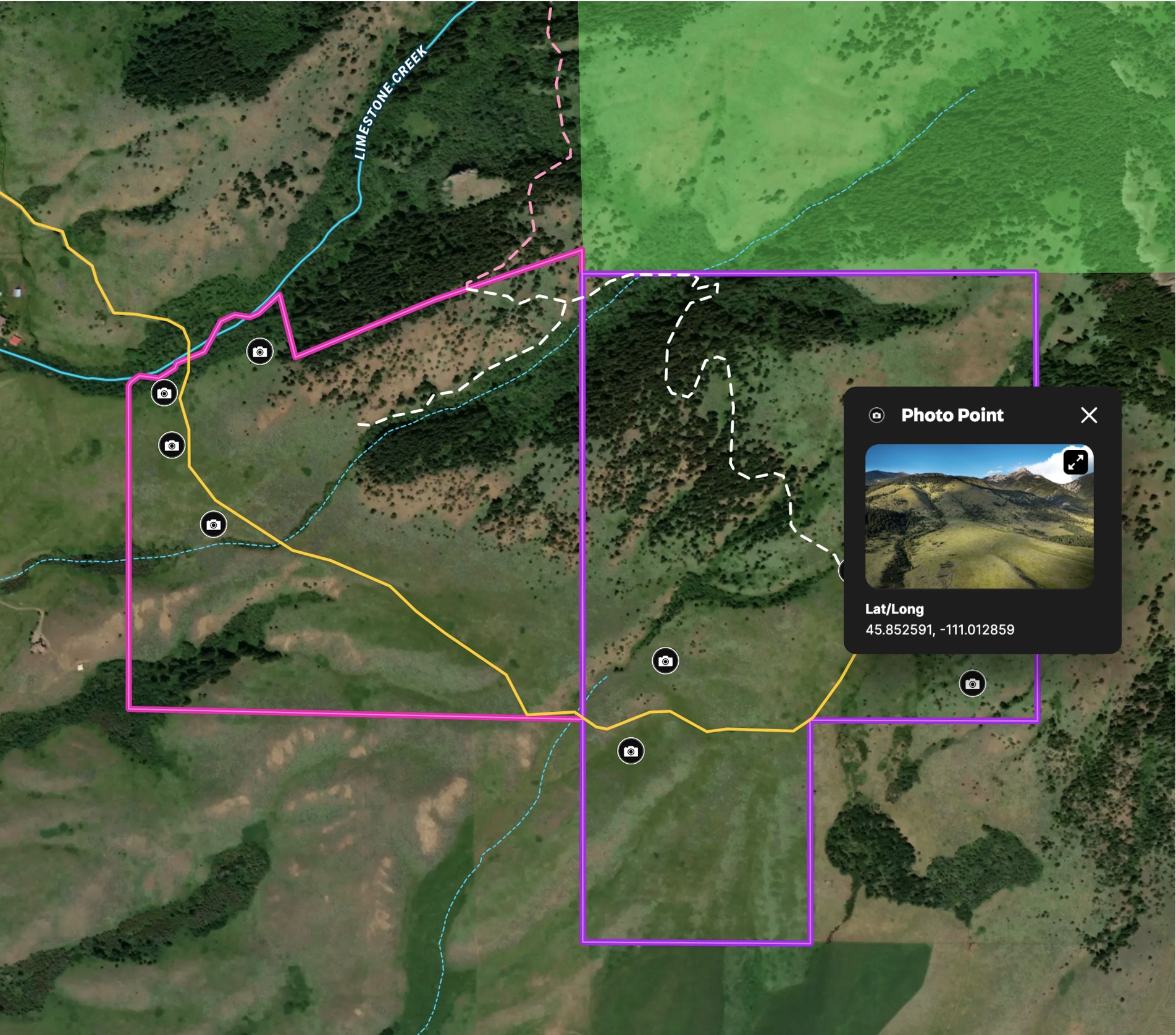
Ranch in Bridger Foothills
Land id® GIS mapping software creates a detailed property map of this 341-acre land parcel, showcasing trails, access, and views.
Listing
Rural
Hunt